

Global Weekly Snow Roundup #314
Weekly Global Snow News, updated 14 May 2026: Fresh snowfall in Argentina, Australia and Lesotho signals winter’s approach, while Japan maintains the world’s deepest snowpack.

Next 3 days weather summary:A dusting of snow. Milder later with heavy rain (total 27.0mm) on Mon night. Very mild (max 11°C on Mon afternoon, min 1°C on Sat morning). Wind will be generally light. | Days 4-6 weather summary:Moderate rain (total 18.0mm), heaviest on Wed afternoon. Very mild (max 13°C on Thu afternoon, min 3°C on Tue morning). Wind will be generally light. | |||||||||||||||||
Saturday 16 | Sunday 17 | Monday 18 | Tuesday 19 | Wednesday 20 | Thursday 21 | |||||||||||||
AM | PM | night | AM | PM | night | AM | PM | night | AM | PM | night | AM | PM | night | AM | PM | night | |
light snow | light rain | light snow | some clouds | rain shwrs | rain shwrs | rain shwrs | risk thun- der | heavy rain | light rain | some clouds | cloudy | light rain | light rain | light rain | rain shwrs | rain shwrs | rain shwrs | |
km/h | ||||||||||||||||||
Snow map |  |  |  |  |  |  | ||||||||||||
3 | — | — | — | — | — | — | — | — | — | — | — | — | — | — | — | — | — | |
— | 2 | 1 | — | 1 | 1 | 1 | 3 | 18 | 1 | — | — | 2 | 4 | 4 | 3 | 3 | 1 | |
max °C | 1 | 3 | 2 | 4 | 8 | 7 | 9 | 11 | 8 | 5 | 11 | 10 | 8 | 10 | 9 | 10 | 13 | 11 |
min °C | 1 | 2 | 1 | 1 | 7 | 3 | 6 | 11 | 3 | 3 | 8 | 6 | 6 | 9 | 8 | 8 | 13 | 8 |
-1 | 0 | 0 | 1 | 7 | 1 | 6 | 11 | 3 | 3 | 8 | 6 | 6 | 8 | 8 | 8 | 12 | 8 | |
99 | 89 | 99 | 74 | 58 | 82 | 60 | 65 | 99 | 88 | 57 | 90 | 87 | 83 | 86 | 78 | 68 | 90 | |
1550 | 1750 | 1450 | 2000 | 2300 | 2100 | 2500 | 2650 | 2000 | 2250 | 2600 | 2400 | 2500 | 2750 | 2700 | 2800 | 2950 | 3000 | |
5:30 | — | — | 5:28 | — | — | 5:26 | — | — | 5:26 | — | — | 5:24 | — | — | 5:24 | — | — | |
— | — | 8:37 | — | — | 8:37 | — | — | 8:39 | — | — | 8:40 | — | — | 8:42 | — | — | 8:43 | |
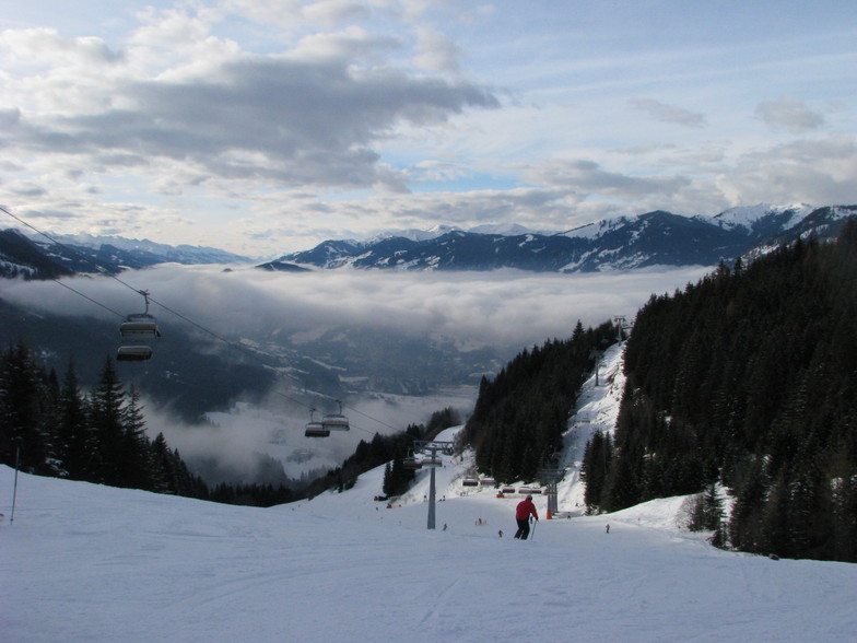
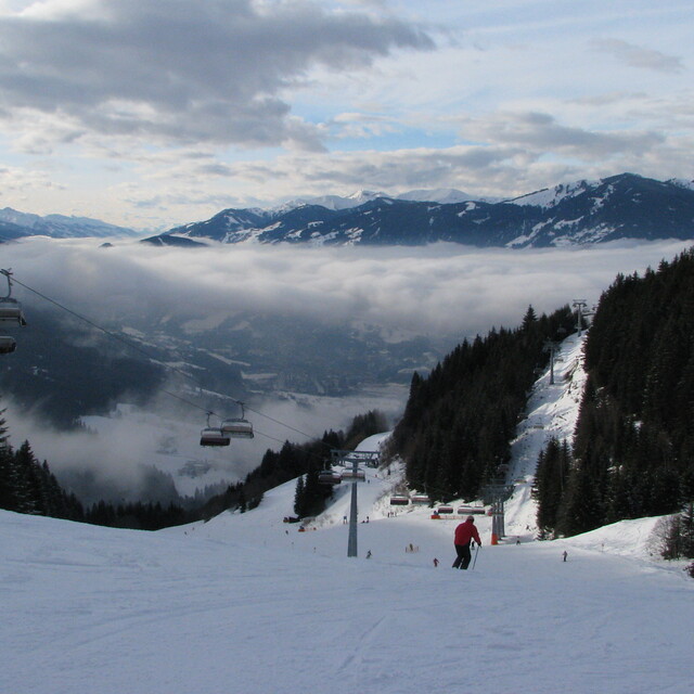
Latest snow reports near St Johann-Alpendorf:
| Top snow depth: | — |
|---|---|
| Bottom snow depth: | — |
| Fresh snowfall depth: | 25 cm |
| Last snowfall: | 15 May 2026 |
| Snow Alerts | Create Alert |
0.0 | Bluebird Powder days Fresh snow, mostly sunny, light wind. |
|---|---|
0.1 | Powder days Fresh snow, limited sun, any wind. |
0.0 | Bluebird days Average snow, mostly sunny, light wind. |
The above table gives the weather forecast for St Johann-Alpendorf at the specific elevation of 1342 m. Our sophisticated weather models allow us to provide snow forecasts for the top, middle and bottom ski stations of St Johann-Alpendorf. To access the weather forecasts for the other elevations, use the tab navigation above the table. For a wider view of the weather, check out the Weather Map of Austria.
Click here to read further information on freezing levels and how we forecast our temperatures.
Overall 4.4 Based on 10 votes and 17 reviews
Here now at the peak week of the season. According to #WePowder, 5 million people headed to the Alps this week as the UK/Dutch and German half-term weeks created a perfect storm. Yes, it is crowded; avoid the bottom lifts between 08.45 and 09.45 and take a picnic as the restaurants are chaos, But the snow is the best in years; we've had two full on powder days and may even squeeze another in before the week is over. It is true that 80% of people go to 20% of the resorts, so we had a day in Grossarl (uncrowded) a day in Schladming (big enough to take the numbers) and will ski Hochkonig on "changeover" day, so it is possible to get some great runs in despite the crowds. I can't comment on hotels but our 8 bed apartment in the Steakhouse Rauchkuchen at €750 per week is a bloody good deal. We're only 4 so plenty of room and usable kitchen. Love Ski Amade and the Austrian Apres so much that we're buying in Flachau. Off ski touring next week so may post an update.
Simon from United Kingdom writes:
Here now at the peak week of the season. According to #WePowder, 5 million people headed to the Alps this week as the UK/Dutch and German half-term weeks created a perfect storm. Yes, it is crowded; avoid the bottom lifts between 08.45 and 09.45 and take a picnic as the restaurants are chaos, But the snow is the best in years; we've had two full on powder days and may even squeeze another in before the week is over. It is true that 80% of people go to 20% of the resorts, so we had a day in Grossarl (uncrowded) a day in Schladming (big enough to take the numbers) and will ski Hochkonig on "changeover" day, so it is possible to get some great runs in despite the crowds.
I can't comment on hotels but our 8 bed apartment in the Steakhouse Rauchkuchen at €750 per week is a bloody good deal. We're only 4 so plenty of room and usable kitchen.
Love Ski Amade and the Austrian Apres so much that we're buying in Flachau.
Off ski touring next week so may post an update.
Read 16 more reviews of St Johann-Alpendorf or submit your own


 Nearest