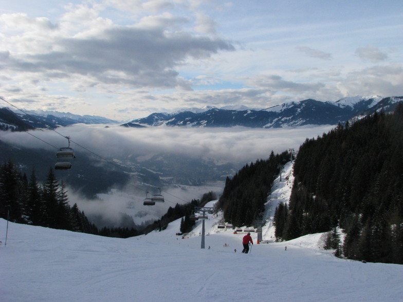
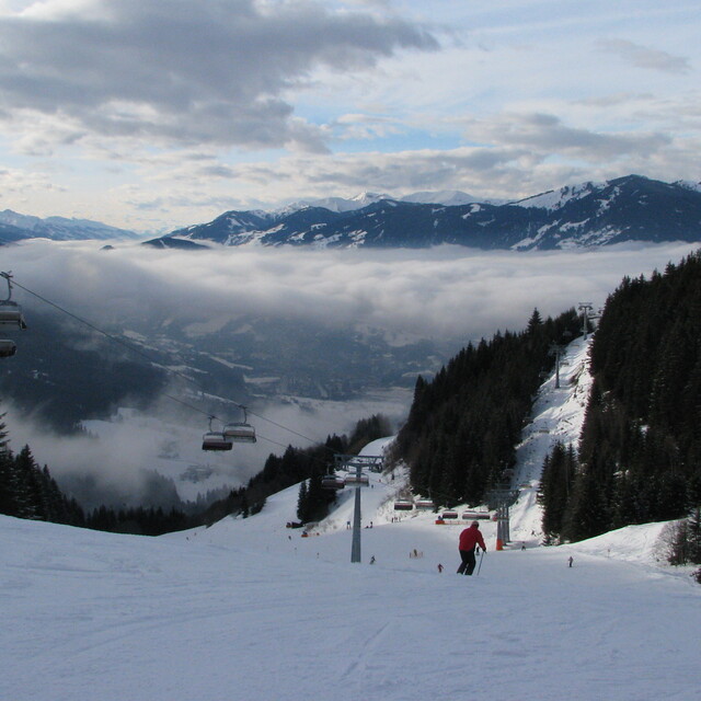
St Johann-Alpendorf snow
Ski Austria

St Johann-Alpendorf Snow Forecast

Weather Forecast for St Johann-Alpendorf at 1850 m
Issued: 6 pm  21 Nov 2025 (local time)

New snow in St Johann-Alpendorf

1.3cm0.5in
Fri 21st (NGT)
The snow forecast for St Johann-Alpendorf is: A dusting of new snow. Temperatures will be below freezing (max -1°C on Mon morning, min -13°C on Sat night). Wind will be generally light.

St Johann-Alpendorf Weather (Next 3 days): The snow forecast for St Johann-Alpendorf is: A dusting of new snow. Temperatures will be below freezing (max -1°C on Mon morning, min -13°C on Sat night). Wind will be generally light.

St Johann-Alpendorf Weather (Days 4-6): A moderate fall of snow, heaviest on Tue afternoon. Temperatures will be below freezing (max -1°C on Mon afternoon, min -12°C on Wed night). Wind will be generally light.


St Johann-Alpendorf Live Weather

ResortSnow DepthTemp. (°C)Wind (km/h)Weather
Top Lift: 
-10
5
light snow
Middle Lift: 
-7
5
light snow
Bottom Lift: 
-4
5
light snow
6 Day Forecast
Issued: 6 pm 21 Nov 2025 / Updates in ::
Change Forecast Height
Choose Forecast
Last 6 daysScroll left for last 6 daysNow
Fri
21
Saturday
22
Sunday
23
Monday
24
Tuesday
25
Wednesday
26
Thursday
27
PM
night
AM
PM
night
AM
PM
night
AM
PM
night
AM
PM
night
AM
PM
night
AM
PM
night
light snow
light snow
cloud
cloud
part cloud
part cloud
light snow
snow showers
snow showers
part cloud
light snow
light snow
light snow
mod snow
light snow
light snow
snow showers
part cloud
part cloud
light snow
light snow
light snow
cloudy
cloudy
some clouds
some clouds
light snow
snow shwrs
snow shwrs
some clouds
light snow
light snow
light snow
mod. snow
light snow
light snow
snow shwrs
some clouds
some clouds
light snow
 km/h
5
NNE
10
N
10
N
10
N
5
S
10
W
5
WSW
10
SSW
10
SSW
15
S
10
WNW
10
NNE
10
N
10
NNW
10
NW
10
NW
5
WNW
5
W
5
W
5
WNW
Snow map
 cm 
1
1
1
4
2
4
7
1
1
1
 mm 
max°C
-8
-10
-10
-10
-13
-4
-5
-5
-1
-1
-3
-5
-6
-7
-8
-9
-10
-7
-8
-9
min°C
-10
-12
-12
-12
-13
-8
-6
-6
-3
-2
-5
-5
-6
-9
-9
-10
-12
-9
-10
-10
chill°C 
-14
-17
-17
-12
-13
-12
-10
-11
-7
-7
-9
-9
-10
-14
-14
-15
-15
-9
-13
-14
Humid% 
95
98
79
70
72
35
72
66
65
76
97
95
97
98
92
96
92
77
74
85
Freezing level (m
600
0
0
0
0
450
950
700
1000
1250
1050
1000
950
800
500
500
0
300
400
0
topliftbotliftSea lvl1000m2000m3000m4000m5000m
-9-11-11-11-13-6-6-6-2-2-4-5-6-8-9-10-11-8-9-10-3-6-4-7-110-2-331111-2-2-4-7-2-6-5
Sunrise
7:20
7:22
7:22
7:24
7:26
7:26
Sunset
4:24
4:24
4:23
4:22
4:22
4:21
4:21
Popular St Johann-Alpendorf Pages

Snow Radar

Submit a report Eyeball Reporter

Latest snow reports near St Johann-Alpendorf:

  • 36 km away from St Johann-Alpendorf

    7 hours ago
    weather station observation

    Light rain showers reported from Schmittenhoehe (automatic) at 1954 metres elevation only 4 kms NNE of Nagelköpfl – Piesendorf but it is forecast cold enough for snow at the ski area from Nagelköpfl – Piesendorf

  • 47 km away from St Johann-Alpendorf

    14 hours ago
    weather station observation

    Rain reported from Loferer Alm at 1625 metres elevation only 3 kms W of Lofer but it is forecast cold enough for snow at the ski area from Lofer

St Johann-Alpendorf Snow Conditions

Top snow depth:
Bottom snow depth:
Fresh snowfall depth:7cm
Last snowfall:20 Nov 2025
Snow AlertsCreate Alert
Other resorts in Austria are reporting: powder (12) / good piste (12)

Find Your Trip

Snow History

Week 3 of November has on average:
0.2
Bluebird Powder days
Fresh snow, mostly sunny, light wind.
1.7
Powder days
Fresh snow, limited sun, any wind.
1.4
Bluebird days
Average snow, mostly sunny, light wind.


Snow-Forecast Partner Offers