

Global Weekly Snow Roundup #314
Weekly Global Snow News, updated 14 May 2026: Fresh snowfall in Argentina, Australia and Lesotho signals winter’s approach, while Japan maintains the world’s deepest snowpack.

Next 3 days weather summary:A moderate fall of snow, heaviest on Mon night. Temperatures will be below freezing (max -5°C on Mon afternoon, min -13°C on Sat morning). Wind will be generally light. | Days 4-6 weather summary:A dusting of new snow. Freeze-thaw conditions (max 1°C on Thu night, min -6°C on Tue morning). Wind will be generally light. | |||||||||||||||||
Saturday 16 | Sunday 17 | Monday 18 | Tuesday 19 | Wednesday 20 | Thursday 21 | |||||||||||||
AM | PM | night | AM | PM | night | AM | PM | night | AM | PM | night | AM | PM | night | AM | PM | night | |
light snow | light snow | snow shwrs | clear | snow shwrs | snow shwrs | light snow | light snow | mod. snow | cloudy | light snow | light snow | light snow | light snow | light snow | some clouds | light snow | snow shwrs | |
km/h | ||||||||||||||||||
Snow map |  |  |  |  |  |  | ||||||||||||
2 | 2 | 1 | — | — | — | — | 1 | 9 | — | 1 | 1 | — | — | 1 | — | — | — | |
— | — | — | — | — | — | — | — | — | — | — | — | — | — | — | — | — | — | |
max °C | -12 | -10 | -9 | -8 | -6 | -6 | -7 | -5 | -5 | -5 | -4 | -4 | -5 | -3 | -3 | -3 | -1 | 1 |
min °C | -13 | -11 | -10 | -9 | -7 | -7 | -7 | -5 | -6 | -6 | -4 | -4 | -5 | -4 | -4 | -3 | -2 | -1 |
-21 | -17 | -16 | -9 | -10 | -7 | -7 | -10 | -6 | -6 | -7 | -6 | -9 | -8 | -9 | -8 | -6 | -4 | |
97 | 93 | 65 | 66 | 88 | 90 | 93 | 86 | 94 | 95 | 97 | 97 | 88 | 88 | 85 | 90 | 88 | 30 | |
1600 | 1850 | 1250 | 2100 | 2300 | 2000 | 2350 | 2550 | 2250 | 2500 | 2700 | 2550 | 2550 | 2750 | 2600 | 2850 | 3100 | 3300 | |
5:39 | — | — | 5:39 | — | — | 5:37 | — | — | 5:35 | — | — | 5:35 | — | — | 5:33 | — | — | |
— | — | 8:45 | — | — | 8:45 | — | — | 8:46 | — | — | 8:47 | — | — | 8:50 | — | — | 8:51 | |
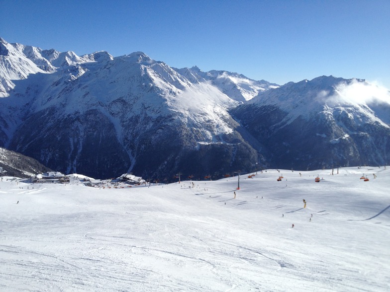
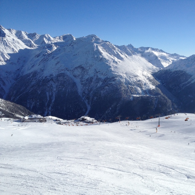
Latest snow reports near Sölden:
| Top snow depth: | 0 cm |
|---|---|
| Bottom snow depth: | 0 cm |
| Fresh snowfall depth: | 43 cm |
| Last snowfall: | 15 May 2026 |
| Snow Alerts | Create Alert |
0.3 | Bluebird Powder days Fresh snow, mostly sunny, light wind. |
|---|---|
2.5 | Powder days Fresh snow, limited sun, any wind. |
0.9 | Bluebird days Average snow, mostly sunny, light wind. |
The above table gives the weather forecast for Sölden at the specific elevation of 3250 m. Our sophisticated weather models allow us to provide snow forecasts for the top, middle and bottom ski stations of Sölden. To access the weather forecasts for the other elevations, use the tab navigation above the table. For a wider view of the weather, check out the Weather Map of Austria.
Click here to read further information on freezing levels and how we forecast our temperatures.
Resort name is also written as Solden.
Overall 3.9 Based on 42 votes and 23 reviews
We went for half term so a bit busy but what resort isn’t. Firstly, this is not a resort for beginners. I would say it’s for good intermediates and up. Beginners and families would be better down the road at Obergurgl. The glacier was good but a big faff to get to. I think it took me over an hour to get there in the morning. The resort is high so the snow held up well considering this year, 2024, has not been great in places. The town is as you would expect, chocolate box it is not. Lots of bars and restaurants though to choose from. None are cheap so factor that in. On the mountain too the restaurants were very expensive. £8 ish for a soup, main meals £15 - £20. We took a packed lunch in the end, which worked well and shared two meals between three (2 x adults 1 x child) in the evenings, which was fine as portions are big. Pizza £15. Burger and chips £20. On the plus side beers were good ish value at £5 a go. It’s worth going to Obergurgl too as included in the ski pass. Plenty of buses included and only 20 mins up the road. If I went again I would go there on half board and visit Solden on a sunny day to head up to the glacier. Restaurants worth visiting were “A Cassa Da Mamma”, best Italian by far. You have to go up the funicular and walk 5 mins or so but well worth it. You will have to book too or get there early. Another place was the “liebelei food bar music” above a shop. Great Mexican food. We liked a beer in the Gizzly too. As a side note, steer clear of the escalator at the Giggijochbaan at busy times. Very dangerous, we were stuck two times in two days with people falling over and no way to stop the lift resulting in utter panic and chaos. Take the lift instead.
Toby from United Kingdom writes:
We went for half term so a bit busy but what resort isn’t. Firstly, this is not a resort for beginners. I would say it’s for good intermediates and up. Beginners and families would be better down the road at Obergurgl.
The glacier was good but a big faff to get to. I think it took me over an hour to get there in the morning.
The resort is high so the snow held up well considering this year, 2024, has not been great in places.
The town is as you would expect, chocolate box it is not. Lots of bars and restaurants though to choose from. None are cheap so factor that in. On the mountain too the restaurants were very expensive. £8 ish for a soup, main meals £15 - £20. We took a packed lunch in the end, which worked well and shared two meals between three (2 x adults 1 x child) in the evenings, which was fine as portions are big. Pizza £15. Burger and chips £20. On the plus side beers were good ish value at £5 a go.
It’s worth going to Obergurgl too as included in the ski pass. Plenty of buses included and only 20 mins up the road. If I went again I would go there on half board and visit Solden on a sunny day to head up to the glacier.
Restaurants worth visiting were “A Cassa Da Mamma”, best Italian by far. You have to go up the funicular and walk 5 mins or so but well worth it. You will have to book too or get there early. Another place was the “liebelei food bar music” above a shop. Great Mexican food. We liked a beer in the Gizzly too.
As a side note, steer clear of the escalator at the Giggijochbaan at busy times. Very dangerous, we were stuck two times in two days with people falling over and no way to stop the lift resulting in utter panic and chaos. Take the lift instead.


 Nearest