
Ski Lessons by SkiBro
BOOK NOW
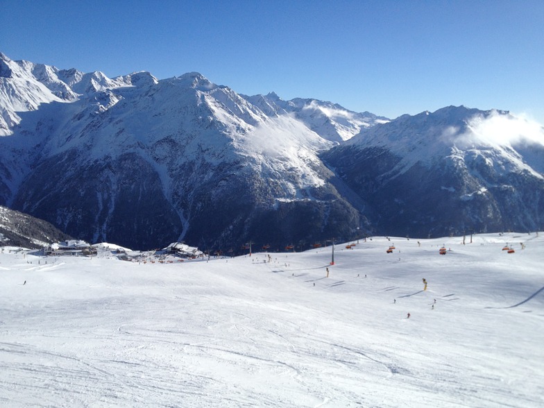
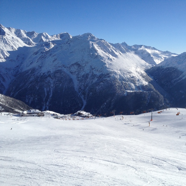
Ski lessons in Sölden
Book now

Sölden Weather (Next 3 days): The snow forecast for Sölden is: A heavy fall of snow, heaviest during Fri night. Freeze-thaw conditions (max 1°C on Fri night, min -11°C on Sat night). Wind will be generally light.
Sölden Weather (Days 4-6): A light covering of new snow, mostly falling on Mon night. Becoming milder with light rain (total 4.0mm) on Thu afternoon. Freeze-thaw conditions (max 5°C on Thu afternoon, min -10°C on Mon night). Wind will be generally light.
| Resort | Snow Depth | Temp. (°C) | Wind (km/h) | Weather | ||
|---|---|---|---|---|---|---|
| Top Lift: | 4.2 m | -12 | ||||
| Middle Lift: | -5 | |||||
| Bottom Lift: | 0 |
Latest snow reports near Sölden:
Moderate rain reported from Flughafen Innsbruck Automatic Weather Station at 721 metres elevation 7 kms ENE of Oberperfuss but it is forecast cold enough for snow at higher elevations in the ski area from Oberperfuss
Moderate rain reported from Flughafen Innsbruck Automatic Weather Station at 721 metres elevation 5 kms WNW of Muttereralm but it is forecast cold enough for snow at higher elevations in the ski area from Muttereralm
Shower light rain shower reported from Flughafen Innsbruck Automatic Weather Station at 721 metres elevation 7 kms ENE of Oberperfuss but it is forecast cold enough for snow at higher elevations in the ski area from Oberperfuss

Saturday 20 | Sunday 21 | Monday 22 | Tuesday 23 | Wednesday 24 | Thursday 25 | ||||||||||||||
night | AM | PM | night | AM | PM | night | AM | PM | night | AM | PM | night | AM | PM | night | AM | PM | night | |
mod. snow | light snow | light snow | light snow | light snow | light snow | light snow | cloudy | light snow | light snow | light snow | light snow | light snow | light snow | light snow | light snow | light rain | light rain | light snow | |
km/h | |||||||||||||||||||
Snow map |  |  |  |  |  |  |  | ||||||||||||
9 | 2.0 | 1.0 | 2.0 | — | 2.0 | 2.0 | — | 3 | 2.0 | — | 1.0 | 2.0 | — | — | — | — | — | 1.0 | |
— | — | — | — | — | — | — | — | — | — | — | — | — | — | — | — | 1.0 | 3 | 3 | |
max°C | 1 | 0 | 0 | -3 | 0 | 1 | -2 | 0 | 1 | -2 | 0 | 1 | -2 | 0 | 3 | -2 | 4 | 5 | 3 |
min°C | -2 | -3 | 0 | -11 | -4 | 0 | -10 | -4 | 1 | -10 | -4 | 1 | -8 | -3 | 2 | -5 | 0 | 4 | -2 |
-7 | -8 | -4 | -14 | -4 | -3 | -10 | -4 | -1 | -10 | -7 | -2 | -8 | -5 | 0 | -7 | -3 | 2 | -6 | |
96 | 74 | 82 | 97 | 72 | 84 | 93 | 73 | 90 | 95 | 81 | 85 | 95 | 77 | 75 | 75 | 73 | 84 | 90 | |
1350 | 1150 | 1200 | 300 | 1150 | 1300 | 600 | 1250 | 1450 | 550 | 1150 | 1400 | 550 | 1250 | 1650 | 950 | 1800 | 2000 | 1400 | |
— | 6:18 | — | — | 6:16 | — | — | 6:15 | — | — | 6:13 | — | — | 6:11 | — | — | 6:09 | — | — | |
— | — | — | 8:10 | — | — | 8:13 | — | — | 8:14 | — | — | 8:15 | — | — | 8:16 | — | — | 8:17 | |
A heavy fall of snow, heaviest during Fri night. Freeze-thaw conditions (max 1°C on Fri night, min -11°C on Sat night). Wind will be generally light.
A light covering of new snow, mostly falling on Mon night. Becoming milder with light rain (total 4.0mm) on Thu afternoon. Freeze-thaw conditions (max 5°C on Thu afternoon, min -10°C on Mon night). Wind will be generally light.
Latest snow reports near Sölden:
Moderate rain reported from Flughafen Innsbruck Automatic Weather Station at 721 metres elevation 7 kms ENE of Oberperfuss but it is forecast cold enough for snow at higher elevations in the ski area from Oberperfuss
Moderate rain reported from Flughafen Innsbruck Automatic Weather Station at 721 metres elevation 5 kms WNW of Muttereralm but it is forecast cold enough for snow at higher elevations in the ski area from Muttereralm
Shower light rain shower reported from Flughafen Innsbruck Automatic Weather Station at 721 metres elevation 7 kms ENE of Oberperfuss but it is forecast cold enough for snow at higher elevations in the ski area from Oberperfuss
| Top snow depth: | 423 cm |
|---|---|
| Bottom snow depth: | — |
| Fresh snowfall depth: | 10 cm |
| Last snowfall: | 18 Apr 2024 |
| Snow Alerts | Create Alert |
0.0 | Bluebird Powder days Fresh snow, mostly sunny, light wind. |
|---|---|
0.6 | Powder days Fresh snow, limited sun, any wind. |
0.0 | Bluebird days Average snow, mostly sunny, light wind. |
The above table gives the weather forecast for Sölden at the specific elevation of 1370 m. Our sophisticated weather models allow us to provide snow forecasts for the top, middle and bottom ski stations of Sölden. To access the weather forecasts for the other elevations, use the tab navigation above the table. For a wider view of the weather, check out the Weather Map of Austria.
Click here to read further information on freezing levels and how we forecast our temperatures.
Resort name is also written as Solden.
Overall 3.8 Based on 31 votes and 22 reviews
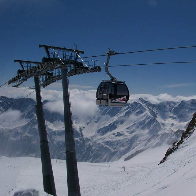
Starting with the positives: - Short transfer from Innsbruck Airport - Modern and efficient lift system - Well groomed slopes - Snow sure - Fantastic views - Ski 3 days which gives access to Obergurgl - Lively nightlife The not so good: - Not that much terrain - Not a picturesque resort - Long and spread out resort - Crowded lower slopes later in the day - Can be quite rowdy (not really a family resort) - No real difficult slopes For a short trip without the kids where you want to let your hair down it's certainly worth a visit.
David from United Kingdom writes:
Starting with the positives:
- Short transfer from Innsbruck Airport
- Modern and efficient lift system
- Well groomed slopes
- Snow sure
- Fantastic views
- Ski 3 days which gives access to Obergurgl
- Lively nightlife
The not so good:
- Not that much terrain
- Not a picturesque resort
- Long and spread out resort
- Crowded lower slopes later in the day
- Can be quite rowdy (not really a family resort)
- No real difficult slopes
For a short trip without the kids where you want to let your hair down it's certainly worth a visit.
The Sölden skiing weather widget is available to embed on external websites free of charge. It provides a daily summary of our Sölden snow forecast and current weather conditions. Simply go to the feed configuration page and follow the 3 simple steps to grab the custom html code snippet and paste it into your own site. You can choose the snow forecast elevation (summit, mid-mountain or bottom lift) and metric/imperial units for the snow forecast feed to suit your own website…. Click here to get the code.
View detailed snow forecast for Sölden at:
snow-forecast.com


 Nearest