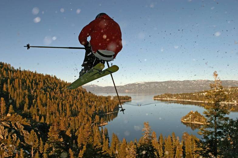


Global Weekly Snow Roundup #314
Weekly Global Snow News, updated 14 May 2026: Fresh snowfall in Argentina, Australia and Lesotho signals winter’s approach, while Japan maintains the world’s deepest snowpack.

Next 4 days weather summary:Mostly dry. Freeze-thaw conditions (max 10°C on Sat afternoon, min -3°C on Sun night). Winds increasing (light winds from the NW on Sat morning, strong winds from the NNE by Sun night). | Days 5-7 weather summary:Mostly dry. Very mild (max 17°C on Thu afternoon, min 1°C on Mon night). Wind will be generally light. | |||||||||||||||
Saturday 16 | Sunday 17 | Monday 18 | Tuesday 19 | Wednesday 20 | ||||||||||||
night | AM | PM | night | AM | PM | night | AM | PM | night | AM | PM | night | AM | PM | night | |
some clouds | some clouds | some clouds | some clouds | some clouds | snow shwrs | clear | clear | clear | clear | clear | clear | clear | some clouds | some clouds | clear | |
km/h | ||||||||||||||||
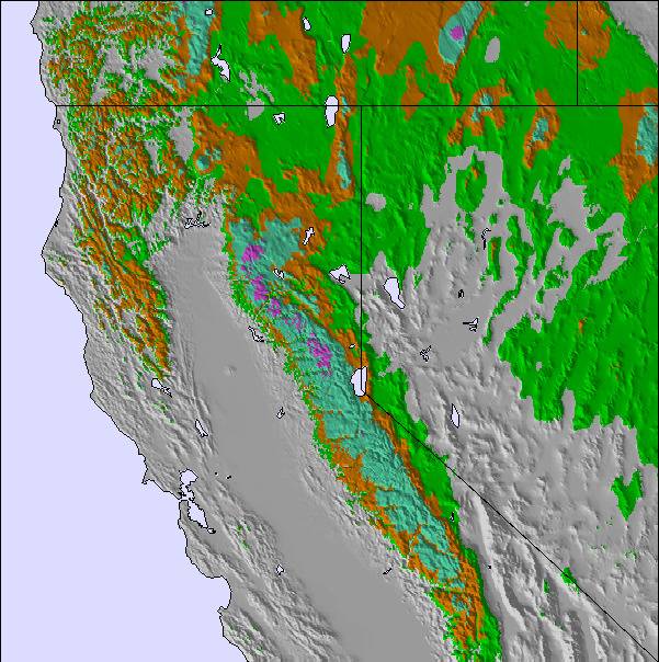
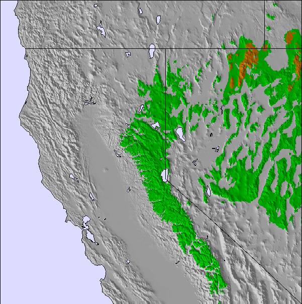
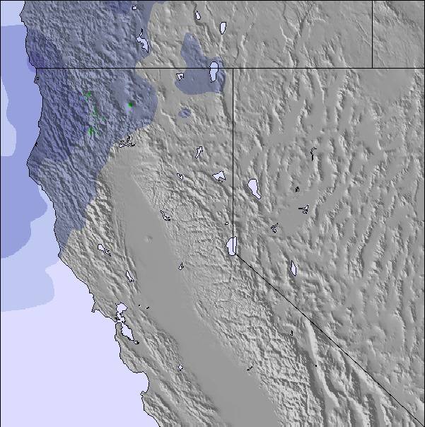
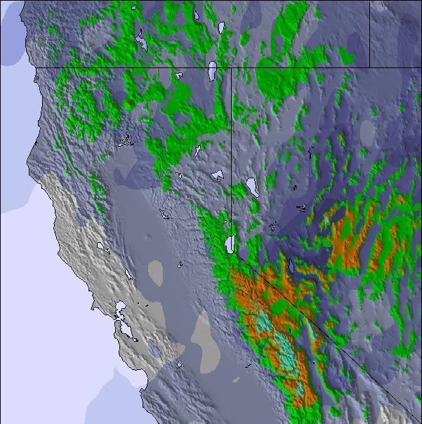
Snow map | 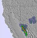 |  | 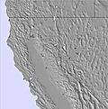 | 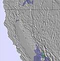 | 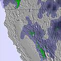 | 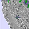 | ||||||||||
— | — | — | — | — | — | — | — | — | — | — | — | — | — | — | — | |
— | — | — | — | — | — | — | — | — | — | — | — | — | — | — | — | |
max °C | 9 | 5 | 10 | 6 | 0 | 1 | 1 | 2 | 6 | 4 | 8 | 13 | 10 | 12 | 16 | 13 |
min °C | 4 | 3 | 9 | 1 | -1 | 1 | -3 | -1 | 5 | 1 | 5 | 11 | 6 | 9 | 14 | 8 |
0 | 0 | 7 | -2 | -7 | -6 | -10 | -7 | 2 | -2 | 5 | 10 | 5 | 8 | 14 | 8 | |
34 | 46 | 31 | 40 | 80 | 32 | 54 | 48 | 23 | 20 | 22 | 21 | 42 | 36 | 29 | 45 | |
3250 | 2900 | 3500 | 2850 | 2150 | 2500 | 2200 | 2550 | 3000 | 3000 | 3250 | 3950 | 3700 | 3850 | 4400 | 4100 | |
— | 5:43 | — | — | 5:43 | — | — | 5:43 | — | — | 5:41 | — | — | 5:41 | — | — | |
— | — | — | 8:07 | — | — | 8:07 | — | — | 8:08 | — | — | 8:08 | — | — | 8:09 | |
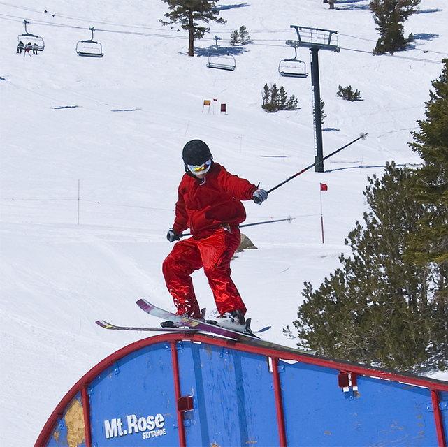
Latest snow reports near Mt Rose Ski at Tahoe:
| Top snow depth: | 0 cm |
|---|---|
| Bottom snow depth: | 0 cm |
| Fresh snowfall depth: | — |
| Last snowfall: | 4 May 2026 |
| Snow Alerts | Create Alert |
0.1 | Bluebird Powder days Fresh snow, mostly sunny, light wind. |
|---|---|
0.1 | Powder days Fresh snow, limited sun, any wind. |
0.3 | Bluebird days Average snow, mostly sunny, light wind. |
The above table gives the weather forecast for Mt Rose Ski at Tahoe at the specific elevation of 2408 m. Our sophisticated weather models allow us to provide snow forecasts for the top, middle and bottom ski stations of Mt Rose Ski at Tahoe. To access the weather forecasts for the other elevations, use the tab navigation above the table. For a wider view of the weather, check out the Weather Map of United States.
Click here to read further information on freezing levels and how we forecast our temperatures.
Overall 3.0 Based on 12 votes and 3 reviews
Well out of all the tahoe resorts this is the one i went to the most. It's not the most high tech but is has good snow because of the very high elevation, and nice views of the lake. The reason why i went there a lot is taht it's uncrowded, and only about 25 mn from reno. So y can stay at a casino hotel for 50-70$ a night and ski here with a very short drivea and 50$ lifts. That compares with skying at squaw with 58$ lifts and prbably like 100-200$ for an hotel in tahoe city. So a good deal overall. The drawbacks are that it can get very windy at the top and most lifts are slooooow.
thibaut colar from United States writes:
Well out of all the tahoe resorts this is the one i went to the most.
It's not the most high tech but is has good snow because of the very high elevation, and nice views of the lake.
The reason why i went there a lot is taht it's uncrowded, and only about 25 mn from reno.
So y can stay at a casino hotel for 50-70$ a night and ski here with a very short drivea and 50$ lifts.
That compares with skying at squaw with 58$ lifts and prbably like 100-200$ for an hotel in tahoe city.
So a good deal overall.
The drawbacks are that it can get very windy at the top and most lifts are slooooow.
Read 2 more reviews of Mt Rose Ski at Tahoe or submit your own

 Nearest