

Global Weekly Snow Roundup #314
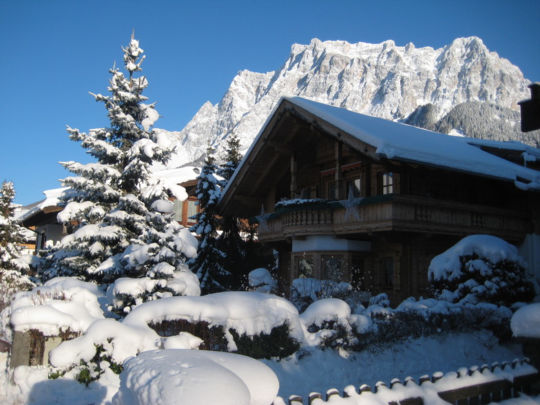
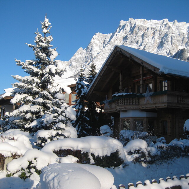
Weekly Global Snow News, updated 14 May 2026: Fresh snowfall in Argentina, Australia and Lesotho signals winter’s approach, while Japan maintains the world’s deepest snowpack.

Next 3 days weather summary:A moderate fall of snow, heaviest on Sat morning. Temperatures will be below freezing (max -3°C on Sun night, min -11°C on Sat morning). Wind will be generally light. | Days 4-6 weather summary:A dusting of new snow. Freeze-thaw conditions (max 3°C on Thu night, min -4°C on Tue morning). Winds increasing (calm on Tue morning, fresh winds from the W by Wed night). | |||||||||||||||||
Saturday 16 | Sunday 17 | Monday 18 | Tuesday 19 | Wednesday 20 | Thursday 21 | |||||||||||||
AM | PM | night | AM | PM | night | AM | PM | night | AM | PM | night | AM | PM | night | AM | PM | night | |
light snow | light snow | snow shwrs | clear | snow shwrs | snow shwrs | snow shwrs | light snow | light snow | some clouds | snow shwrs | light snow | light snow | snow shwrs | light snow | some clouds | clear | clear | |
km/h | ||||||||||||||||||
Snow map |  |  |  |  |  |  | ||||||||||||
3 | 2 | — | — | — | — | — | 3 | 4 | — | — | 2 | — | 1 | — | — | — | — | |
— | — | — | — | — | — | — | — | — | — | — | — | — | — | — | — | — | — | |
max °C | -11 | -9 | -8 | -6 | -5 | -3 | -4 | -4 | -5 | -3 | -3 | -3 | -2 | -1 | -1 | 0 | 1 | 3 |
min °C | -11 | -10 | -9 | -8 | -6 | -5 | -5 | -4 | -5 | -4 | -3 | -3 | -3 | -1 | -1 | -1 | 0 | 2 |
-18 | -15 | -16 | -12 | -8 | -5 | -5 | -4 | -10 | -6 | -6 | -7 | -10 | -7 | -8 | -7 | -4 | -3 | |
92 | 92 | 78 | 48 | 76 | 71 | 88 | 97 | 85 | 61 | 88 | 97 | 90 | 72 | 87 | 50 | 81 | 36 | |
1450 | 1800 | 1600 | 2000 | 2400 | 2250 | 2400 | 2350 | 2050 | 2500 | 2650 | 2500 | 2600 | 2900 | 2750 | 2900 | 3050 | 3400 | |
5:39 | — | — | 5:37 | — | — | 5:35 | — | — | 5:35 | — | — | 5:33 | — | — | 5:33 | — | — | |
— | — | 8:45 | — | — | 8:47 | — | — | 8:49 | — | — | 8:50 | — | — | 8:51 | — | — | 8:52 | |
Latest snow reports near Ehrwald:
| Top snow depth: | — |
|---|---|
| Bottom snow depth: | — |
| Fresh snowfall depth: | 21 cm |
| Last snowfall: | 15 May 2026 |
| Snow Alerts | Create Alert |
0.4 | Bluebird Powder days Fresh snow, mostly sunny, light wind. |
|---|---|
1.3 | Powder days Fresh snow, limited sun, any wind. |
1.0 | Bluebird days Average snow, mostly sunny, light wind. |


The above table gives the weather forecast for Ehrwald at the specific elevation of 2964 m. Our sophisticated weather models allow us to provide snow forecasts for the top, middle and bottom ski stations of Ehrwald. To access the weather forecasts for the other elevations, use the tab navigation above the table. For a wider view of the weather, check out the Weather Map of Austria.
Click here to read further information on freezing levels and how we forecast our temperatures.
Overall 3.6 Based on 11 votes and 4 reviews
Oh, Ehrwald is amazing. Slopes were great and Zugspitze was very good. Pretty high up but was good so would definitely go back.
CH from United Kingdom writes:
Oh, Ehrwald is amazing. Slopes were great and Zugspitze was very good. Pretty high up but was good so would definitely go back.


 Nearest