

Global Weekly Snow Roundup #314
Weekly Global Snow News, updated 14 May 2026: Fresh snowfall in Argentina, Australia and Lesotho signals winter’s approach, while Japan maintains the world’s deepest snowpack.

Next 3 days weather summary:Light rain (total 8.0mm), mostly falling on Mon afternoon. Freeze-thaw conditions (max 4°C on Sun afternoon, min -2°C on Sat morning). Winds decreasing (fresh winds from the NNW on Sat afternoon, calm by Sun night). | Days 4-6 weather summary:Moderate rain (total 17.0mm), heaviest on Tue afternoon. Mild temperatures (max 9°C on Thu afternoon, min 1°C on Tue morning). Wind will be generally light. | |||||||||||||||||
Saturday 16 | Sunday 17 | Monday 18 | Tuesday 19 | Wednesday 20 | Thursday 21 | |||||||||||||
AM | PM | night | AM | PM | night | AM | PM | night | AM | PM | night | AM | PM | night | AM | PM | night | |
light snow | light snow | some clouds | clear | light rain | light rain | rain shwrs | risk thun- der | rain shwrs | rain shwrs | rain shwrs | rain shwrs | some clouds | light rain | rain shwrs | rain shwrs | light rain | rain shwrs | |
km/h | ||||||||||||||||||
Snow map |  |  |  |  |  |  | ||||||||||||
— | — | — | — | — | — | — | — | — | — | — | — | — | — | — | — | — | — | |
— | — | — | — | 1 | 1 | 1 | 3 | 2 | 1 | 4 | 2 | — | 3 | 2 | 1 | 3 | 1 | |
max °C | -1 | 0 | -1 | 1 | 4 | 3 | 3 | 4 | 4 | 3 | 5 | 5 | 5 | 7 | 6 | 7 | 9 | 8 |
min °C | -2 | 0 | -2 | -1 | 3 | 1 | 2 | 4 | 2 | 1 | 4 | 3 | 4 | 6 | 5 | 5 | 8 | 6 |
-7 | -6 | -8 | -3 | 3 | 1 | 2 | 2 | 0 | 0 | 4 | 3 | 2 | 5 | 2 | 2 | 7 | 4 | |
76 | 65 | 71 | 53 | 67 | 85 | 71 | 78 | 88 | 81 | 77 | 68 | 72 | 72 | 75 | 68 | 61 | 73 | |
1950 | 2050 | 1750 | 2250 | 2450 | 2250 | 2450 | 2600 | 2350 | 2450 | 2650 | 2600 | 2700 | 2850 | 2800 | 2900 | 3050 | 2950 | |
5:28 | — | — | 5:28 | — | — | 5:26 | — | — | 5:26 | — | — | 5:24 | — | — | 5:24 | — | — | |
— | — | 8:32 | — | — | 8:34 | — | — | 8:35 | — | — | 8:37 | — | — | 8:37 | — | — | 8:38 | |
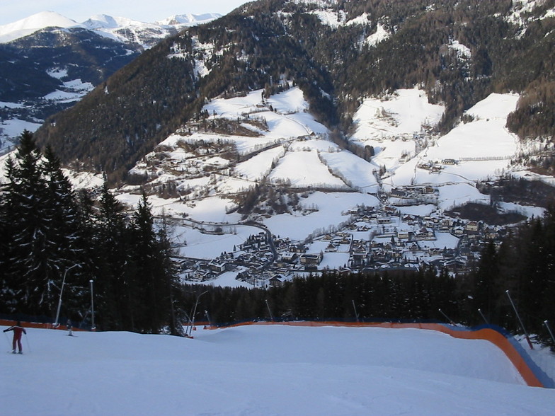
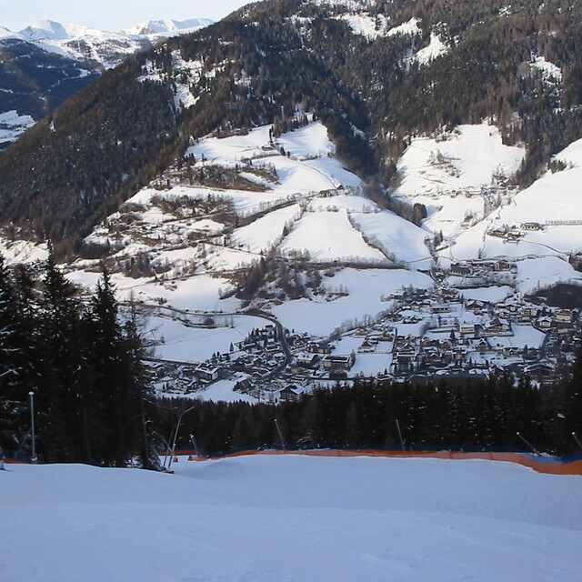
Latest snow reports near Bad Kleinkirchheim:
| Top snow depth: | — |
|---|---|
| Bottom snow depth: | — |
| Fresh snowfall depth: | 25 cm |
| Last snowfall: | 15 May 2026 |
| Snow Alerts | Create Alert |
0.0 | Bluebird Powder days Fresh snow, mostly sunny, light wind. |
|---|---|
0.2 | Powder days Fresh snow, limited sun, any wind. |
0.0 | Bluebird days Average snow, mostly sunny, light wind. |
The above table gives the weather forecast for Bad Kleinkirchheim at the specific elevation of 2055 m. Our sophisticated weather models allow us to provide snow forecasts for the top, middle and bottom ski stations of Bad Kleinkirchheim. To access the weather forecasts for the other elevations, use the tab navigation above the table. For a wider view of the weather, check out the Weather Map of Austria.
Click here to read further information on freezing levels and how we forecast our temperatures.
Overall 3.6 Based on 16 votes and 9 reviews
A beautiful little town with plenty; two very clean spas. The skiing is great in the winter. There are plenty of restaurants to choose from with very good quality hotels and apartments to choose from for accommodation. Recommended to visit especially in the winter for the skiing.
Adrian from United Kingdom writes:
A beautiful little town with plenty; two very clean spas. The skiing is great in the winter. There are plenty of restaurants to choose from with very good quality hotels and apartments to choose from for accommodation.
Recommended to visit especially in the winter for the skiing.
Read 8 more reviews of Bad Kleinkirchheim or submit your own


 Nearest