

Global Weekly Snow Roundup #314
Weekly Global Snow News, updated 14 May 2026: Fresh snowfall in Argentina, Australia and Lesotho signals winter’s approach, while Japan maintains the world’s deepest snowpack.

Next 3 days weather summary:Moderate rain (total 10.0mm), heaviest on Mon afternoon. Very mild (max 13°C on Sun afternoon, min 1°C on Sat night). Wind will be generally light. | Days 4-6 weather summary:Moderate rain (total 17.0mm), heaviest on Tue afternoon. Very mild (max 18°C on Thu afternoon, min 6°C on Tue night). Wind will be generally light. | |||||||||||||||||
Saturday 16 | Sunday 17 | Monday 18 | Tuesday 19 | Wednesday 20 | Thursday 21 | |||||||||||||
AM | PM | night | AM | PM | night | AM | PM | night | AM | PM | night | AM | PM | night | AM | PM | night | |
light rain | light rain | some clouds | clear | light rain | light rain | rain shwrs | risk thun- der | rain shwrs | rain shwrs | rain shwrs | rain shwrs | some clouds | light rain | rain shwrs | rain shwrs | light rain | rain shwrs | |
km/h | ||||||||||||||||||
Snow map |  |  |  |  |  |  | ||||||||||||
— | — | — | — | — | — | — | — | — | — | — | — | — | — | — | — | — | — | |
1 | 1 | — | — | 1 | 1 | 1 | 3 | 2 | 1 | 4 | 2 | — | 3 | 2 | 1 | 3 | 1 | |
max °C | 7 | 8 | 5 | 10 | 13 | 9 | 12 | 13 | 9 | 11 | 12 | 10 | 14 | 14 | 11 | 15 | 18 | 13 |
min °C | 4 | 8 | 1 | 5 | 12 | 5 | 8 | 12 | 5 | 7 | 12 | 6 | 9 | 14 | 7 | 11 | 17 | 8 |
3 | 5 | -2 | 3 | 12 | 5 | 8 | 12 | 4 | 6 | 12 | 6 | 9 | 14 | 6 | 11 | 17 | 8 | |
67 | 59 | 81 | 51 | 50 | 80 | 63 | 70 | 88 | 74 | 68 | 76 | 62 | 61 | 77 | 61 | 45 | 78 | |
1950 | 2050 | 1750 | 2250 | 2450 | 2250 | 2450 | 2600 | 2350 | 2450 | 2650 | 2600 | 2700 | 2850 | 2800 | 2900 | 3050 | 2950 | |
5:28 | — | — | 5:28 | — | — | 5:26 | — | — | 5:26 | — | — | 5:24 | — | — | 5:24 | — | — | |
— | — | 8:32 | — | — | 8:34 | — | — | 8:35 | — | — | 8:37 | — | — | 8:37 | — | — | 8:38 | |
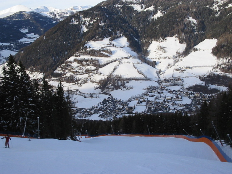
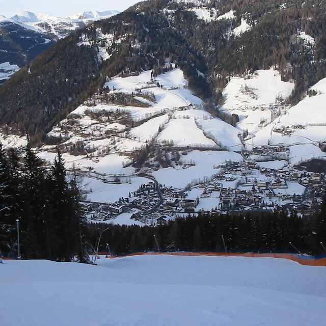
Latest snow reports near Bad Kleinkirchheim:
| Top snow depth: | — |
|---|---|
| Bottom snow depth: | — |
| Fresh snowfall depth: | 25 cm |
| Last snowfall: | 15 May 2026 |
| Snow Alerts | Create Alert |
0.0 | Bluebird Powder days Fresh snow, mostly sunny, light wind. |
|---|---|
0.0 | Powder days Fresh snow, limited sun, any wind. |
0.0 | Bluebird days Average snow, mostly sunny, light wind. |
The above table gives the weather forecast for Bad Kleinkirchheim at the specific elevation of 1100 m. Our sophisticated weather models allow us to provide snow forecasts for the top, middle and bottom ski stations of Bad Kleinkirchheim. To access the weather forecasts for the other elevations, use the tab navigation above the table. For a wider view of the weather, check out the Weather Map of Austria.
Click here to read further information on freezing levels and how we forecast our temperatures.
Overall 3.6 Based on 16 votes and 9 reviews
We stayed with family in Bad Kleinkirchheim for 9 days. Nice town, good food but if you are going for a ski vacation you could be disappointed because of the lack of snow and bad preparation of slopes (several days there was ice on the slopes). I don't know why they are not making artificial snow, seems they don't care. In summary, if you are going to this place for skiing you could be very disappointed.
Markas from Lithuania writes:
We stayed with family in Bad Kleinkirchheim for 9 days. Nice town, good food but if you are going for a ski vacation you could be disappointed because of the lack of snow and bad preparation of slopes (several days there was ice on the slopes). I don't know why they are not making artificial snow, seems they don't care. In summary, if you are going to this place for skiing you could be very disappointed.
Read 8 more reviews of Bad Kleinkirchheim or submit your own


 Nearest