WORLD SNOW ROUNDUP #286
Issued: 12th April 2023
By Patrick “Snowhunter” Thorne
World Overview
We’re into the final weeks of the main 22-23 season now, with the Easter weekend behind us and the majority of ski areas now closed. But the good news is it hasn’t stopped snowing and hundreds of ski areas are still open into the latter half of April, with a growing number extending their seasons into May.
Ski areas in the Alps posted up to 25cm (10”) of fresh snowfall on higher slopes through the weekend, although for most it was more like 5-15cm (2-6”). There was also snowfall earlier last week in the Balkans and the Pyrenees and it is snowing now again in Scandinavia
In North America, remarkably, there have been still more heavy snowfalls in the Rockies leading to more resort closures in the west, with the Little Cottonwood Canyon, in Utah, seeing the most intense weather; another five feet (150cm) plus of snowfall, leading to avalanche risk closures and severe access road restrictions once re-opened through much of last week.
In the Southern Hemisphere, there was excitement in Australia at the weekend as ski areas saw a few millimetres of snowfall on their slopes for Easter Sunday morning, two months before the start of the 2023 ski season there.
Europe
EUROPE INTRO
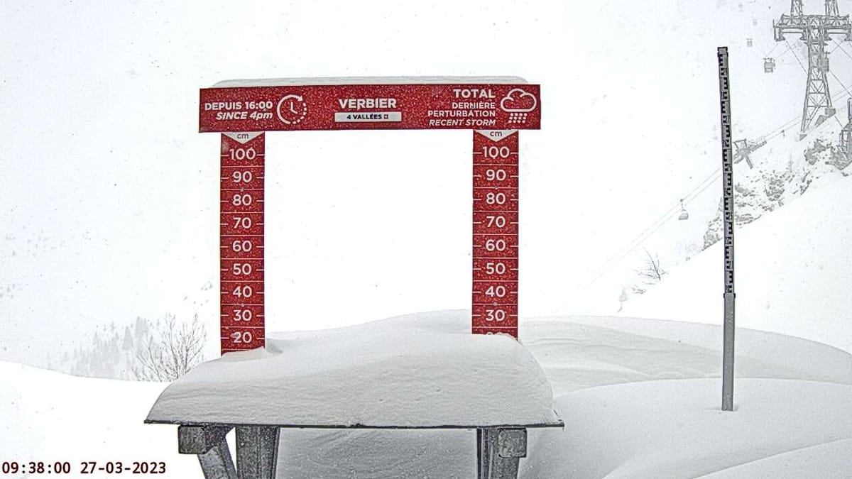
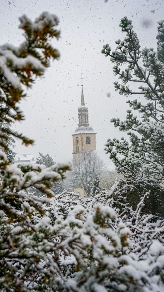
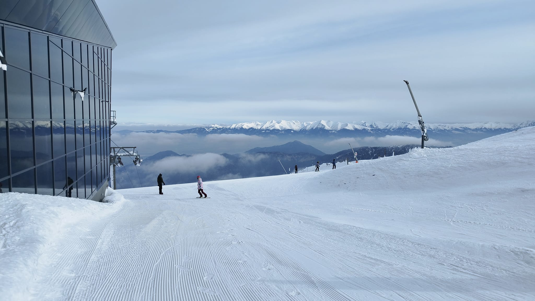
It was a snowy Easter weekend in the Alps as ski areas across the region reported 5-25cm (2-10″) of snowfall through the weekend, heaviest in the northeast and southwest and continuing up into the Czech and Slovak republics. That followed snowfall earlier last week in the Balkans and the Pyrenees. But we’re also very much reaching the end of the 22-23 season with hundreds of ski areas closing after the Easter weekend and most of those still open this week planning to close after the coming Sunday, although several hundred more will continue into the latter half of April. It’s now sunny in the Alps although there’s more snow forecast later this week for higher slopes. Elsewhere, Scandinavia is seeing snow again after a mostly dry and sunny week up to Easter Day and Scotland has almost completely ended its season with just a couple of runs still open at one centre at the time of compilation of this report.
AUSTRIA REPORT
Around half of Austria’s ski areas had closed for the season ahead of the Easter weekend and that number jumped to nearer 85% this week. It was a cold final weekend of the season for many though with highs down to single figures in valleys and subzero temperatures above 2000m 24-7 for most. There was snowfall too, with the Stubai Glacier (30/195cm / 12/78”) among those posting 10cm (4”) of fresh snowfall on Easter Saturday. For those still operating there’s still a lot of terrain open. The Arlberg region, where St Anton (60/265cm / 24/105”) will be open to the start of May, still has about 80% of its slopes open and it’s a similar story for the Silvretta Arena around Ischgl (20/130cm / 8/52”), which had more than 90% of its terrain open to the weekend.
AUSTRIA FORECAST
After the cool weekend temperatures have risen around ten degrees in valleys. But the next few days will see overcast skies and temperatures dropping again. The next front could bring snowfall to high slopes and glaciers this coming weekend.
SWITZERLAND REPORT
Swiss centres have also enjoyed a cold Easter weekend with snow reported across the country’s ski slopes, light in the east but with up to 10cm (4″) in the west along the French border. Many Swiss centres have now closed for the season, including a large amount after the Easter weekend, but several dozen remain open to later this month and several including Zermatt (0/150cm / 0/60”), Glacier 3000 (10/270cm / 4/108”), near Gstaad and the Diavolezza glacier (5/60cm / 2/24”), near St Moritz (although the snow cover here may not be adequate), as well as the Gemsstock ski area above Andermatt (0/100cm / 0/40”) all plan to stay open into May.
SWITZERLAND FORECAST
After a brief sunny, warm spell midweek temperatures are set to drop again from Thursday across Switzerland with more snow showers expected on higher slopes to end the week.
FRANCE REPORT
The main French ski areas remain open with the first of the big names closing this coming weekend, but many staying in operation until the 23rd, 30th/1st or even the second weekend in May in the case of Tignes (150/450cm / 60/260″) and several others. Most of the big ski areas like the 3 Valleys continue to have 70-90% of their terrain open too, thanks to their predominately high (above 1800m) ski areas. There was fresh snowfall on those higher runs here too over the Easter weekend. La Plagne (125/250cm / 50/100”) reported 14cm (6”), perfectly timed on Saturday morning and great news for the weekend. Many other areas posted 5-10cm (2-4″) of fresh too as temperatures got below freezing 24-7 above 2000m altitude.
FRANCE FORECAST
After a sunny few days with warming temperatures clouds should roll back in and temperatures cool again midweek. It currently looks like cold weather will return from Thursday/Friday with the potential for snowfall up high again.
ITALY REPORT
There was snowfall across northern Italy at the start of the Easter weekend with the Monterosa ski region (0/100cm / 0/40”) reporting the biggest fresh snowfall accumulation of 165cm (6”) on the Saturday morning. Temperatures were cool here too. As with the rest of Europe, many Italian areas decided to end their seasons after Easter Sunday and many of those still open will close this coming Sunday. However, others like Cervinia (0/150cm / 0/60”) and Passo Tonale (20/120cm / 8/48″) will keep their higher slopes open into May. After the snowy start to the weekend, it has turned sunny across much of the country and temperatures have risen a little but remain below freezing day and night above 2500m.
ITALY FORECAST
After the sunny start to the week cloud is expected to build over the next few days with the chance of snow showers for high slopes to the end of the week. Temperatures back into double figures above zero Celsius in alpine valleys, however, and a little warmer, though still close to freezing above 2000m.
GERMANY REPORT
The ski season is all but over on German ski slopes with just a handful of ski areas left operating after the Easter weekend. Oberstdorf (40/90cm / 16/36″) reports the most terrain still skiable with 29km (18 miles) of slopes open. Its season ends at the weekend. The Zugspitze (206/206cm / 82/82″) looks set to be the only ski area in the country open for the final weeks of April, with its closure date set for the start of May. As with the rest of the Alps, it has been a cold Easter weekend with fresh snowfall reported on higher German slopes.
GERMANY FORECAST
Unsettled conditions continuing and although temperatures are rising a few degrees they should stay below freezing above 2000m for much of the 24-hour cycle. Fronts moving in should mean more snowfall on the highest terrain over the latter half of this week.
SCANDINAVIA FORECAST
The cold and snowy weather is expected to continue through the rest of this week. So many areas could see 30-60cm of new snow, particularly on higher slopes (in total) by the weekend.
SCOTLAND REPORT
Sadly, barring a late miracle, Scotland’s ski season is all but over. Cairngorm was the only centre keeping a few runs open for the Easter weekend and Glencoe ran its access chair up for ski tourers, there was even fresh snow down to its base on Tuesday morning. However, Glenshee and The Lecht both gave up on plans to make plus-temperatures snow to offer beginner lessons due to the warm daytime temperatures. Nevis Range only managed to open for a few days this winter and is now in full mountain biking mode.
SCOTLAND FORECAST
A little colder with overnight lows below freezing and the chance of hill snow later in the week, but with daytime highs still getting up to double figures in valleys. So, there is the possibility of the hills turning white again but it seems unlikely to be enough to allow much of anything to reopen at this stage of the season.
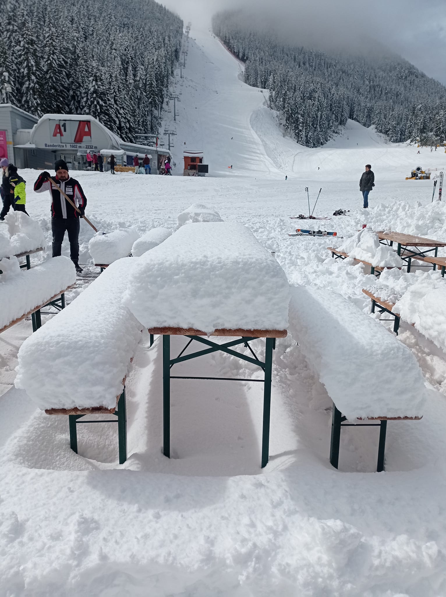
SPAIN / ANDORRA REPORT
There was some snowfall reported high in the Pyrenees a week ago with 2-30cm (8-12”) reported and some centres reporting great conditions on higher slopes. Most that were still open have closed after the Easter weekend though and many of those that are still open are down to 20-40% of their higher terrain left for their final days or week(s). Grandvalira (15/55cm / 6/22″) is one of the last areas still open. The largest ski area in the Pyrenees has about a third of its 240km (150 miles) of runs still open for what’s expected to be the final week of the season there.
SPAIN / ANDORRA FORECAST
It’s getting very warm now with temperatures at lower elevations, where the snow has long since departed, getting into the high teens. Plenty of sunshine although with showers forecast for later in the week, potentially bringing snow very high overnight, though rain is equally likely.
BULGARIA / ROMANIA REPORT
There was some fresh snowfall on higher slopes in Bulgaria just as last week’s report was being published. Actually, more than expected with some centres posting as much as 40cm (16″). So, while temperatures quickly rose again and the sunshine returned, conditions were much better, on higher slopes at least, for the Easter weekend. The cold and snowy weather did in fact return over the weekend. For still open centres in the region, we’re into the final week of the season. Bansko (0/100cm / 0/40″) still has about two-thirds of its terrain open though.
BULGARIA / ROMANIA FORECAST
After the cold and cloudy weather clears, sunshine and a rapid rise in temperatures to the mid-teens is expected over the next few days, marking a pretty clear end of the season in the Balkans.
CZECH REPUBLIC / SLOVAKIA REPORT
The few remaining ski areas still open in the Czech and Slovak Republics and Poland post-Easter, mostly reported some decent snowfalls on Good Friday, with 10-20cm (4-8”) accumulations into the holiday weekend. Slovakia’s Tatranská Lomnica (20/60cm / 8/24″), one of those planning to stay open until the end of the month, posted 10cm (4″) of fresh on Saturday morning and it was a similar story at the largest centre, Jasna (20/180cm / 8/48”), which remains 95% open and plans to stay open to the start of May.
CZECH REPUBLIC / SLOVAKIA FORECAST
A mixture of sunshine and cloud with snowfall/rain is expected at the weekend. Temperatures get up to +15C in valleys, and +5C on higher slopes in the daytime, so freeze-thaw conditions up there.
NORTH AMERICA INTRO
Remarkably, it has been another week of extreme snowfall in the west of the continent with Utah the focus with conditions having most impact. Some areas were forced to close for several days due to severe avalanche danger following 5 feet (1.5m) more snowfall, which also saw another centre pass the 800” (20.3m) season snowfall to date record mark. Otherwise, as with Europe, more and more ski areas have ended their seasons or will do this coming weekend. Although others will continue later into spring. The weather in the east has been more warm and sunny so the thaw is currently happening faster there.
ROCKIES REPORT
It just won’t stop snowing in the Rockies it seems. One Utah resort, Deer Valley, commented that it is, “starting to look like spring but still skiing like January.” That was nowhere more the case than in Little Cottonwood Canyon where there was a prolonged period last week due to high avalanche danger and resorts there including Alta, Snowbird and Solitude declared “Interlodge” asking skiers to stay inside for safety. Snowbird passed through it’s all time-seasonal-snowfall record mark and then the 800” (20.3m) total too, joining Alta in reaching this historic level. On Thursday an avalanche from outside the ski area boundary crossed an open run but no one was hurt. While not quite so extreme the snowy weather continues to impact Colorado and other Rockies ski states too. While this is all happening some ski resorts that have not announced extensions are ending their seasons with many calling it a day after the Easter weekend.
ROCKIES FORECAST
It seems the months of snowy weather may finally be easing with mostly sunny weather this week and temperatures climbing well above freezing at all elevations, reaching the mid-50s at mountain bases and into the 40s in the daytime at high elevations. So the thaw should gather pace. Outside chance of some light snowfall in the longer-term forecast for the weekend.
USA WEST REPORT
There’s been a mixed week in the west with more heavy snowfall for the northwest of the region – particularly high slopes in Washington state and up in Alaska, but warmer weather further south causing flooding concerns as the massive snowpack that is currently more than double the average and triple or quadruple the more recent drought seasons beginning to thaw. Mammoth Mountain (260/319” / 650/797cm), in California, continues to hold the North American and global top spot for snow depth but it has dropped about three feet (90cm) on a week ago to below 320”/8m. It still has more than 90% of its slopes open and plans to continue operating at least until the end of July. The rest of the North American/world top five for snow depth remain in California with Sierra at Tahoe (149/244″) in second spot.
USA WEST FORECAST
Spring has finally sprung with mostly warm, sunny weather forecast for the western US, meaning fast-thawing of the huge snowpack and the danger of flooding and wet snow avalanches. An outside chance of rain/snow up high to end the week.
MIDWEST REPORT
The vast majority of Midwest ski areas have now closed for the season with just a handful continuing on into the latter half of April. Overnight lows have still been dropping a few degrees below freezing and there have been reports of an inch (2.5cm) or so of fresh snowfall, but daytime highs have reached the high 50s, so snowpacks are definitely shrinking. Among those still open, Michigan’s Ski Brule (72/72” / 180/80cm) is posting the deepest snowpack of the still open resorts and all runs open.
MIDWEST FORECAST
Sunny weather ahead with highs in the low 70s, and lows in the high 40s, so the thaw will continue and gather pace.
USA EAST REPORT
It’s the end of the season in the east with the majority of ski areas still closed but some aiming to stay open until the end of this month or later. The recent sunny, warm weather isn’t helping much with that ambition, creating a rapid thaw. Temperatures have been reaching the high 50s or even low 60s at bases in the afternoons. Sunday River (36/51” / 91/127cm), up in Maine, is posting the deepest base of the season with still has a couple of weeks of the season to run; about two-thirds of its slopes are still open.
USA EAST FORECAST
Full sunshine continues to be forecast for the week ahead with the potential for ever warmer temperatures heading towards the weekend.
CANADA WEST REPORT
Strong winds were an issue over the Easter weekend in western Canada with coastal Whistler Blackcomb (0/238cm / 0/95”) forced to close large amounts of terrain due to high avalanche danger as heavy snowfall arrived too, leading to concerns about safe lift operations. Fellow coastal BC resort Mount Seymour (310/442cm / 124/177″) continues to post Canada’s deepest snowpack on its upper slopes and remains 98% open. It is snowing again though for the post-Easter week on many slopes in the area. Despite the snowfall, many western Canadian ski areas, including Big White, Kimberley and Silver Star have closed in the last few days after the Easter weekend but others plan to stay open until the end of this month or in the case of Sunshine (70/159cm 28/64″), Marmot Basin (116/116cm / 46/46″), Lake Louise (108/135cm / 43/54″) and Whistler, into May. Fernie (100/229cm / 40/92”) and Revelstoke (40/223 / 16/89”) are into their final week of 22-23.
CANADA WEST FORECAST
The current snowy weather is expected to continue for the rest of this week in many areas. Temperatures in the range of -15C up high overnight to +5C in resort are expected to continue through to the weekend.
CANADA EAST REPORT
The season is winding down in eastern Canada with most areas there now closed. It’s been a mixed winter with some ski areas posting all-time record snow totals, while others with lower elevation terrain have been struggling to open many runs all winter. Tremblant (54/140cm / 22/56″), the biggest resort and one of those reporting its most-ever snowfall, has extended its season by an extra week and still has about 80% of its runs open.
CANADA EAST FORECAST
Getting warmer with plenty of sunshine, which should speed up the season’s end for those centres still open. Daytime temperatures in the range of +7 to +15C are forecast with the odd rain shower thrown in.
Asia
JAPAN REPORT
The ski season has been winding down fast in Japan with most smaller and mid-sized areas closing over the past two weekends, some earlier than expected due to very mild temperatures. However, about a dozen will continue on into early May if they can; the Gassan summer ski area also started its season on Monday. The internationally best-known area of Niseko (0/265cm / 0/106″) is one of those staying open although Niseko Hanazono, Niseko Village and Niseko Moiwa ski areas all closed for the season on Sunday. It has been reporting some fresh snowfalls (3-8cm (1-3” typically) on higher slopes, nothing or rain lower down.
JAPAN FORECAST
Spring is in the air with valley temperatures in the +5 to -15C range at many still open areas, so snow sports are reserved for the upper mountain. The week ahead will see a mix of weather including rain/snowfall then sunny and cloudy but dry spells.


