WORLD SNOW ROUNDUP #285

Issued: 5th April 2023
By Patrick “Snowhunter” Thorne
World Overview
It is April and the next two or three weekends will see the vast majority of the Northern Hemisphere’s ski centres end their 22-23 seasons. The process has already got underway with the first swathe of lower altitude resorts, particularly in countries like Austria, calling it a day on their seasons on Monday, having made it to April.
But it keeps snowing, particularly on higher slopes in Europe and western slopes in North America. Resorts in the Alps continue to see some of their biggest snowfalls of the season, just as it nears its end, while in Western North America more records are being broken for snowpack depth and seasonal snowfall totals. Where it is snowing the reports are of conditions “like mid-winter”. Fresh accumulations of up to a metre (40″) have been reported on higher slopes on both sides of the Atlantic. Fortunately, a lot of the bigger accumulations are at those centres open to late April, into May or, thanks to season extensions announced by a growing number of resorts in the US West because of the unprecedented snow depths there, even later in the year.
As it is April the snow that is falling is not powder, or not for long and only on the highest slopes. There are increasingly long periods of rain preceding the snow and although temperatures keep dipping well below freezing, they then rapidly rise. So, for most, it’s a mix of snowfall, rain showers and an increasing thaw at the mountain base.
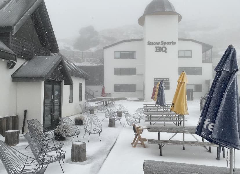
Elsewhere in the world, ski areas in New Zealand have been posting fresh snowfall, again, on their higher slopes with just over two months until the 2023 ski season is due to start there.
Europe
EUROPE INTRO
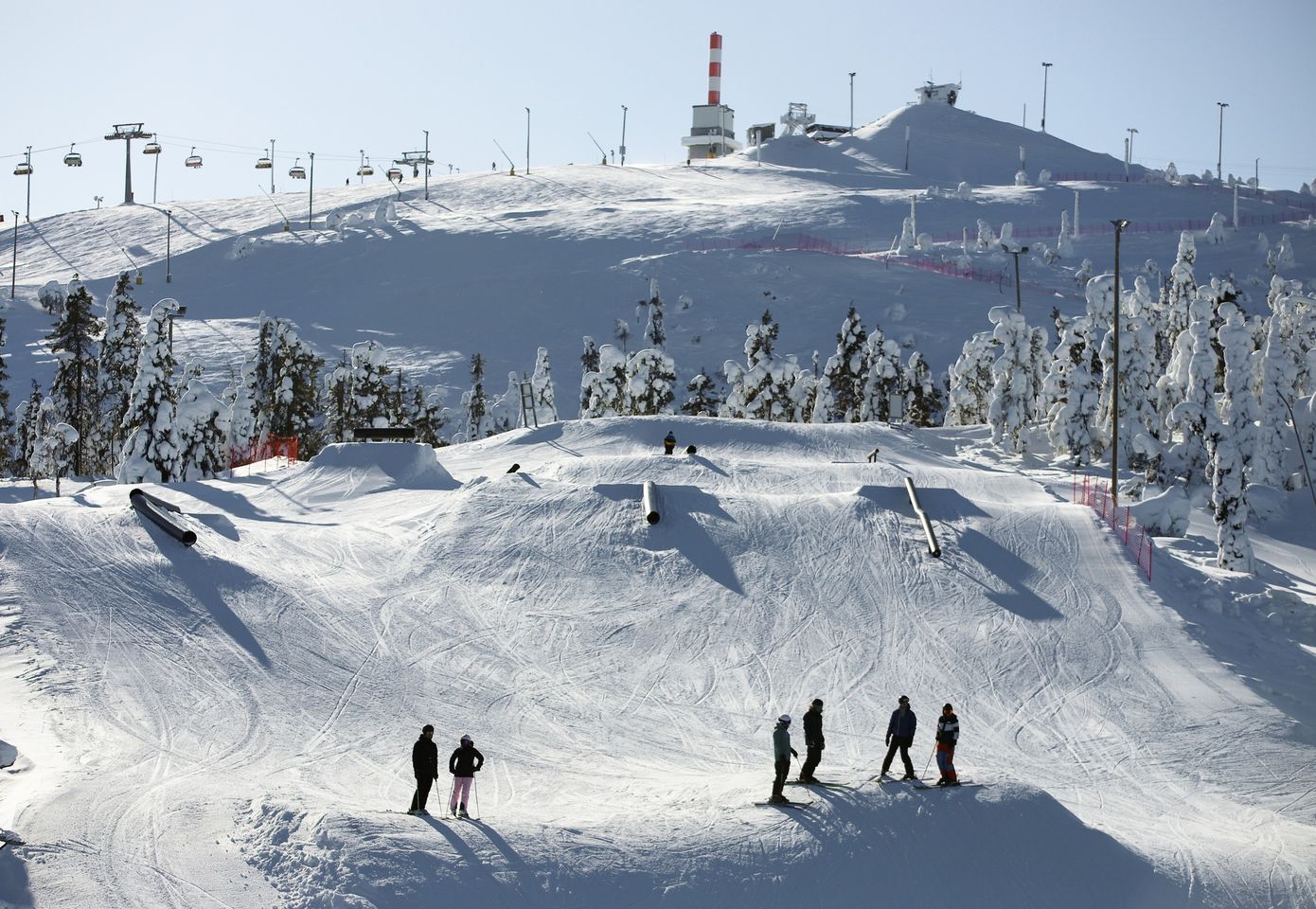
A week of weather extremes in the Alps with sunny weather and daytime highs of +15C in the latter half of last week, then by the weekend it was dumping again on higher slopes with temperatures dipping to -15C above 3,000m. This is all pretty normal for the springtime of course. Although the snow accumulation continues up high the average temperatures keep climbing so there’s more rain rather than snow down low and the snow up high is heavier than in mid-winter. This can add to the avalanche danger and it is still running high Level 3 or 4 (of 5) in many areas, especially in the northern and western Alps.
Elsewhere, it has got cooler and there’s been some snowfall in the Pyrenees as well as the Balkans, but the spring thaw continues relentlessly. Cooler in Scandinavia, but here too things are finally feeling a little more springlike. Unfortunately, in Scotland there’s not much left open for the Easter holidays.
AUSTRIA REPORT
More than half of Austrian ski areas have now closed for the season and many of those still open continue to battle challenging conditions on lower slopes. It has, though, been a cooler week with snowfall over the weekend on higher runs. Unfortunately, rain at lower levels. 10-20cm (4-8″) accumulations at altitude were reported up to Monday, the most in the north and west. The Arlberg region around St Anton (75/285cm / 30/114”) still has 80% of its slopes open – some 240km (150 miles), the most in the country at present and remains open through to May.
AUSTRIA FORECAST
Staying dry and getting increasingly warm and sunny as we move through the remainder of the week. Going from freeze-thaw at present back to double digits at mountain bases and well above freezing at altitude too by the weekend.
SWITZERLAND REPORT
Swiss centres are also beginning to close down, with more than half of the country’s ski areas having ended their seasons. Although these are mostly the smaller, lower centres, many larger resorts will be closing this weekend after Easter or the weekend after. For the bigger resorts with higher slopes, particularly in the west of the country, there’s been a good deal more snowfall over the last week, much of it falling at the weekend. It’s stayed cool but has been sunny since. Saas Fee (60/370cm / 24/148”) has had another half metre (20”) of snowfall and has the second deepest base in Europe now. It still has 80% of its slopes open.
SWITZERLAND FORECAST
Cool and sunny through midweek with temperatures lower than they have been. Becoming more unsettled towards the weekend with more snow forecast from Friday on higher slopes.
FRANCE REPORT
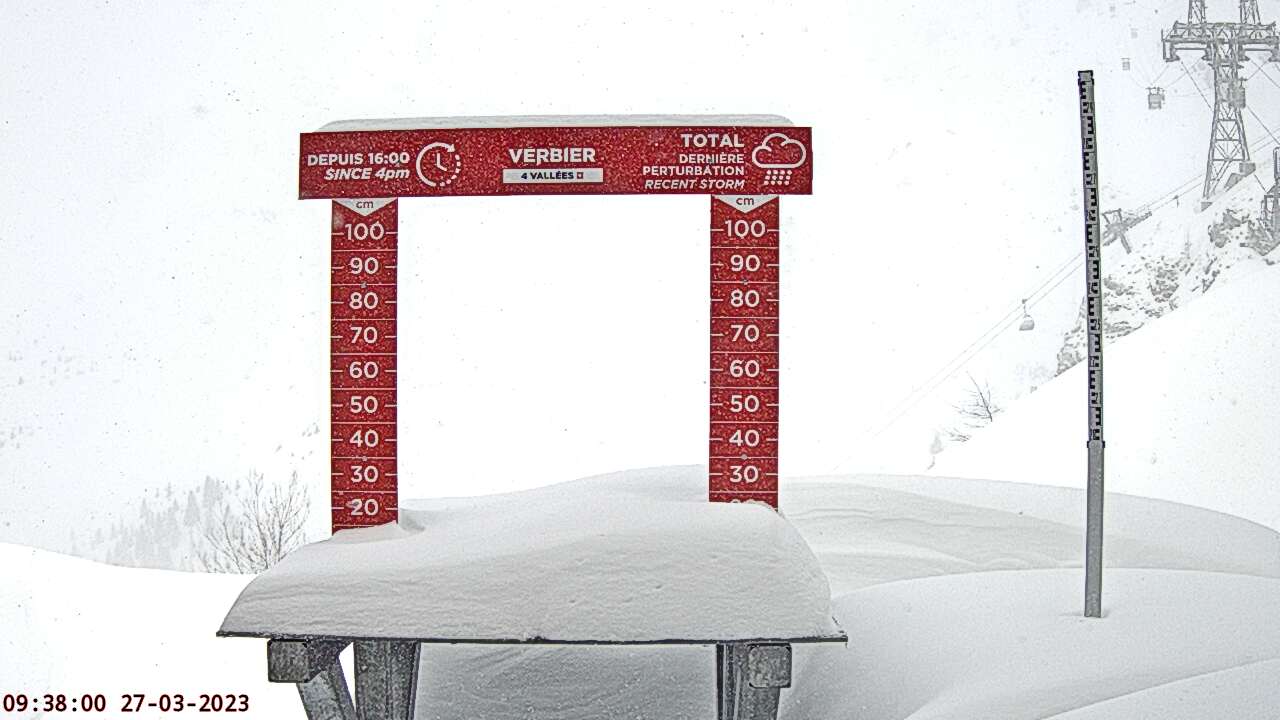
France saw more heavy snowfall on higher slopes through the weekend. Tignes (150/450cm / 60/180”) further increased its base, Europe’s deepest. But it’s neighbour, Val d’Isere (150/250cm / 60/100”), did especially well with top-to-bottom snowfall at the weekend. Having a base up at 1850m was certainly a help there, whilst lower ski areas saw rain at times. Temperatures did cool though through the weekend and even though the sunshine returns it is currently cooler in the French mountains than we’ve seen for much of March. As a result big and fairly high areas like the 3 Valleys (180/340cm / 72/136″) still have about 90% of their slopes open.
FRANCE FORECAST
Staying fairly cool with temperatures in the -6 to +6 Celcius range at 1500m. So freeze-thaw conditions at that altitude but less thaw above 2000m. Getting a little cooler with snow showers expected into the Easter weekend.
ITALY REPORT
There was more snowfall in western Italy at the weekend with some ski areas in the Aosta Valley reporting totals of 40cm (16”) or more by Monday. There were lighter falls further east. La Thuile (90/320cm / 36/128”), on the French border, continues to post the (now increased) deepest snow depth in the country. It’s the first to pass 3 metres (10 feet) this season. Sella Nevea is at 15/220cm / 6/88”) in the east (located on the Slovenian border and usually open until mid-May thanks to its good snow record, despite its proximity to the Adriatic visible from the top of the slopes). The sunshine has returned across the country over the last few days though it remains a little cooler than it has been of late.
ITALY FORECAST
Sunny midweek but with increasing cloud build up as the days pass. Getting into double digits above freezing at resort bases below 1500m, but staying below freezing 24-7 on ski slopes above 2500m.
GERMANY REPORT
The vast majority of German ski areas had already closed by the weekend, and another dozen or so followed suit on Sunday/Monday leaving just a handful still operating for the upcoming Easter weekend. The German ski season does tend to end by late March for most resorts anyway, but 22-23 has been particularly poor for warm weather and limited natural snowfall. Still open though is Oberstdorf (40/90cm / 16/36”), to mid-April. The highest slopes are at Zugspitze (213/213cm / 85/85”) until May 1st. It has actually been cold and snowy the last few days with temperatures not getting above freezing.
GERMANY FORECAST
Staying cool but dry with not much snow forecast. Temperatures remaining close to freezing down to low elevations for the remainder of the week.
SCANDINAVIA FORECAST
A mix of sunshine and cloud across the region with no real fresh snow forecast. Temperatures typically in the region of -6 to +6C, obviously cooler in the north.
SCOTLAND REPORT
Alas,- there’s been no big improvement in conditions in Scotland with less and less terrain open, and there hadn’t been much before. Cairngorm has a handful of runs in the Top Bowls and at the base and has managed to stage The Brits this week. Glenshee says it can no longer maintain ski runs even with its all-weather snow-making and has switched to sledging on the slope instead, the same model as Glencoe at present, which also offers chairlift access to ski tourers. The Lecht says there’s an outside chance they’ll be able to reopen next weekend.
SCOTLAND FORECAST
Although Scottish centres do offer the hope of late-season spring skiing it isn’t looking likely this year with more warm and sunny weather forecast. There remains a chance of hill snow but it is diminishing and likely to be enough to allow terrain to open even if it arrives now.
SPAIN / ANDORRA REPORT
There was some snowfall on higher slopes in the Pyrenees at the weekend but it has made little impact on the big picture of a fast-thawing snowpack. The region’s biggest ski area, Grandvalira, (20/60cm / 8/24″), in Andorra, has managed to keep about half of its terrain still open for Easter weekend with full-on freeze-thaw conditions. About half of the region’s ski areas have now closed for the season with the remainder battling on to the upcoming Easter weekend.
SPAIN / ANDORRA FORECAST
It’s back to full sun for the run up to the Easter weekend, which will further impact the snowpack. That said, temperatures won’t be as warm as they have been with valley highs of +5-7C and as all the snow has gone down there and the remainder is up on higher runs, where it will remain closer to freezing, it will perhaps not get much worse for the open terrain.
BULGARIA / ROMANIA REPORT
There’s been a little fresh snowfall as the season winds down in the Balkans. Bansko (0/70cm / 0/28”) appears to have closed its long run down from the base of the ski area to the village as the thaw sets in and Vitosha (20/35cm / 8/14”) was reported closed early due to inadequate snow cover remaining but it does plan to reopen if possible. Last week was mostly warm and sunny with daytime highs reaching +15C but it has got much cooler, back closer to freezing, with snow showers since Sunday.
BULGARIA / ROMANIA FORECAST
There looks to be a late-season rallying of winter conditions underway in the Balkans with the cold and snowy weather of the past few days expected to continue for the next few days, temperatures staying close to freezing even at base levels.
CZECH REPUBLIC / SLOVAKIA REPORT
Most ski areas in the Czech and Slovak republics, as well as Poland, have already closed for the season but larger resorts remain open and have been enjoying fairly cool temperatures slowing the rate of thaw, and even a little fresh snowfall. The largest ski area in the Czech Republic, Špindlerův Mlýn (15/75cm / 6/30”) still has about two-thirds of its terrain skiable. In Slovakia, Jasna (20/180cm / 8/72”) has the deepest snow in the region and remains 90% open.
CZECH REPUBLIC / SLOVAKIA FORECAST
Remaining fairly cool for the rest of this week. Not much precipitation is forecast, a mixture of cloudy and sunny spells. Highs around +6C but generally in the -3 to +3C range in the mountains.
NORTH AMERICA INTRO
There have been still more fronts moving into the US West off the Pacific bringing both rain and snowfall. The snowpack is getting heavier and wetter at lower altitudes but there’s still plenty of fresh high up. Resorts have begun closing though as the traditional season-end dates arrive and most will follow suit either this coming weekend or the next. At the same time though more have announced extended seasons with the snowpack in states like Utah running at more than 200% average for the start of April. It is not just the west coast North American resorts setting snowfall records though. Although there have been reported warm weather issues all season for east coast ski areas, Mont Tremblant appears to have missed the worst of them and reports it has had its most ever snow, more than 6 metres (20 feet) and has joined the list of areas extending their seasons.
ROCKIES REPORT
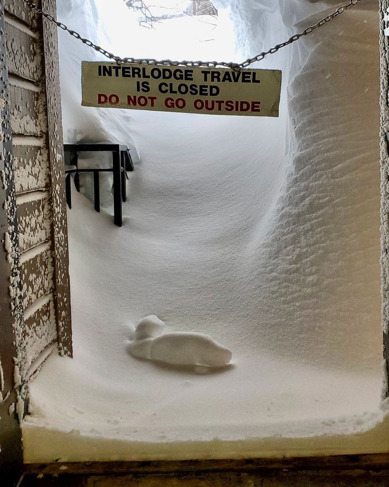
Incredibly, it is still dumping down in The Rockies, with many areas reporting several more feet this week as ski resorts end their seasons. Many have already closed or will be closing this coming weekend. But Little Cottonwood Canyon, home to Alta (64/231” / 160/572cm) and Snowbird ski resorts, was closed again on Friday by ‘interlodge’, the state of emergency called when the avalanche danger is so high everyone is required to leave ski slopes and vehicles and just get indoors. Alta also passed the 800” (20.3 metres) season-snowfall-to-date mark, one of the biggest totals reported anywhere for several years and double the total for famously snowy Niseko in Japan this winter.
ROCKIES FORECAST
It is a bit too soon to say that spring is finally here but it is looking warmer and drier at last over the remainder of this week, with temperatures getting up to the high 40s in the daytime.
USA WEST REPORT
More snowfall has bolstered bases even further along the US West coast where several resorts have already said they’ll stay open at least until July. The sunshine has now returned after a snowy end to last week. California’s Mammoth Mountain (286/351″ / 716/873cm) continues to post the deepest snow in the world and reported another three feet (90cm) of snowfall this week. It still reports 90% of its slopes open. Sierra at Tahoe (151/244″ / 373/610cm), which reopened this season after closing in winter 21-22 following forest fires has the second deepest snowpack in the region and one of the five deepest in the world right now.
USA WEST FORECAST
Springlike conditions for the remainder of this week with plenty of sunshine and temperatures climbing up to the high 40s, even the low 50s, at lower areas.
MIDWEST REPORT
Most Midwest ski areas have now ended their 22-23 ski seasons, whether they have snow cover or not, as the locals move into spring mode. Others are staying open, but only at weekends for a few more weeks and there are some more still open daily. There has been some fresh snowfall to bolster those still operating with temperatures typically still in the 20-40F range at Midwestern ski slopes. Some of these late falls have set records for April snowfall with Trollhaugen in Wisconsin, for example, reporting 12” (30cm) on Sunday, its closing day, but somehow managed to stage a pond skim. Wild Mountain, which had been the first ski area to open in the US last October 18th, has closed for the season.
MIDWEST FORECAST
Drier, warmer weather than recently is expected in the run-up to Easter. No more snow forecast and the minority of remaining ski areas still open will be focussed on maintaining their snowpacks as best they can.
USA EAST REPORT
Springlike weather in the East with some cold, snowy days, particularly for higher, more northerly centres in Maine and New York State. But, again, some warm and wet days too. More centres have been ending their seasons here too and again most of the rest will close either this coming weekend or the one after.
USA EAST FORECAST
Springlike weather increasingly dominating with plenty of sunshine forecast and climbing temperatures. Unfortunately, what precipitation is expected coincides with warm weather spells, the consequence therefore likely to be rain.
CANADA WEST REPORT
The season winds down fast in western Canada in the first few weeks of April with many Alberta and BC ski areas closing for the season. It has been fairly cold still and light snowfall has been reported between periods of cloud and sunshine over the last few days, with temperatures still not climbing much above freezing. So most will close with plenty of snow still lying and fresh snow falling. The country’s second-largest area, Sun Peaks (194/224cm / 78/90″), is among those reporting fresh snow but closing this coming weekend. Kimberley (111/407cm / 44/163″), with the country’s deepest snowpack, also closes this weekend.
CANADA WEST FORECAST
Mostly dry with a mixture of sunshine and cloud. Temperatures still getting to-10C on higher slopes overnight but daytime highs are in the +4 to +8C range at bases. Most Western Canadian ski areas that didn’t close last weekend will close this weekend, although several big names (Banff, Jasper, Whistler) continue to later this month or into May.
CANADA EAST REPORT
Mont Tremblant (50/140cm / 20/56″) has been posting the deepest base in eastern Canada by some distance all winter and now reports that it has received 627cm (21 feet) of snowfall so far this season, a new record they say. As a result, it is extending its ski season by a week until Sunday, April 23. It doesn’t have the most terrain open in the region at present though, that title is held by Mont Sainte Anne (50/75km / 20/30”), to the east, with a thinner base but more terrain open, close to 70km (45 miles). The past week has seen mostly cool temperatures in the region still and some snow showers but there was a warm weather spike, which saw some areas reach +10C and get rain at the weekend before it got cooler again.
CANADA EAST FORECAST
Mostly sunny and unfortunately, though inevitably, getting warm over the next few days, with +10C expected to high altitudes on Wednesday-Thursday. This means that the only precipitation in the forecast is rain. Cooler later in the week though.
Asia
JAPAN REPORT
There has been warm weather on Japanese ski slopes in recent days leading a sizable number to decide to end their seasons at the weekend, citing rapid thawing on lower slopes and in some cases rain. This followed a warm and below-average March for snowfall in the country leading many ski areas, particularly in western and central Japan, having to close earlier than planned. The big centres remain open though with several planning to continue through to May, including Niseko (40/295cm / 16/118”), which is seeing a more gradual thaw. The country’s Gassan summer ski area is expected to start its 2023 season, which usually runs to July, within the coming week.
JAPAN FORECAST
The warm weather is expected to continue for the coming week and staying mild. Unfortunately, it’s mostly rain rather than snow forecast for the latter half of the week.


