WORLD SNOW ROUNDUP #250

Issued: 27th July 2022
By Patrick “Snowhunter” Thorne
World Overview
We are into the final few days of having ski lifts operational and serving snow slopes on six continents. There are a few weeks of the season left, hopefully, for the only area open in North America. But for Asia, the last centre open in Japan will end its 2022 run at the weekend.
In Europe, ski areas are never supposed to close with two centres operating glacier slopes year-round, but limited snowfall last winter followed by a hot spring and summer has put that under pressure. One of the two, Zermatt, with its summer glacier slopes accessed from Cervinia on the Italian side, has now announced it will temporarily suspend operations from Friday due to the ‘exceptional’ conditions. It’s the latest glacier centre that had been offering summer skiing which has been forced to close in the past week because of this and we are now down to only one area left open to the public in the Alps, two in all of Europe, an all-time low, with nowhere open at all in France or Italy. The centres that are still open (including one in Scandinavia) and hoping to remain so through to the autumn if they can make it through August, but bases are very thin in the Alps.
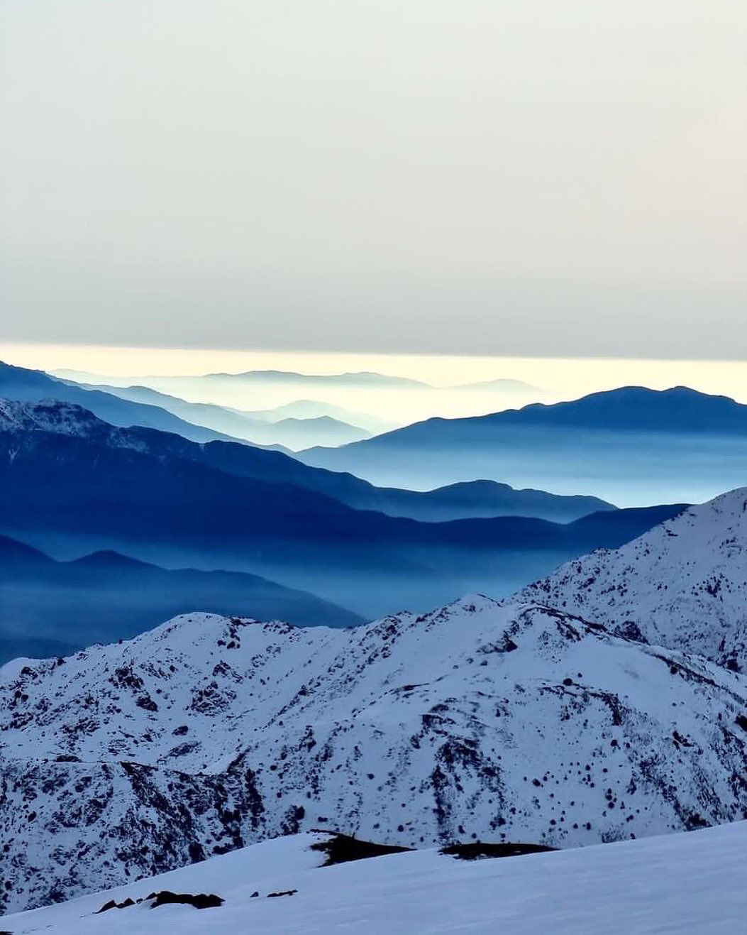
But for fresh snowfall, the focus is on the ski centres of the southern hemisphere and most have plenty of it, with the deepest snowpack passing the three-metre (10 feet mark for the first time this season in the past week). That’s in the Andes mountains of Chile, which continue to report some of the best conditions in a decade, nicely timed as international travel has been allowed to resume for the first ski season since 2019.
There has not been a huge amount of fresh snowfall in the last week but most areas in Australia, the Andes and New Zealand have at least seen some new snow, the biggest accumulations reported by centres on New Zealand’s South Island.
SOUTHERN HEMISPHERE INTRO
A quieter week for fresh snowfall than those in the first half of the month, but most centres in the Andes, Australia, New Zealand and even southern Africa have posted at least some fresh snowfall to freshen up cover over the past seven days.
New Zealand’s South Island ski areas have probably seen the most, with heavy snow in the middle of last week and then again in the past 48 hours. However, the country has seen storms moving in from the south bringing gales and flooding at lower elevations which closed quite a lot of the country’s centres for a day or two at the end of last week before sublime conditions at the weekend. So it has been seven days of highs and lows there. North Island centres remain challenged for snow cover but have at least opened more terrain this week.
AUSTRALIA REPORT
Some low temperatures reached in Australia over the past seven days with the country’s largest resort Perisher (75/110cm / 30/44”) reporting overnight lows into double digits below freezing celsius at the end of last week. That said, it hasn’t been consistently cold with skiers at Falls Creek (70/107cm / 32/43”) reporting the snow was getting heavy at the weekend. Unsurprisingly, given its extensive terrain, Perisher is also reporting the most slopes open in the country, about 60km (37 miles) of runs. Like most Aussie areas that represents about 95% of the slopes available. Business is reported to be booming with the great conditions and pent-up demand after the two pandemic winters and both Perisher and Thredbo (70/120cm / 28/48”) hit capacity on Saturday morning leading traffic police to turn cars around that were heading to the New South Wales centres on Saturday morning for a few hours until people started leaving late afternoon. Thredbo is also posting the country’s deepest base although the numbers are pretty similar for all the major areas in NSW and Victoria.
AUSTRALIA FORECAST
Another largely clear and sunny week ahead with fairly ideal slope conditions, on the groomers at least. Temperatures down as low as -10C overnight but daytime highs of +5 to +10C are possible. Some light snow showers are possible with the potential for more significant accumulations increasing in the latter half of the weekend and early next week.
NEW ZEALAND REPORT
After skiing was written off in the middle few days of last week for many ski areas in New Zealand following warm, wet and windy weather, a return to colder conditions and heavy snow brought epic skiing from Thursday onwards. Centres posted up to 50cm (20”) of fresh powder and many took several more days to re-open everything, meaning there was fresh powder on successive mornings into the weekend. Two South Island centres, Temple Basin (100/270cm / 40/108”) and Treble Cone (120/240cm / 48/96”) are posting the country’s deepest snowpacks and two of the four deepest in the world at present. The snow was falling again as we complete the report and several centres across the country including larger resorts like Cardrona (70/140cm / 28/56″) were closed midweek while the latest snowstorm blows through. Things are still running a bit behind on the North Island where the largest resort, Ruapehu, has not opened much terrain so far. But there is some improvement with Whakapapa’s Valley T-bar opening at the weekend.
NEW ZEALAND FORECAST
It’s a mostly cold and snowy week forecast for most New Zealand ski areas with temperatures set to hover a few degrees on either side of freezing up on the snowfields. Lighter snowfall is expected for the rest of this week getting heavier into the weekend.
ARGENTINA REPORT
Great conditions were reported by Argentina’s ski areas after another cold and sometimes snowy week. There have been some snow showers freshening up slopes, but none of the big dumps we saw earlier in the month. There is still though plenty of powder to be found. Caviahue (160/220cm / 64/88”) reports the deepest snow in the country while Catedral (50/120cm / 20/48”) has the most terrain open at present in South America and in fact the whole world, with over 80km (50 miles) of slopes accessible. That said Las Lenas (40/100cm / 16/40”), which probably has the most backcountry terrain on the continent, reports all lifts running and all groomed runs open. So that means accessing it is as straightforward as it gets.
ARGENTINA FORECAST
It looks like it should be largely dry and sunny over the coming week for most Argentinian ski areas. Although down in the far south snow is forecast daily for Cerro Castor into next week, that’s the world’s most southerly full ski resort. Temperatures ranging between overnight lows of -8C, and daytime highs of +8C.
CHILE REPORT
After all the snowfall of recent weeks in the Andes it’s the turn of Nevados de Chillán (80/350cm / 32/140”) to post the deepest snowpack in South America and the southern hemisphere. In fact, it is the second deepest in the world at present behind the thawing deep snowpack on a Norwegian glacier built up last year. The snow depth stats are impressive now across the country’s ski slopes though with Portillo (140/205cm / 56/82”) the latest to pass the two metre (80”) upper slope depth mark. Most of Chile’s centres are also reporting the slopes 80-100% open.
CHILE FORECAST
After the heavy snowfall earlier this month, we’re looking at predominantly dry and sunny weather in Chile for a second week. It will be warming up too with the possibility of double-digit plus temperatures at the base of the slopes by Friday afternoon but then the weekend should bring a temperature drop and the one possibility this week of a few centimetres of snowfall for some centres.
AFRICA REPORT
We are officially into the final month of operations at Afriski (20/50cm / 8/20”) in Lesotho, the only centre open in southern Africa. The centre’s main slope remains fully open despite some rather warm daytime highs this last week. There was actually snowfall over the weekend, which was heaviest up high and caused issues on the access road over from South Africa for a few days. Besides the snow, the warmer temperatures also made it misty for a few days. Overnight lows are still well below freezing though and snowmaking systems have been pumping out more cover in the small hours of the night. Access from South Africa is now easier for South Africans with only a negative home lateral flow test result required to enter the country. Although those from outside Lesotho/SA still need a full negative test result from a private provider.
AFRICA FORECAST
There’s the chance of some snowfall over the next few days as a front moves through and temperatures drop, it could be rain at times though. Later in the week and through the weekend we’ll see daytime highs of +6 to +8C but overnight lows remaining below freezing meaning snowmaking can continue as required.
EUROPE INTRO
Alas, the news continues to be grim for skiers, boarders and everyone else really in the Alps as the rapid thaw of snow and ice continues. The normally mostly frozen mountains between about 3000m and 4000-5000m above sea level have seen almost constant above-freezing temperatures, sometimes getting to 10C+ at 3,000m and that simply means melting. Passo Stelvio in Italy and Zermatt in Switzerland are the latest summer ski areas to give up for now on their 2022 seasons as a result, both saying they’ll re-open as soon as conditions permit. This leaves just two areas in the Alps and one in Scandinavia currently open and everyone hoping for a turn in conditions sooner, rather than later and cooling as we start to move towards autumn.
ALPS REPORT
We’re down to two glaciers open in the Alps from Friday as Passo Stelvio has shut down its lifts and Zermatt will do the same from the 29th. Passo Stelvio is supposed to be open from May to November and says it hopes to re-open soon if things cool and there’s fresh snow. It is offering a premium snowcat service to the remaining snow. Stelvio was the only ski area still open in Italy, although you can access the glacier skiing above Zermatt (0/120cm / 0/48”) from the Cervinia side until Friday when Zermatt too will temporarily suspend operation. Conditions here had been reported to be good although the snow cover on Europe’s highest lift-accessed and groomed slopes, is thin. The other year-round centre, Hintertux (0/25cm / 0/10”), remains open but with a fast-thinning surface. It reports the 20km (13 miles) of slopes it had open last week are now down to only 6km (3.5 miles) and at the current rate of thaw it’s hard to see how long even these can stay open, the northern hemisphere’s largest area. Saas Fee is also open with 10km of slopes but these are currently reserved for race teams only until conditions improve. The lower glacier lifts are closed due to the same climate change issues increasingly impacting all glaciers.
ALPS FORECAST
Unfortunately, there’s no sign of a big change in the weather for the Alps coming up any time soon. Temperatures up at glacier level will remain largely above freezing if perhaps not quite so much as before. It’s a largely sunny picture with temperatures in valleys once more in the +20 to +30C range, but there will be showers, likely to be rain up to high elevations, through the week.
SCANDINAVIA REPORT
There’s still only Norway’s Fonna glacier (280/540cm / 112/216”) open at present in Norway although the region’s highest summer ski centre, Galdhopiggen, did say it intends to re-open from this coming weekend. Fonna’s base depth is starting to drop now, by about a third from its spectacular opening stats a few months ago. But the snowpack is still the deepest reported for any open ski area in the world at present (although the gap with some southern hemisphere ski areas where the snowpack is growing is shrinking).
SCANDINAVIA FORECAST
It’s a mostly sunny weather forecast on Norway’s glaciers but with overnight lows close to freezing on higher slopes and daytime highs not getting too high, the low teens Celsius. The start of August looks more unsettled with rain showers expected from Monday.
NORTH AMERICA INTRO
The Palmer snowfield above Timberline (0/80” / 0/200cm) on Mt Hood in Oregon remains the only centre open to the skiing/boarding public in North America. It has been another predominantly hot and sunny week here with the main concern across North America the danger of wildfires. But the snow depth on what amounts to a couple of miles (3km) of slopes remains in place and the centre is currently expected to stay open to late August. The centre’s fun park also remains open although the halfpipe is reported closed. Besides Timberline a snowy terrain park remains open at Copper Mountain in Colorado for skiers and boarders signed up for the freestyle camps at the local Woodward facility.
NORTH AMERICA FORECAST
There’s no real change expected to the hot, dry weather. Temperatures at the snowfield are expected to reach the mid-60s Fahrenheit by the afternoon with skiing in the mornings. Lower down the mountain we will see daily highs of the 80s or even 90s Fahrenheit.
JAPAN REPORT
It’s very much the final week of the season for Asia’s 21-22 season with the only ski centre still open, Gassan (0/80cm / 0/32”), hoping to make it to the weekend. The centre opened in April with an eight-metre (27 feet) snowpack, but the past few weeks have seen increasingly rapid thawing of what’s left. The main runs that had been accessed by the centre’s double chairlift closed some time ago and higher terrain accessed by T-bars has now almost all gone and the T-bars can no longer be used as of last weekend. So the only option is to hike up to the snow from the top of the chairlift.
JAPAN FORECAST
The final few days of the season should see plenty of sunshine although an occasional rain shower with temperatures getting into the 20s Celsius in the afternoon, even up where the remaining snow is lying.
You might also like...

A Guide to the Perfect Skiing Stance in All Conditions with Maison Sport

Huge Snowstorm Hitting Western North America

World Snow Roundup #231
