WORLD SNOW ROUNDUP #215

Issued: 03 November 2021
By Patrick “Snowhunter” Thorne
European Roundup
North American Roundup
Asia Roundup
WORLD OVERVIEW
With the season now over in the Southern Hemisphere, attention is focussed on the season-opening in Europe, North America and Asia. As last year, along with the normal serves about how good the snow will be, there’s the added worry of whether pandemic surges will cause problems. So far though we’re inching towards the main season start with no major setbacks on the latter score, fingers crossed.
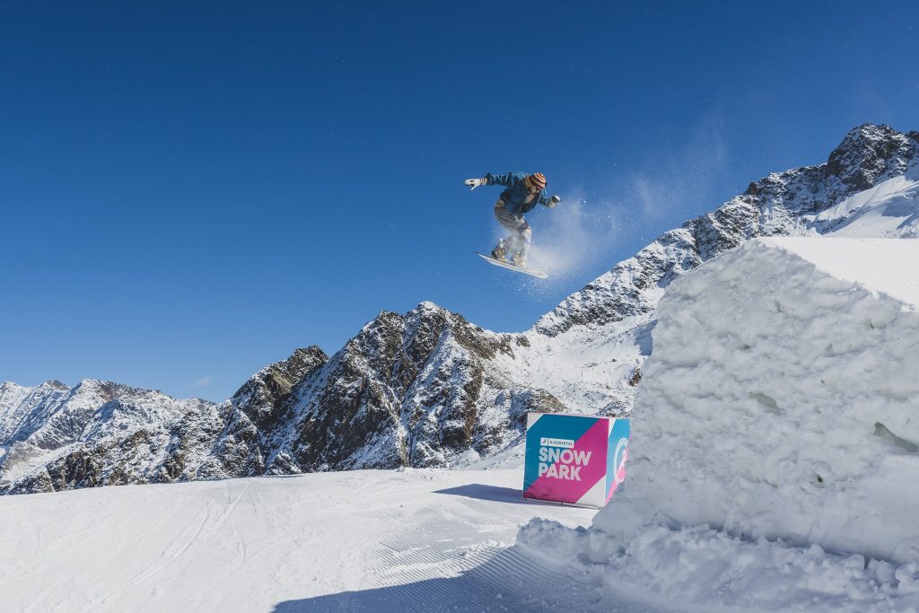
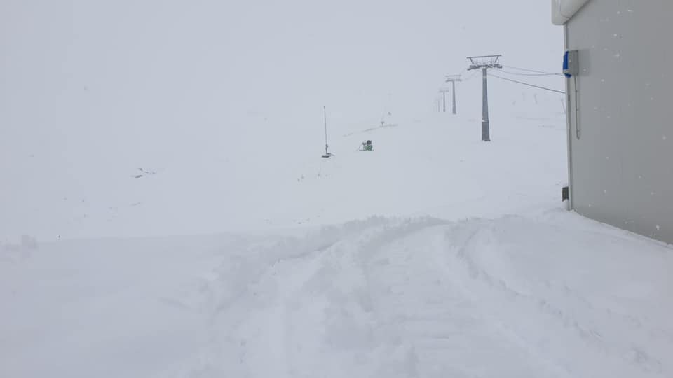
In Europe the start of November is showing no announcements of any fresh lockdowns so far. This is being seen as a good sign. More centres have opened in Austria, Italy and Switzerland including the first in the Alps to open that doesn’t have glacier slopes and we’re now up to around 30 centres open in the Alps and Scandinavia. Snowfall, particularly in the Alps, has been modest through autumn so far and bases on glaciers are generally thin. But a front has moved through in the past few days to start November on the right note, with up to 35cm (14”) reported by Tuesday and the snow is still falling in many areas as we publish this week’s report.
For North America, the big story remains to be the huge snowfall in California last week which led to several areas opening early for the season and in time for Halloween. It has stayed cold and snowy across much of the continent’s ski regions over the past week and the Canadian ski season is expected to kick off this coming weekend.
One other bit of news this week is that Argentina and Chile have re-opened their borders to leisure travel after more than 18 months and two lost seasons. Alas, the re-opening comes three weeks too late for the 2021 season but is hopefully good news for 2022.
EUROPE INTRODUCTION
he snow has returned to the Alps and temperatures have plummeted as we start November. The snow hit the Western Alps first with many resorts reporting up to 20cm (8”) of snow up high by the end of Monday and snowfall to low elevations. The storm is currently progressing east and ski areas in Austria were reporting up to 35cm (14”) by Tuesday morning with the snow still falling.
It’s a bit of a relief for ski areas after a warm and dry latter half of October which saw several glaciers that had planned to open last weekend decide to delay that decision. Not all did though, with Switzerland’s Andermatt going ahead with the planned opening of its Gemsstock slopes despite a lack of deep snow cover, and Kitzbuhel began its season at the weekend too, in its case using snow saved from last year and spread back out on the slopes at Resterkogel to create a 700-metre long slope.
About half a dozen centres remain open up in Scandinavia so with the 20 or so currently operating in the Alps, we’re up to about 25 centres already open for the season in seven countries. This time last year three of those seven, representing about half of areas currently open (Austria, France and Italy) had announced and begun second lockdowns closing their slopes, so whilst we’re definitely not out of the woods it feels good to have at least made it into November. One of those closed for the last few days of its 2020 season, Italy’s Passo Stelvio. made it to the end of its spring to autumn 2021 run on Sunday.
The current snowy start to November is expected to continue all week. Hopefully, good news for the many areas due to open later this month as well as for much needed fresh cover at the centres already open.
AUSTRIA
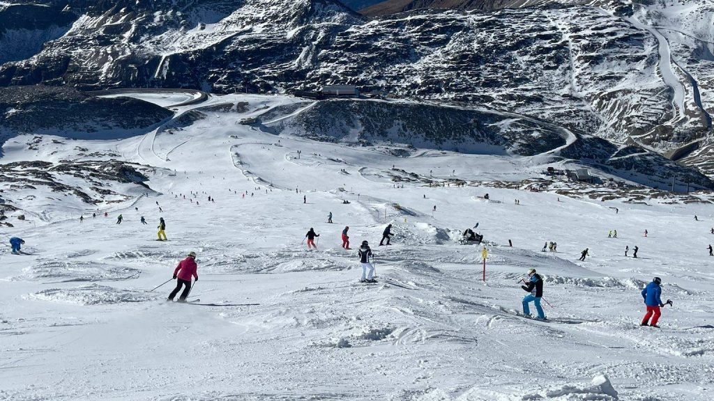
AUSTRIA REPORT| The main resort opening news from Austria last weekend was Kitzbuhel’s (0/40cm / 0/16”) annual season start on its Rasterkogel slopes. The resort uses snow-farming to be the first in the Alps to open terrain below 2000m altitude each autumn. This year has been particularly challenging but they managed a 700m long descent, primarily for race training but open to the public Sunday/Monday, despite warm sunny weather in the run-up to opening. Austria has now seen winter arrive, or at least winter weather, with snow due to fall all week after getting started on Sunday and continuing since. The country’s eight glacier areas have been opening additional terrain and terrain park features as they compete for skiers. Hintertux (0/105cm / 0/42”) has the most terrain open in the country (and maybe the world, certainly Europe) at present with 40km (25 miles) of terrain open. Solden (0/790cm / 0/32”) is not too far behind with 33km (21 miles). The Stubai (0/30cm / 0/12”) has managed to open 25km (16 miles) despite its thin base, now being bolstered by a reported 35cm (124”) of fresh snow by Tuesday morning. The Kaunertal (35/65cm / 14/26”) now has 75% of its terrain open, 18km of 24km potentially whilst the Kitzsteinhorn (0/55cm / 0/22”) has 15km of slopes open. The Pitztal (5/60cm / 2/24”) and Molltal (0/50cm / 0/20”) are also open to all, the Dachstein (0/50cm / 0/20”) still for race training at present. It’s just a few weeks now until the first full resorts without glaciers, Obergurgl and Obertauern, are set to open.
AUSTRIA FORECAST| The cold snowy weather that moved into Austria ending the warm, summer-like temperatures and sunshine to end October is set to stay for at least a week with moderate to heavy snow showers forecast through to Friday. Drying out but staying cold at the weekend.
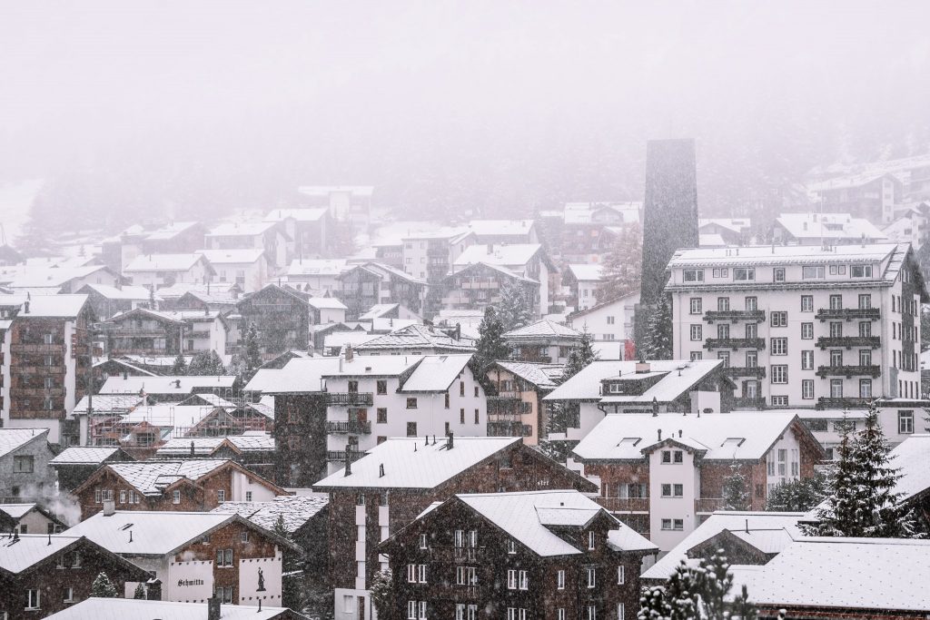
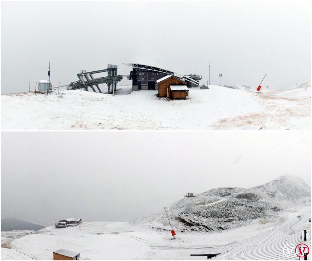
SWITZERLAND REPORT| The hope of four ski areas opening in Switzerland for the Halloween weekend did not materialise as several, including Laax, decided to postpone until the arrival of fresh snow. That’s now happening after the warm, dry end to October so perhaps next weekend is looking promising now. Andermatt (0/70vcm / 0/32”) did stick to its plan, even though the Gemsstock freeride ski mountain was not boasting the deep snow terrain for which it is famous at that point, though it is beginning to now. It joined Switzerland’s four already open areas, the Titlis glacier above Engelberg (0/35cm / 0/14”), The Diavolezzza glacier (0/30cm / 0/12”) near St Moritz and Saas-Fee (0/165cm / 0/65″) and Zermatt (0/150 / 0/60”). All are currently enjoying a snowy start to November. Davos has announced it will open for glacier skiing this coming weekend and its possible Laax and others that postponed last weekend may follow suit.
SWITZERLAND FORECAST| As with the rest of the Alps the weather is looking to stay cold and snowy for the rest of this week. Temperatures well below freezing, reaching double-digits below up on the glaciers, where the weather may cause some temporary closures. Some areas may see 60cm (two feet) of snow up high by the weekend (hopefully). Skies should start to clear from the weekend.
FRANCE REPORT| There remain two areas open in the French Alps as we start the week but we’ll be down to one for a few weeks after Sunday when Les 2 Alpes (0/20cm / 0/8”) ends its fortnight of autumn opening. There are 8km (5 miles) of glacier slopes open there for now. We’ll then need to wait just a fortnight until the other currently open French area Tignes (0/50cm / 0/20”) is due to be joined by Val Thorens opening on the 20th. The weather has finally taken a change for the better in the French Alps after a largely dry and sunny October with a snow-bearing front moving in at the end of the weekend bringing much needed fresh cover to the slopes.
FRANCE FORECAST| The current snowfall is expected to keep dumping through Thursday, bringing cumulative totals of over 50cm (20”) for some areas and potentially more. Skies will clear from Friday but temperatures should stay well below freezing in the mountains, climbing above in the daytime in the valleys.
ITALY REPORT| We have actually dropped an Italian area open this week with Passo Stelvio ending its five-month season from last spring, just as the fresh snow began to arrive. It did, however, make it to the end of its season whereas last year it missed the final few days as the second Italian lockdown kicked in. Still open though are Cervinia (0/150cm / 0/60”), giving access to the ski area on the Klein Matterhorn shared with Zermatt, Val Senales (0/40cm / 0/16”), which has increased its open terrain considerably to 12km (7 miles) and the more recently open Sulden (0/30-cm / 0/12”) with 176km/11 miles of runs available. Here, as with the rest of the Alps, the weather has taken a big turn to start the week/November and heavy snowfall is underway after another sunny/dry week last week.
ITALY FORECAST| The snowfall that began on Monday is expected to keep dumping over the middle of the week which should hopefully be transforming Italian areas already open and lay the base for those aiming to open later this month. Temperatures will be well below freezing to quite low levels and the snowfall will carry on through the week, beginning to ease at the weekend.
GERMANY REPORT| The start of Germany’s ski season is only a fortnight away at the Zugspitze Glacier and as Germany didn’t really have a ski season last winter, anticipation is probably at an all-time high. The good news is that after very warm and sunny weather to the end of October it’s finally full winter and it has been dumping down.
GERMANY FORECAST| It looks snowy, on and off, into the weekend with thick clouds hanging over the Bavarian Alps, sub-zero temperatures and regular snowfalls expected.
SCANDINAVIA REPORT| Scandinavia has seen some more snowfalls, especially in the north, over the past week with rain at lower altitudes at more southerly centres. Up to 40cm was reported in some areas over the weekend and start of this week. We have the same half-dozen areas open as for the past few weeks. But we’re only a fortnight or so away now from the main season start when the region’s big resorts begin opening. As it is though Norway’s Galdhopiggen glacier (20/60cm / 8/24”), which would normally be ending its six month summer ski season last weekend, has decided to stay open another fortnight to mid-November after missing two months of operations in August and September due to warm weather. In Finland, the snow-farmed runs are now covered in natural snowfall at Levi (5/30cm / 2/12”) and Ruka (15/40cm / 6/16”). In Sweden there remains a run open at both Idre Fjall (0/70cm / 0/28”) (here still a river of white on a brown hillside) and at Kåbdalis (5/100cm / 2/40”).
SCANDINAVIA FORECAST| It is looking drier, with a mixture of sunshine and cloud for the rest of this week, but temperatures should stay close to freezing in ski regions.
SCOTLAND REPORT|It has got a little colder in Scotland over the past few days, along with seeing some of the region’s characteristic strong winds and rain, but so far it has remained well above the seasonal average so there’s little or no white to be seen on mountaintops so far.
SCOTLAND FORECAST| The standard mix of showers, wind, sunny spells, clouds and fog for Scottish hills over the next seven days. Mountain temperatures shouldn’t be too high above freezing so the rain could be snow up high – +5 to +10C down is resort.
SPAIN / ANDORRA REPORT| Sierra Nevada, Europe’s most southerly resort, reported its first snow of the season at the ends of last week dusting its higher slopes, but otherwise, things remain fairly meagre in terms of early season snow in the region. However, it is still a month until most resorts there aim to open, although some will open as soon as there’s a good fall and accumulation. Things look to be moving in the right direction at present with temperatures dropping.
SPAIN / ANDORRA FORECAST| A midweek band of cloud should bring 5-10cm (2-4inches) of snowfall on Wednesday/Thursday and another at the end of the weekend should do the same again. Cool and cloudy on the days between.
BULGARIA / ROMANIA REPORT| Largely sunny over the past week but with some snow showers at higher elevations. Ski areas in the region are expected to start opening from late November.
BULGARIA / ROMANIA FORECAST| There’s not much change for the week ahead, If anything daytime highs in the valleys will be higher, getting back into double figures with sunny skies and highs in the valleys back up to potentially +20C by the end of the week.
CZECH REPUBLIC / SLOVAKIA REPORT| A warm, dry and sunny week in the Czech and Slovak republics, but things started to change on Monday and Tuesday saw a few centimetres/inches of snowfall on ski slopes. Ski areas are expected to start opening in the region in about a month’s time.
CZECH REPUBLIC / SLOVAKIA FORECAST| Cooler and cloudier for the coming week with temperatures dipping towards freezing bringing rain, sleet and snow showers.
NORTH AMERICA
NORTH AMERICA INTRO| It’s been one of the best starts to the season for the Western US in years with four Colorado ski areas managing to open in time for Halloween weekend but, much more unusually, three centres in California opening thanks to huge natural snowfalls at the start of last week. The official verdict is with over 40 inches (a metre) of snow falling in places, these were “not quite but “close to” the biggest October snowfalls ever recorded in the region. Although the focus has been on California other areas have had quite a lot of snowfall too with up to 60cm (two feet) reported in Western Canada and some decent accumulation in the Rockies too. That perhaps helped Loveland to decide to open on Saturday. It’s not looking quite so great further east. It’s also good news for the start of Canada’s season, scheduled for Friday at Lake Louise and (announced on Monday), fellow Banff resort Mt Norquay. Ski areas had already opened in the Midwest and on the East Coast by late October last winter. This year it is getting colder with a few touches of frost and snow flurries but nowhere has quite managed to open yet.
ROCKIES REPORT| Staying cold with a band of clouds coming through midweek that should bring very light snowfall on Wednesday., Clear skies again from Thursday through the weekend but mountain temperatures staying low so snow-making systems should be able to fire up.
ROCKIES FORECAST| A real mix of sunshine and snow showers forecast, with temperatures well below freezing in the mountains but fluctuating 5-10 degrees either side of freezing down in resort.
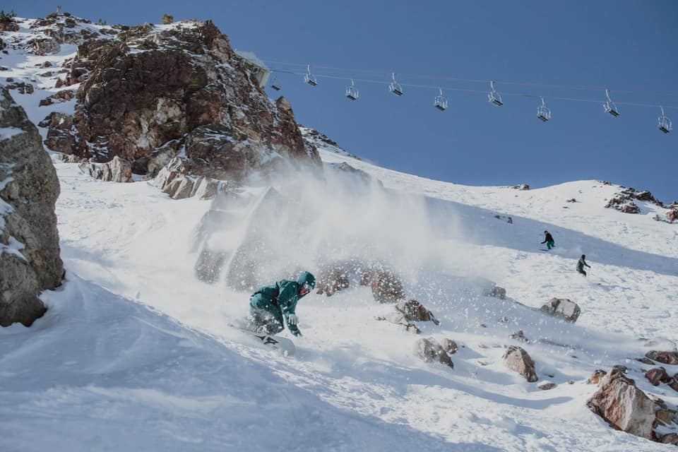
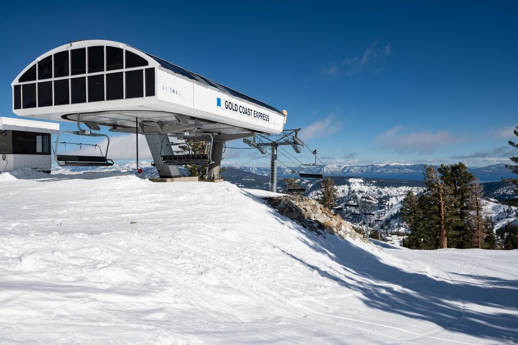
USA WEST REPORT| Palisades Tahoe (formerly Squaw Valley) (6/37” / 15/94cm), Boreal (12/36” / 30/91cm) and Mammoth Mountain (12/36″ / 30/91cm) all opened early for their 21-22 ski seasons, on Friday, in time for Halloween weekend. The decisions came after a huge snowstorm deposited “over three feet” (90cm) of snowfall on their upper slopes. It has been mostly dry with clear skies since (with a slight front coming through at the start of the week) and some people were skiing in t-shirts and shorts at the weekend. Mammoth opened with top-to-bottom cover on day one with the Broadway Express (1), Face Lift Express (3), Discovery Chair (11), and the Panorama Gondola to McCoy Station running from 8:30 am-4 pm daily with a small terrain park set up in lower Main Park. It was only the third time in 72 years of operation that Palisades Tahoe opened in October. The last time they were able to open in October with comparable terrain was in 2004. The resort kicked off the season with the Funitel, Gold Coast, and Shirley Lake lifts spinning 9 am-3 pm. It has now closed again but plans to reopen weekends (weather and conditions permitting) in November until the 24th when daily operations will begin. Mt Rose was expected to be the 8th area to open in North America later this week, giving California and Colorado four open areas each, but has postponed doing so.
USA WEST FORECAST| We’re back to largely sunny weather for the coming week, temperatures somewhere between 10 above and five below freezing point. Upper mountain snow should be fine, down at the base of the slopes there’ll most likely be some thawing.
MIDWEST REPORT| It is getting ever colder with some light natural snowfalls reported in places in the Midwest. But, alas, this year it looks like no areas in the region managed to open in October, after having the kudos of getting the first slopes open in North America in mid-October last year. Overnight lows have been reaching freezing at some areas though so snow-making systems are starting to fire up.
MIDWEST FORECAST| Nothing hugely promising in the forecast, temperatures to continue annoyingly slightly too warm for full-on snow-making by just a degree or two although some areas may be viable overnight. Mostly dry, a mixture of sunshine and cloud.
USA EAST REPORT| It’s an ever-improving picture in terms of natural snowfall and low temperatures for snow-making but so far no ski area has opened on the eastern side of North America, which is unusual for the start of November, though not unheard of. True, it was a little warm and wet for the last day of October on Sunday but since then temperatures have been dropping below freezing and there have even been some fresh light snow flurries in the mountains.
USA EAST FORECAST| It is looking ever more promising for somewhere opening soon in the east with good overnight snow-making temperatures. More light snowfall through the middle of the week and daytime highs not too high. The question is which resort will it be?
CANADA
CANADA WEST REPORT|After the big snowfalls in California at the start of last week it turned mostly dry there, but in Western Canada, the snow kept falling and most ski areas reported at least 30cm (12″) of cumulative snowfall with the snow falling down to base level, some double that. Canada’s 2021-22 ski season is due to kick off on Friday with Lake Louise in Alberta looking likely to be first to get its lift turning, in readiness for hosting the first downhill speed event of the 21-22 World cup and Olympic Alpine ski racing season at the end of the month, marking a return of the world tour to North America for the first time in two years too. Mt Norquay announced at the start of this week it also plans to open on Friday and nearby Nakiska is hoping to open the following day on Saturday 6th with a third Alverta area, Sunshine, due to follow on Tuesday next week.
CANADA WEST FORECAST| Mostly cold and clear for the coming week, with temperatures in the mountains staying below freezing day and night and not getting much above freezing even in the daytime down in resort. Not much snow in the forecast but there could be a light fall at the end of the week.
CANADA EAST REPORT| It seems likely that one or more ski areas in Quebec will open a few runs with snow-making in the near future. But there have been no reports of any managing to do so as yet, although the weekend was a little too warm and wet for snow-making in most areas. However, opening day is coming closer for many of the well-known resorts in the area, for some only a fortnight away now. Temperatures dipped at the start of the week/November and Tremblant posted pictures of a snow covering on its upper mountain.
CANADA EAST FORECAST| |Temperatures have been falling since the start of the week and fresh snowfall is forecast through the middle of the week, which should give the wintery start to November resorts have been hoping for. Drier from Thursday but well below freezing overnight so looking like good snow-making conditions.
ASIA
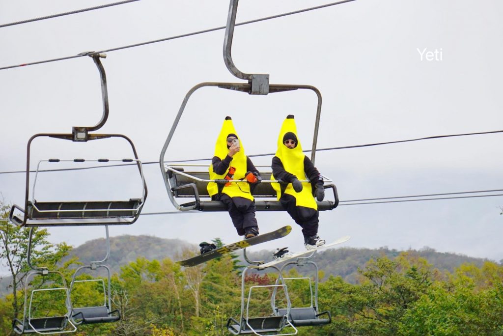
JAPAN REPORT| Japan’s Fujiyama Snow Resort YETI has become the first in the country to open for the ski season, as it has been most years in recent times. The resort, which also markets itself as the nearest ski area to Mount Fuji uses an all-weather snow-making machine to create a short stretch of snow. Opening day always brings skiers and boarders to the centre near Hadano City, in Shizuoka Prefecture, to celebrate in fancy dress.. Most of Japan’s well-known resorts open in the latter half of November. There has been some light to moderate snowfalls reported in recent weeks. The country’s borders are currently closed to international leisure travel arrivals due to the pandemic but travel companies hope this may be eased before the main ski season with cases in the country reported to be dropping.
JAPAN FORECAST| After a rather warm and sometimes wet weekend and start to the week skies are clearing and temperatures dropping through the week in Japan’s mountains, getting towards freezing by the weekend, overnight at least.


