North America Weekly Snow Roundup #312
Weekly Snow News for North America, updated 30 April 2026: Palisades gains a fortnight of extra skiing after 80" (2m) of April snow, while Arapahoe Basin shocks with an unusually early closure.
- Palisades extends its season by two weeks after 80" (2m) of April snowfall
- Arapahoe Basin shocks with early closure as it's usually open into June
- Mammoth Mountain leads the West with 305cm (123") base and half its slopes still open
- Jay Peak tops the East with 100cm (40")
- Canada's Lake Louise and Marmot Basin heading into their final weekends at 85–100% open
North America Intro
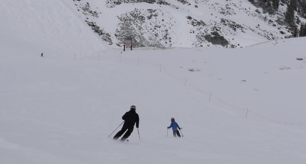
North America is down to around 20 ski areas still operating into May, evenly divided between East and West, with a third in Canada and the rest in the US. What is unusual this year is that far more ski areas in the Western US have closed, or are about to close, earlier than usual , with Breckenridge and Mt Bachelor among them. The biggest shock has been Colorado's Arapahoe Basin, which typically stays open into June, announcing its closure this coming Sunday.
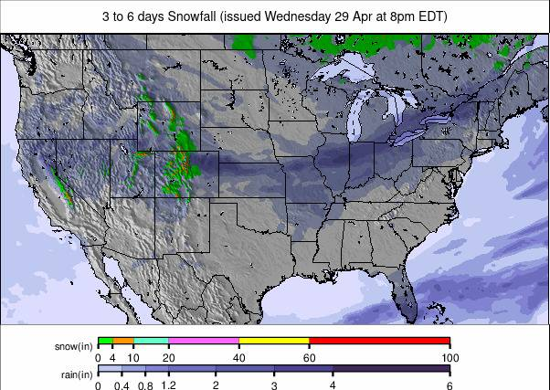
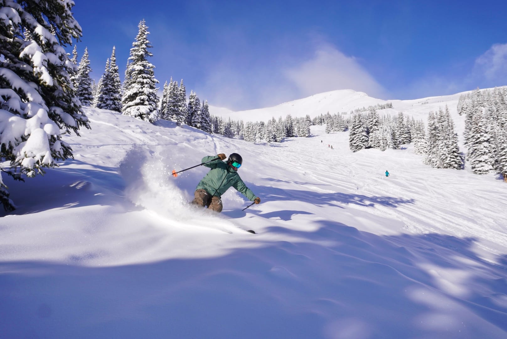
On the upside, Palisades has announced its season is extending by at least a fortnight into May, thanks to more than 80" (2m) of April snowfall, which is a turnaround from its earlier announcement that the season would end early due to poor winter snow totals. As for the past week's weather, it has been typical late April: upper mountains still getting an overnight freeze, lower slopes thawing in most areas, with plenty of sunshine, temperatures into the 40s, 50s, even 60s°F, and showers of rain, sleet and - on the highest terrain or at northerly latitudes - sometimes snow.
Canada Snow Report
We are down to the usual half-dozen ski areas open in Canada, most in Alberta and BC, plus Sommet-Saint-Sauveur's Summit ski area (25/35cm / 10/14") in Quebec. Lake Louise (65/230cm / 26/94") and Jasper's Marmot Basin (135/135cm / 54/54") are both coming up to their final weekends, though both still report 85–100% of their slopes open — better than most areas at this stage of the season. From Monday, only Whistler (0/200cm / 0/80") and Banff's Sunshine (50/255cm / 20/102") continue alongside Sommet-Saint-Sauveur, both operating into the latter half of May.
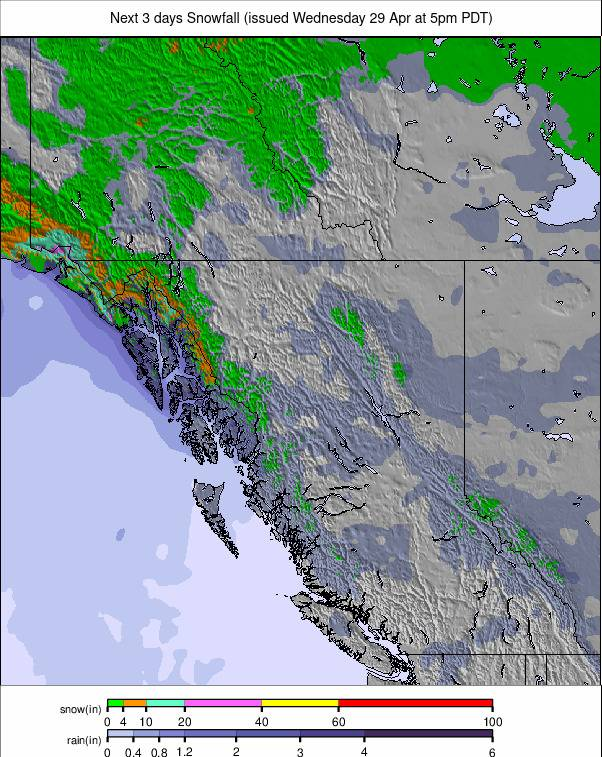
Canada Snow Forecast
Mostly mild, bright and spring-like, with only brief overnight refreezes on the highest terrain. Across Alberta's high-alpine resorts — Sunshine, Lake Louise and Marmot Basin — the period trends dry and warm, with freezing levels well above 2,500m and daytime temperatures softening the snowpack quickly each morning. Calgary's forecast aligns: sun, highs of 17–21°C and minimal precipitation over the coming days.
Western US Snow Report
We are just about down to single figures for the number of areas still open in the Western US. Montana's Big Sky and Utah's Alta both closed last weekend — Big Sky after reporting some of the biggest snowfall totals in the world in its final days, with 20" (50cm) for its closing weekend. Lift-served skiing is still accessible in California, Colorado, Oregon and Utah.
Mammoth Mountain (41/123" / 105/305cm) tops the table, with more than half its slopes open and plans to keep operating for at least another month — another foot (30cm) fell as last week's report was completed. The Rockies also reported 6–12" of snowfall on upper slopes earlier this week. Currently, Utah's Brian Head and Brighton, along with Colorado's Arapahoe Basin and Copper Mountain, are expected to close at the end of the ski day on Sunday, 3 May. Arapahoe Basin's closure announcement powerfully illustrates the consequences of a poor 2025/26 season in the Rockies.
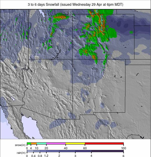
Western US Snow Forecast
Warm, dry and increasingly late-spring-like, with strong sunshine and steadily rising freezing levels across Colorado, Utah, California and the Pacific Northwest. In the central Rockies, daytime highs reach the 50s and 60s°F, with freezing levels well above 8,500 feet, ensuring rapid softening of the remaining snowpack. Nights are cool but too mild for a strong refreeze. Winds are generally light to moderate, though exposed high slopes may see occasional gusts.
Eastern US Snow Report
Very warm temperatures have dominated the East Coast and Midwest, often reaching the 60s°F at mountain bases. Overnight lows continue to drop below freezing on high terrain, allowing freeze-thaw cycles on the upper-mountain runs that remain skiable. Around eight centres are continuing into May, though many only open at weekends with just a run or two available.
Vermont's Jay Peak (16/40" / 40/100cm) posts the deepest snow cover of still-open Eastern areas. Sugarbush ended daily skiing last Sunday but reopens on Saturday, 2 May, for a final hurrah. Killington (8/28" / 20/70cm) remains open daily but has only a couple of miles of slopes — less than 5% of its winter extent. In the Midwest, Michigan's Mount Bohemia (95/95" / 237/237cm) closed earlier than its planned 10 May date due to rapid thawing; Minnesota's Boyne Mountain (20/20" / 50/50cm) is currently reopening at weekends.
Eastern US Snow Forecast
Spring conditions dominate all still-open Eastern ski areas. Daytime highs climb into the 60s to low 70s°F at base areas and the upper 40s to mid-50s°F on upper-mountain terrain around 3,000–4,000 ft. Freezing levels stay well above the summits, so any passing showers fall strictly as rain. Snowpack softens early each day and nights are too mild for meaningful refreezing.