WORLD SNOW ROUNDUP #170
Issued: 16 December 2020
By Patrick “Snowhunter” Thorne
European Roundup
North American Roundup
Asia Roundup
EUROPE INTRODUCTION
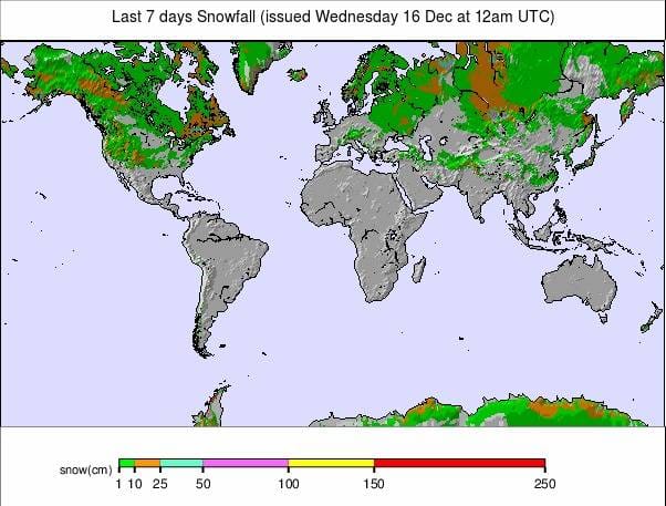
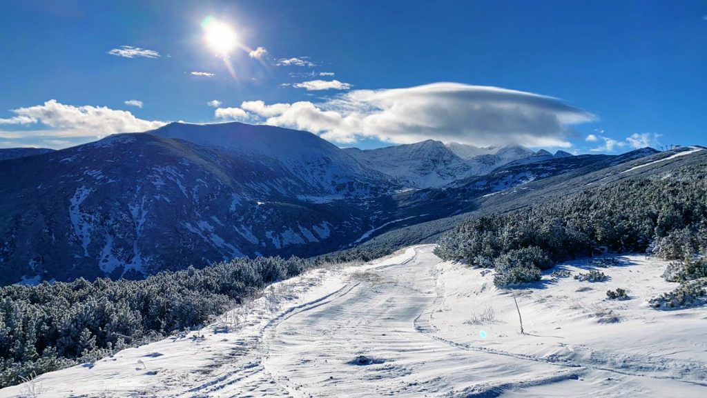
It’s been a good week for ski areas in countries with names beginning with S. Switzerland is by far and away the big winner for those wanting to ski or snowboard as dozens more ski areas have opened here since a week ago and those that have been open there for weeks or months already have opened up more terrain after the big snowfalls at the beginning of last week. The first resort to report a 3m (10 foot) plus base in the world this season is Andermatt.
But in other “countries beginning with ‘S’ news”, Scotland, Sweden, Spain and Slovenia have all opened, or are about to open, ski areas for the 20-21 season too. Of course, it’s not just countries beginning with S, more resorts have opened in Finland and Norway, and the season looks about to start in Bulgaria too.
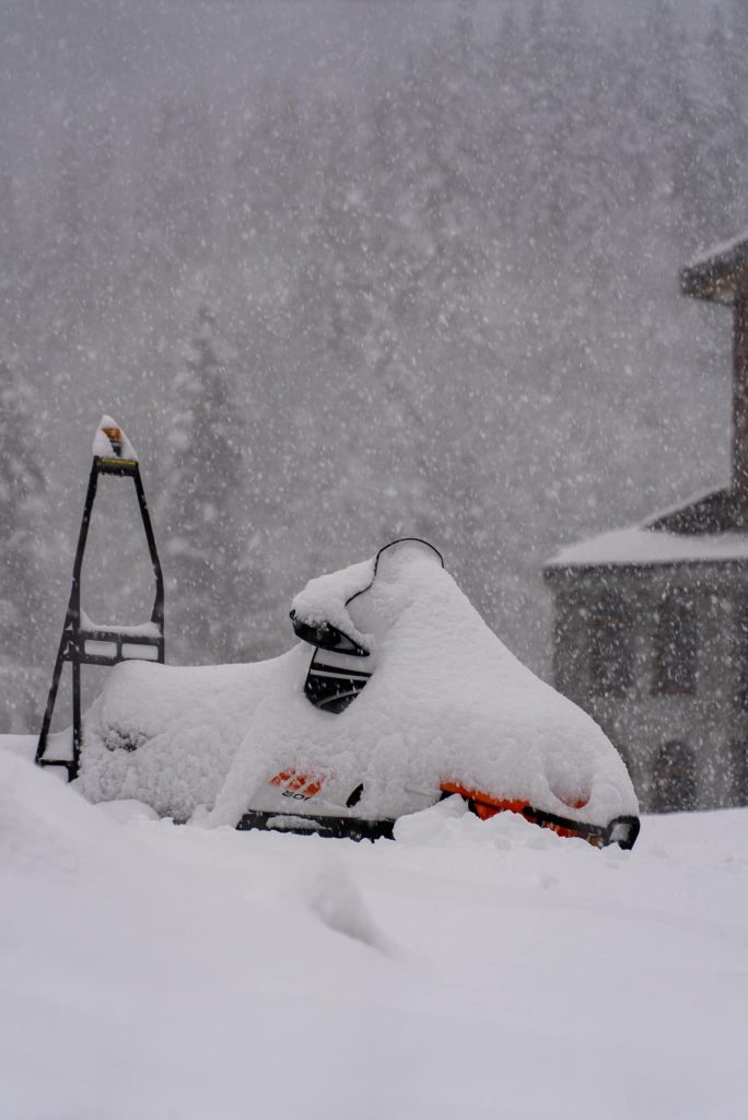
There’s been more fresh snowfall, if not a repeat of the huge dumps of the weekend before last, but the 40-50cm that landed on parts of the Alps and Pyrenees at the weekend would have been enough to excite us had it not been for those earlier falls …and that the majority of big-name ski areas are closed still, and travel to those that are open generally fall in to one of the following: difficult/illegal/probably ill-advised at present
Currently, ski areas in Andorra, France, Germany and Italy will remain closed until the new year with January 7th being mooted as a probable opening date. This is the date when Austrian ski areas hope to open to tourists, although here they’ll open to locals from Christmas Eve.
AUSTRIA
AUSTRIA REPORT| Austria is just over a week away from opening for the season, with most of the country’s leading resorts expected to open from Christmas Eve onwards, as the Austrian government has permitted. Hotels will be closed and border restrictions in place to try to ensure there are just limited numbers of locals on the slopes. After the huge snowfalls over the weekend before last, things have settled down in the Austrian Alps, although there have been more, smaller snowfalls over the past week too. Few resorts are publishing snow depth data although those 10 or so Austrian ski areas that were open in September and October, before the November lockdown, still have live snow reporting in some cases. The normally year-round Hintertux Glacier says the snow is lying 3.3 metres (11 feet) deep there, making it possibly the deepest in the world. Ski tourism is expected to resume in Austria on 7th January 2021.
AUSTRIA FORECAST| Sunny weather for the coming week on Austrian slopes with temperatures hovering around freezing. In fact, the freezing point looks to be about 1500m in the daytime so warmer for many Austrian villages and lower slopes in the afternoon, sub-zero overnight and higher up in the daytime too.
SWITZERLAND
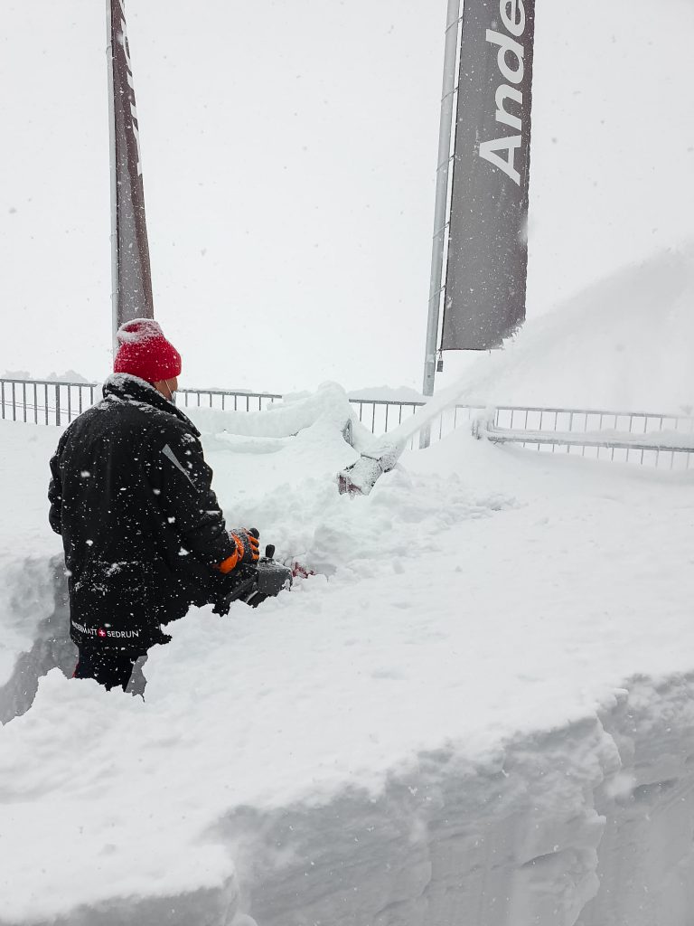
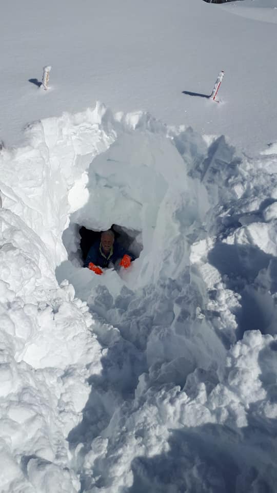
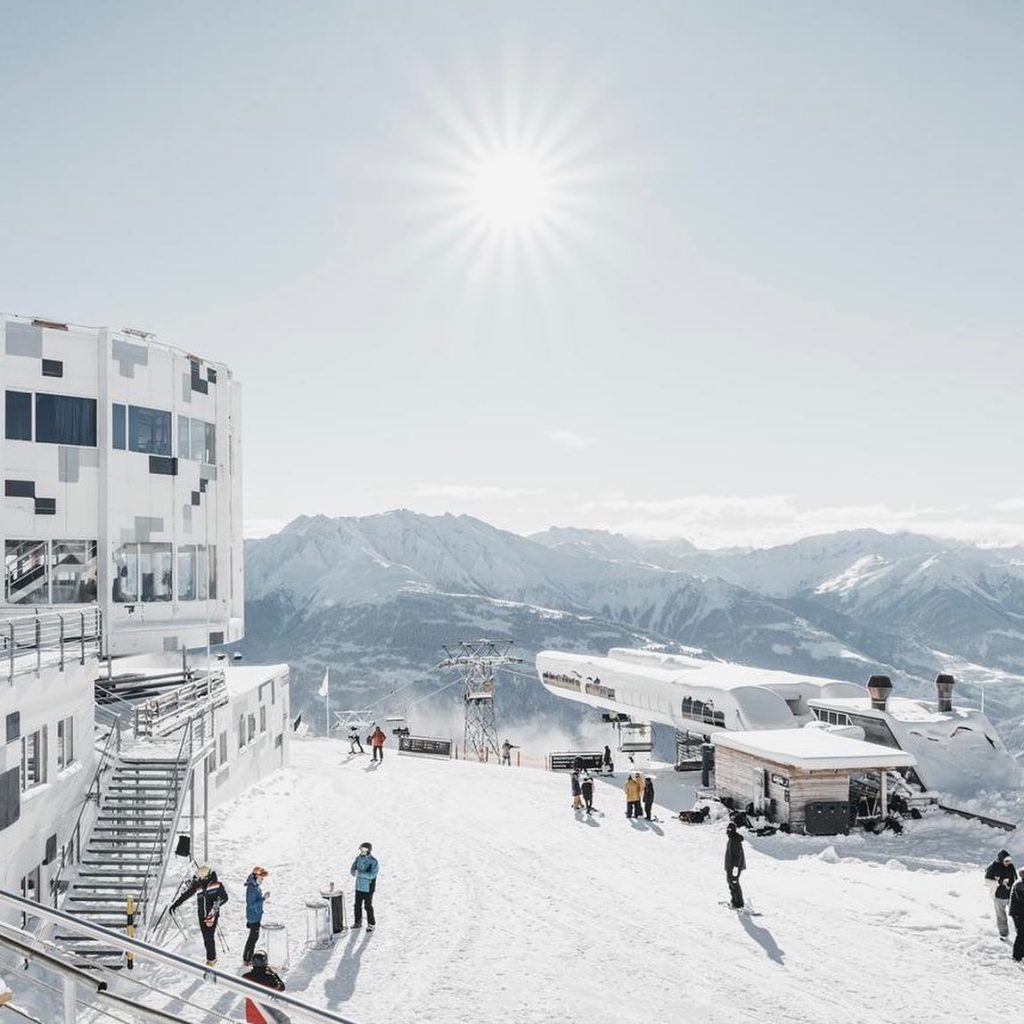
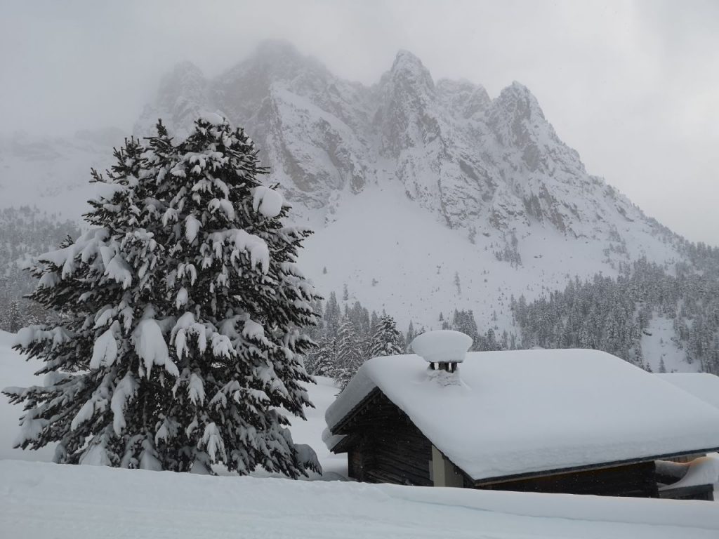
SWITZERLAND REPORT| There were fears that Switzerland would decide to closed its ski areas as part of a government announcement last Friday, but as has happened before, that wasn’t the case. Instead, there was a dramatic jump in the number of Swiss areas open by the next day, with over 100 Swiss centres open on Saturday, a number set to double again this coming weekend despite ongoing pressure from its neighbours to close ski centres down and high infection rates in the country. What is closed are restaurants, many other businesses and there are increasing restrictions on the numbers of people on the mountain and riding in enclosed lifts, moving closer to the North American ski area operating model. In common with other alpine areas, there was more snow at the end of last week and some areas got light snowfall on Tuesday, but generally, things have been settling down after the big falls 8-12 days ago and the avalanche danger has reduced. Andermatt (70/310cm / 28/124”) is posting the deepest base in the country, and the world, of open ski areas. The 4 Valleys have 112km (70 miles) of ski runs open, the most in the country (and in Europe) to date.
SWITZERLAND FORECAST| In common with much of Europe the forecast is for dry and often sunny weather in the upcoming week. On the mountain slopes, temperatures should be below freezing but in the valleys, afternoon temperatures could climb up to 5 or even 10 degrees above freezing point.
FRANCE
FRANCE REPORT| There has been morefresh snow in the French Alps and Pyrenees following the heavy snowfalls just over a week ago. Chamonix, for example, reported a 40cm (16”) accumulation on Saturday. There was more, lighter, snowfall for many on Tuesday. Saturday was when the opening Men’s Downhill World Cup race of the 20-21 ski season was due to take place at Val d’Isere, but this was switched to be run on Sunday due to the weather. Sunday was a stunning, blue sky, fresh snow day in the French Alps so this was a smart move of course. Although rules can change at short notice, French ski resorts can open to tourists this week as things stand, with most on-snow activities available including cross-country skiing and ski touring, but the ski lifts must not run by government order and tourers have been warned that resort slopes are closed and potentially dangerous. There’s speculation that French ski areas may be able to re-open on 7th January when Austrian resorts are also due to open.
FRANCE FORECAST| It is looking largely sunny as we approach Christmas week in the French Alps. Temperatures on ski slopes should stay below freezing but daytime temperatures in valleys will climb 5-10 degrees into positive temperatures.
ITALY
ITALY REPORT| Italian ski areas too reported some more fresh snowfall after the huge falls a week or so back now. Local reports indicate that Italian ski areas will begin opening from January 6th (in three weeks) if the government does not change the rules again before then. The country’s biggest ski region, Dolomiti Superski, has been warning hikers and ski tourers that its slopes are closed in the meantime and may not be made avalanche safe or patrolled and that heavy machinery may be working, all combining to give extreme danger.
ITALY FORECAST| It’s looking largely dry and mostly sunny across Italian ski slopes as we head into winter (by the astronomical measure of the seasons) next week. Temperatures should remain at or below freezing on the ski slopes, perhaps creeping a few degrees above in the valleys.
GERMANY
GERMANY REPORT| Germany extended its partial lockdown to December 20th and as cases have continued to rise, now has a full national lockdown over Christmas. So the country’s ski areas definitely won’t be opening until some point in January. Conditions though, if they could open, look very good, particularly at higher elevations and in the Bavarian Alps following the big snowfalls just over a week ago, and the lighter snowfall top-ups at the end of last week.
GERMANY FORECAST| Not the best weather for the week ahead in Germany with temperatures rarely getting below freezing at most areas, although not getting too warm either, just a few degrees above freezing for most. It’s looking overcast in many areas until the weekend when it looks like it will be increasingly sunny.
SCANDINAVIA
SCANDINAVIA REPORT| Scandinavia’s ski season continues to gather pace with most of Norway’s larger ski areas opening last weekend and the region’s biggest, Are in Sweden, scheduled to open this coming weekend. The leading resorts in Finland, most of which are currently in a period in which the sun won’t rise above the horizon again until January, have been open for some time now, some like Levi and Ruka are into their third month of 20-21 season operations already. Norway’s Trysil (40/67cm / 16/27”) was one of the areas to open at the weekend and reported 20cm (8”) of fresh snowfall on Tuesday, a pattern repeated across much of the region.
SCANDINAVIA FORECAST| Scandinavian ski areas will see mostly overcast skies (so far as they can make them out in the limited daylight hours!) after a brief midweek sunny spell. Temperatures should be at or a little below freezing with snow showers possible most days, Thursday, Sunday and Monday looking the most promising.
SCOTLAND
SCOTLAND REPORT| Scotland’s ski season is due to officially kick off from this Saturday, 19th December, at four centres: Glencoe, Cairngorm, the Lecht and Glenshee. All have been making snow with their all-weather snow-making systems, and there’s also been more snowfall over the past week building bases on higher slopes from the snowfall earlier this month. Glencoe has allowed its chairlift to be used to access ski-touring terrain and has had a toboggan slope open with the machine-made snow. It is not yet clear how much will be able to open in terms of ski runs on Saturday, the focus is on beginner terrain using the machine-made snow but there may be enough natural snow to open full runs. Nevis Range won’t open for now due to the pandemic, the others have measures in place but skiers need to check before travelling to them.
SCOTLAND FORECAST| Temperatures continue to hover around freezing point at Scottish ski centres, sometimes creeping a few degrees above, other times dropping below. This can make a crucial difference between whether precipitation falls as snow or rain and whether the snow that is lying, thaws. The week ahead looks dry midweek, with snowier or possibly ‘sleetier’ weather from Friday and through the weekend as centres open.
SPAIN / ANDORRA
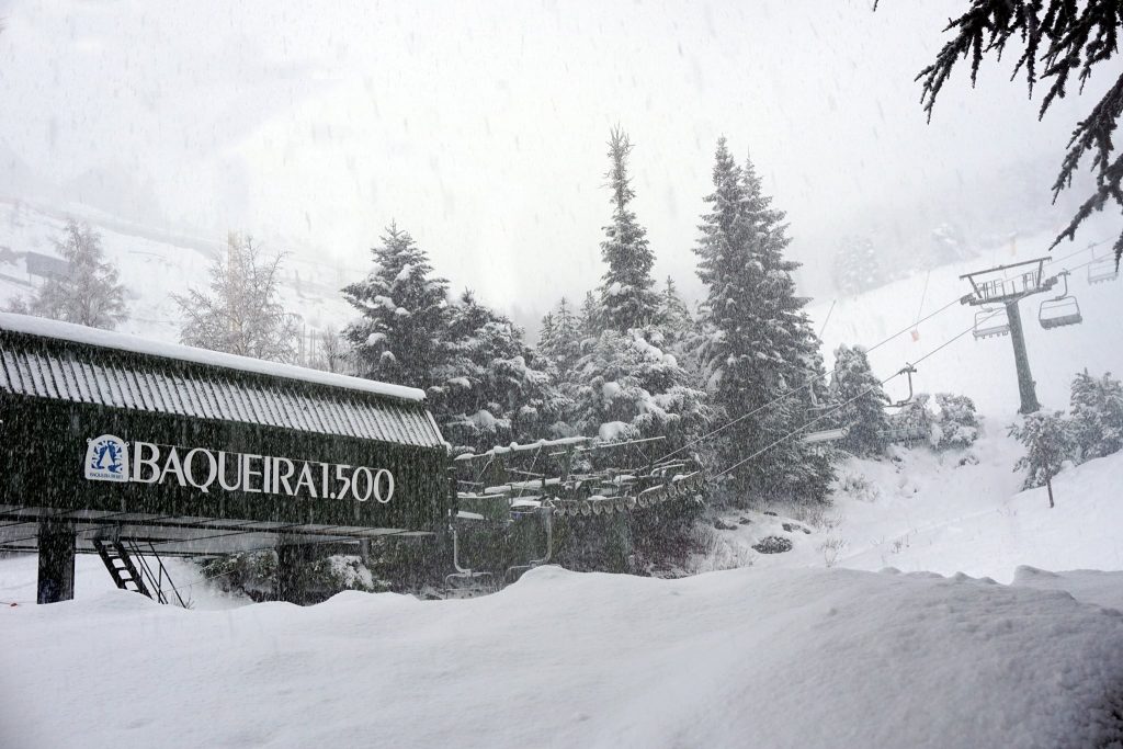
SPAIN / ANDORRA REPORT| Whilst most of the major ski nations of Europe are keeping their slopes closed over Christmas, after weeks of uncertainty Spanish ski areas have finally begun opening this week, with more areas, including Sierra Nevada in the south, saying they will be opening in the next few days in time for Christmas. There are strict opening rules with most only allowing locally based skiers on their slopes, like the Austrian model. Ski areas in Andorra and the French Pyrenees will remain closed into January 2021. Inevitably, fate being what it is, there have been more great snowfalls in the Pyrenees and it would be an epic start to the season in Andorra if ski areas could open, Grandvalira reported 40cm (16”) more snow at the last big weekend snowfall. Some reports say ski areas in Andorra may open Jan 3rd, ahead of France on Jan 7th, but that’s unconfirmed. But those lucky enough to be able to get on to Spanish slopes should be able to enjoy it. Baqueira-Beret (50/60cm / 20/24”), which claims the most piste kilometres in the country, was among the first to open on Monday, with 33 runs over 36km served by 13 lifts. Only local skiers are welcome at this time though. Most of the rest of Spain’s resorts will open this Friday, 18th December.
SPAIN / ANDORRA FORECAST| After the most recent snowfalls in the Pyrenees on Tuesday, it looks like a clear and fairly cold week ahead here too, very similar to the Alps. Temperatures should be below freezing on ski slopes, warmer, but not many degrees above freezing in valleys and there’s plenty of sunshine in the forecast.
BULGARIA / ROMANIA REPORT
BULGARIA / ROMANIA REPORT| It’s been looking increasingly promising on the slopes of Bulgaria with fresh snowfall giving everywhere a white coat, Pamporovo posting pictures of top to bottom coverage ahead of the expected start to the season this coming weekend. The country’s leading ski area of Bansko has now said it will open Friday 17th. The ski season has got underway in Slovenia, although with centres currently open only to local people with travel between municipalities banned. Kranjska Gora opened first last Thursday 10th December, followed by Pohorje above Maribor and Krvavec on Saturday 12th, again only for locals with apres-ski banned.
BULGARIA / ROMANIA FORECAST| Dry and largely sunny weather forecast for the week ahead in Bulgaria and Romania too. Temperatures shouldn’t get above freezing on mountain slopes meaning snow-making systems should be able to fire up overnight. Daytime in the valleys is forecast to be rather warmer, but not too warm.
CZECH REPUBLIC / SLOVAKIA

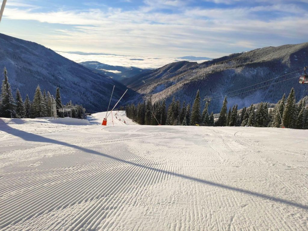
CZECH REPUBLIC / SLOVAKIA REPORT| Three of the Slovak Republic’s larger ski areas are open, and with gradually improving conditions and increasing amounts of terrain open. Donovaly (10/40cm / 4/16”), Štrbské Pleso (20/40cm / 8/16”) and Jasná (0/80cm / 0/32”) are all open, the latter with the most terrain open but still only about 8km (5 miles) of runs so far. The situation remains unclear in the Czech republic. The country’s leading resort of Spindleruv Mlyn said at the start of this month that they would open on December 18th and has now confirmed that’s the plan. It’s good news as more recently, at the end of last week, the Czech Government had said they could not yet make a decision on when the country’s resorts could open, saying it was “too soon” Resorts had said that position was “frustrating”. In the wider region, ski areas in Poland have also begun opening with Białka Tatrzańska (30/40cm / 12/16”) one of the first to do so.
CZECH REPUBLIC / SLOVAKIA FORECAST| It is mostly dry and often sunny weather for the week ahead with temperatures a little too warm for snow comfort in the valleys, staying around freezing on higher slopes.
NORTH AMERICA
NORTH AMERICA INTRO| Hundreds of ski areas are now open across North America, indeed the vast majority of the continent’s major ski areas are now open, and many of the smaller resorts too.
At the same time, unfortunately, virus cases continue to increase and restrictions are strict. The calls for skiers and boarders to abide by the rules, so that resorts can stay open, are as strong as ever. So far, ski areas have stayed open in states like California even when most other businesses have had to close.
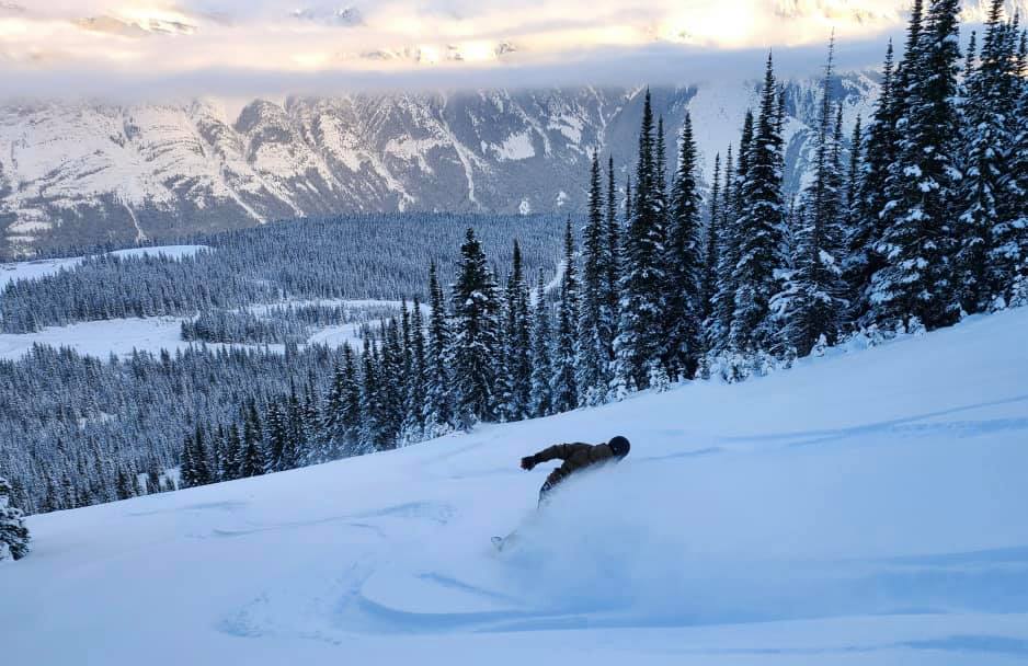
Although last week was mostly dry across much of the continent, the snow has been falling since the weekend with accumulations of up to 55cm (22 inches) reported in the west, greatly improving conditions, and there’s been some snow in the east too. The continent’s deepest base has now passed 10 feet (3 metres) in Alberta, Canada.
ROCKIES
ROCKIES REPORT| It has been the snowiest week for a while in the Rockies, with most areas seeing fresh snowfall over the weekend, continuing into the start of this week, and more terrain opening. The fresh snow is particularly welcome for ski areas in states like Utah which had been trying to open more terrain in the dry conditions that were the main feature of the first 10 days of December, but they had only thin cover. It was also welcome in Colorado’s Summit County where snow levels are at about 70% of last year at this time, even with the fresh snowfall. Idaho’s Lookout Pass (83/108”/ 208/269cm) is currently posting the deepest base in the US and one of the deepest in the world, whilst Colorado’s Wolf Creek (67/71” / 168/178cm) posted one of the biggest snowfalls in North America between Saturday and Monday, totalling 22 inches (55cm) and is the first in the Rockies to post more than 100 inches (2.5 metres) of snowfall this season.
ROCKIES FORECAST| Cold and generally sunny over the coming week in the Rockies, with, unfortunately, not a huge amount of fresh snow in the forecast. That said, temperatures should be well below freezing all week, top to bottom, including getting well into double digits sub-zero on the upper mountains. There is some snowfall on the horizon though with a front moving through on Thursday for most.
USA WEST
USA WEST REPORT| It has been a snowy few days in western North America with Taos (14/35” / 35/84cm) in New Mexico posting 20 inches (50cm) of snow over the weekend, Sugar Bowl, in California 12 inches (30cm) in just 24 hours on Sunday-Monday. It is, therefore, an improving picture across most of the west after the dry conditions a week ago. Famously snowy Mt Baker (57/68” / 142/170cm) is reporting the deepest snow in the region with another foot (30cm) of fresh snowfall in the past few days but the numbers are getting good for many ski areas in northwest states like Oregon and Washington now. Oregon’s Mt. Hood Meadows (54/68” / 135/170cm) has the same upper slope depth as Mt Baker for example and posted 15” (36cm) of fresh snowfall to start the week.
USA WEST FORECAST| Very changeable weather ahead with temperatures fluctuating above and below freezing. Dry midweek but there should be snow showers on Thursday then more precipitation over the weekend; however, with temperatures getting above freezing then too, some areas could see rain whilst others see snowfall.
USA MIDWEST REPORT
MIDWEST REPORT| Despite the lack of any huge snowfalls for most parts of the region so far, some centres are posting impressive snow totals already. Michigan’s Ski Brule (49/57” / 122/142cm), open weekends, is looking good for snow depth. Down in the southeast in North Carolina, Cataloochee Ski Area (52/93”) is surprisingly posting one of the best snow depths in North America.
MIDWEST FORECAST| Conditions look like they’ll continue to remain predominantly cold, dry and sunny, good snow-making weather, with temperatures well below freezing. Heading into the weekend it’s looking cloudier and warmer but there remains little precipitation in the forecast.
USA EAST
USA EAST REPORT| It’s an improving picture in the northeast with some decent snowfalls over the past week. Smugglers’ Notch Resort (24/49” / 61/122cm) in Vermont, USA is one of several resorts in the region now posting more than two feet lying at the base and over four feet on the mountain.
USA EAST FORECAST| It’s looking like a very snowy week ahead, great news in the build-up to Christmas week. Wednesday brings increasing clouds then snow should start falling after dark when a large snowstorm should begin and continue to unfold into Thursday. The heaviest snow is expected late Wednesday night through Thursday before a drier Friday.
CANADA
CANADA WEST
CANADA WEST REPORT| Two ski areas in western Canada are posting bases of more than 3 metres (10 feet), the deepest in the world for open ski areas. Sunshine Village (100/323cm / 40/129”) near Banff in Alberta and Kicking Horse (90/303cm / 36/121”) in British Columbia are the two areas in question, testimony to a very snowy November and early December in the region. The past week has been rather drier though, although that said both Lake Louise and Marmot Basin reported significant fresh snowfall, powder conditions and more terrain open to end last week. It’s not all good though, BC’s Red Mountain Resort by the ski town of Rossland delayed its opening day, due last weekend, due to the relatively mild and dry conditions over the past month.
CANADA WEST FORECAST| Staying very cold (typically 10-20 degrees below freezing) and increasingly cloudy with snowfall due on Thursday then through the weekend bringing a forecast 10-309cfm of snowfall in total to mountain areas.
CANADA EAST
CANADA EAST REPORT| It is the reverse of Canada’s west in the east, not just geographically but the autumn weather too has been too often warm and wet. Few ski areas are open here still and those that are have just a handful of runs open, other than the largest, Tremblant (0/60cm / 0/24”) which has made it up past 20 of its 120 named trails. It is now cold, in fact exceptionally cold, hitting more than 20 degrees below freezing in the past few days. Although this means snow-making systems can operate, it ironically means it is pretty much too cold for snowfall.
CANADA EAST FORECAST| There is some light at the end of the lack-of-snow tunnel in Canada’s east with temperatures set to climb back up towards freezing by the end of the weekend and the chance of some snowfall to start next week.
ASIA
JAPAN REPORT| There was some excitement in Japan earlier this week with big snowfalls reported on Monday on Hokkaido in the north, and significant, if smaller falls further south. This is more like the kind of snowfall that’s normal for Japan, but which has been in short supply over the colder months of the past year. Niseko (95/155cm / 38/42”) posted 45cm (18 inches) in 24 hours. Further south Nozawa (20/50cm / 8/20”) unveiled their new gondola with plenty of fresh snow falling too. There’s not much snow depth built up there yet but 30-45cm (12-18”) over Monday-Tuesday has greatly improved the early part of the season.
JAPAN FORECAST| The forecast is looking good for most of Japan’s ski resorts with essentially snow in the forecast for almost every day for the week ahead, very much like a normal Japanese December and very different to 2019.


