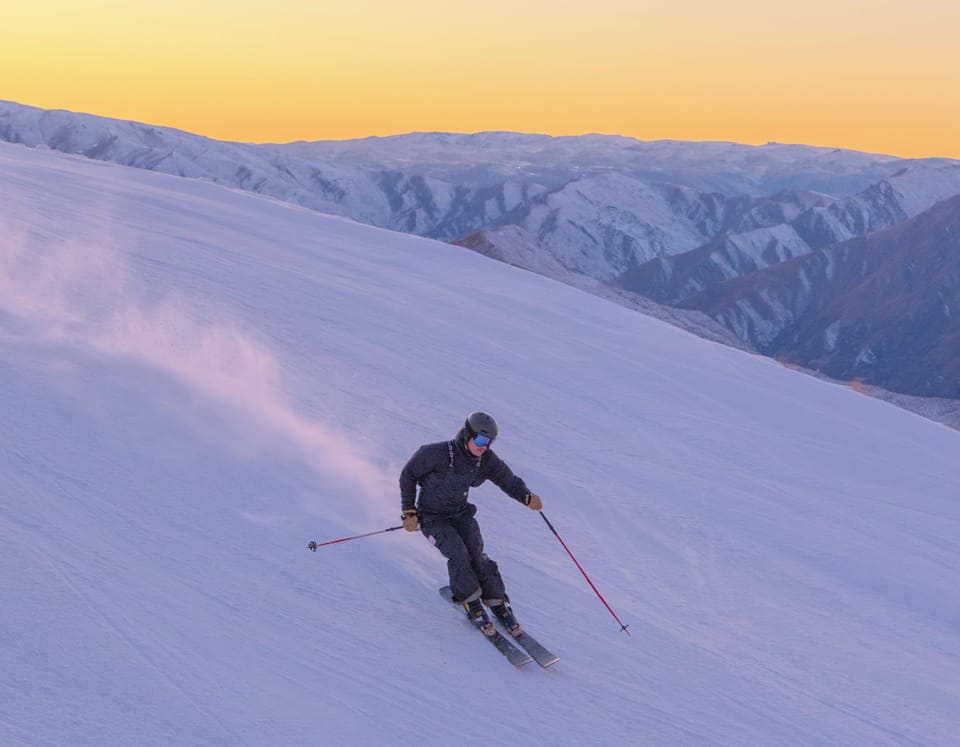
WORLD SNOW ROUNDUP #118
Issued: 18 December 2019
By Patrick “Snowhunter” Thorne
INTRODUCTION EUROPE
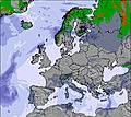
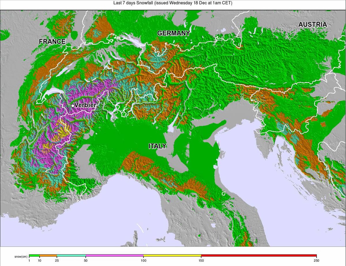
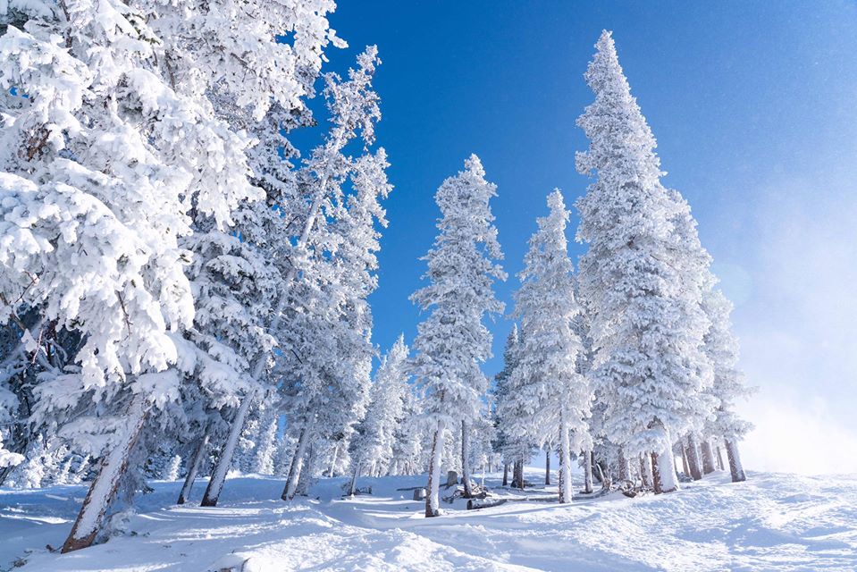
It has been a snowy week again in the Alps as the main season gets started with some resorts receiving more than a metre of snowfall in total between Monday and Sunday. This was mostly from two big snowstorms at the start and end of that period; however, it wasn’t entirely good news with some of the precipitation falling as rain at times and in places up to about 1600 metres altitude. There were also gale force winds bringing blizzard conditions. The experts at Henry’s Avalanche Talks have warned that the off-piste avalanche danger has climbed to 4 out of 5 on the danger scale. The rain froze after hitting the ground, making off-piste skiing treacherous until a good dollop of fresh snow fell on top.
Elsewhere, it has been snowing in the Pyrenees which has improved conditions further and helped build bases. Whilst Scandinavia has continued to see some of the biggest snowfalls in Europe this month, with western Norway seeing the heaviest falls.
Unfortunately, it has been very warm in parts of eastern Europe, particularly Bulgaria and Greece, which has impacted conditions there. Scotland, however, has seen more consistently cold, snowy conditions and all five Highland centres now expect to be open by the weekend.
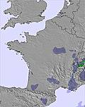
Western Alps
France / Western Italy / Western Switzerland
Report: The Western Alps saw another big snowfall boost at the end of last week when resorts in the region got their second big snowfall in six days, taking some in western Switzerland past the metre mark for seven-day snowfall tallies. Unfortunately, it wasn’t all good news as it was warm enough for rain to fall on lower slopes and it has been windy too.
Forecast: Temperatures look set to stay subzero at most ski areas in the western Alps over the next seven days, hovering around freezing and five degrees below with snow falling in France, western Switzerland and Italy on a daily basis. There are no really big falls in the forecast at present although Friday looks like it will be the snowiest day of the week with up to 30cm.
Eastern Alps
Austria / Eastern Italy / Eastern Switzerland
Report: There’s been moderate snowfall in Austria over the past few days which looks set to get heavier as
the week progresses with Thursday currently looking like the snowiest day of the week so far with
20-30cm of snowfall forecast for many ski areas, probably with resorts in Carinthia and then elsewhere in southern and eastern Austria seeing the heaviest falls.
Forecast: After a dry few days the snow clouds are expected to roll into the eastern Alps and Dolomites from Thursday with 10cm accumulations expected at resorts like St Moritz in eastern Switzerland and Cortina in the Dolomites. This could be followed by bigger 30cm (1ft) accumulations on Saturday.
Further south, in north central Italy, Thursday looks like the snowiest day this week with 20-30cm forecast for slopes in Trentino after lighter snow beforehand.
In the far eastern Alps of Slovenia, both Thursday and Friday look like snowy days with the potential for 30cm (1ft plus) snowfalls on both days.
Pyrenees

Report: Things have certainly turned snowier over the past week in the Pyrenees with resorts in Spain, Andorra and the French Pyrenees reporting some good accumulations and excellent conditions. In Andorra, bases continue to grow with Pal-Arinsal 970/100cm / 28/40”), in the Vallnord sector, posting the deepest base. It is one of the first areas in the world to report all of its runs 100% open.
Forecast: The snowy weather of the past week should return from the end of this week with more snow expected from Friday; beginning with significant 30cm+ falls to end the week. The snow should begin with 5-15cm accumulations on the Spanish side of the mountains on Thursday with 30-40cm falls on Friday and the region’s biggest area, Grandvalira in Andorra, in line for a 40cm accumulation that day if forecasts prove to be correct.
Switzerland

Report: Swiss ski areas remain in good shape on the whole despite lower runs falling victim to rain and some strong winds since the weekend. Also, temperatures have been above freezing rather too often at about 1600 metres altitude. But there’s been more snow with Ovronnaz (30/150cm / 12/60”) actually posting the biggest snowfall total in Europe in the last seven days, 105cm/42″ since last week. Base depths continue to hold up but more snow on lower elevations would be nice. Engelberg (15/191cm / 6/76”), for example, has one of the five deepest upper-slope base depths in the country; however, 2,000 vertical metres (6,670 vertical feet) below at the base of its lifts the cover is thin. Andermatt (30/330cm / 12/134”) still has the deepest base in the country.
Forecast: Swiss slopes have seen plenty of snowfall already this winter and this week promises more of the same with the current snowfall looking likely to increase through Wednesday bringing another 20-30cm of snowfall to slopes across the country. Accumulations of up to 40cm look possible on Wednesday potentially bringing 48-72 hour accumulations of another 60cm (2ft) of snow by the end of Thursday.
France
Report: It was a snowy and windy weekend in the French Alps leading to the cancellation of FIS World Cup racing at Val d’Isere despite the best efforts of the teams to clear the slopes. Most resorts in the area reported 20-30cm of fresh snow in 24 hours by Saturday lunchtime. Val d’Isere was one of them but Risoul, in the southern Alps, reported 60cm (2ft) of snow in the same period. For the big ski regions, the 3 Valleys say 20-40cm of snow and Paradiski (30-40cm). Risoul (100/200cm / 40/80″), however, has reported the biggest 7-day snowfall total in the country with 105cm (3.5ft) of fresh snow in the past week.
Forecast: After a mostly dry, sometimes windy few days, it looks like it will be snowier in France from Thursday onwards. The heaviest falls of up to 60cm (2ft) of snow by the end of the weekend are expected for resorts like Les Deux Alpes and Montgenevre, on the southern side of the Alps. With lighter 10-20cm (4-8″) accumulations over the same period further north.
Italy

Report: Italian slopes have seen less snow in most areas than the rest of the Alps this week but thanks to the big November snowfalls, conditions continue to look good. What snow there has been tended to be in the western Italian Alps this past week, close to Wiss and the French borders. La Thuile (50/210cm / 20/84”), for example, posted the biggest snowfall in the country this past week with 70cm (26″) of fresh cover. The Presena glacier (40/400cm / 16/160″) continues to post the deepest base in the world and remains the only area to have hit the 4-metre level.
Forecast: It is looking like a fairly snowy week ahead in Italy, although without any huge falls expected. The west of the country should see 5-15cm accumulations on a daily basis this week meaning many areas should see over 30cm of fresh snow by Friday. Monterosa, in the northwest of the country, may see one of the biggest accumulations in the Alps over the next few days with nearly 50cm more snowfall expected by Friday.
Germany

Report: There’s still only a few dozen of the hundreds of German ski areas open with the majority aiming to open either this coming weekend or even over Christmas Eve/Christmas Day, as is the tradition. With many of the ski areas here being fairly small and low lying the often warm autumn has left many with just limited snow cover, if any, so far. The Zugspitze glacier (90/102cm / 36/41″) with the country’s highest slopes, has been open longest (almost a month now) and has the deepest snow with about 5cm (2″) of fresh in the past few days.
Forecast: It is not looking promising for the start of the German ski season during Christmas week with temperatures looking like they’ll be double digits above freezing heading into the weekend. It should get progressively colder as we move nearer to Christmas, next week, but many areas could see a nasty mix of snow and rain. The country’s few higher areas, like the Zugspitze glacier, look like the best places to be in Germany over Christmas with precipitation here falling as snow due to its high altitude.
Greece
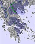
Report: It’s a mixed picture in Greece with a largely good, snowy start to the season; however, in recent days a jump in temperature to above +6C (40F) has led to some thawing and rainfall. At Parnassos (30/60cm / 12/243”), one of the country’s biggest areas, there is plenty of snow in Aeolos and Pericles but due to the temperature rise a lot of terrain is currently closed. It’s a similar story at other Greek areas, of which half-a-dozen have opened for the season so far.
Forecast: It’s looking like a snowy week ahead on Greek slopes with more areas planning to open over the next few days. One of these should be Vasilitsa ski centre which expects to open at the weekend with 20cm of snowfall expected between now and then. Generally, areas that have had rain are expected to get snowfall as the week progresses.
Scandinavia
Norway / Sweden / Finland
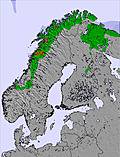
Report: It has stayed snowy in Scandinavia with the biggest accumulations of the region continuing to fall in western Norway. Roldal (50/90cm / 20/36″) pipped Voss (30/95cm / 12/38″), last week’s snowiest Scandinavian resort, to report the most snowfall in the past week, (70cm/28′ compared to Voss’s 62cm/25″); however, both resorts and others in the region continue to offer deep snow for skiing on floodlit slopes as the short Scandinavian days reach their shortest point of the year over the weekend. Elsewhere in the region, conditions are generally good with fresh snow almost everywhere, just not so much as in western Norway.
Forecast: The weather is expected to remain cold (5 to 10 degrees below freezing) over the coming week on Scandinavian ski slopes with a mixture of snowy and sunny days. Moderate accumulations of 15-30cm over the next 7 days are forecast widely, although it’s likely ski areas in western Norway will again see the heaviest falls in the area.
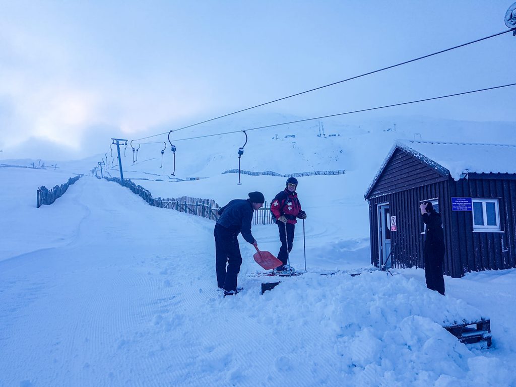
Scotland

Report: There has been cold weather and several light-to-moderate snowstorms over the Scottish hills so things are looking nice and white again. Unfortunately, there’s not enough snow to be able to open any large areas of terrain where natural snow of a reasonable depth is required. Some resorts have opened terrain using either all-weather or regular snow-making systems to enable beginner runs or small snow-parks to operate. Among them are Cairngorm and The Lecht, the latter opening last weekend (although it was closed Monday to Wednesday this week). Glenshee and Nevis range have both announced they’ll open some terrain later this week meaning that all five Scottish areas will be open.
Forecast: The forecast for Scottish hills is constantly changing but currently looks promising for temperatures, on higher slopes at least, to stay close to zero over the coming week up to Christmas. There is not a great deal of snow in the forecast but, equally, there should not be much thawing either. It seems likely that what precipitation there is, mostly forecast as rain in the valleys, should hopefully fall as snow on higher ground and ski slopes.
Spain / Portugal
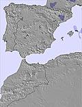
Report: It’s looking good on Spanish ski slopes right now with more than a dozen areas posting at least 90cm/3ft of snow lying on their upper runs and most either fully operational ahead of the upcoming Christmas holidays or almost there. Baqueira/Beret (100/180cm / 40/72”), the largest ski area in Spain, has the most terrain open (160km/100 miles) and the deepest reported base. Conditions are currently overcast.
Forecast: It appears some serious snowfall is en-route for the Pyrenees and Iberian peninsula to end the week. Heavy snow is expected from Thursday with Friday potentially seeing some really big accumulations of 50cm/20″ plus at some areas including Sierra Nevada down in the south, Europe’s most southerly resort.
Bulgaria / Romania
Report: Ski areas in southeastern Europe have been struggling to maintain their bases in recent days with temperatures climbing to double digits above freezing. Things should improve later this week but for now it’s a case of trying to maintain snow cover. Bulgaria’s leading area Bansko (10/80cm / 4/32″) saw temperatures hit +14C/+57F on Tuesday. It describes its slope condition as ‘hard-packed’.
Forecast: Far eastern Europe should benefit from the same snowy weather that’s set to impact the Alps later this week with the slopes of Slovenia likely to see light snow up to Thursday when a 20-30cm accumulation is forecast to end the week.
Iceland
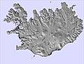
Report: It’s a fairly typical winter in Iceland with temperatures around 5-10 degrees below freezing and heavy snowfall at times. The country’s avalanche warning agency, within the meteorology office, is warning the avalanche danger is currently considerable across much of the country following heavy snow showers from the north and strong winds creating unstable slab conditions in the backcountry. The country’s largest ski area, Bláfjöll near capital Reykjavik, is fully open. It is currently operational afternoons and evenings during the week and during the daytime at the weekends.
Forecast: It’s looking like it should stay snowy in Iceland over the coming week with the largest resort, Bláfjöll, in line for over a metre/40 inches more snow. In fact, there is little sign of any different weather other than snowfall over the coming seven days. Other areas look like they’ll get less snow but still significant accumulations of at least 60cm/several ft.
Czech Republic / Slovakia
Report: It’s been a fairly snowy week for many areas in Eastern Europe where almost all centres have now opened for the season (those that haven’t should be joining the party this weekend in almost all cases). Among the biggest snowfalls reported over the past seven days was 20cm in 24 hours at the weekend at Špindlerův Mlýn (20/20cm / 8/8”) in the Czech Republic. Jasna (40/80cm / 16/32”), over the border in the Slovak Republic, reported the same amount in the same period.
Forecast: After the snowy start to the week, it looks like temperatures will stay low through to the weekend with a mixture of cloudy and sunny days but at present there is no real fresh snow forecast until next week. Temperatures should be low enough for snow-making systems to keep building bases.
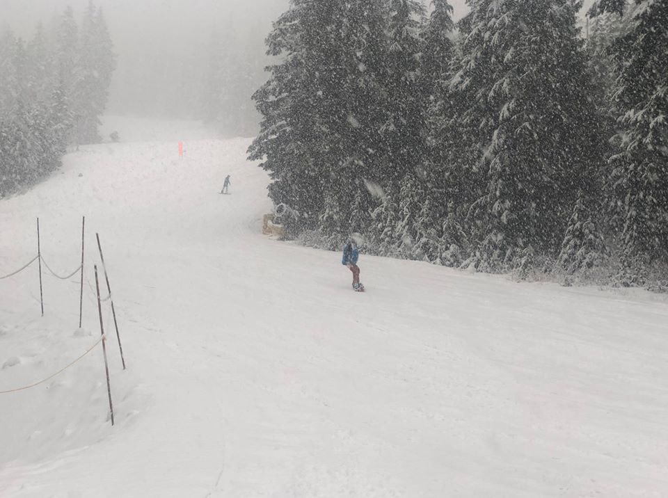
North America

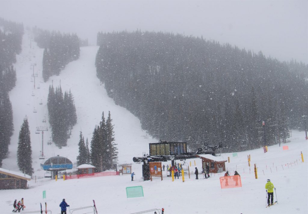
Report: It has been mostly good news for skiers and boarders over the past week in North America. There was plenty more snow in the Rockies and in California with resorts around Tahoe as well as in Colorado and Utah all benefiting from a weekend freshen up of the slopes. Ski areas in the Rockies have reported up to 60 inches/1.5 metres of snowfall in the past seven days with the heaviest accumulations in Utah. This has brought avalanche danger with it and there has been at least one out-of-bounds death reported here this week and one close-call rescue. Resorts in Colorado got a great snowfall boost at the weekend with many reporting 20-40cm of fresh snowfall in 24 hours on Saturday/Sunday and many reporting much more since on top to create great conditions. It was a snowy weekend for ski areas in California with several around the Lake Tahoe area reporting 20-25cm of fresh snow in 24 hours. Perhaps most noteworthy though is that it finally got a little colder and started snowing in the Pacific Northwest, the one part of the continent that had really been suffering from warm, wet weather leading several resorts in the region to delay planned opening dates until this weekend.
Forecast: It looks like a fairly quiet week ahead for much of North America with most areas seeing dry, sunny and sometimes rather warm weather until around Christmas Eve/Christmas Day when some snow is forecast in the Rockies and further east. It’s a similar picture to the south in New England, USA, with sunny days dominating the forecast here too; however, it should be colder. The main exception is the continent’s Pacific Coast which should get plenty of snow.
West Canada
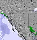
Report: It has finally turned colder and snowier in Western BC with coastal resorts like Grouse and Cypress Mountains reporting midwinter conditions at last. Whistler, too, had some snowfall up high.
Meanwhile, conditions continue to look great in Alberta, where it has been a very different, much colder autumn and winter to date with Banff’s Sunshine Village opening their Goat’s Eye Express meaning 100% of their lifts are now operating. Nearby, fellow Banff resort Lake Louise Ski Resort has seen over 75cm/42“ of snow this week and over 100 runs are now open. Banff’s third area, Mt. Norquay, opened their North American chair following a 16 cm/7″ ‘pow’ day to build up the base for some great skiing and riding there.
Forecast: Continuing the Pacific NW trend for heavy snow, Whistler Blackcomb should continue to be ‘dumped on’ with as much as a metre of snowfall possible in the alpine higher slopes by this time next week. That should transform things dramatically in time for the new year. Further inland in eastern BC and Alberta there will be more snow too but continuing with the moderate levels of recent weeks and months. Alas, there’s no immediate end in sight to the low snow problems in eastern Canada; however it is no longer too warm and wet but cold and dry instead. Snow-making systems can operate and it is beautiful weather for skiing and boarding on what snow is already around.
North California
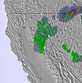
Report: It has been a snowy few days for the ski areas of North California with many reporting up to 16″/40cm of snowfall since the weekend. Boreal Mountain (57/57″ / 143/143cm) and Soda Springs (55/55″ / 138/138cm) were among the big winners from the latest storms but almost everywhere reported at least 10″/25cm of fresh snow. For some there was more than 50″/125cm in total for the last week. Squaw Valley (36/85″ / 90/213cm) is the latest US resort to pass the two metre/seven foot upper slope base depth mark.
Forecast: It’s good news at last in the Pacific Northwest after the warm and wet start to winter 2019-20 there. The light snow showers that have finally rolled in over the past week should ramp up again in the middle of this week with 30-40cm of snowfall expected in 24 hours on Wednesday/Thursday. The same applies for the US Pacific coast and up in Coastal BC so it should be an increasingly snowy picture.
Japan
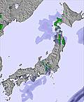
Report: Japanese ski areas are reported to be getting increasingly nervous about the ongoing warmer than usual start to the season as the weeks go by. Although there have been periods of the usual Japanese endless snow showers, for which the country is famous, some resorts continue to see more rain than snow as the temperatures stay unseasonably warm.
Forecast: The start of Japan’s 2019-20 season has been a bit of a nightmare with warm weather and rain rather than snow but it is finally looking like a return to normal conditiions may be on the horizon. The weather has turned colder and there has been light fresh snowfall with more forecast to end the week. Then next week Christmas Eve and Christmas Day should see a serious snowy deluge on Hokkaido with Niseko expecting up to 50cm of snow. It’s a similar picture at resorts like Hakuba and Nozawa, to the south, and indeed across Japan with light snowfall in the forecast through the weekend as temperatures drop. Some serious snowfall is expected early next week.