Southern Hemisphere Weekly Snow Roundup #319
Weekly Snow News for the Southern Hemisphere, updated 18 June 2026: African and South American resorts open but mild spells cause problems for Australian and New Zealand snow centres.
- Cerro Bayo first ski area to open in South America, more follow this weekend.
- Australia's season start stalls, some centres close again after mild week.
- Big name resorts in Andes incl Portillo, Las Lenas etc opening this weekend.
- After snowy week NZ season start stalls again with brief mild spell forecast.
- Africa's 2026 season underway at Lesotho's Afriski.
After a rather lacklustre pre-season month of often dry and mild weather for most southern hemisphere ski regions, the past week has finally delivered some much more wintery weather and significant snowfall in the Andes, Patagonia and New Zealand.
Whilst New Zealand's ski areas largely delayed opening to this coming weekend (with some now postponing again), Africa's 2026 season did get underway last Friday, with the continent's only remaining lift-served ski area starting its lift spinning. Most of Australia's resorts opened on the first weekend of the month, the first to do so without needing all-weather snowmaking, but have been facing challenging weather still, the freezing point mostly well above mountain level and very limited, if any, snowmaking windows, leading some to shut down again until things improve.
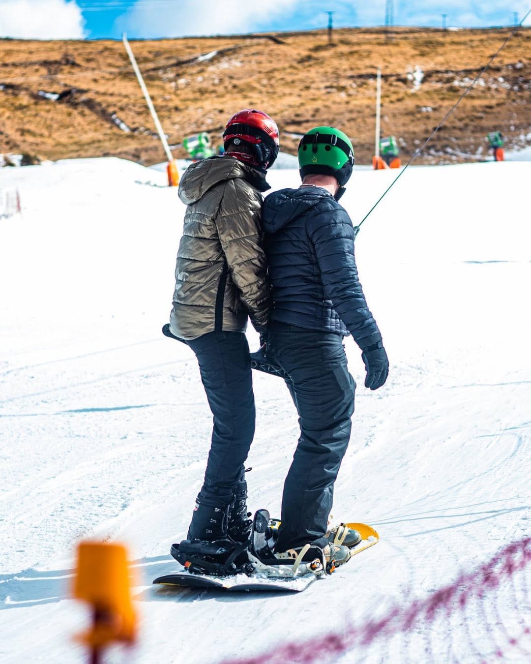
Australia Report
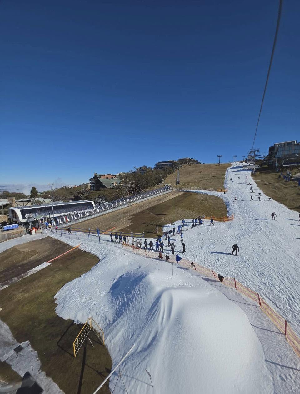
After getting the southern hemisphere’s season properly started on the first weekend of June, Aussie ski areas have sadly been battling thawing conditions ever since, so it's mostly limited areas of ribbons of snow available so far. There’s been unusually mild temperatures and showers that should have been snow had things been normal; they have fallen as rain instead. As a result, Falls Creek and Hotham have both temporarily closed again until conditions improve, whilst others are struggling on against the elements. Perisher (15/20cm / 6/8") and Thredbo (13/13cm / 5/5”) are both reporting less than 15 of their terrain open. Mt Buller (20/65cm / 8/26”) is in the best shape on snow depth thanks to its all-weather snowmaking machine, but has about the same amount open.
Australia Forecast
There’s no huge improvement in the forecast, alas, but it is looking slightly more wintry over the coming days, with a few centimetres (an inch or snow) of snow possible, mainly across the higher slopes of NSW and Victoria. Colder air is expected to arrive toward the weekend, dropping summit temperatures to around –3 to –1°C and bases close to freezing. This should allow for a return of snowmaking windows and hopefully a refresh of early cover. Saturday and Sunday look the chilliest period, with occasional flurries and brisk winds keeping conditions feeling wintry.
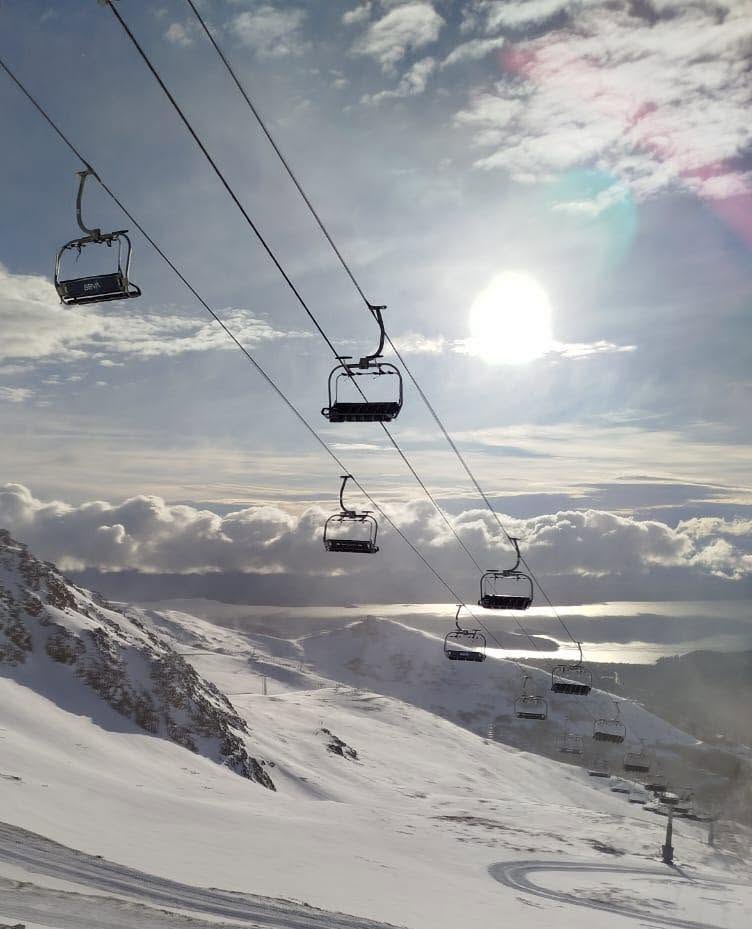
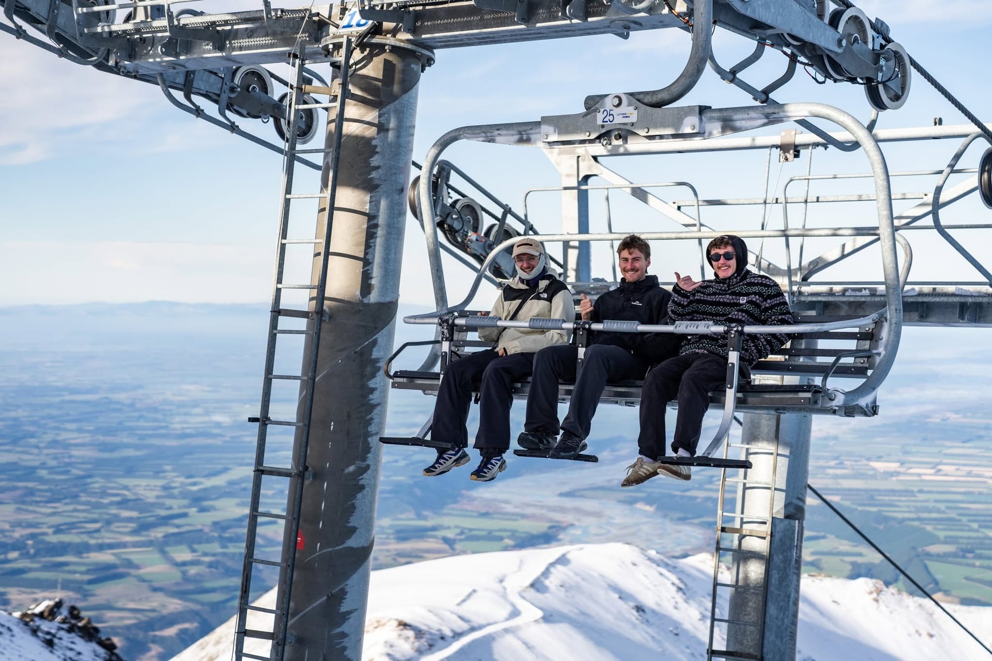
New Zealand Report
New Zealand's weather finally took a turn for the better at the start of this week as a series of southerlies brought cold temperatures and plenty of precipitation up from Antarctica, with heavy rain in valleys but hill snow up high. Currently, it’s only really been Coronet Peak offering snowsports after what looks like an increasingly smart decision to invest in an all-weather snowmaking machine, which allowed it to open a short run with terrain park features for first arrivals. It was looking good for the delayed openings of Mt Hutt, The Remakables and Cardrona this coming weekend, after all three centres reporting good snowmaking windows as well as some natural snowfall (if not perhaps so much as earlier forecasts predicted) but now a forecast brief change in conditions over what would have been the upcoming revised opening weekend. Mt Hutt announced they had a solid 12 hour stint of snowmaking on Wednesday before gale westerlies arrived last night, laying down over 5000m3 of snow on the main trails (or 20,000 large wheelie bins worth!).
“Unfortunately, with marginal snowmaking temps forecast in the lead up to the onset of warmer, gale-force winds this Saturday, opening this weekend is looking less and less likely. We really need another 3 full days of snowmaking to get going so hopefully the colder weather arrives next week as many forecasts are still predicting. Rest assured, we’ve got the best people and the best gear so as soon as we reach a 30cm base we’ll be into it!” a spokesperson said.
Cardrona announced they were impacted by the same scenario but The Remarkables have not yet provided any update on their revised plans, announced a week ago, to open this Saturday June 20th.
New Zealand Forecast
The mixed early‑season pattern continues, with mostly dry spells punctuated by a few centimetres of snow on the higher South Island fields. Temperatures stay on the cool side through the end of the week, but ski areas will be impacted by the warm winds and accompanying potential rain forecast before a more notable dip arrives early next week, when summit stats should fall back to around –5 to –3 °C and bases hover near freezing. Light flurries are possible at areas including Mt Hutt, The Remarkables, Coronet Peak and Treble Cone, while Ruapehu remains more changeable with passing cloud and brisk winds. The colder weekend window should briefly improve snowmaking and surface conditions across most of New Zealand’s ski regions.
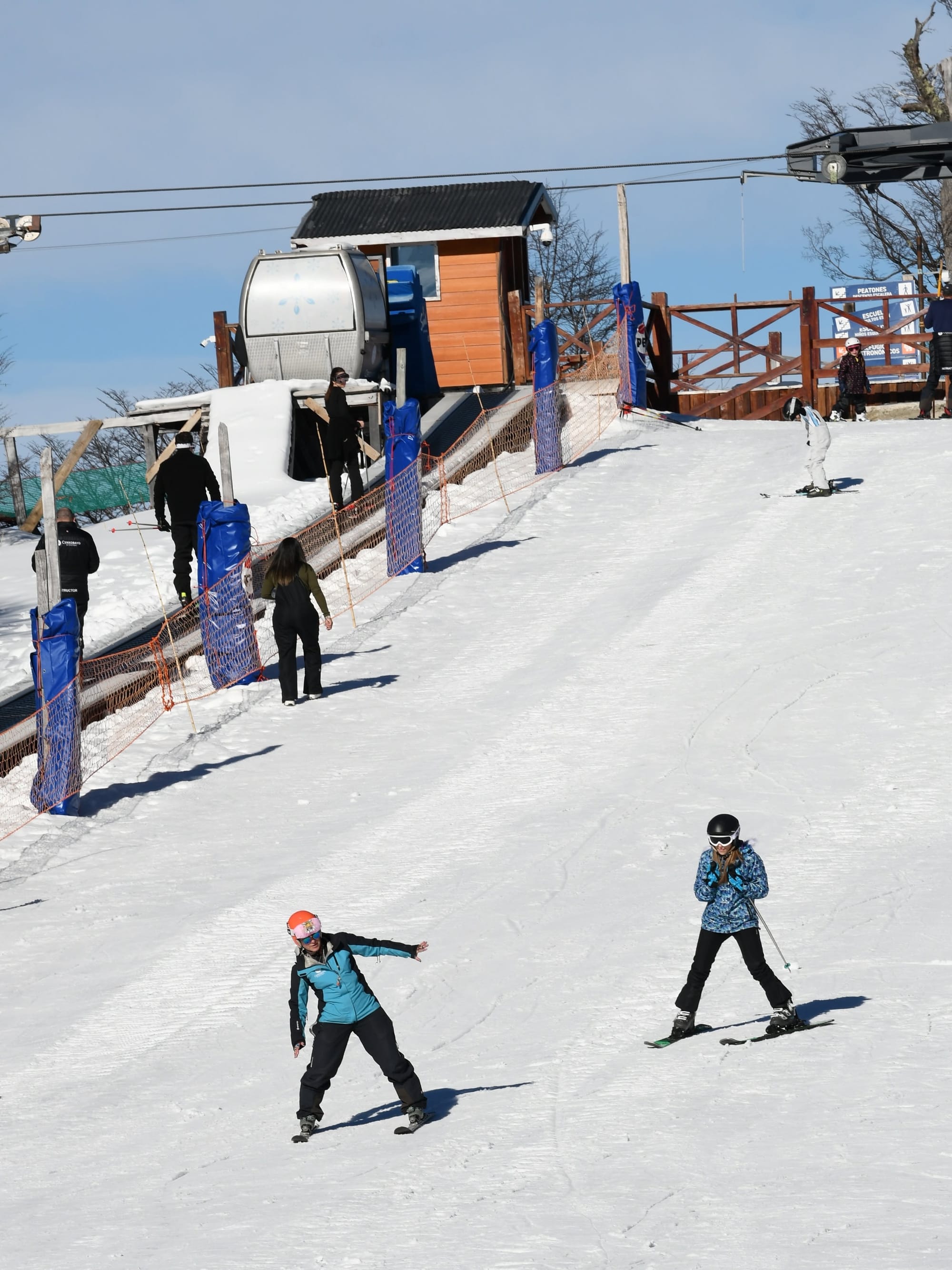
Argentina Report
Argentina’s ski season got underway this week, with Cerro Bayo (0/15cm / 0/6") the first to open in the Andes. It just has a few hundred metres (500') of terrain open initially. Next up, the country's ski season proper is set to kick off this weekend after a promising week of snowfall and low temperatures dropping down to double digits below freezing. Bariloche was among the areas posting images of white slopes and announcing its intention to open this coming weekend after the first snowfall of the season arrived in Patagonia at the end of last week. Chapelco Ski Resort picked up about 30 cm (12 inches) of new snow on its upper slopes in that initial fall, with more following since.
Argentina Forecast
Argentina’s ski slopes are set to stay cold through the coming week, with upper‑mountain temperatures commonly between –10 and –4 °C at Catedral, Chapelco and Cerro Bayo, and even lower at high‑Andean resorts such as Las Leñas and Vallecitos, where summit values fall to –12 to –6 °C. Light snow showers are possible mid‑period, mainly in Patagonia, with the chance of a few centimetres on higher slopes. Bases generally sit between –3 and +5 °C, keeping nights consistently below freezing.
Chile Report
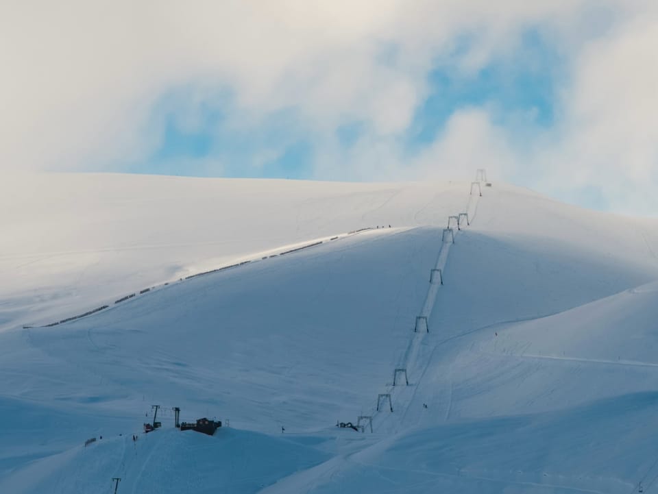
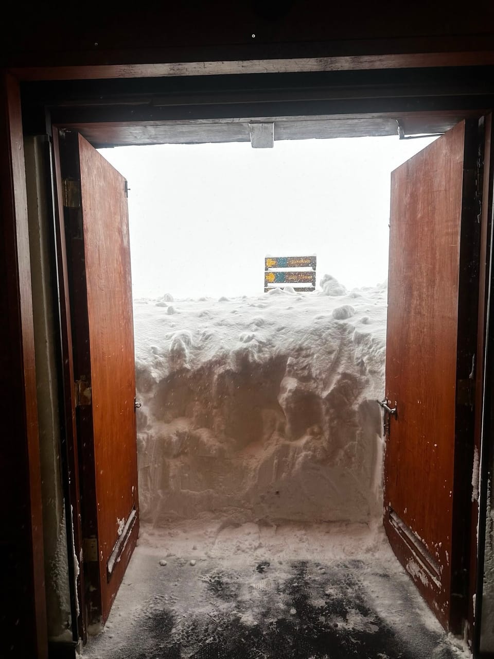
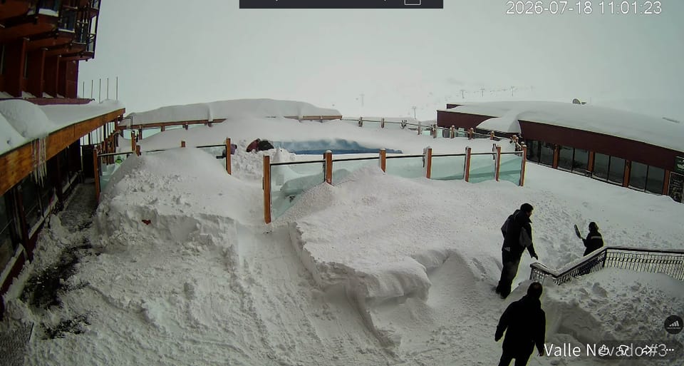
Its opening weekend in the Chilean Andes and things are looking much more promising compared to a week ago, with a 25-20cm (10-20") snowfall at the end of last week followed by heavier falls for some at the weekend and earlier this week, which brought totals up to nearly a metre for some on higher terrain over the last seven days. Valle Nevado posted a 25cm (10”) accumulation at the end of last week, although not much since, Portillo got 45cm (18") on Tuesday. Both (and most of the rest of Chile's ski areas) expect to open this coming weekend, but as yet it’s not clear how much they’ll be able to open.
Chile Forecast
Chile’s slopes should stay on the colder side through the coming week, with summit temperatures frequently between –10 and –3 °C in the central and southern regions, and bases mostly 0 to 7 °C. The pattern is largely dry, but several resorts, including Valle Nevado, La Parva, El Colorado, Portillo and Nevados de Chillán, see brief windows for light snow or flurries, mainly at higher elevations. The coldest spell is expected to arrive early next week, improving overnight freezes and snowmaking potential. Southern areas such as Corralco and Villarrica remain more changeable with cloud, brisk winds and occasional light precipitation.
Southern Africa Report
Southern Africa’s ski season kicked off last Friday as Afriski in Lesotho opened for its 2026 season. After the snowfall at the start of the week, it's been a typical week of mostly dry, sunny weather, but with temperatures dipping towards -5C overnight and not getting much above freezing in the daytime, allowing for snowmaking topping up as required. Afriski maintains a run of about a mile (1.6km) long, but it's unclear if it has fully opened the full slope so far.
Southern Africa Forecast
The cold early‑winter pattern is set to continue with summit temperatures ranging from –13 to +5 °C through the week and the base sitting between –11 and +7 °C. Most days remain dry and bright, but the persistent overnight freezes continue to support snowmaking whenever humidity allows. The coldest spell should be over the next few days into the weekend, when upper‑mountain values drop back toward –10 °C, keeping surfaces firm. While no significant snowfall is indicated, the chance of a light dusting or brief flurries on the highest ridges cannot be ruled out, especially during the chilliest nights.