
Over 2.7m (9 Feet) Of Snowfall in 48 Hours as Super Storm Hits Andes
A powerful winter storm which could be the biggest in several years has begun hammering the central Andes, delivering extraordinary snowfall and forcing authorities to shut down key mountain roads before conditions deteriorate further.
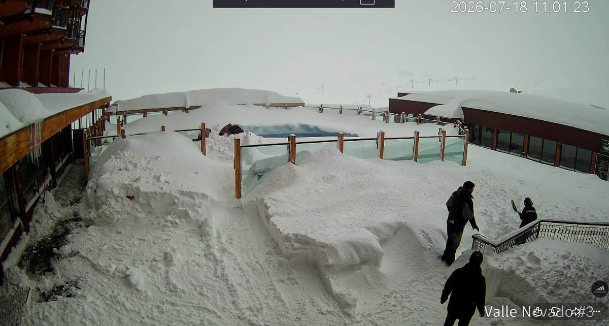
A powerful winter storm which could become the biggest in several years has begun hammering the central Andes, delivering extraordinary snowfall and forcing authorities to shut down key mountain roads before conditions deteriorate further.
The famous Chilean ski resort of Portillo reported 105cm (42”) of snowfall in the first 24 hours of the storm, then 165cm in the past 24 hours, for a 2.7m/9 feet 48 hour total. Valle Nevado has posted 161cm (over 5 feet) since Thursday.
Chile’s Ministry of Public Works has pre‑emptively closed Routes G‑21 and G‑251, the only access roads to Valle Nevado, as forecasts call for potentially up to 3.5–6 metres (12–20 feet) of snow through the weekend. Officials say the closures, which began late Wednesday, will remain in place until at least Saturday morning, though reopening will depend entirely on avalanche danger and road stability.
The storm promises a dramatic turnaround after a dry and sometimes mild first month to the 2026 season, which saw resorts repeatedly delay opening then operate with you small fractions of their terrain open due to a lack of snow up to now. Authorities warn though, that extreme snowfall, unstable slopes and buried infrastructure may keep transport routes closed for several days as crews work to clear snow and restore safe access.
Resorts have begun adjusting operations: Valle Nevado urged guests not to attempt the ascent and offered early check‑in before the shutdown among several options designed to mitigate the impact of the extreme weather on holidays, while Portillo has closed entirely with no set reopening date. Whiteout conditions and wind loading are rapidly elevating avalanche risk, leaving high‑altitude ski areas effectively cut off.
Meteorologists note that the storm is being fuelled by a long‑duration atmospheric river drawing enhanced Pacific moisture into central Chile. While no agency has formally tied this specific event to El Niño, the developing strong El Niño is widely expected to increase the frequency of moisture‑rich systems impacting the region, and forecasters say this week’s setup is consistent with that emerging pattern.