Europe Weekly Snow Roundup #290 – Early-Season Alps Snow Update
Weekly Snow News for Europe, updated 26 November 2025: Austrian, Swiss and French resorts report deep November snow and rapidly expanding piste openings.
- Alps enjoy early-season powder and expanding glacier terrain
- Austria and Switzerland report deep November snow and busy openings
- French and Italian resorts ramp up lifts before December
- Scandinavia, Pyrenees and Scotland prepare after fresh snowfalls
- Skiers in Wales, UK make the news after Pembrokeshire Dangler
Europe Snow Report and Ski Conditions – Week Ending 26 November 2025

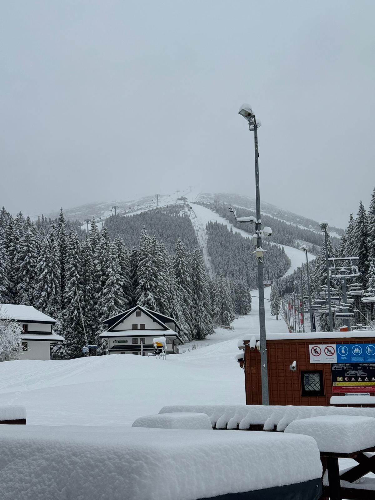
Heavy snow in French resorts: La Plagne, Val d'Isere and Tignes last week
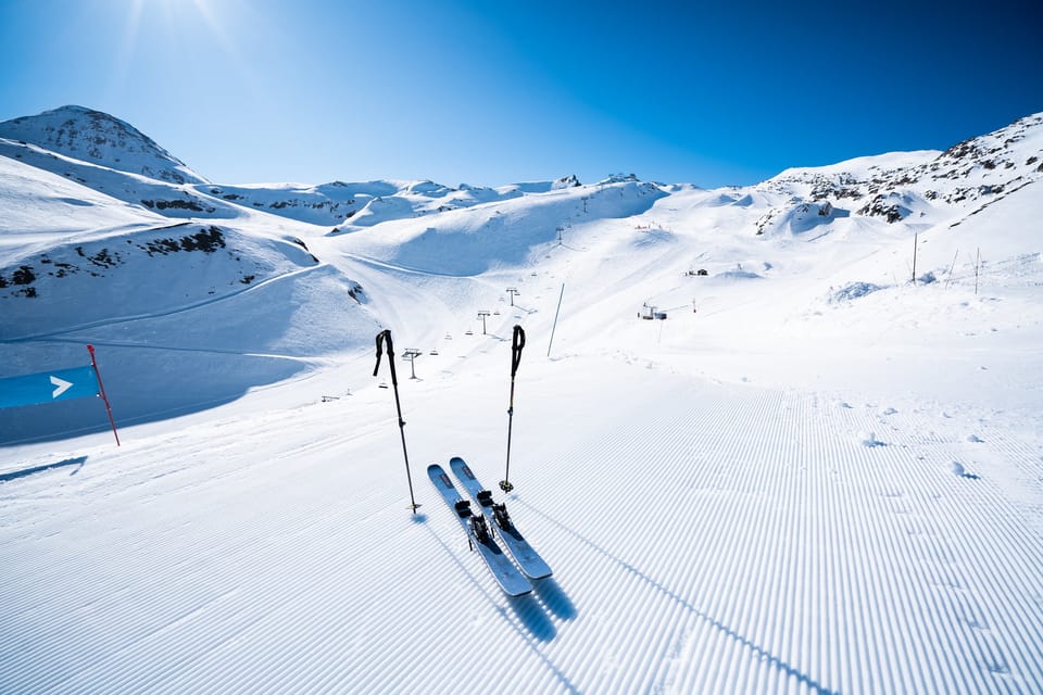
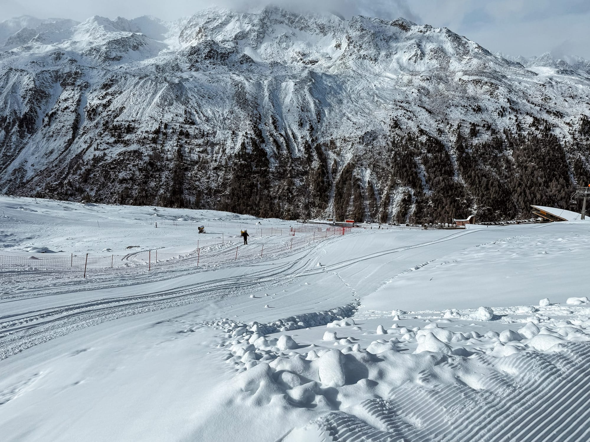
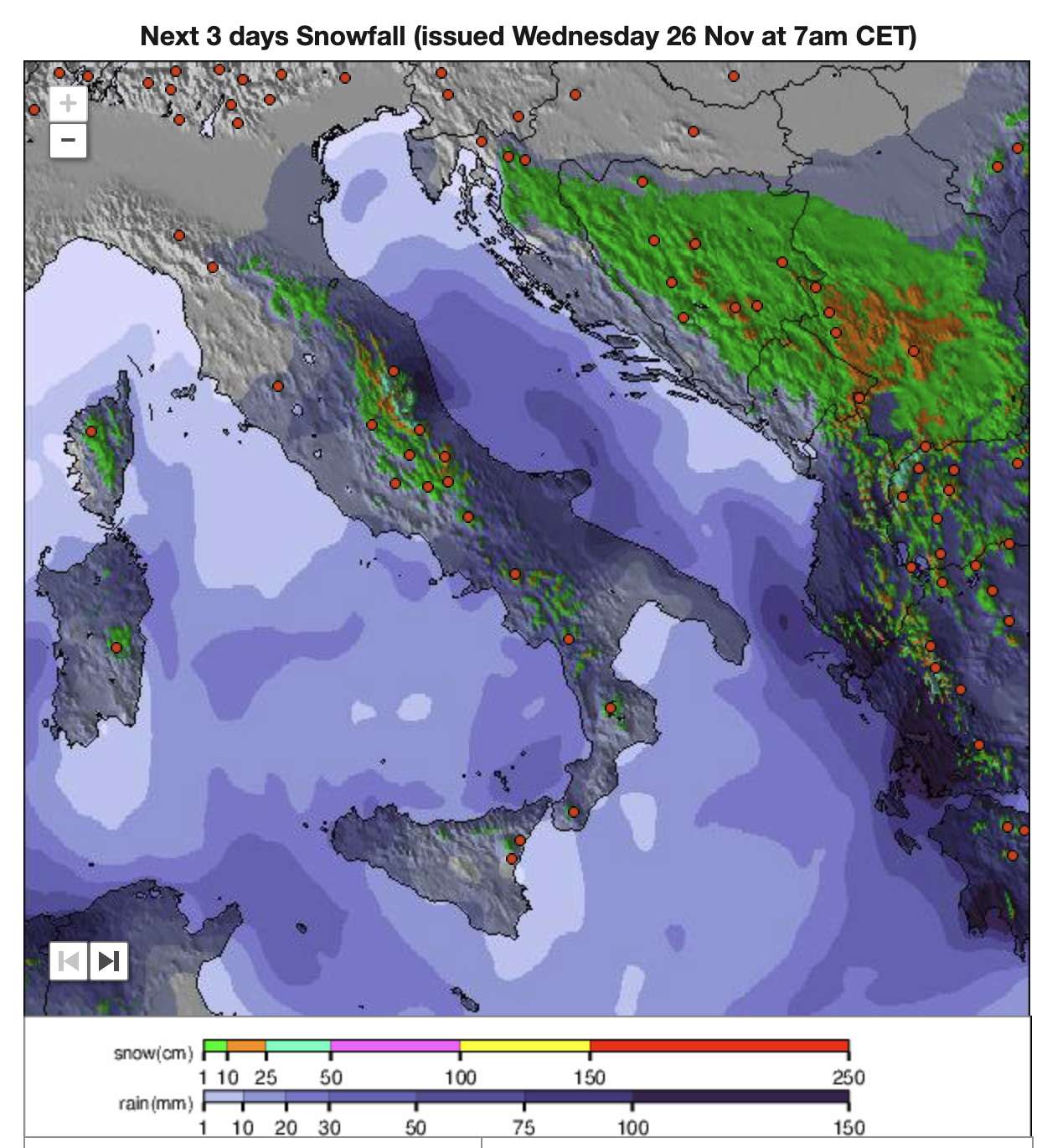
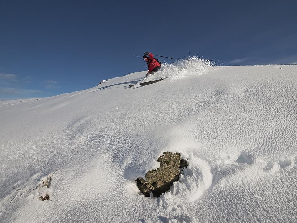
Europe Introduction | There has been excellent skiing in the Alps over the past week, with ski areas reporting up to a metre of snowfall in 24 hours—exceptionally good news just before many leading resorts begin their seasons. There have also been a few blue-sky ski days, especially further east, allowing everyone to enjoy it all. The only downside has been the rapid rise in avalanche danger levels to 3 or 4 due to the heavy snowfall. It’s a busy period with the first non-glacier ski areas opening (apart from those that opened earlier thanks to snow farming) and the French and Scottish ski seasons getting underway.
Most other ski areas not yet open are busy with snowmaking where possible, and the next few weekends will see most preparing to open.
The amount of terrain available at already-open areas has been increasing rapidly as well. The highest offered at any single resort has now reached nearly 100km (63 miles), and it seems certain that some will surpass 100km (63 miles) of runs this weekend. The ski season is also expected to begin in more countries and mountain ranges, including the Dolomites, Pyrenees, and Eastern European mountains.
Austria Snow Report and Ski Conditions
Fresh snow in Stubai Glacier
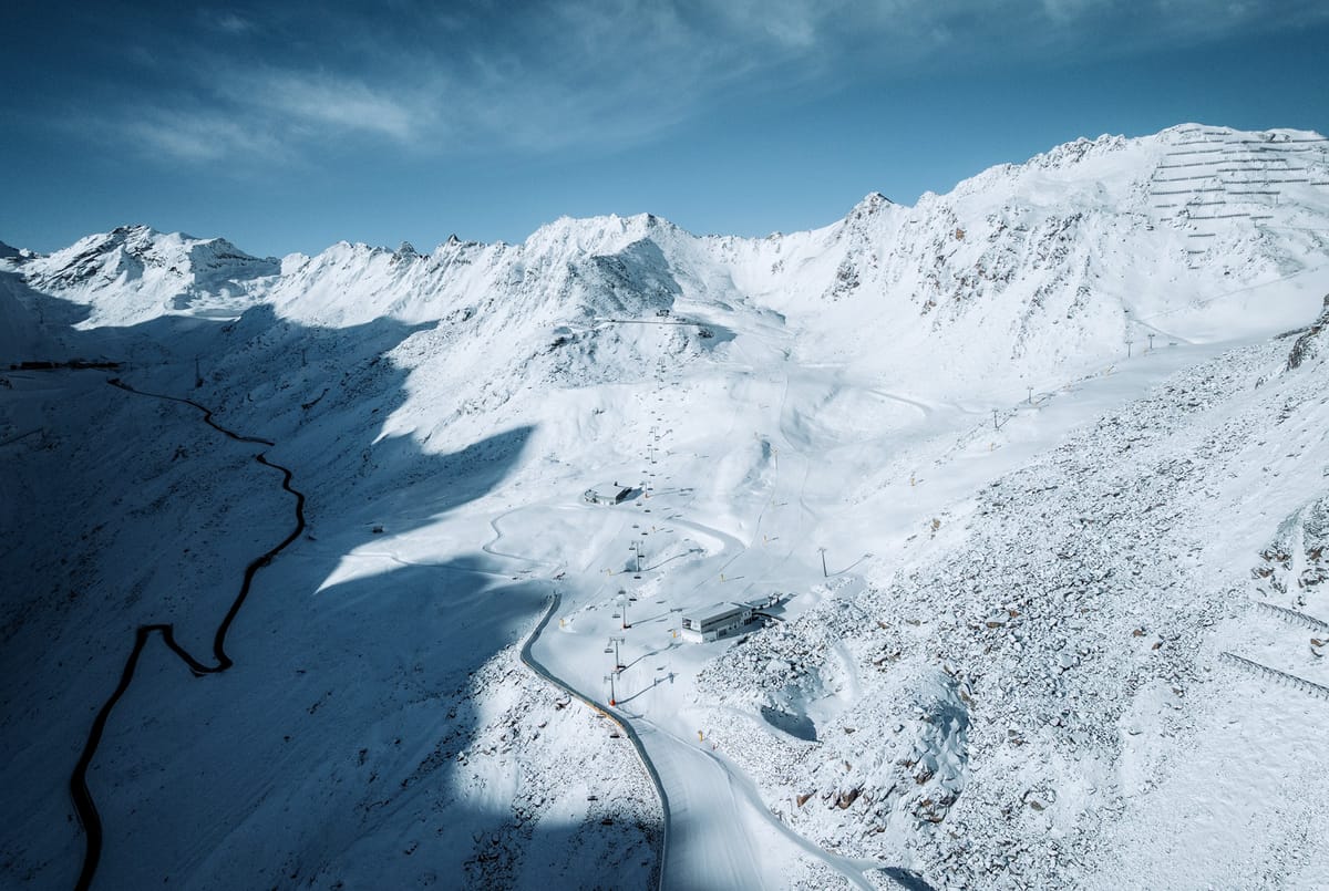
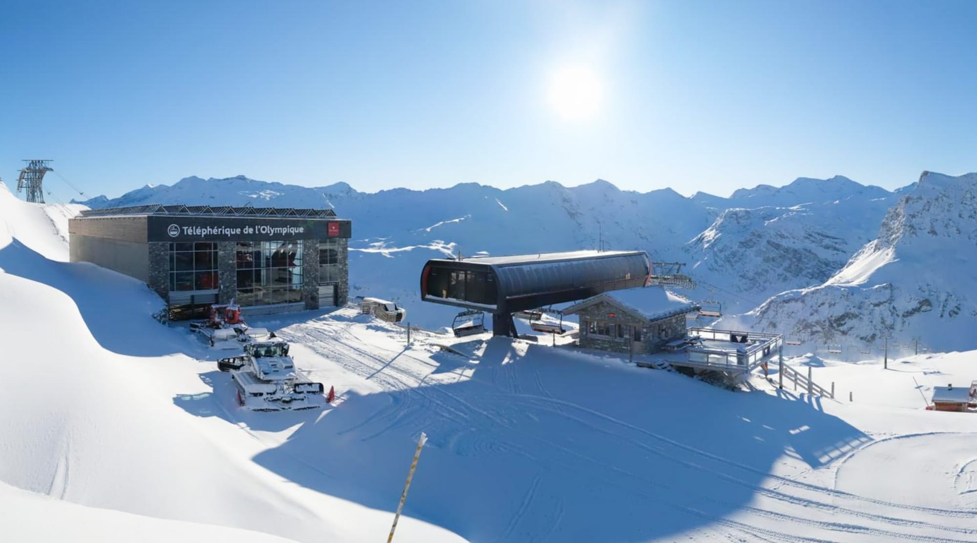
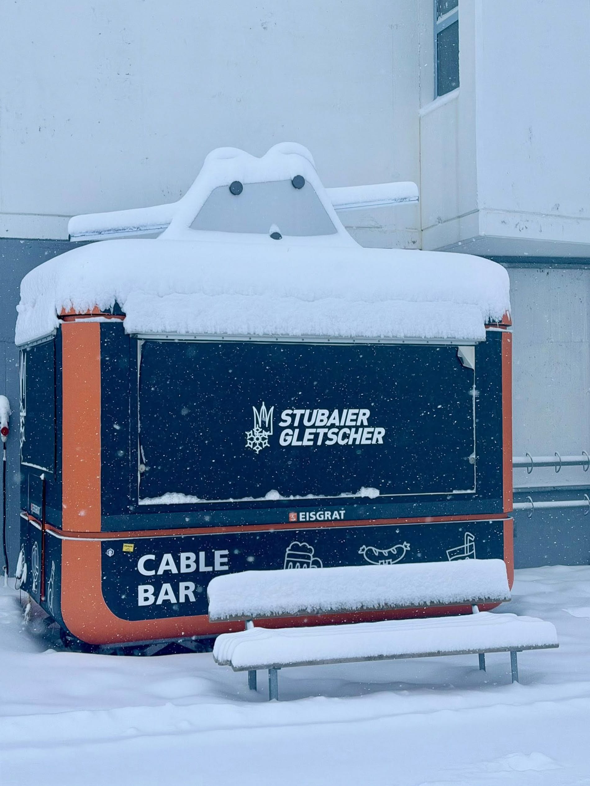
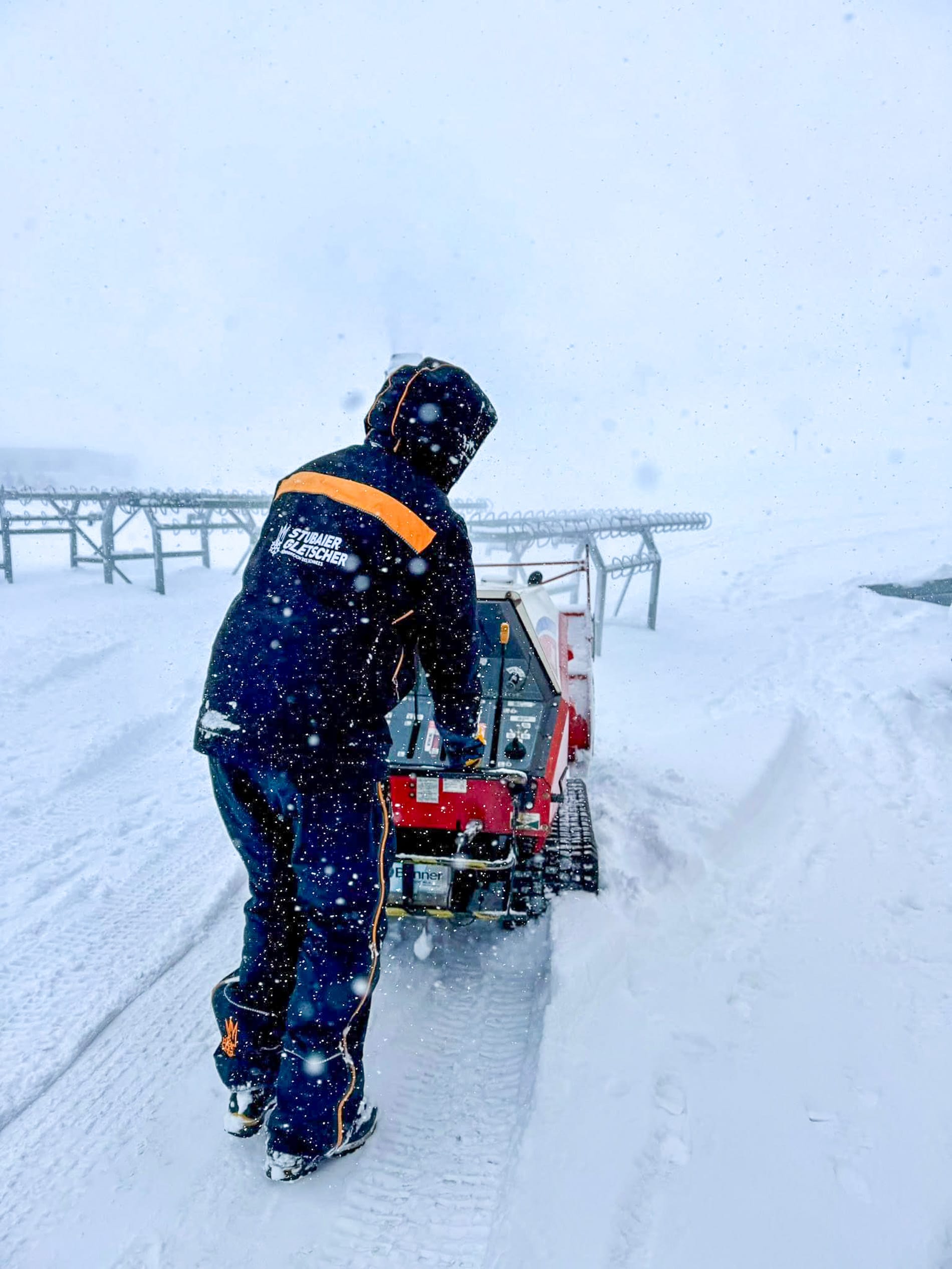
AUSTRIA REPORT | It has felt quite like winter in the Austrian Alps over the past week, with some good snowfalls delaying the World Cup Slopestyle competition on the Stubai glacier (15/60cm / 6/24”). Obergurgl (20/33cm / 8/13”) opened for the season last Thursday, becoming the first resort to do so without relying on a glacier or snow-farming. It immediately posted the most terrain open in the world at that point, with more than 70km of slopes from day one, overtaking its neighbour, Solden (0/37cm / 0/15”), which had held that position over the past few weeks. Solden did respond by increasing to 80km (50 miles) of slopes open at the weekend, though, so Obergurgl’s lead was short-lived.
Solden was then overtaken by Zermatt/Cervinia, but at the time of writing had moved back to the top spot with 98km (62 miles). Ischgl is set to open on Friday, often posting over 100km from day one, so it remains to be seen where we’ll be in the ‘most open’ table this coming weekend. Obertauern (20/50cm / 8/20”) and Schladming (10/60cm / 4/24”) also started their 25-26 seasons at the weekend, meaning Austria has joined Switzerland and the US in being into double figures for the number of areas open. Snowfalls here have not been as spectacular, yet, as further west, but 50cm (20") totals have been reported.
AUSTRIA FORECAST
The Austrian Alps will experience more wintry conditions with cold air, bright spells midweek, and fresh snow accumulating towards the weekend. Conditions across the country look promising, with low temperatures and light snow showers, especially on higher slopes, adding a few centimetres of fresh snow from Thursday. A stronger snowy spell is expected at the weekend, with accumulations on upper slopes and temperatures remaining below average.
France Snow Report and Ski Conditions
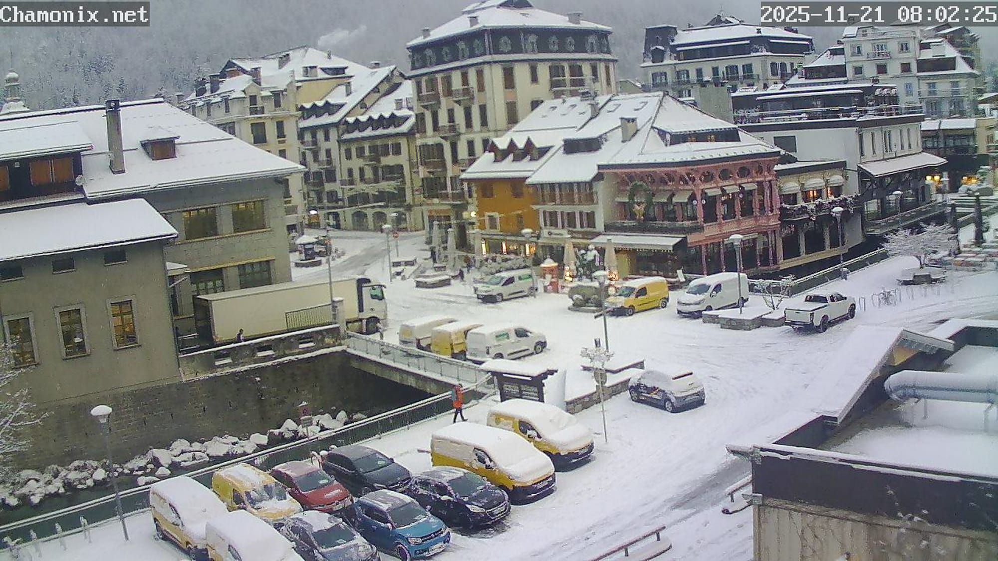
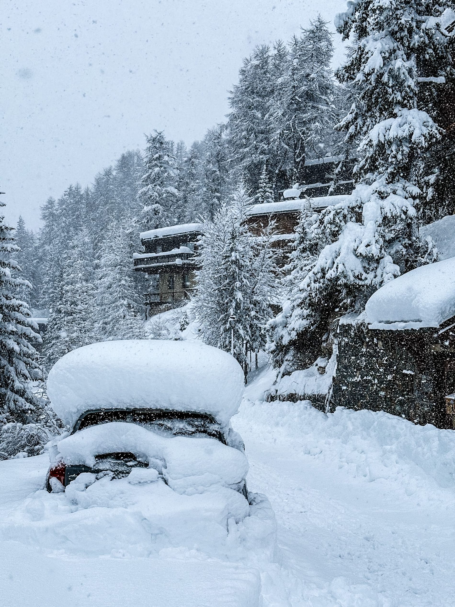
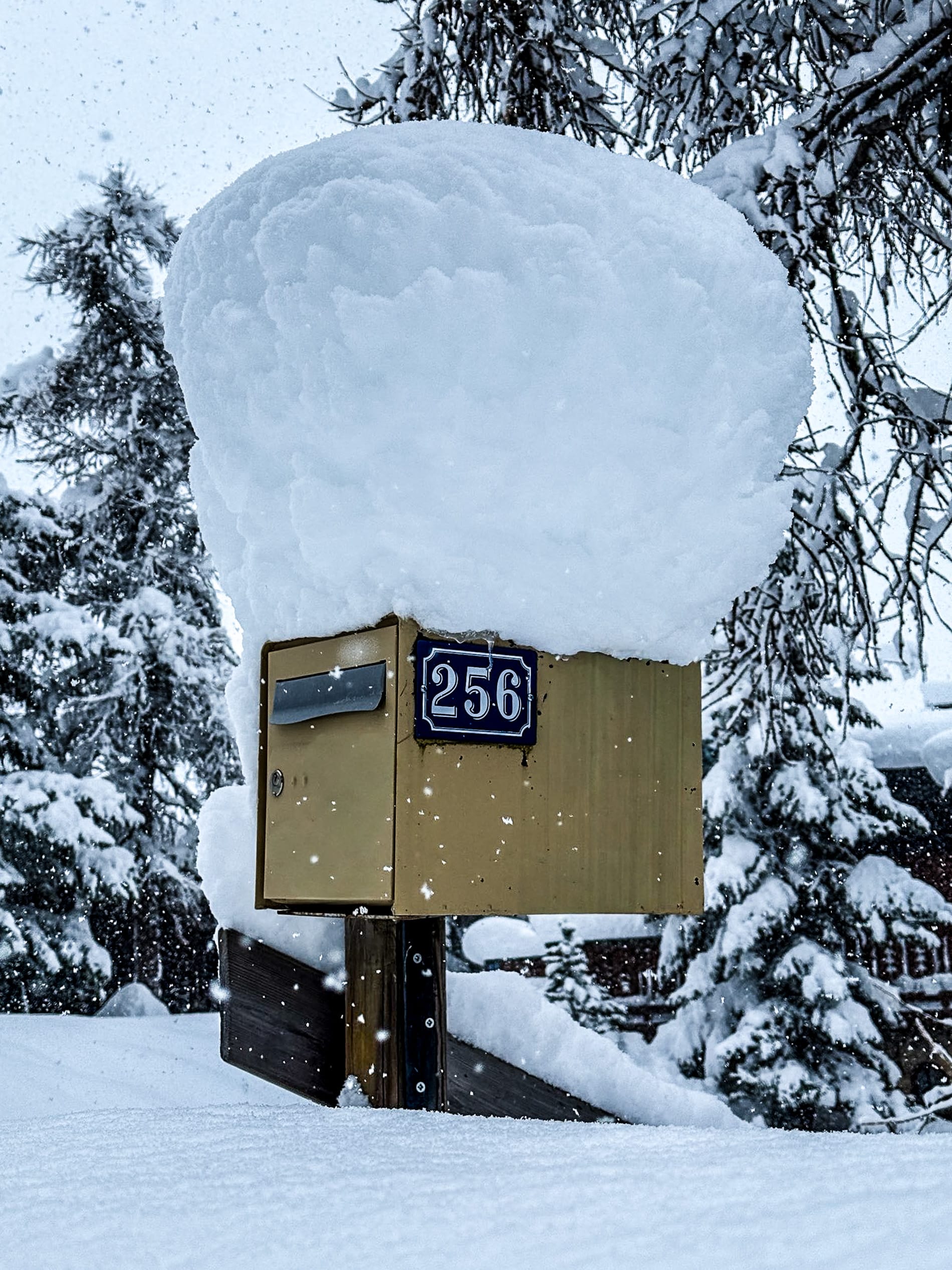
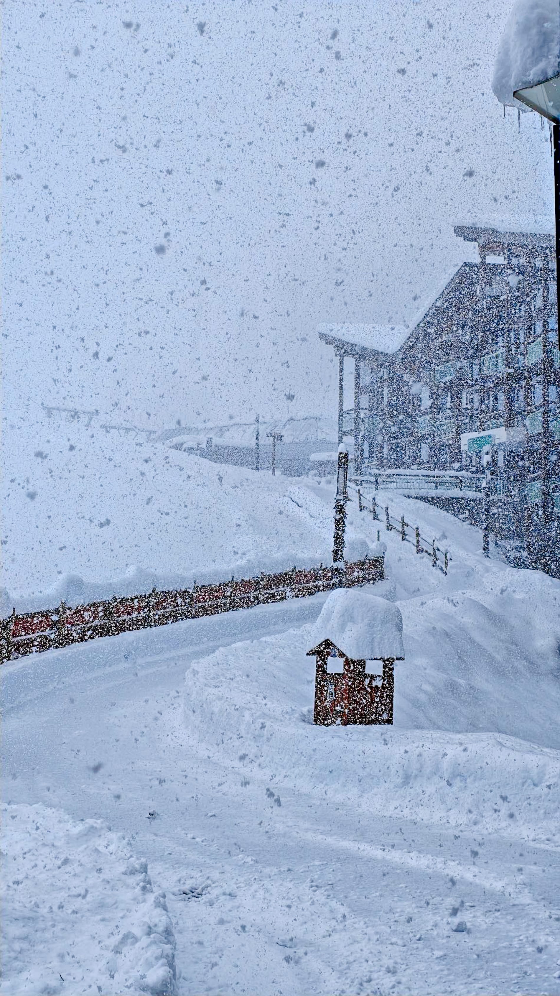
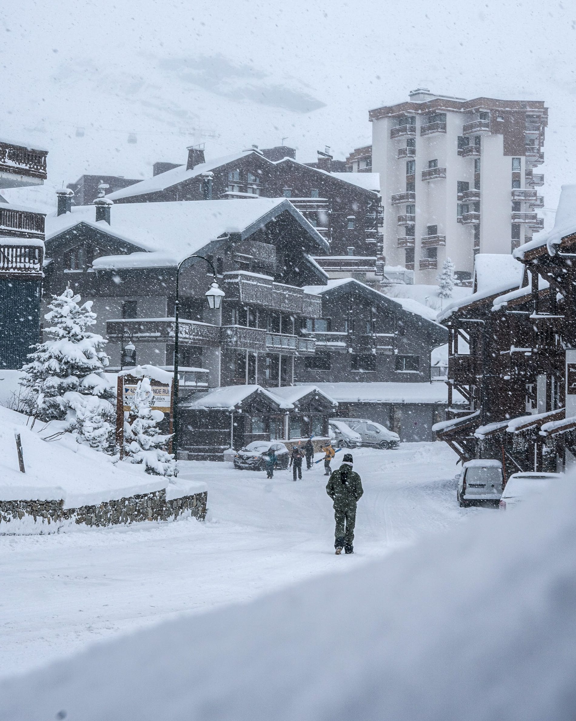
FRANCE REPORT | The French ski season started promisingly at the weekend, with Tignes and Val Thorens both getting their lifts running along with opening festivities, and about 25 km (16 miles) of slopes open each. There had been up to 25 cm (10 inches) of fresh snowfall in the days before opening, creating excellent conditions for the first skiers. Things then escalated at the start of this week, with reports of 1 m (40 inches) of 24-hour snowfall in the Chamonix Valley and Aravis region around La Clusaz. Here, the avalanche danger surged to nearly maximum level 4 (high). More French ski areas expected to open this weekend include Alpe d’Huez, Flaine (preview weekend), Chamonix (Grand Montets), Les 2 Alpes, and Montgenevre.
French Pyrenean resorts such as Les Angles and Porte Puymoren are also expected to open.
FRANCE FORECAST
The French Alps are set for a wintry spell, with cold air and regular snowfall strengthening early-season conditions. Midweek begins with clear skies and light snow showers at altitude, keeping temperatures below freezing above 2,000m. By Thursday, snow showers will become more frequent, adding several centimetres across mid- and upper-mountain slopes. Friday offers brighter skies and crisp sunshine, although valley temperatures remain cold, helping preserve the fresh cover. The weekend then becomes more dynamic, with Saturday expected to bring heavier snowfall, particularly overnight, although accompanied by strong winds at altitude, while Sunday continues with scattered snow showers, especially in Savoie and Isère, as freezing levels drop to around 1,500 m.
Italy Snow Report and Ski Conditions
ITALY REPORT | Italy has also seen some of its major resorts opening in recent days, with Cortina d'Ampezzo (5/30cm / 2/12") and Madonna di Campiglio (15/40cm / 6/16") joining already open Cervinia (0/150cm / 0/60”), Val Senales (0/50cm / 0/20”) and others. Currently, seven Italian areas are open in total, with many more expected to open this weekend when the country's largest area, Dolomiti Superski, begins its first wave of openings. It has also been colder here, resulting in some decent snow accumulations over the past week. Most areas initially have only a few kilometres of slopes open, but numbers are increasing, and Cervinia’s shared area with Zermatt now offers up to 85km (52 miles).
Passo Tonale (60/90cm / 24/36") boasts the deepest snow in Italy.
ITALY FORECAST
The Italian Alps and Dolomites will also experience a wintry mix of cold air and regular snowfall, which will strengthen early-season cover. Wednesday begins with crisp conditions and light showers above 1,800 m, while Thursday is expected to bring more widespread snow, adding several centimetres across mid- and upper slopes. Friday will turn brighter, with sunshine and sub-zero nights helping to preserve fresh snow. A stronger front arrives on Saturday, bringing heavier falls and gusty winds, especially in the western Italian Alps near the French border. Freezing levels will drop to 1,400–1,600 m, meaning early-opening high resorts should enjoy excellent early-season skiing.
Switzerland Snow Report and Ski Conditions
SWITZERLAND REPORT | There are now more than a dozen ski areas open in Switzerland, the most of any country in Europe, with Zermatt (0/150cm / 0/60") standing out as mentioned in the Italy report, offering 86km (53 miles) of cross-country slopes. Although most other Swiss centres only have a few kilometres of runs available, the amount each offers is increasing, with the Schilthorn above Murren beginning the Muttleren chairlift's season to access more terrain. Other resorts that had only opened on weekends are now operating daily. Switzerland has also had a good week, with snow accumulations on higher slopes reaching up to 20cm (8”) in 24 hours and snowfall reaching valley floors as the freezing point dropped.
SWITZERLAND FORECAST
The Swiss Alps are expected to experience scattered light showers above 1800m from Thursday, resulting in more widespread snow and several centimetres accumulating on mid- and upper slopes. Friday will be brighter with sunshine and sub-zero nights, helping to preserve the fresh snowfall. A stronger front will arrive on Saturday, bringing heavier falls and gusty winds, especially in Valais and Graubünden. On Sunday, unsettled weather persists, with more snow showers and freezing levels dropping to around 1500m.
Pyrenees Snow Report and Ski Conditions
PYRENEES REPORT | The 24-25 season in the Pyrenees is expected to get underway this weekend with Spain’s Baqueira/Beret, Formigal and Les Angles and Porté Puymorens on the French side of the range among the areas expected to start their lifts spinning. The past week has seen some great snowmaking conditions, with overnight temperatures down to -15C at altitude and some good natural snowfall, too, although it remains to be seen just how much will be open.
Pyrenees Forecast
Widespread snowfall is forecast in the Pyrenees from Thursday, bringing several centimetres above mid-mountain level. The end of the week should see clearer weather with sunshine, but sub-zero nights will help preserve the fresh cover. A stronger front arrives on Saturday, bringing heavier falls and gusty winds, particularly in the central Pyrenees. Sunday remains unsettled, with further snow showers and freezing levels dropping to around 1400m.
Scandinavia Snow Report and Ski Conditions
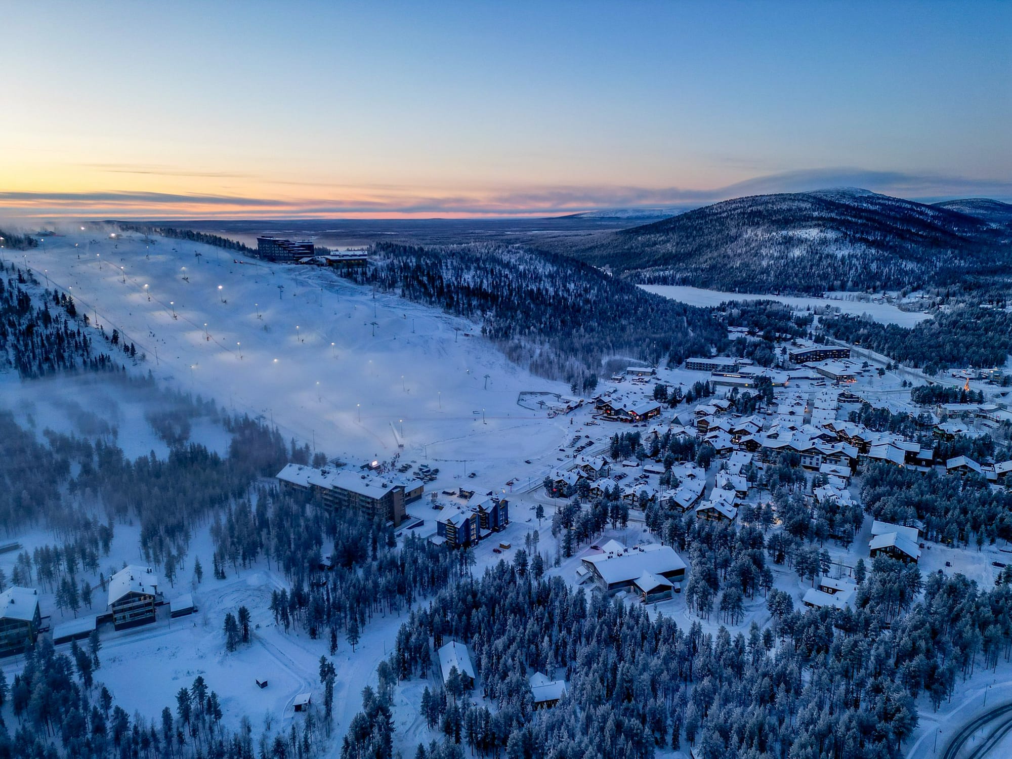
SCANDINAVIA REPORT | Only a few ski areas remain open in Sweden and Finland, each with just a few kilometres of runs so far in Scandinavia. However, some major resorts are set to open from this weekend as the main Scandinavian season kicks off. In Lapland, Levi (30/50cm / 12/20") reported temperatures as low as -23 °c this week. Thanks to good conditions and recent snowfall, the ski area has expanded from the initial Front Slopes all the way to the South Slopes, with run 8.4 and the South chairlift beginning operations for 2025-26. Ruka is also open here. In Sweden, Tärnaby (30/50cm / 12/20”) and Kåbdalis (30/60cm / 12/24”) are currently open.
Among the resorts expected to open this weekend are Norway’s Beitostølen, Geilo, Oppdal, and Trysil, which are among those set to open for the season.
SCANDINAVIA FORECAST
The story in Scandinavia is similar, with light snow showers midweek and more widespread accumulation by the end of the week. The weekend is expected to be brighter, with sunshine and sub-zero nights maintaining the snow cover, but heavier snowfall will occur, especially in western Norway, accompanied by gusty winds at higher altitudes. Sunday remains unsettled, with further showers and freezing levels dropping to around 600–800m.
Eastern Europe Snow Report and Ski Conditions
EASTERN EUROPE REPORT | There are no ski areas open yet in Eastern Europe, but that is set to change this weekend with one of the region’s largest, Slovakia’s Jasná, preparing to start operations. It has reported low temperatures with 10–20 cm of fresh snow expected and temperatures ranging from -5°C to- 12°c. Further south in the Balkans, there has been less positive news, where rain was falling as temperatures stayed above +10°C at the end of last week; however, cooler, if not cold air has arrived since, bringing temperatures down to the low single digits. In the Carpathians, Romanian mountains have experienced a pre-season mix of rain and snow, with highs near 0–4°C and cold nights suitable for snowmaking.
EASTERN EUROPE FORECAST
Eastern Europe’s mountain ranges are expected to experience colder, snowier weather for the remainder of this week, ideally preparing them well for the start of the season. In Bulgaria’s Rila and Pirin ranges, there will be light showers above 1600m initially, becoming heavier towards the weekend. Romania's Carpathians follow a similar pattern, with snowfall accumulating through midweek. Poland's Tatras and Slovakia's High Tatras will brighten on Friday, with sunshine and sub-zero nights helping to maintain the snow cover. Saturday will bring a stronger front, bringing heavier snowfall across the region, accompanied by gusty winds at altitude.
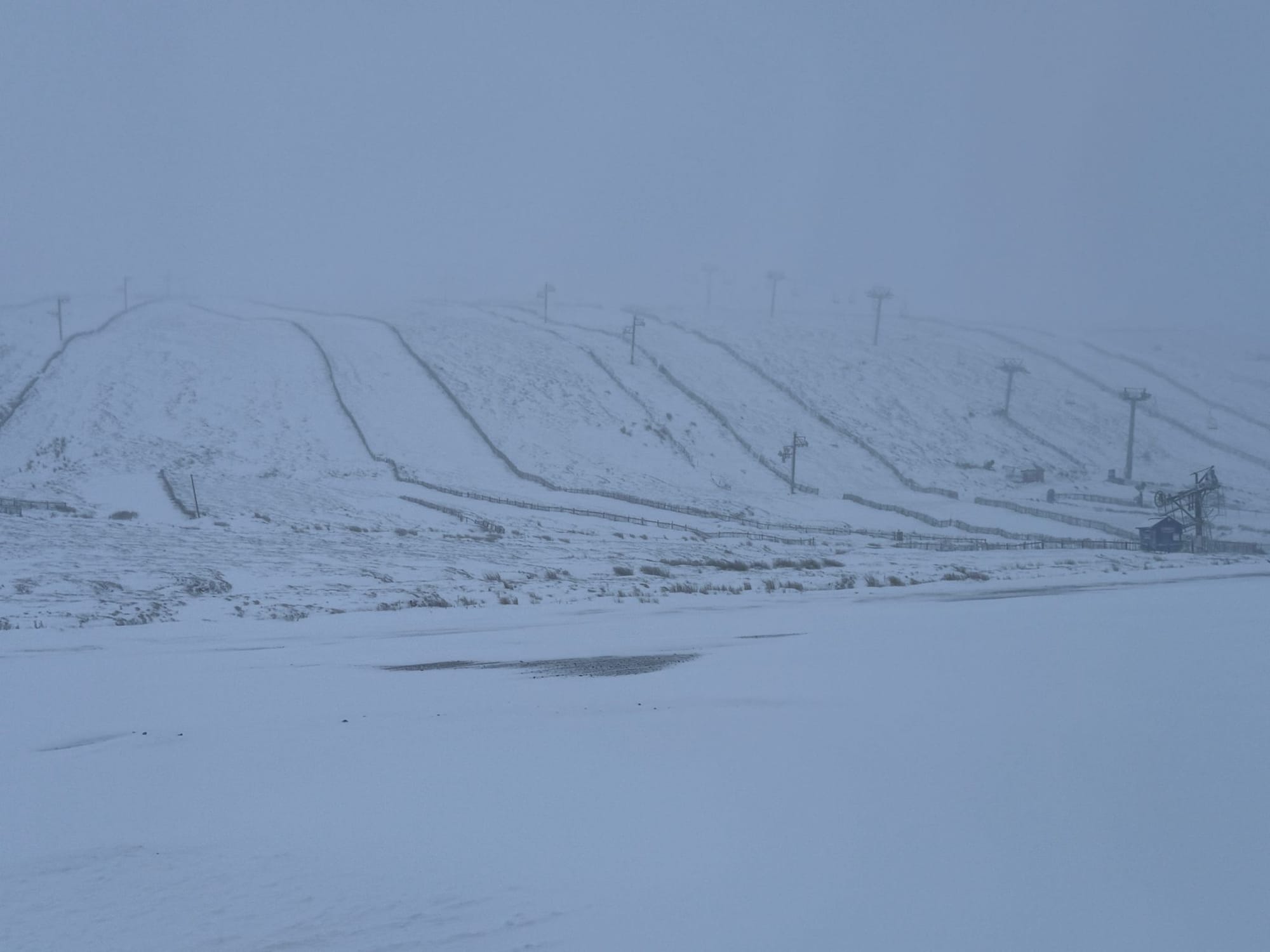
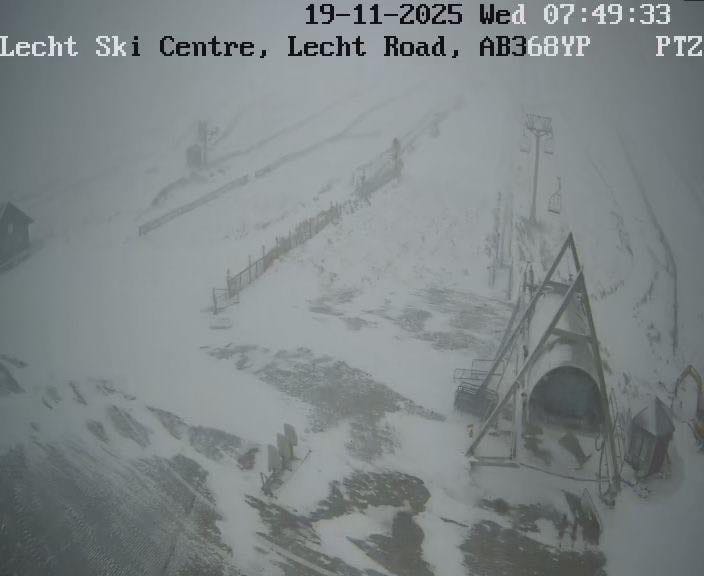
Scotland Snow Report and Ski Conditions
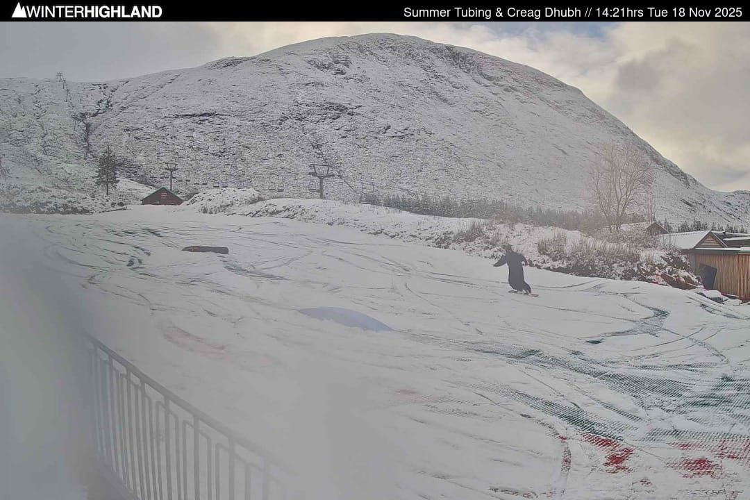
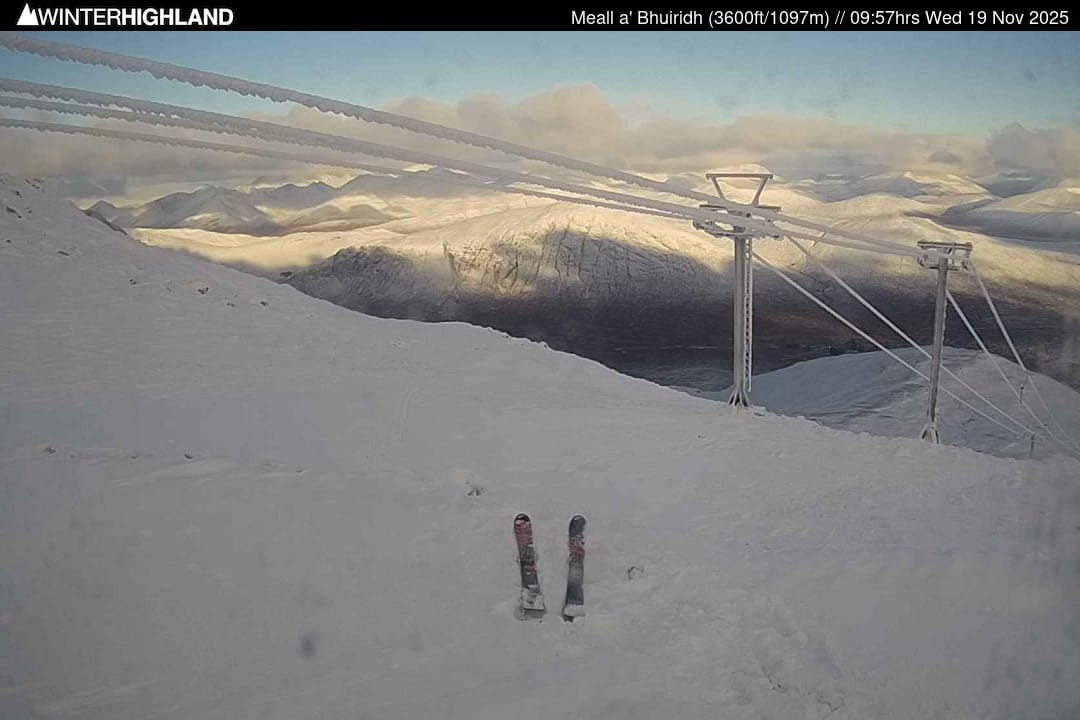
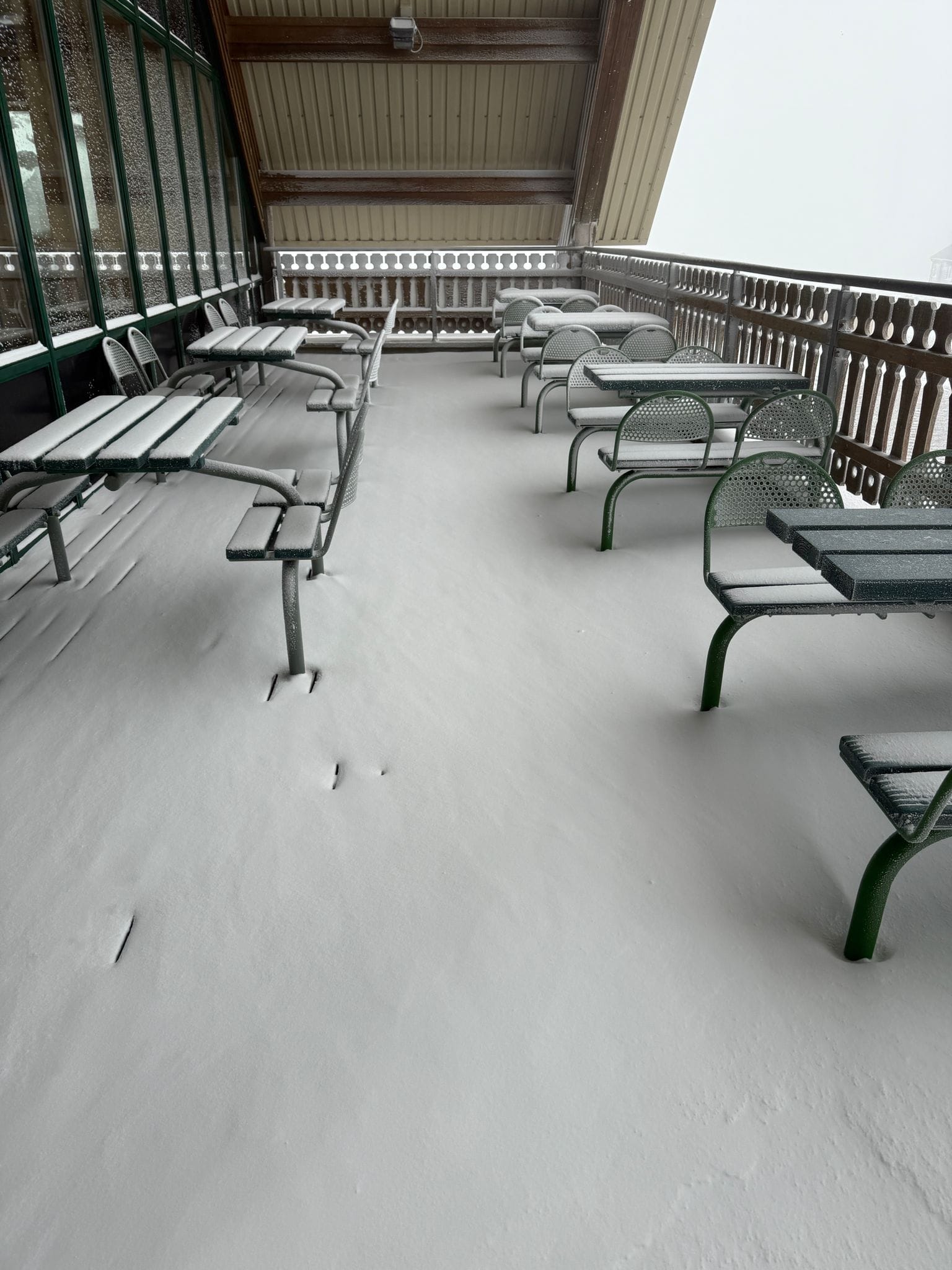
Images from Scottish ski resorts on 19th November
SCOTLAND REPORT | Cold weather and fresh snowfall prompted an earlier-than-expected opening at Cairngorm ski area above Aviemore last week. Around 20cm (8 inches) of snow fell on Thursday, enabling the resort to open a marked run from Ptarmigan Top Station to the funicular mid-station via the Traverse, 105, and Zig Zags, with uplift solely on the Funicular Railway. The Polar Express Poma also opened, serving limited beginner terrain. Reduced-rate day passes (£27 adults/£17 juniors) are available online, initially capped at 100 per day. Glencoe has begun snowmaking and is offering lift-accessed snowsports on its sometimes snow-covered dry slope, while The Lecht remains closed while awaiting more snow, and Glenshee says they’ll open in the week before Christmas.
SCOTLAND FORECAST
It remains to be seen whether a midweek warm spell will cause significant damage to the base, but crisp conditions with scattered snow showers above 600–800 m should follow. Snowfall is expected to increase in intensity towards the weekend, adding several centimetres across the Cairngorms. Sub-zero nights will hopefully help preserve the new snow cover. A stronger front is forecast for the weekend, bringing heavier falls and the Highlands’ characteristic gusty winds.
Skiing in Wales
As usual with Dangler-type events, snowfall was patchy: some communities saw several centimetres while others, only a few miles away, recorded almost none. Looking ahead, the main concerns are overnight refreezing, icy surfaces on untreated routes and locally challenging conditions around the higher terrain of north Pembrokeshire.
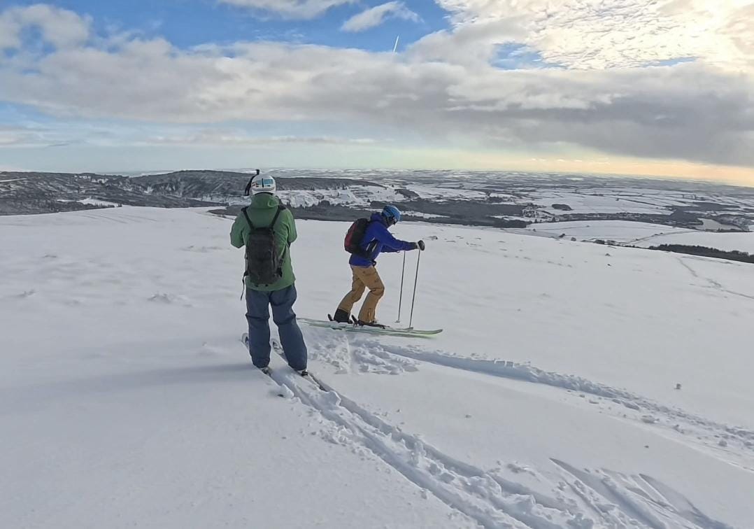
Skiing the Preseli Hills, Pembrokeshire (images: Mike Richards)
As usual with Dangler-type events, snowfall was patchy: some communities saw several centimetres while others, only a few miles away, recorded almost none.