

Freeride Added To 2030 Olympic Winter Games
The IOC has today announced a swathe of decisions ahead of the Alpes 2030 Winter Olympics and Paralympics in the French Alps.

Next 3 days weather summary:Heavy rain (total 40.0mm), heaviest during Wed afternoon. Warm (max 21°C on Thu afternoon, min 17°C on Wed afternoon). Mainly fresh winds. | Days 4-6 weather summary:Heavy rain (total 45.0mm), heaviest during Sat night. Warm (max 22°C on Sat afternoon, min 19°C on Sat morning). Mainly near gales. | |||||||||||||||||
Wednesday 8 | Thursday 9 | Friday 10 | Saturday 11 | Sunday 12 | Monday 13 | |||||||||||||
AM | PM | night | AM | PM | night | AM | PM | night | AM | PM | night | AM | PM | night | AM | PM | night | |
light rain | mod. rain | rain shwrs | t-storm risk | t-storm risk | mod. rain | t-storm risk | t-storm risk | rain shwrs | some clouds | t-storm risk | heavy rain | light rain | light rain | mod. rain | t-storm risk | t-storm risk | light rain | |
km/h | ||||||||||||||||||
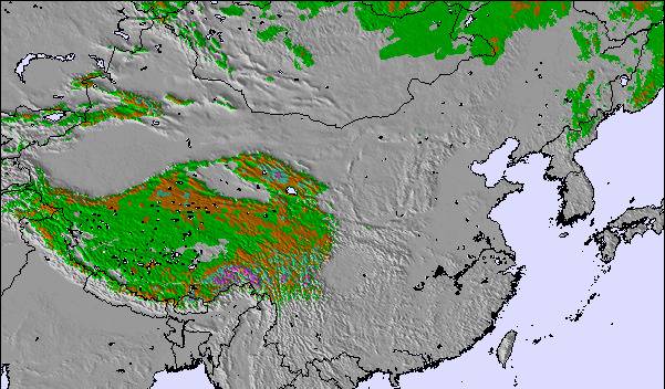
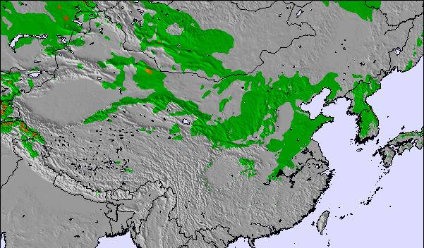
Snow map |  |  |  | 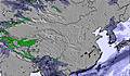 | 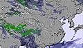 | 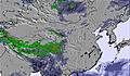 | ||||||||||||
— | — | — | — | — | — | — | — | — | — | — | — | — | — | — | — | — | — | |
mm | 3 | 6 | 1 | 1 | 6 | 8 | 3 | 4 | 8 | — | 4 | 16 | 4 | 4 | 7 | 2 | 3 | 5 |
max °C | 18 | 17 | 17 | 20 | 21 | 20 | 18 | 20 | 19 | 20 | 22 | 21 | 20 | 20 | 20 | 22 | 22 | 20 |
min °C | 18 | 17 | 17 | 19 | 21 | 18 | 18 | 20 | 19 | 19 | 21 | 20 | 20 | 20 | 20 | 21 | 21 | 19 |
chill °C | 17 | 16 | 16 | 18 | 21 | 17 | 18 | 20 | 19 | 19 | 21 | 19 | 19 | 19 | 19 | 20 | 21 | 18 |
Humid % | 84 | 98 | 96 | 85 | 81 | 89 | 92 | 88 | 91 | 93 | 94 | 93 | 97 | 97 | 97 | 86 | 93 | 73 |
Freeze m | 4450 | 4400 | 4300 | 4300 | 4450 | 4400 | 4350 | 4500 | 4650 | 4800 | 4950 | 5000 | 5200 | 5350 | 5200 | 5400 | 5200 | 4900 |
3:45 | — | — | 3:46 | — | — | 3:47 | — | — | 3:47 | — | — | 3:47 | — | — | 3:48 | — | — | |
— | 7:15 | — | — | 7:14 | — | — | 7:14 | — | — | 7:13 | — | — | 7:13 | — | — | 7:12 | — | |
Go pro and carve into:
Latest snow reports near Yabuli:
| Top snow depth: | — |
|---|---|
| Bottom snow depth: | — |
| Fresh snowfall depth: | — |
| Last snowfall: | 20 Apr 2026 |
| Snow Alerts | Create Alert |
0.0 | Bluebird Powder days Fresh snow, mostly sunny, light wind. |
|---|---|
0.0 | Powder days Fresh snow, limited sun, any wind. |
0.0 | Bluebird days Average snow, mostly sunny, light wind. |
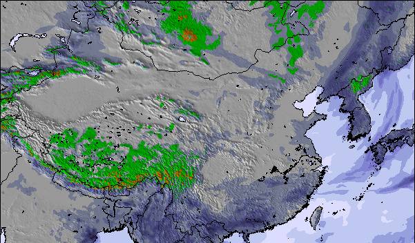
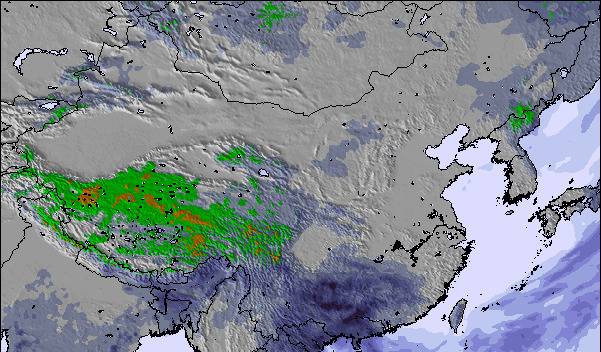
The above table gives the weather forecast for Yabuli at the specific elevation of 942 m. Our sophisticated weather models allow us to provide snow forecasts for the top, middle and bottom ski stations of Yabuli. To access the weather forecasts for the other elevations, use the tab navigation above the table. For a wider view of the weather, check out the Weather Map of China.
Click here to read further information on freezing levels and how we forecast our temperatures.
Overall 3.3 Based on 3 votes and 2 reviews
Great little ski field in China. If you are around the area worth a visit.
paul from Australia writes:
Great little ski field in China. If you are around the area worth a visit.

 Nearest