We're just finalising plans for our 2nd trip here in a couple of weeks or so. We first visited last year as we have friends who live in Grenoble and have an apartment in the town of Villard de Lans.
In short, it is an ideal resort for a family holiday (as we discovered taking our 2, aged 4 and 6, for their first trip).
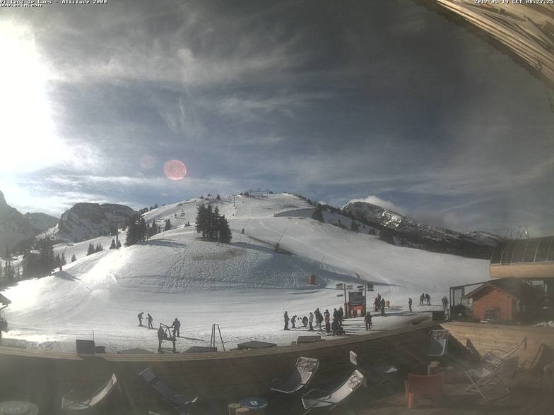
Firstly, the town is small and largely remains a working rural hub for the area, combined with a holiday resort. Walking and cycling are as common here in summer (from what we hear from our friends) as skiing and cross-country (it's a bit of a mecca) are in winter.
A good selection of restaurants, in town, from a quick pizza to something more local and traditional. The advantage of it being a working town is that there are supermarkets and real local shops. So, if you're self-catering, as we were, you can get great food at non-'resort' prices.
A free bus takes you up to the slopes from the town but if you're visiting out of peak season, check the times very carefully, it doesn't run that often. Once up at the base, you're fairly quickly whisked up to the mountain hub where the ski school is.
From there, you have your pick of cruisy blues, fun reds and some properly challenging blacks. We would drop our kids off at ski school and then make our way across the resort and back in time to pick them up. My wife is an expert and I'm fairly advanced, so we like a challenge but also enjoy some carving. The advantage of being there in low-season, yet mid-season (early-mid Feb) is that the snow was fabulous and the place was deserted.
Eating up the mountain doesn't offer a huge choice but the food is fine and compared to the mega resorts, not badly priced.
There's a great leisure pool to loosen the limbs in after a day and this year we're hoping to catch the local ice hockey team, the Bears, for a match.
As I said, all in all, it's a great family 'resort', relaxed, friendly and unpretentious. Can't wait to get back!
PS That said, 4 weeks after this trip I'm heading to Meribel with the guys (7x 40-50 yr olds) for the annual trip. I wouldn't take them to Villard de Lans. But then I wouldn't take my kids to Meribel yet when they don't need that amount of terrain and whilst VdL offers such a 'nice' family holiday.


 Nearest