

Portillo Re-Opens To Guests Arriving By Helicopter
Chile’s famous Portillo ski resort is reported to have re-opened to guests arriving by helicopter after being cut off by road for more than two weeks by over 6m/20 feet of snowfall.

Next 3 days weather summary:Moderate rain (total 13.0mm), heaviest on Mon night. Very mild (max 18°C on Mon afternoon, min 12°C on Mon night). Wind will be generally light. | Days 4-6 weather summary:Heavy rain (total 44.0mm), heaviest during Sat night. Very mild (max 18°C on Sat afternoon, min 12°C on Thu night). Wind will be generally light. | ||||||||||||||||
Mon 3 | Tuesday 4 | Wednesday 5 | Thursday 6 | Friday 7 | Saturday 8 | ||||||||||||
PM | night | AM | PM | night | AM | PM | night | AM | PM | night | AM | PM | night | AM | PM | night | |
cloudy | rain shwrs | some clouds | light rain | rain shwrs | clear | t-storm risk | t-storm risk | t-storm risk | mod. rain | rain shwrs | clear | t-storm risk | rain shwrs | clear | t-storm risk | rain shwrs | |
km/h | |||||||||||||||||
Snow map |  |  |  |  |  |  | |||||||||||
— | — | — | — | — | — | — | — | — | — | — | — | — | — | — | — | — | |
mm | — | 3 | — | 1 | 1 | — | 1 | 4 | 3 | 9 | 10 | — | 5 | 1 | — | 2 | 17 |
max °C | 18 | 17 | 15 | 16 | 14 | 16 | 18 | 15 | 15 | 15 | 13 | 14 | 15 | 14 | 16 | 18 | 16 |
min °C | 17 | 12 | 13 | 15 | 13 | 14 | 16 | 14 | 13 | 15 | 12 | 12 | 14 | 13 | 14 | 17 | 13 |
chill °C | 16 | 11 | 13 | 15 | 13 | 14 | 16 | 14 | 12 | 15 | 11 | 10 | 14 | 12 | 13 | 17 | 13 |
Humid % | 52 | 71 | 51 | 63 | 73 | 55 | 68 | 74 | 66 | 77 | 77 | 70 | 80 | 68 | 46 | 64 | 50 |
Freeze m | 4550 | 4250 | 4200 | 4450 | 4450 | 4500 | 4550 | 4550 | 4400 | 4400 | 4550 | 4500 | 4400 | 4550 | 4600 | 4700 | 4700 |
— | — | 6:46 | — | — | 6:47 | — | — | 6:48 | — | — | 6:48 | — | — | 6:50 | — | — | |
— | 9:08 | — | — | 9:07 | — | — | 9:06 | — | — | 9:05 | — | — | 9:04 | — | — | 9:02 | |
Go pro and carve into:
Avalanche information: European Avalanche Warning Services (EAWS)
Latest snow reports near Vall de Núria:
| Top snow depth: | — |
|---|---|
| Bottom snow depth: | — |
| Fresh snowfall depth: | — |
| Last snowfall: | 17 May 2026 |
| Snow Alerts | Create Alert |
0.0 | Bluebird Powder days Fresh snow, mostly sunny, light wind. |
|---|---|
0.0 | Powder days Fresh snow, limited sun, any wind. |
0.0 | Bluebird days Average snow, mostly sunny, light wind. |
The above table gives the weather forecast for Vall de Núria at the specific elevation of 2260 m. Our sophisticated weather models allow us to provide snow forecasts for the top, middle and bottom ski stations of Vall de Núria. To access the weather forecasts for the other elevations, use the tab navigation above the table. For a wider view of the weather, check out the Weather Map of Spain.
Click here to read further information on freezing levels and how we forecast our temperatures.
Resort name is also written as Vall de Nuria.
Overall 3.7 Based on 2 votes and 3 reviews
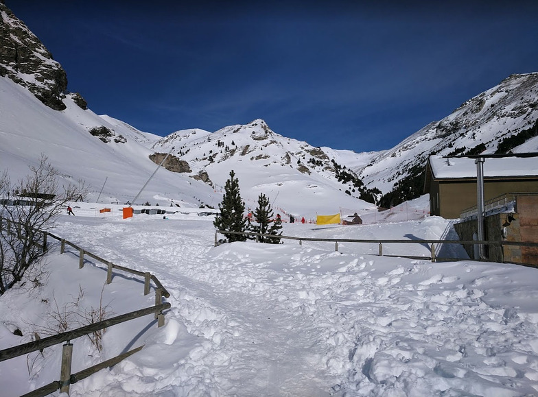
Vall de Nuria (Vall de Núria) is the ideal place to visit if you want to give your children a first ski experience. With the hotel and ski school located on the slopes and zero wait time at the lifts you can spend your holidays enjoying the sun and snow. The hotel also has an excellent restaurant with local specialties combined with the food that children like: fries and chicken. I have visited Vall de Nuria (Vall de Núria) many times, both my children learned the ski there, and we still enjoy coming back each and every time. Although it has a limited number of ski slopes it is absolutely a fantastic place to spend your winter holidays for the starting or medium level skier. You'll arrive in Vall de Nuria (Vall de Núria) by railrack train in a unique scenery of the Spanish Pyrenees, which everybody should have seen at least once in his lifetime, a paradise on earth.
Ronald Van Leemput from Belgium writes:
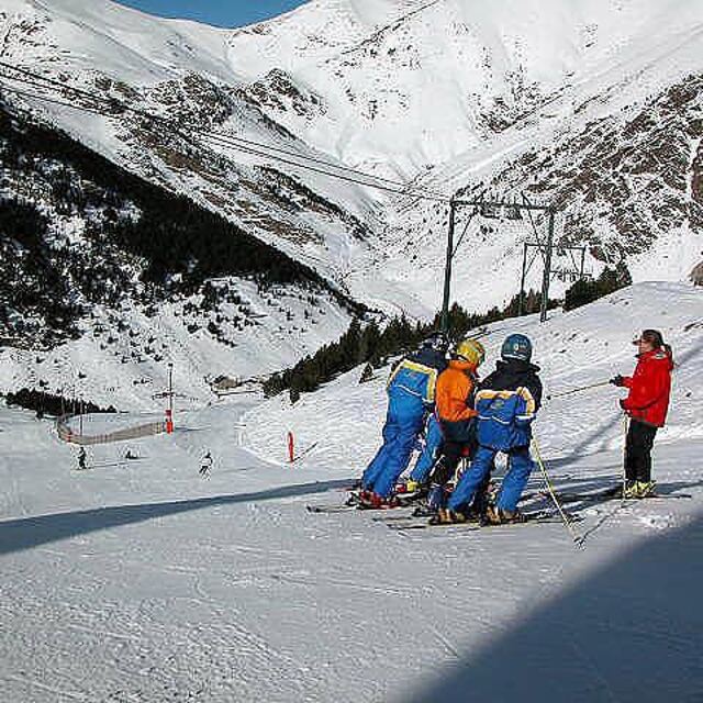
Vall de Nuria (Vall de Núria) is the ideal place to visit if you want to give your children a first ski experience. With the hotel and ski school located on the slopes and zero wait time at the lifts you can spend your holidays enjoying the sun and snow.
The hotel also has an excellent restaurant with local specialties combined with the food that children like: fries and chicken.
I have visited Vall de Nuria (Vall de Núria) many times, both my children learned the ski there, and we still enjoy coming back each and every time.
Although it has a limited number of ski slopes it is absolutely a fantastic place to spend your winter holidays for the starting or medium level skier.
You'll arrive in Vall de Nuria (Vall de Núria) by railrack train in a unique scenery of the Spanish Pyrenees, which everybody should have seen at least once in his lifetime, a paradise on earth.


 Nearest