Issued by Snow-Forecast.com at:10 am (local time) / 30 Jul 2026
Last 6 daysScroll left for last 6 daysNow
Next 3 days weather summary:
Light rain (total 2.0mm), mostly falling on Sat afternoon. Warm (max 25°C on Fri afternoon, min 4°C on Sat night). Winds increasing (calm on Fri morning, fresh winds from the W by Sat afternoon).
Days 4-6 weather summary:
Mostly dry. Warm (max 23°C on Tue afternoon, min 4°C on Sun night). Winds increasing (calm on Mon morning, fresh winds from the E by Tue morning).
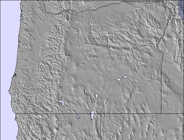
The above table gives the weather forecast for Timberline at the specific elevation of 1478 m. Our sophisticated weather models allow us to provide snow forecasts for the top, middle and bottom ski stations of Timberline. To access the weather forecasts for the other elevations, use the tab navigation above the table. For a wider view of the weather, check out the Weather Map of United States.
Click here to read further information on freezing levels and how we forecast our temperatures.
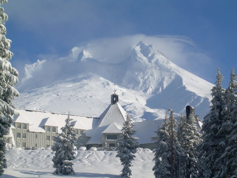
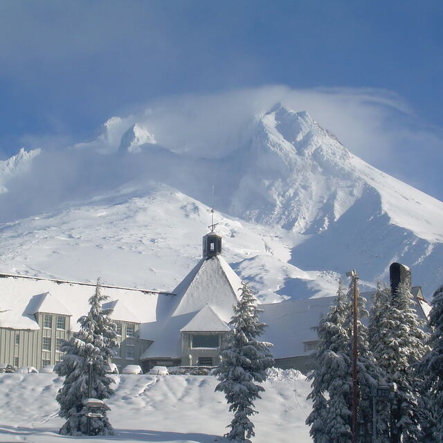
I like Timberline. It usually isn't that crowded although the parking lot, like most other resorts, can fill up on weekends. It's a good place for recreational types in the winter season. The terrain parks look great and they do a pretty good job of keeping the recreational types and the park rats separated on the slope. There are some great advanced beginner runs but you need to navigate solid blue runs to get to them. Once you get there though, it's some relaxing skiing without worrying too much about speed demons coming at you. They tend to stay on the upper intermediate runs and you mostly just see them at the lifts.
However, once the other ski areas close in the spring, all the hardcore skiers show up as it's the only game in town. I get that the beginners and intermediates put their equipment away come the end of spring break and it's not cost effective to keep the easier runs maintained, but it's still disappointing. As an older intermediate skier, I wouldn't go back in the late spring or summer because there's few options for slower skiers and boarders on weekends. The last time I was up, I felt like I was getting in people's way. Weekdays, it's probably better.
The shape of the mountain dictates everything but I wish the beginner lift served more terrain or there was a longer lift that didn't require navigating steeper blue terrain to use. I don't use it myself but it would also be great if the magic carpet conveyor was closer to the day lodge (so parents can keep an eye on their little ones).
Free Snow-Forecast.com weather widget for your website
Embed the Timberline weather widget on your site for free. It provides a weekly snapshot of snow and rain conditions across all elevations. Follow the two quick steps to grab your custom code and paste it into your site. Choose between metric or imperial units. Click here to get the code.


 Nearest