
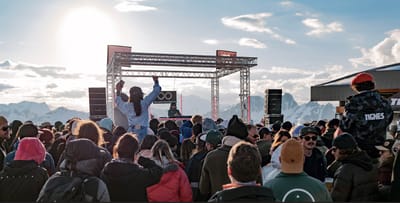
Tignes Unlimited Festival Into May
Tignes, one of the few French ski areas staying open into May, will round off the 2025–26 winter season with the return of the Tignes Unlimited electronic music festival, running from 25 April to 3 May 2026.

Next 3 days weather summary:Moderate rain (total 11.0mm), heaviest on Sun night. Very mild (max 15°C on Sat afternoon, min 6°C on Sat night). Wind will be generally light. | Days 4-6 weather summary:Heavy rain (total 27.0mm), heaviest during Wed afternoon. Freeze-thaw conditions (max 8°C on Mon morning, min -2°C on Wed night). Wind will be generally light. | |||||||||||||||||
Friday 1 | Saturday 2 | Sunday 3 | Monday 4 | Tuesday 5 | Wednesday 6 | |||||||||||||
AM | PM | night | AM | PM | night | AM | PM | night | AM | PM | night | AM | PM | night | AM | PM | night | |
some clouds | risk thun- der | rain shwrs | some clouds | light rain | light rain | cloudy | light rain | light rain | light rain | light rain | light rain | cloudy | light rain | light rain | light rain | mod. rain | rain shwrs | |
km/h | ||||||||||||||||||
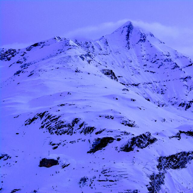
Snow map |  |  |  |  |  |  | ||||||||||||
— | — | — | — | — | — | — | — | — | — | — | — | — | — | — | — | — | — | |
— | 1 | 1 | — | 1 | 1 | — | 2 | 5 | 2 | 5 | 2 | — | 2 | 2 | 1 | 9 | 4 | |
max °C | 11 | 13 | 11 | 13 | 15 | 11 | 12 | 13 | 9 | 8 | 7 | 6 | 8 | 8 | 7 | 7 | 6 | 3 |
min °C | 8 | 12 | 7 | 8 | 15 | 6 | 7 | 12 | 7 | 7 | 7 | 4 | 6 | 7 | 4 | 5 | 4 | -2 |
8 | 12 | 7 | 8 | 15 | 4 | 6 | 12 | 6 | 6 | 6 | 2 | 5 | 7 | 4 | 5 | 2 | -2 | |
72 | 69 | 85 | 57 | 51 | 87 | 49 | 67 | 88 | 89 | 89 | 90 | 81 | 99 | 84 | 82 | 99 | 76 | |
2850 | 3150 | 3000 | 3050 | 3350 | 3000 | 2950 | 3000 | 2750 | 2600 | 2550 | 2550 | 2600 | 2700 | 2400 | 2450 | 2150 | 1800 | |
6:20 | — | — | 6:20 | — | — | 6:18 | — | — | 6:16 | — | — | 6:15 | — | — | 6:13 | — | — | |
— | — | 8:37 | — | — | 8:38 | — | — | 8:39 | — | — | 8:42 | — | — | 8:43 | — | — | 8:44 | |
Latest snow reports near Tignes:
Wow - excellent conditions. Clear blue skies, most lifts are open. from Val Thorens
| Top snow depth: | 134 cm |
|---|---|
| Bottom snow depth: | 17 cm |
| Fresh snowfall depth: | — |
| Last snowfall: | 28 Apr 2026 |
| Snow Alerts | Create Alert |
0.0 | Bluebird Powder days Fresh snow, mostly sunny, light wind. |
|---|---|
0.0 | Powder days Fresh snow, limited sun, any wind. |
0.0 | Bluebird days Average snow, mostly sunny, light wind. |
The above table gives the weather forecast for Tignes at the specific elevation of 1556 m. Our sophisticated weather models allow us to provide snow forecasts for the top, middle and bottom ski stations of Tignes. To access the weather forecasts for the other elevations, use the tab navigation above the table. For a wider view of the weather, check out the Weather Map of France.
Click here to read further information on freezing levels and how we forecast our temperatures.
Overall 4.2 Based on 109 votes and 99 reviews
Been on holiday for 2 weeks in Tignes and came here for the DC park. You would think in 2 weeks you might find it open once.... Not so much. Utterly useless. This may be because the lift company do not invest enough money in the shaper crew and they had a comp on, but still 350 Euros for 6 day pass and this is what you get. A resort the size and reputation of Tignes should be doing better, particularly when their own website is advertising the DC park when you pay your hard earned money out for a holiday and lift pass. People don't pay thousands of quid to watch other people do the sport they're going on holiday for. Utter joke. Maybe Macron needs to get on top of this lot as well. Certainly is false advertising for the last 2 weeks.
James from United Kingdom writes:
Been on holiday for 2 weeks in Tignes and came here for the DC park. You would think in 2 weeks you might find it open once.... Not so much. Utterly useless. This may be because the lift company do not invest enough money in the shaper crew and they had a comp on, but still 350 Euros for 6 day pass and this is what you get. A resort the size and reputation of Tignes should be doing better, particularly when their own website is advertising the DC park when you pay your hard earned money out for a holiday and lift pass. People don't pay thousands of quid to watch other people do the sport they're going on holiday for. Utter joke. Maybe Macron needs to get on top of this lot as well. Certainly is false advertising for the last 2 weeks.


 Nearest