


America’s Next Indoor Snow Centre Takes Shape
Construction of a new indoor snow centre for skiers, boarders and tubers appears to be making good progress at Heritage Farm in Wayne County, West Virginia.

Next 3 days weather summary:Moderate rain (total 19.0mm), heaviest on Tue night. Very mild (max 18°C on Tue afternoon, min 8°C on Wed night). Winds decreasing (strong winds from the S on Tue night, light winds from the WNW by Thu night). | Days 4-6 weather summary:Mostly dry. Warm (max 20°C on Fri afternoon, min 13°C on Sat night). Wind will be generally light. | |||||||||||||||||
Tuesday 21 | Wednesday 22 | Thursday 23 | Friday 24 | Saturday 25 | Sunday 26 | |||||||||||||
AM | PM | night | AM | PM | night | AM | PM | night | AM | PM | night | AM | PM | night | AM | PM | night | |
cloudy | cloudy | heavy rain | clear | rain shwrs | clear | some clouds | some clouds | clear | clear | some clouds | some clouds | clear | clear | clear | clear | some clouds | some clouds | |
km/h | ||||||||||||||||||
Snow map |  |  |  |  |  |  | ||||||||||||
— | — | — | — | — | — | — | — | — | — | — | — | — | — | — | — | — | — | |
mm | — | — | 16 | — | 3 | — | — | — | — | — | — | — | — | — | — | — | — | — |
max °C | 16 | 18 | 17 | 17 | 18 | 13 | 9 | 15 | 13 | 18 | 20 | 18 | 19 | 20 | 17 | 18 | 20 | 19 |
min °C | 15 | 17 | 15 | 17 | 16 | 8 | 9 | 12 | 11 | 14 | 20 | 14 | 16 | 20 | 13 | 16 | 20 | 16 |
chill °C | 13 | 16 | 13 | 16 | 14 | 4 | 5 | 9 | 10 | 14 | 20 | 14 | 16 | 20 | 13 | 16 | 20 | 16 |
Humid % | 64 | 80 | 96 | 91 | 84 | 89 | 76 | 45 | 61 | 46 | 47 | 67 | 53 | 49 | 55 | 39 | 46 | 62 |
Freeze m | 4000 | 4000 | 4150 | 3900 | 3800 | 3800 | 2800 | 3100 | 3000 | 3100 | 3200 | 3650 | 3900 | 3900 | 3900 | 3900 | 3750 | 3700 |
5:13 | — | — | 5:13 | — | — | 5:15 | — | — | 5:16 | — | — | 5:16 | — | — | 5:18 | — | — | |
— | — | 8:20 | — | — | 8:19 | — | — | 8:17 | — | — | 8:16 | — | — | 8:15 | — | — | 8:15 | |
Go pro and carve into:
Avalanche information: National Avalanche Center
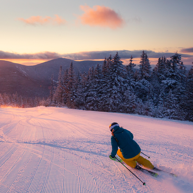
Latest snow reports near Sugarloaf:
| Top snow depth: | 0 cm |
|---|---|
| Bottom snow depth: | 0 cm |
| Fresh snowfall depth: | — |
| Last snowfall: | 29 May 2026 |
| Snow Alerts | Create Alert |
0.0 | Bluebird Powder days Fresh snow, mostly sunny, light wind. |
|---|---|
0.0 | Powder days Fresh snow, limited sun, any wind. |
0.0 | Bluebird days Average snow, mostly sunny, light wind. |
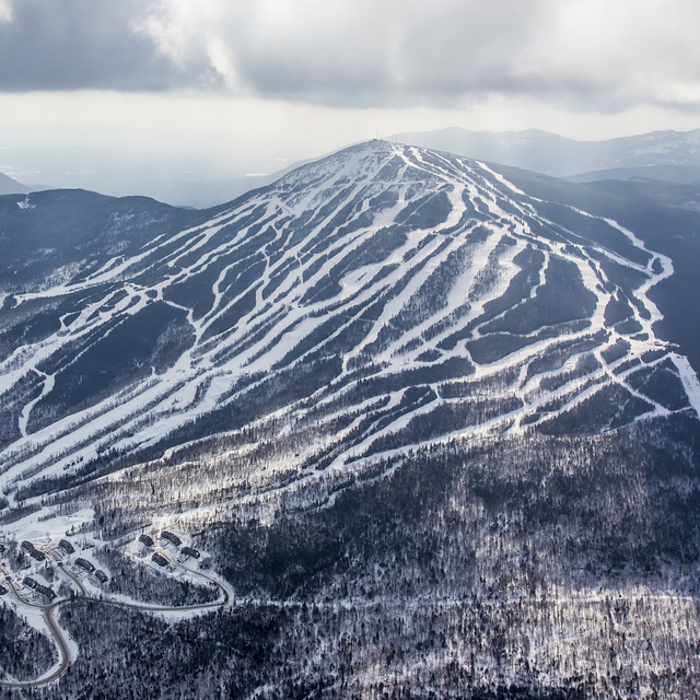
The above table gives the weather forecast for Sugarloaf at the specific elevation of 866 m. Our sophisticated weather models allow us to provide snow forecasts for the top, middle and bottom ski stations of Sugarloaf. To access the weather forecasts for the other elevations, use the tab navigation above the table. For a wider view of the weather, check out the Weather Map of United States.
Click here to read further information on freezing levels and how we forecast our temperatures.
Overall 3.9 Based on 39 votes and 8 reviews
Great mountain. Most obnoxious city folk stop at Sunday River to drink, party and show off their new clothes. Best part of distance from metro areas is no (?ed). I say again no lift lines. Just ski 'til you drop. My son learned to ski/snow board here 26 years ago and is now gainfully employed at Jackson Hole ski area. He still loves Sugarloaf and calls it “The Jackson Hole of the East”. Some bad publicity with a couple of lift mishaps but all have been replaced and now have a quick ride to the top. IF you love skiing this is the place in the east.
Bob from United States writes:
Great mountain. Most obnoxious city folk stop at Sunday River to drink, party and show off their new clothes. Best part of distance from metro areas is no (?ed). I say again no lift lines. Just ski 'til you drop. My son learned to ski/snow board here 26 years ago and is now gainfully employed at Jackson Hole ski area. He still loves Sugarloaf and calls it “The Jackson Hole of the East”. Some bad publicity with a couple of lift mishaps but all have been replaced and now have a quick ride to the top. IF you love skiing this is the place in the east.


 Nearest