

America’s Next Indoor Snow Centre Takes Shape
Construction of a new indoor snow centre for skiers, boarders and tubers appears to be making good progress at Heritage Farm in Wayne County, West Virginia.

Next 3 days weather summary:Light rain (total 4.0mm), mostly falling on Mon night. Warm (max 23°C on Mon afternoon, min 10°C on Tue night). Wind will be generally light. | Days 4-6 weather summary:Mostly dry. Warm (max 21°C on Wed afternoon, min 9°C on Thu night). Wind will be generally light. | ||||||||||||||||
Sun 19 | Monday 20 | Tuesday 21 | Wednesday 22 | Thursday 23 | Friday 24 | ||||||||||||
PM | night | AM | PM | night | AM | PM | night | AM | PM | night | AM | PM | night | AM | PM | night | |
some clouds | clear | clear | clear | rain shwrs | t-storm risk | rain shwrs | clear | clear | clear | clear | clear | clear | clear | clear | clear | clear | |
km/h | |||||||||||||||||
Snow map |  |  |  |  |  |  | |||||||||||
— | — | — | — | — | — | — | — | — | — | — | — | — | — | — | — | — | |
mm | — | — | — | — | 1 | 2 | 1 | — | — | — | — | — | — | — | — | — | — |
max °C | 22 | 19 | 20 | 23 | 19 | 18 | 21 | 17 | 18 | 21 | 17 | 17 | 20 | 17 | 17 | 21 | 17 |
min °C | 22 | 12 | 16 | 23 | 12 | 14 | 21 | 10 | 13 | 21 | 10 | 13 | 19 | 9 | 12 | 20 | 10 |
chill °C | 22 | 12 | 16 | 23 | 12 | 14 | 21 | 10 | 13 | 21 | 10 | 13 | 19 | 9 | 12 | 20 | 10 |
Humid % | 35 | 57 | 44 | 27 | 52 | 58 | 32 | 49 | 36 | 33 | 54 | 44 | 34 | 63 | 39 | 32 | 48 |
Freeze m | 3950 | 3950 | 3850 | 4100 | 4000 | 3800 | 3900 | 4150 | 4150 | 4000 | 4100 | 3600 | 3700 | 4250 | 4150 | 3950 | 4050 |
— | — | 6:03 | — | — | 6:05 | — | — | 6:05 | — | — | 6:07 | — | — | 6:07 | — | — | |
— | 9:15 | — | — | 9:15 | — | — | 9:14 | — | — | 9:13 | — | — | 9:12 | — | — | 9:10 | |
Go pro and carve into:
Avalanche information: European Avalanche Warning Services (EAWS)
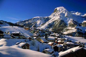
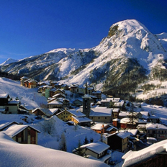
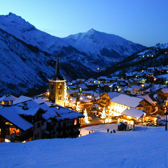
Latest snow reports near St Martin de Belleville:
| Top snow depth: | — |
|---|---|
| Bottom snow depth: | — |
| Fresh snowfall depth: | — |
| Last snowfall: | 4 Jun 2026 |
| Snow Alerts | Create Alert |
0.0 | Bluebird Powder days Fresh snow, mostly sunny, light wind. |
|---|---|
0.0 | Powder days Fresh snow, limited sun, any wind. |
0.0 | Bluebird days Average snow, mostly sunny, light wind. |
The above table gives the weather forecast for St Martin de Belleville at the specific elevation of 1402 m. Our sophisticated weather models allow us to provide snow forecasts for the top, middle and bottom ski stations of St Martin de Belleville. To access the weather forecasts for the other elevations, use the tab navigation above the table. For a wider view of the weather, check out the Weather Map of France.
Click here to read further information on freezing levels and how we forecast our temperatures.
Overall 4.4 Based on 17 votes and 9 reviews
We had ski holidays in Courcheval and Mottaret for several years and having skied into St Martin many times we decided to give it a try as our holiday base and we loved it. While keeping the small resort feel it also has lots of apartments available to rent, nice hotels, good restaurants and friendly bars. Great for a growing family. We love it so much we bought our own place here and believe me, it's a lovely place to visit in the summer too if you like walking.
Carol Verrier from France writes:
We had ski holidays in Courcheval and Mottaret for several years and having skied into St Martin many times we decided to give it a try as our holiday base and we loved it.
While keeping the small resort feel it also has lots of apartments available to rent, nice hotels, good restaurants and friendly bars. Great for a growing family.
We love it so much we bought our own place here and believe me, it's a lovely place to visit in the summer too if you like walking.
Read 8 more reviews of St Martin de Belleville or submit your own


 Nearest