The above table gives the weather forecast for Spitzingsee at the specific elevation of 1336 m. Our sophisticated weather models allow us to provide snow forecasts for the top, middle and bottom ski stations of Spitzingsee. To access the weather forecasts for the other elevations, use the tab navigation above the table. For a wider view of the weather, check out the Weather Map of Germany.
Click here to read further information on freezing levels and how we forecast our temperatures.
As Spitzingsee is only 40 minutes from the centre of Munich it´s getting crowded on week-ends. But they got 2 new big chair lift´s that work pretty well. However, be aware of heavy traffic-jams all the way from/to Munich.
It is the first mountain range getting hit from the snow clouds arriving from the north, unloading large amounts of snow regularly and offsetting the lack of altitude (this fits for all German alpine resorts. At mid-winter usually the 2000m high Nebelhorn near Oberstdorf f.e. offers more snow than the 3000m high Sölden area located south in Austria).
Spitzingsee isn´t very big but works well for a 1 or 2 day trip. If you´re planning to stay longer think about buying the 'Alpenplus card' covering all nearby resorts, even some smaller Austrian spots.
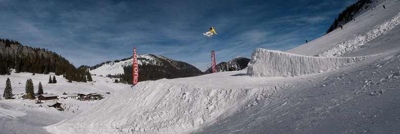
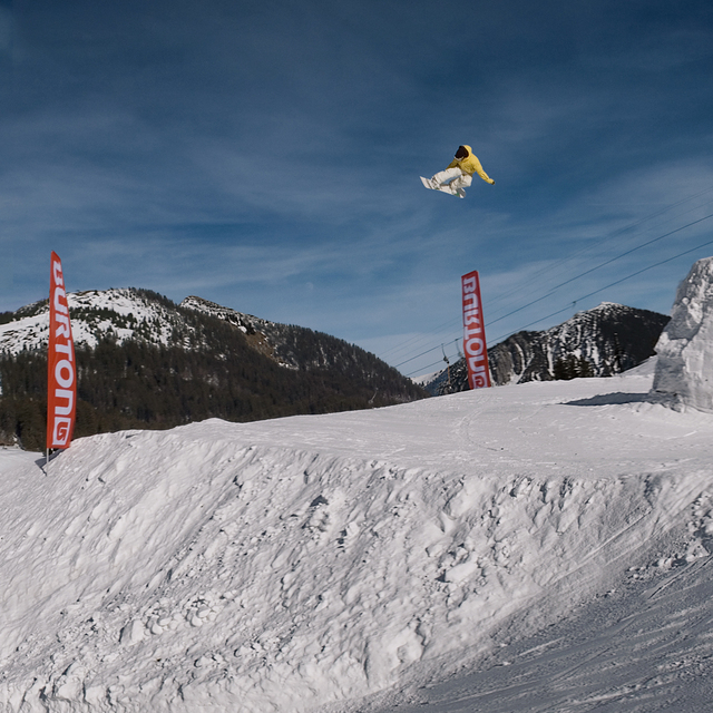
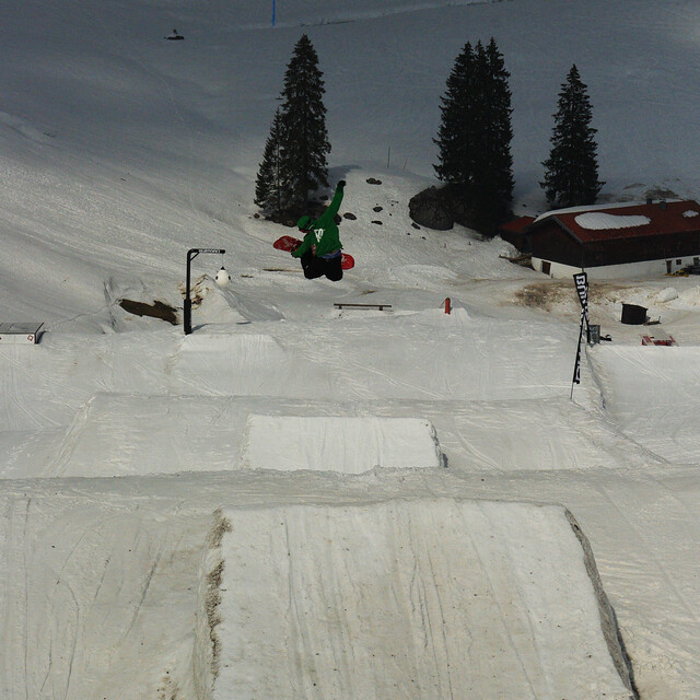
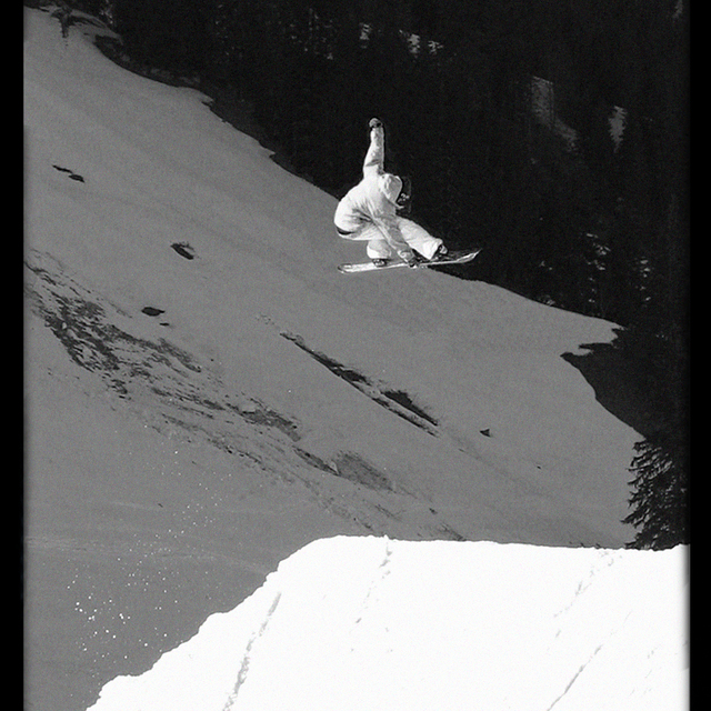
Unusual for a resort of this size, Spitzingsee offers a very good snow park for all levels, even pros find they are challenged on well shaped 20+ meter jumps. Expect a big variation of jumps and rails, but no half-pipe.
As Spitzingsee is only 40 minutes from the centre of Munich it´s getting crowded on week-ends. But they got 2 new big chair lift´s that work pretty well. However, be aware of heavy traffic-jams all the way from/to Munich.
It is the first mountain range getting hit from the snow clouds arriving from the north, unloading large amounts of snow regularly and offsetting the lack of altitude (this fits for all German alpine resorts. At mid-winter usually the 2000m high Nebelhorn near Oberstdorf f.e. offers more snow than the 3000m high Sölden area located south in Austria).
Spitzingsee isn´t very big but works well for a 1 or 2 day trip. If you´re planning to stay longer think about buying the 'Alpenplus card' covering all nearby resorts, even some smaller Austrian spots.
Unusual for a resort of this size, Spitzingsee offers a very good snow park for all levels, even pros find they are challenged on well shaped 20+ meter jumps. Expect a big variation of jumps and rails, but no half-pipe.
Free Snow-Forecast.com weather widget for your website
Embed the Spitzingsee weather widget on your site for free. It provides a weekly snapshot of snow and rain conditions across all elevations. Follow the two quick steps to grab your custom code and paste it into your site. Choose between metric or imperial units. Click here to get the code.


 Nearest