The above table gives the weather forecast for Ski Bromont at the specific elevation of 370 m. Our sophisticated weather models allow us to provide snow forecasts for the top, middle and bottom ski stations of Ski Bromont. To access the weather forecasts for the other elevations, use the tab navigation above the table. For a wider view of the weather, check out the Weather Map of Canada.
Click here to read further information on freezing levels and how we forecast our temperatures.
Great potential wasted.
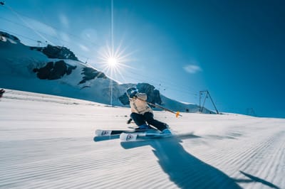
Bromont is just 1hr driving from Montreal, on the south shore. There are plenty of varied slopes for all levels of skiers. The chalets (base and top) are recent or renovated, the slopes are groomed three times a day, the lifts are gradually replaced year after year and the snowmaking equipment is regularly updated (last generation fixed fans).
Unfortunately, they don't make enough snow with unfavourable seasons, opening only 50 to 60% of terrain, mostly boring tracks for beginners/intermediates. This combined with too many lift passes sold, and crazy real estate development in the last years. It's always crowded in the lines and annihilates the pleasure of skiing on the slopes with crazy skiers coming from everywhere. Not to mention the prices through the roof now.
In addition, there's a lot of lift failures for no reason increasing the frustration.
Bromont used to be a great place. Hoping they wake up soon to focus on why people come in the first place. Skiing and have fun.
Free Snow-Forecast.com weather widget for your website
Embed the Ski Bromont weather widget on your site for free. It provides a weekly snapshot of snow and rain conditions across all elevations. Follow the two quick steps to grab your custom code and paste it into your site. Choose between metric or imperial units. Click here to get the code.


 Nearest