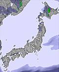
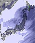
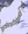
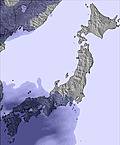
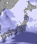
The above table gives the weather forecast for Senhata at the specific elevation of 810 m. Our sophisticated weather models allow us to provide snow forecasts for the top, middle and bottom ski stations of Senhata. To access the weather forecasts for the other elevations, use the tab navigation above the table. For a wider view of the weather, check out the Weather Map of Japan.
Click here to read further information on freezing levels and how we forecast our temperatures.
Senhata WAS a good spot. I had a season pass there a couple of winters. However, it's lack of attendance (which made it great for me) proved it to be one of the less profitable holdings of the Prince Hotel Group when they restructured a few years ago as the result of a corporate scandal that hit the railway company that owns Prince. Senhata has been closed for a few years now. The infrastructure is there (high speed 8-place gondola, restaurant, etc.) so I can't see it collecting rust too many more seasons before someone buys it. The management sucked. It could have turned a profit, having one of the biggest vertical drops in the region. They had a habit of paying 7 guys to stand around directing traffic in their mostly empty parking lot, and they had zero marketing. Given the fact that they had just a few trails, they could have lighted it easily for night skiing, and they made a very poor effort at putting together a terrain park. So heads up, investors: buy it, light it, put a top-notch terrain park in, and then market the hell out of it to nearby Akita City (pop. 330,000).
Senhata WAS a good spot. I had a season pass there a couple of winters. However, it's lack of attendance (which made it great for me) proved it to be one of the less profitable holdings of the Prince Hotel Group when they restructured a few years ago as the result of a corporate scandal that hit the railway company that owns Prince. Senhata has been closed for a few years now. The infrastructure is there (high speed 8-place gondola, restaurant, etc.) so I can't see it collecting rust too many more seasons before someone buys it. The management sucked. It could have turned a profit, having one of the biggest vertical drops in the region. They had a habit of paying 7 guys to stand around directing traffic in their mostly empty parking lot, and they had zero marketing. Given the fact that they had just a few trails, they could have lighted it easily for night skiing, and they made a very poor effort at putting together a terrain park. So heads up, investors: buy it, light it, put a top-notch terrain park in, and then market the hell out of it to nearby Akita City (pop. 330,000).
Free Snow-Forecast.com weather widget for your website
Embed the Senhata weather widget on your site for free. It provides a weekly snapshot of snow and rain conditions across all elevations. Follow the two quick steps to grab your custom code and paste it into your site. Choose between metric or imperial units. Click here to get the code.


 Nearest