

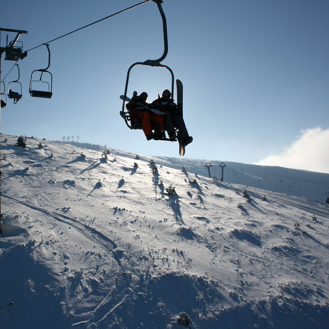
Global Weekly Snow Roundup #320
Weekly Snow News for the world, updated 25 June 2026: Chile and New Zealand's seasons proper set to begin, Tignes and Sunshine reopen for summer skiing. weekend as Riksgransen ends its 2026 season.

Next 3 days weather summary:Light rain (total 5.0mm), mostly falling on Fri afternoon. Very mild (max 17°C on Fri afternoon, min 14°C on Fri night). Wind will be generally light. | Days 4-6 weather summary:Mostly dry. Very mild (max 18°C on Tue afternoon, min 15°C on Wed morning). Wind will be generally light. | ||||||||||||||||
Fri 26 | Saturday 27 | Sunday 28 | Monday 29 | Tuesday 30 | Wednesday 1 | ||||||||||||
PM | night | AM | PM | night | AM | PM | night | AM | PM | night | AM | PM | night | AM | PM | night | |
t-storm risk | rain shwrs | rain shwrs | clear | clear | clear | clear | clear | clear | clear | clear | clear | clear | clear | clear | some clouds | clear | |
km/h | |||||||||||||||||
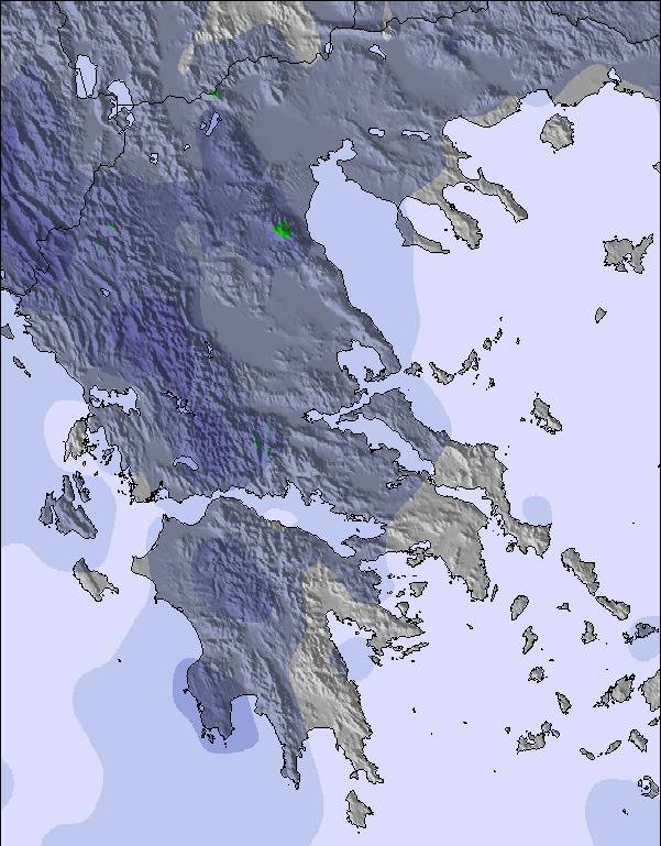
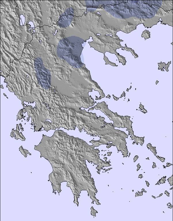
Snow map | 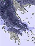 | 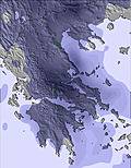 | 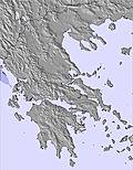 | 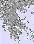 | 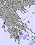 | 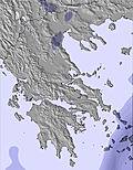 | |||||||||||
— | — | — | — | — | — | — | — | — | — | — | — | — | — | — | — | — | |
mm | 1 | 3 | 1 | — | — | — | — | — | — | — | — | — | — | — | — | — | — |
max °C | 17 | 16 | 15 | 17 | 17 | 15 | 16 | 16 | 15 | 17 | 16 | 16 | 18 | 18 | 16 | 18 | 17 |
min °C | 16 | 14 | 15 | 16 | 14 | 14 | 15 | 14 | 14 | 16 | 16 | 16 | 17 | 16 | 15 | 17 | 16 |
chill °C | 16 | 14 | 14 | 15 | 13 | 13 | 14 | 13 | 12 | 14 | 15 | 15 | 16 | 16 | 15 | 17 | 16 |
Humid % | 61 | 62 | 69 | 63 | 68 | 67 | 64 | 63 | 54 | 56 | 63 | 59 | 55 | 56 | 56 | 51 | 57 |
Freeze m | 3950 | 4100 | 4050 | 4150 | 4200 | 4350 | 4350 | 4200 | 4100 | 4100 | 4100 | 4100 | 4150 | 4100 | 4050 | 4100 | 4200 |
— | — | 6:03 | — | — | 6:03 | — | — | 6:03 | — | — | 6:03 | — | — | 6:03 | — | — | |
— | 9:06 | — | — | 9:06 | — | — | 9:06 | — | — | 9:06 | — | — | 9:06 | — | — | 9:06 | |
Go pro and carve into:
Latest snow reports near Seli:
| Top snow depth: | — |
|---|---|
| Bottom snow depth: | — |
| Fresh snowfall depth: | — |
| Last snowfall: | 3 May 2026 |
| Snow Alerts | Create Alert |
0.0 | Bluebird Powder days Fresh snow, mostly sunny, light wind. |
|---|---|
0.0 | Powder days Fresh snow, limited sun, any wind. |
0.0 | Bluebird days Average snow, mostly sunny, light wind. |
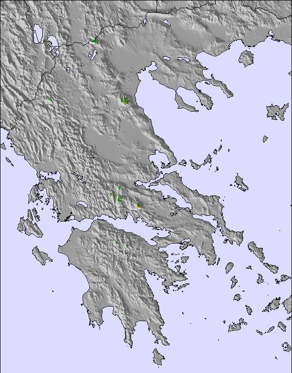
The above table gives the weather forecast for Seli at the specific elevation of 1900 m. Our sophisticated weather models allow us to provide snow forecasts for the top, middle and bottom ski stations of Seli. To access the weather forecasts for the other elevations, use the tab navigation above the table. For a wider view of the weather, check out the Weather Map of Greece.
Click here to read further information on freezing levels and how we forecast our temperatures.
Overall 4.0 Based on 58 votes and 14 reviews
ουσιαστικες αλλαγες στο σελι αλλαξαν στο καλυτερο την επισκεψη και το αθλημα. ηλεκτρονικη καρτα χρησης με εκπτωσεις-παρκαδορο- σημειο προσκαιρης αποβιβασης επιβατων λεοφωρειων-περισοτερα ταμεια-διοικηση που γνωριζει απο οργανωση και προεδρος που ξερει την χιονοδρομια-προγραμματισμος προπονησεων ομαδων σε πιστες που δεν ενοχλουν τουριστες επισκεπτες-πιστερ ασφαλειας- και καθε μερα γιατρος στο κεντρο. και εγγυηση καθαρου δρομου στην αναβαση. το σελι ειναι απολαυστικο αν του δωσεις την οργανωση που χρειαζεται.! 14-03-2013
ΓΡΗΓΟΡΗΣ from Greece writes:
ουσιαστικες αλλαγες στο σελι αλλαξαν στο καλυτερο την επισκεψη και το αθλημα. ηλεκτρονικη καρτα χρησης με εκπτωσεις-παρκαδορο- σημειο προσκαιρης αποβιβασης επιβατων λεοφωρειων-περισοτερα ταμεια-διοικηση που γνωριζει απο οργανωση και προεδρος που ξερει την χιονοδρομια-προγραμματισμος προπονησεων ομαδων σε πιστες που δεν ενοχλουν τουριστες επισκεπτες-πιστερ ασφαλειας- και καθε μερα γιατρος στο κεντρο. και εγγυηση καθαρου δρομου στην αναβαση. το σελι ειναι απολαυστικο αν του δωσεις την οργανωση που χρειαζεται.! 14-03-2013

 Nearest