
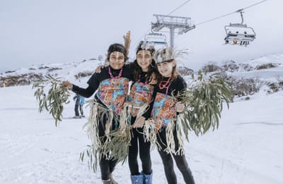
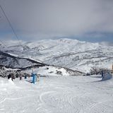
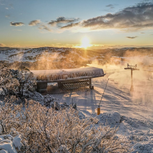
New Highest Lift in Australia Officially Open
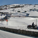
Australia’s Perisher ski area, the country’s largest, has celebrated the official opening of the Mt Perisher 6 Chairlift, a six-seater, high-speed detachable chairlift with an opening ceremony.
By using Snow-Forecast, you agree to our Terms & Services.
Don't have an account? Join now
Alternatively, you can now use your Outside account to sign in to any brand in the Outside digital ecosystem, including Snow-Forecast, Surf-Forecast, and Mountain-Forecast.
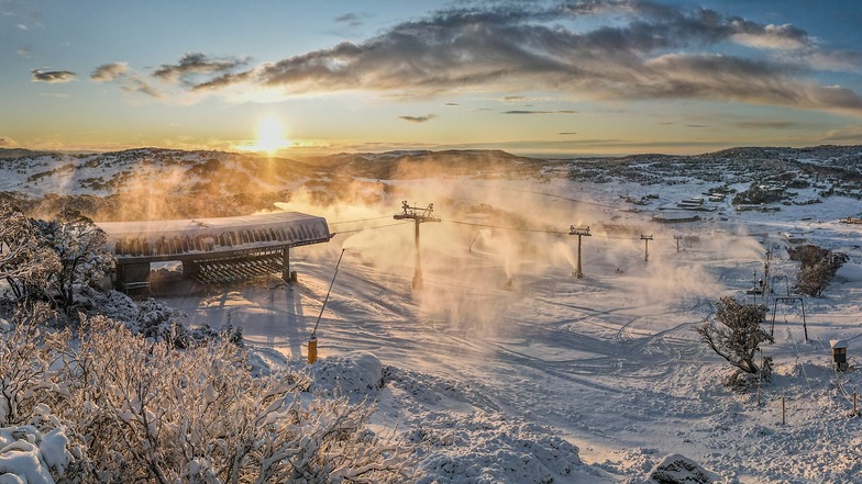


Perisher Weather (Next 3 days): The snow forecast for Perisher is: A heavy fall of snow, heaviest during Wed morning. Freeze-thaw conditions (max 7°C on Mon morning, min -4°C on Wed night). Winds decreasing (gales from the WNW on Mon morning, calm by Tue night).
Perisher Weather (Days 4-6): Some drizzle, heaviest during Sat afternoon. Freeze-thaw conditions (max 3°C on Sat morning, min -3°C on Thu morning). Wind will be generally light.
| Resort | Snow Depth | Temp. (°C) | Wind (km/h) | Weather | ||
|---|---|---|---|---|---|---|
| Top Lift: | 2.5 m | 6 | ||||
| Bottom Lift: | 1.3 m | 6 |
Latest snow reports near Perisher:

Monday 8 | Tuesday 9 | Wednesday 10 | Thursday 11 | Friday 12 | Saturday 13 | Sunday 14 | |||||||||||||||
AM | PM | night | AM | PM | night | AM | PM | night | AM | PM | night | AM | PM | night | AM | PM | night | AM | PM | night | |
clear | clear | clear | clear | clear | some clouds | mod. snow | mod. snow | mod. snow | light snow | light snow | some clouds | some clouds | clear | clear | some clouds | rain shwrs | some clouds | some clouds | clear | cloudy | |
km/h | |||||||||||||||||||||
Snow map |  |  |  |  | 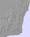 | 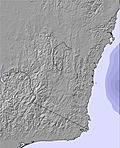 | 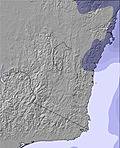 | ||||||||||||||
— | — | — | — | — | — | 6 | 9 | 8 | — | — | — | — | — | — | — | — | — | — | — | — | |
— | — | — | — | — | — | — | — | — | — | — | — | — | — | — | — | 1 | — | — | — | — | |
max°C | 7 | 6 | 4 | 4 | 4 | 2 | 0 | -2 | -3 | -2 | -1 | -2 | 1 | 1 | 1 | 3 | 3 | 2 | 5 | 4 | 4 |
min°C | 6 | 4 | 2 | 3 | 3 | 0 | -1 | -3 | -4 | -3 | -2 | -2 | -1 | 1 | 0 | 1 | 2 | 1 | 3 | 3 | 3 |
0 | -3 | -5 | -4 | -2 | -4 | -7 | -8 | -12 | -10 | -5 | -4 | -4 | -2 | -2 | -2 | 0 | -2 | 0 | -2 | -2 | |
59 | 48 | 52 | 31 | 33 | 66 | 98 | 98 | 97 | 79 | 72 | 66 | 68 | 69 | 62 | 65 | 73 | 63 | 54 | 42 | 55 | |
3250 | 2900 | 2500 | 2700 | 2700 | 2300 | 2050 | 1500 | 1300 | 1500 | 1700 | 1350 | 1850 | 2200 | 2050 | 2300 | 2400 | 2500 | 2700 | 2800 | 2750 | |
6:18 | — | — | 6:16 | — | — | 6:15 | — | — | 6:13 | — | — | 6:11 | — | — | 6:09 | — | — | 6:09 | — | — | |
— | 5:51 | — | — | 5:51 | — | — | 5:52 | — | — | 5:52 | — | — | 5:53 | — | — | 5:54 | — | — | 5:54 | — | |
A heavy fall of snow, heaviest during Wed morning. Freeze-thaw conditions (max 7°C on Mon morning, min -4°C on Wed night). Winds decreasing (gales from the WNW on Mon morning, calm by Tue night).
Some drizzle, heaviest during Sat afternoon. Freeze-thaw conditions (max 3°C on Sat morning, min -3°C on Thu morning). Wind will be generally light.
Latest snow reports near Perisher:
| Top snow depth: | 250 cm |
|---|---|
| Bottom snow depth: | 134 cm |
| Fresh snowfall depth: | — |
| Last snowfall: | 4 Sep 2025 |
| Snow Alerts | Create Alert |
0.0 | Bluebird Powder days Fresh snow, mostly sunny, light wind. |
|---|---|
0.4 | Powder days Fresh snow, limited sun, any wind. |
0.4 | Bluebird days Average snow, mostly sunny, light wind. |


The above table gives the weather forecast for Perisher at the specific elevation of 2034 m. Our sophisticated weather models allow us to provide snow forecasts for the top, middle and bottom ski stations of Perisher. To access the weather forecasts for the other elevations, use the tab navigation above the table. For a wider view of the weather, check out the Weather Map of Australia.
Click here to read further information on freezing levels and how we forecast our temperatures.
Overall 3.3 Based on 33 votes and 50 reviews
Thredbo and Perisher refuse to acknowledge reality and move this weekend on a week or two, to a time when there is actual snow on the ground. In the seven years that I have lived in Canberra there has never been natural snow on the ground in the first week of July. And to add insult to injury, Thredbo has now even refused to offer the fake snow and toboggan rides which drew families to it. Oh, and they waited until a week before the day to announce that. So what can you expect? At Thredbo expect zero snow, paying top dollar for ski-lifts, mechanical sled rides food and drink, a sad snow sculpture melting in the heat, empty pubs where one or two bored people watch footy, over-heated coffee shops closing early, a DJ playing house music to which toddlers and pre-teens dance while their parents stand around sipping over-priced beer and wine. The fireworks were such a non-event that we didn’t even realise they had happened. At Perisher expect some man-made snow, a few better musos, but not much more. Don’t expect a magical, fun-filled snow weekend as advertised in the brochures. Don’t waste your money, time and energy on this over-hyped, over-priced kids party. Snow open weekend offers you zero snow and zero fun at full season prices. Despite the fact that Threbo and Perisher no doubt know, after so many years of having no actual snow on this weekend, that it will be snowless, they continue to promote this weekend as a funtastic opening to the snow. Too much to expect snow on a weekend claiming (and priced) to be the “start of the snowy season”? Apparently it is. Even Perisher barely has any snow at this time of the year and the reason those photos look so filled with happy people on the snow is because everyone is trying to squeeze onto the few man-made patches of snow for their instagram moment. Until both Thredbo and Perisher start admitting that they are artificially extending the snow season in order to rake in extra money, and stop charging like there is actual snow on the ground, do yourself a favour and don’t fall for their lies. Show them the contempt they deserve by boycotting them for these first two weeks of June and go when there is actual snow and you are getting what you pay for. I for one will not be paying snow fees for a zero snow weekend again. Fool me once.....
Schagne Venter from Australia writes:
Thredbo and Perisher refuse to acknowledge reality and move this weekend on a week or two, to a time when there is actual snow on the ground. In the seven years that I have lived in Canberra there has never been natural snow on the ground in the first week of July. And to add insult to injury, Thredbo has now even refused to offer the fake snow and toboggan rides which drew families to it. Oh, and they waited until a week before the day to announce that.
So what can you expect? At Thredbo expect zero snow, paying top dollar for ski-lifts, mechanical sled rides food and drink, a sad snow sculpture melting in the heat, empty pubs where one or two bored people watch footy, over-heated coffee shops closing early, a DJ playing house music to which toddlers and pre-teens dance while their parents stand around sipping over-priced beer and wine. The fireworks were such a non-event that we didn’t even realise they had happened. At Perisher expect some man-made snow, a few better musos, but not much more. Don’t expect a magical, fun-filled snow weekend as advertised in the brochures.
Don’t waste your money, time and energy on this over-hyped, over-priced kids party. Snow open weekend offers you zero snow and zero fun at full season prices. Despite the fact that Threbo and Perisher no doubt know, after so many years of having no actual snow on this weekend, that it will be snowless, they continue to promote this weekend as a funtastic opening to the snow. Too much to expect snow on a weekend claiming (and priced) to be the “start of the snowy season”? Apparently it is. Even Perisher barely has any snow at this time of the year and the reason those photos look so filled with happy people on the snow is because everyone is trying to squeeze onto the few man-made patches of snow for their instagram moment.
Until both Thredbo and Perisher start admitting that they are artificially extending the snow season in order to rake in extra money, and stop charging like there is actual snow on the ground, do yourself a favour and don’t fall for their lies. Show them the contempt they deserve by boycotting them for these first two weeks of June and go when there is actual snow and you are getting what you pay for. I for one will not be paying snow fees for a zero snow weekend again. Fool me once.....
The Perisher skiing weather widget is available to embed on external websites free of charge. It provides a daily summary of our Perisher snow forecast and current weather conditions. Simply go to the feed configuration page and follow the 3 simple steps to grab the custom html code snippet and paste it into your own site. You can choose the snow forecast elevation (summit, mid-mountain or bottom lift) and metric/imperial units for the snow forecast feed to suit your own website…. Click here to get the code.
View detailed snow forecast for Perisher at:
snow-forecast.com


 Nearest