

America’s Next Indoor Snow Centre Takes Shape
Construction of a new indoor snow centre for skiers, boarders and tubers appears to be making good progress at Heritage Farm in Wayne County, West Virginia.

Next 3 days weather summary:Light rain (total 8.0mm), mostly falling on Tue morning. Very mild (max 19°C on Mon afternoon, min 11°C on Tue night). Wind will be generally light. | Days 4-6 weather summary:Mostly dry. Very mild (max 17°C on Wed afternoon, min 8°C on Thu night). Wind will be generally light. | |||||||||||||||||
Sunday 19 | Monday 20 | Tuesday 21 | Wednesday 22 | Thursday 23 | Friday 24 | |||||||||||||
AM | PM | night | AM | PM | night | AM | PM | night | AM | PM | night | AM | PM | night | AM | PM | night | |
rain shwrs | some clouds | clear | clear | some clouds | rain shwrs | t-storm risk | rain shwrs | clear | clear | clear | clear | clear | clear | clear | clear | clear | clear | |
km/h | ||||||||||||||||||
Snow map |  |  |  |  |  |  | ||||||||||||
— | — | — | — | — | — | — | — | — | — | — | — | — | — | — | — | — | — | |
mm | 1 | — | — | — | — | 2 | 4 | 1 | — | — | — | — | — | — | — | — | — | — |
max °C | 15 | 18 | 16 | 16 | 19 | 17 | 14 | 17 | 15 | 16 | 17 | 15 | 13 | 15 | 13 | 14 | 17 | 15 |
min °C | 13 | 17 | 12 | 14 | 18 | 12 | 12 | 16 | 11 | 13 | 17 | 10 | 11 | 15 | 8 | 10 | 16 | 12 |
chill °C | 13 | 17 | 12 | 14 | 18 | 12 | 12 | 16 | 11 | 13 | 17 | 10 | 11 | 15 | 8 | 10 | 16 | 12 |
Humid % | 56 | 42 | 63 | 43 | 31 | 63 | 70 | 37 | 43 | 30 | 38 | 56 | 47 | 44 | 60 | 20 | 36 | 50 |
Freeze m | 3700 | 4000 | 4000 | 3850 | 4100 | 3950 | 3750 | 4000 | 4150 | 4100 | 3950 | 3850 | 3450 | 3650 | 3750 | 4200 | 4150 | 4500 |
6:01 | — | — | 6:01 | — | — | 6:03 | — | — | 6:03 | — | — | 6:05 | — | — | 6:07 | — | — | |
— | — | 9:15 | — | — | 9:15 | — | — | 9:14 | — | — | 9:13 | — | — | 9:12 | — | — | 9:10 | |
Go pro and carve into:
Avalanche information: European Avalanche Warning Services (EAWS)
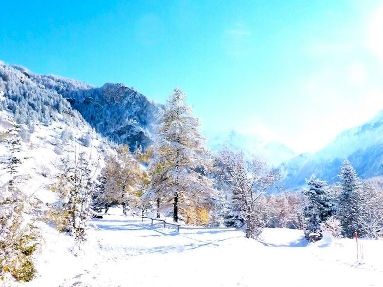
Latest snow reports near Peisey/Vallandry:
No information received. Clear blue skies, all lifts open. from La Giettaz en Aravis
| Top snow depth: | — |
|---|---|
| Bottom snow depth: | — |
| Fresh snowfall depth: | — |
| Last snowfall: | 16 May 2026 |
| Snow Alerts | Create Alert |
0.0 | Bluebird Powder days Fresh snow, mostly sunny, light wind. |
|---|---|
0.0 | Powder days Fresh snow, limited sun, any wind. |
0.0 | Bluebird days Average snow, mostly sunny, light wind. |
The above table gives the weather forecast for Peisey/Vallandry at the specific elevation of 1851 m. Our sophisticated weather models allow us to provide snow forecasts for the top, middle and bottom ski stations of Peisey/Vallandry. To access the weather forecasts for the other elevations, use the tab navigation above the table. For a wider view of the weather, check out the Weather Map of France.
Click here to read further information on freezing levels and how we forecast our temperatures.
Overall 4.3 Based on 12 votes and 13 reviews
Sitting in Peisey. Temperature is +7C and best prospect is a sun tan and a canoe down the mountain with the melting snow. Great resort when there is snow though.
Trotsky from France writes:
Sitting in Peisey. Temperature is +7C and best prospect is a sun tan and a canoe down the mountain with the melting snow.
Great resort when there is snow though.


 Nearest