Mount Hotham snow
Ski Australia - Victoria

Mount Hotham Snow Forecast

Weather Forecast for Mount Hotham at 1652 m
Issued: 9 am  27 Apr 2024 (local time)

New snow in Mount Hotham

11.0cm4.3in
Sat 4th (AM)
The snow forecast for Mount Hotham is: Mostly dry. Mild temperatures (max 9°C on Sat morning, min 1°C on Mon night). Winds decreasing (strong winds from the NW on Sun night, calm by Mon afternoon).

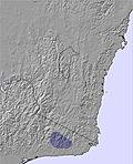
Mount Hotham Weather (Next 3 days): The snow forecast for Mount Hotham is: Mostly dry. Mild temperatures (max 9°C on Sat morning, min 1°C on Mon night). Winds decreasing (strong winds from the NW on Sun night, calm by Mon afternoon).

Mount Hotham Weather (Days 4-6): Mostly dry. Mild temperatures (max 6°C on Wed morning, min 2°C on Tue morning). Wind will be generally light.


Mount Hotham Live Weather

ResortSnow DepthTemp. (°C)Wind (km/h)Weather
Top Lift: 0.0m
8
15
clear
Bottom Lift: 0.0m
11
15
clear
Powered by Snow-Forecast.comSnow-Forecast.com
6 Day Forecast
Issued: 9 am 27 Apr 2024 / Updates in ::
Change Forecast Height
Choose Forecast
Last 6 daysScroll left for last 6 daysNow
Saturday
27
Sunday
28
Monday
29
Tuesday
30
Wednesday
1
Thursday
2
Friday
3
AM
PM
night
AM
PM
night
AM
PM
night
AM
PM
night
AM
PM
night
AM
PM
night
AM
PM
night
clear
clear
cloud
cloud
part cloud
part cloud
cloud
cloud
cloud
clear
clear
clear
clear
clear
clear
part cloud
part cloud
clear
part cloud
cloud
mod rain
clear
clear
cloudy
cloudy
some clouds
some clouds
cloudy
cloudy
cloudy
clear
clear
clear
clear
clear
clear
some clouds
some clouds
clear
some clouds
cloudy
mod. rain
 km/h
15
NNW
15
NNW
20
NNW
25
NNW
30
NNW
35
NW
25
WNW
15
W
10
SE
10
SE
15
SE
5
ESE
10
SE
20
SE
10
ESE
10
ESE
10
SE
5
NE
5
ESE
15
ESE
10
E
Snow map
 cm 
 mm 
10
max°C
9
9
7
8
8
8
7
6
3
5
5
5
6
6
4
6
6
5
7
6
4
min°C
7
7
6
7
8
6
6
5
1
2
2
4
4
3
3
3
4
4
6
4
2
chill°C 
4
4
2
3
4
1
2
5
-2
-1
-1
2
2
-1
1
1
2
3
5
0
0
Humid% 
49
39
55
61
59
66
56
70
88
76
57
49
50
50
74
85
68
64
59
63
91
Freezing level (m
3300
3250
3400
3300
3150
2800
2550
2500
2250
2200
2650
2550
2450
2550
2350
2250
2400
2350
2350
2400
2300
topliftbotliftSea lvl1000m2000m3000m4000m5000m
77677655233443344454210851096972641852853964
Sunrise
6:47
6:48
6:48
6:50
6:50
6:52
6:52
Sunset
5:30
5:28
5:27
5:25
5:24
5:23
5:22

Snow Radar

Latest snow reports near Mount Hotham:

No recent snow reports

No recent snow reports

Mount Hotham Snow Conditions

Top snow depth:0cm
Bottom snow depth:0cm
Fresh snowfall depth:
Last snowfall:23 Apr 2024
Snow AlertsCreate Alert
Other resorts in Australia - Victoria are reporting: powder (0) / good piste (0)

Snow-Forecast Partner Offers

Snow History

Week 4 of April has on average:
0.1
Bluebird Powder days
Fresh snow, mostly sunny, light wind.
0.2
Powder days
Fresh snow, limited sun, any wind.
0.1
Bluebird days
Average snow, mostly sunny, light wind.

Mount Hotham Resort Webcam

Live Snow webcam for Mount Hotham
Most recent Mount Hotham webcam image
Webcam courtesy of Hotham website
  • todayMount Hotham webcam at lunchtime today
  • 2pm yesterdayMount Hotham webcam at 2pm yesterday
  • 2 days agoMount Hotham webcam 2 days ago
  • 3 days agoMount Hotham webcam 3 days ago
  • 4 days agoMount Hotham webcam 4 days ago