

Portillo Re-Opens To Guests Arriving By Helicopter
Chile’s famous Portillo ski resort is reported to have re-opened to guests arriving by helicopter after being cut off by road for more than two weeks by over 6m/20 feet of snowfall.

Next 3 days weather summary:Mostly dry. Very mild (max 13°C on Tue afternoon, min 11°C on Wed morning). Wind will be generally light. | Days 4-6 weather summary:Light rain (total 5.0mm), mostly falling on Fri afternoon. Very mild (max 12°C on Thu afternoon, min 10°C on Sat morning). Winds decreasing (fresh winds from the ESE on Thu night, light winds from the SE by Sat afternoon). | ||||||||||||||||
Mon 3 | Tuesday 4 | Wednesday 5 | Thursday 6 | Friday 7 | Saturday 8 | ||||||||||||
PM | night | AM | PM | night | AM | PM | night | AM | PM | night | AM | PM | night | AM | PM | night | |
clear | clear | clear | clear | clear | clear | clear | clear | clear | clear | clear | clear | rain shwrs | rain shwrs | rain shwrs | rain shwrs | some clouds | |
km/h | |||||||||||||||||
Snow map |  |  |  | 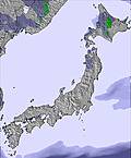 | 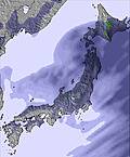 | 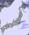 | |||||||||||
— | — | — | — | — | — | — | — | — | — | — | — | — | — | — | — | — | |
mm | — | — | — | — | — | — | — | — | — | — | — | — | 1 | 1 | 1 | 2 | — |
max °C | 12 | 12 | 12 | 13 | 13 | 12 | 12 | 11 | 11 | 12 | 12 | 11 | 11 | 11 | 11 | 11 | 11 |
min °C | 12 | 12 | 12 | 13 | 12 | 11 | 11 | 11 | 11 | 11 | 11 | 11 | 11 | 11 | 10 | 11 | 11 |
chill °C | 10 | 10 | 10 | 12 | 10 | 9 | 9 | 8 | 9 | 9 | 8 | 8 | 9 | 8 | 8 | 10 | 9 |
Humid % | 77 | 83 | 50 | 24 | 33 | 62 | 66 | 84 | 83 | 77 | 58 | 92 | 89 | 93 | 83 | 69 | 36 |
Freeze m | 5550 | 5500 | 5400 | 5400 | 5500 | 5350 | 5450 | 5250 | 5250 | 5250 | 5250 | 5200 | 5200 | 5150 | 5100 | 5150 | 5250 |
— | — | 4:54 | — | — | 4:56 | — | — | 4:56 | — | — | 4:56 | — | — | 4:58 | — | — | |
6:46 | — | — | 6:45 | — | — | 6:45 | — | — | 6:44 | — | — | 6:43 | — | — | 6:42 | — | |
Go pro and carve into:
Avalanche information: Japan Avalanche Network
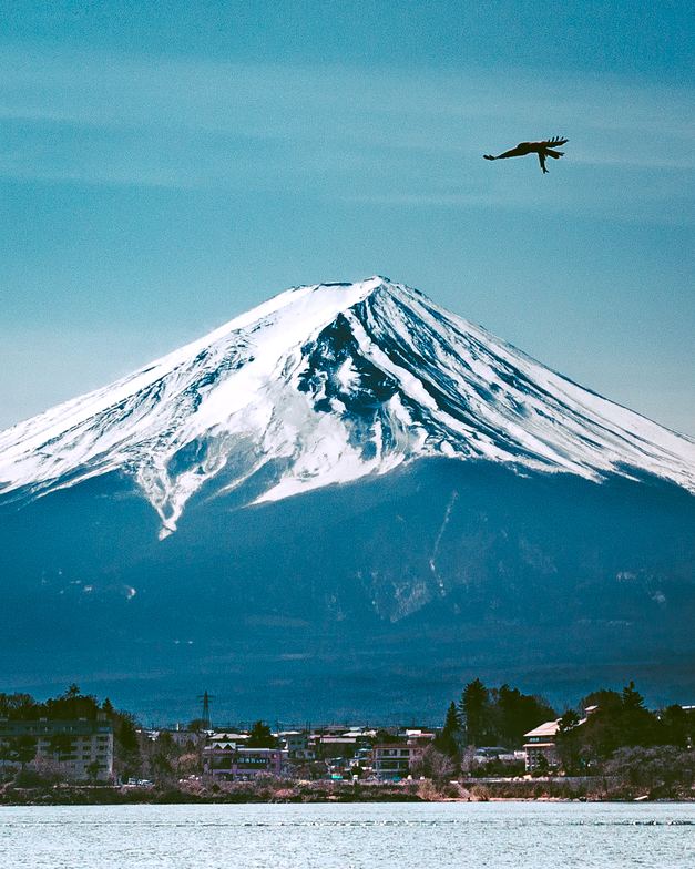
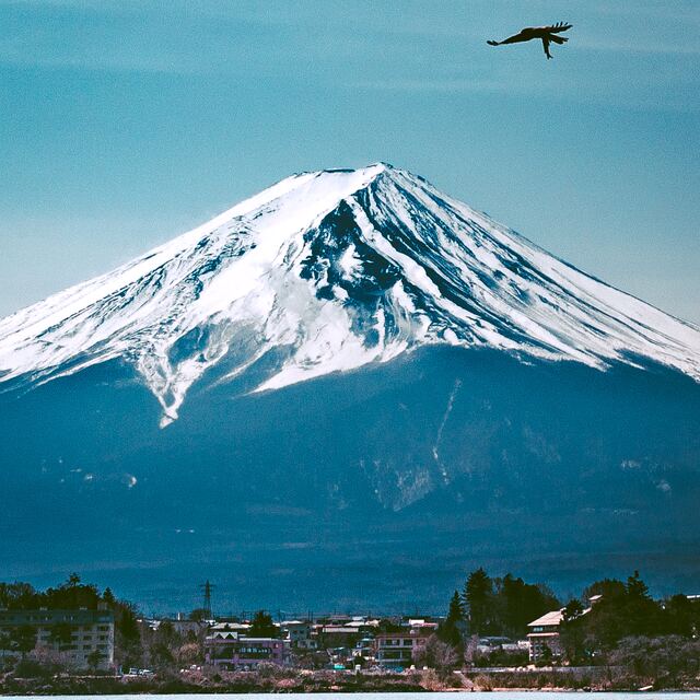
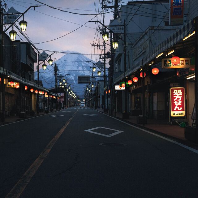
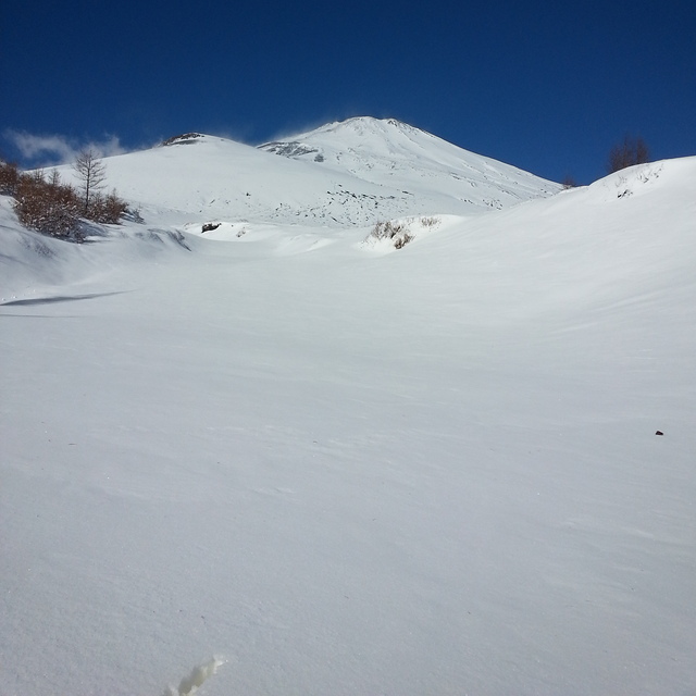
Latest snow reports near Mount Fuji:
| Top snow depth: | — |
|---|---|
| Bottom snow depth: | — |
| Fresh snowfall depth: | — |
| Last snowfall: | 14 Jun 2026 |
| Snow Alerts | Create Alert |
0.0 | Bluebird Powder days Fresh snow, mostly sunny, light wind. |
|---|---|
0.0 | Powder days Fresh snow, limited sun, any wind. |
0.0 | Bluebird days Average snow, mostly sunny, light wind. |
The above table gives the weather forecast for Mount Fuji at the specific elevation of 3014 m. Our sophisticated weather models allow us to provide snow forecasts for the top, middle and bottom ski stations of Mount Fuji. To access the weather forecasts for the other elevations, use the tab navigation above the table. For a wider view of the weather, check out the Weather Map of Japan.
Click here to read further information on freezing levels and how we forecast our temperatures.
Overall 2.8 Based on 2 votes and 7 reviews
Since discovering this site, I always check the weather forecast on the summit before going to Mt. Fuji. I have been to the summit 25 times now. The forecast, on this site, is generally very accurate but the weather on Fuji is changeable and on my last trip (August 15) the forecast was for a clear night sky, mild temperatures and all good for a sunrise. Things took a turn around 01:00 around 3200m with heavy rain and very strong winds. The rain stopped around 05:00 but the winds remained moderately strong until at least 07:00 by which time I was heading back down from the summit. Most important thing is to be prepared just in case there is a change in the weather. Some extra layers and waterproofs, even when the forecast is good, are definitely a must. Mt. Fuji is great. I have this site bookmarked and I'm often checking the forecast a week ahead if I get that feeling I need to go to again. Safe climbing !
Jasbir from Japan writes:
Since discovering this site, I always check the weather forecast on the summit before going to Mt. Fuji.
I have been to the summit 25 times now. The forecast, on this site, is generally very accurate but the weather on Fuji is changeable and on my last trip (August 15) the forecast was for a clear night sky, mild temperatures and all good for a sunrise. Things took a turn around 01:00 around 3200m with heavy rain and very strong winds. The rain stopped around 05:00 but the winds remained moderately strong until at least 07:00 by which time I was heading back down from the summit.
Most important thing is to be prepared just in case there is a change in the weather. Some extra layers and waterproofs, even when the forecast is good, are definitely a must.
Mt. Fuji is great. I have this site bookmarked and I'm often checking the forecast a week ahead if I get that feeling I need to go to again.
Safe climbing !


 Nearest