

Portillo Re-Opens To Guests Arriving By Helicopter
Chile’s famous Portillo ski resort is reported to have re-opened to guests arriving by helicopter after being cut off by road for more than two weeks by over 6m/20 feet of snowfall.

Next 3 days weather summary:Moderate rain (total 16.0mm), heaviest on Tue night. Very mild (max 12°C on Mon afternoon, min 8°C on Wed morning). Wind will be generally light. | Days 4-6 weather summary:Light rain (total 8.0mm), mostly falling on Thu afternoon. Very mild (max 10°C on Thu afternoon, min 8°C on Thu afternoon). Wind will be generally light. | ||||||||||||||||
Mon 3 | Tuesday 4 | Wednesday 5 | Thursday 6 | Friday 7 | Saturday 8 | ||||||||||||
PM | night | AM | PM | night | AM | PM | night | AM | PM | night | AM | PM | night | AM | PM | night | |
t-storm risk | rain shwrs | t-storm risk | t-storm risk | rain shwrs | clear | t-storm risk | rain shwrs | clear | mod. rain | rain shwrs | clear | clear | clear | clear | clear | clear | |
km/h | |||||||||||||||||
Snow map |  |  |  |  |  |  | |||||||||||
— | — | — | — | — | — | — | — | — | — | — | — | — | — | — | — | — | |
mm | 1 | 2 | 1 | 2 | 4 | — | 3 | 3 | — | 6 | 2 | — | — | — | — | — | — |
max °C | 12 | 11 | 11 | 11 | 9 | 9 | 10 | 10 | 10 | 10 | 8 | 9 | 9 | 9 | 9 | 10 | 10 |
min °C | 11 | 10 | 10 | 10 | 9 | 8 | 10 | 10 | 10 | 8 | 8 | 8 | 9 | 8 | 8 | 10 | 10 |
chill °C | 10 | 8 | 8 | 9 | 8 | 8 | 10 | 10 | 10 | 7 | 7 | 8 | 9 | 8 | 8 | 10 | 10 |
Humid % | 64 | 63 | 59 | 72 | 65 | 74 | 83 | 56 | 56 | 86 | 66 | 50 | 85 | 76 | 51 | 61 | 46 |
Freeze m | 4600 | 4500 | 4450 | 4400 | 4450 | 4350 | 4450 | 4450 | 4400 | 4250 | 4300 | 4250 | 4250 | 4350 | 4400 | 4450 | 4500 |
— | — | 6:20 | — | — | 6:20 | — | — | 6:22 | — | — | 6:24 | — | — | 6:24 | — | — | |
— | 8:59 | — | — | 8:58 | — | — | 8:55 | — | — | 8:54 | — | — | 8:53 | — | — | 8:52 | |
Go pro and carve into:
Avalanche information: European Avalanche Warning Services (EAWS)
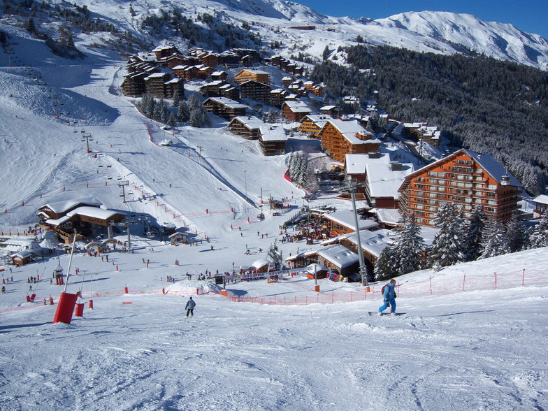
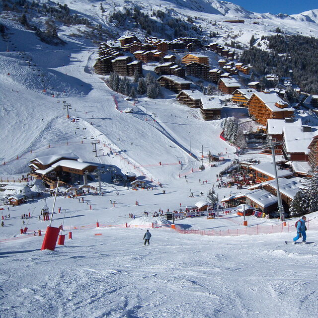
Latest snow reports near Mottaret:
| Top snow depth: | — |
|---|---|
| Bottom snow depth: | — |
| Fresh snowfall depth: | — |
| Last snowfall: | 4 Jun 2026 |
| Snow Alerts | Create Alert |
0.0 | Bluebird Powder days Fresh snow, mostly sunny, light wind. |
|---|---|
0.0 | Powder days Fresh snow, limited sun, any wind. |
0.1 | Bluebird days Average snow, mostly sunny, light wind. |
The above table gives the weather forecast for Mottaret at the specific elevation of 2950 m. Our sophisticated weather models allow us to provide snow forecasts for the top, middle and bottom ski stations of Mottaret. To access the weather forecasts for the other elevations, use the tab navigation above the table. For a wider view of the weather, check out the Weather Map of France.
Click here to read further information on freezing levels and how we forecast our temperatures.
Overall 4.3 Based on 6 votes and 10 reviews
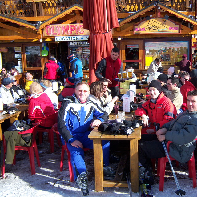
Have just returned from Mottaret. We were there for Feb 1/2 term term and had the most fantastic time. The snow conditions were the best we have ever had. The piste was not crowded and there were no really long lift queues. Prices for food and drink seem to have stayed the same for the past 2-3 years. Ok, more expensive than you would like but they do have to get everything up the mountain. We made the most of the new group lift pass which is available for groups of 3 or more. We booked all our travel and accommodation independently which worked out so much cheaper We stayed in the Ruitor appartments right in the centre of Mottaret with the shops bars and lifts just outside the door. The apartment was fantastic. Not the small cramped type we stayed in last year. It slept 6 and we all had decent beds.There was separate bathroom and toilet as well as kitchen and lounge/diner. The huge balcony was south facing looking onto the slopes. Will be going back there next year. Travel was on the overnight sleeper train from Paris and at 600euros return for 6 of us was a bargain. Transfers was by Altibus which can be booked online.The bonus of the night train is you get 8 full days ski. For those that want lively apres-ski there is the free bus to Meribel. I loved Mottaret and am looking forward to returning there next year.
rozita from Jersey writes:
Have just returned from Mottaret. We were there for Feb 1/2 term term and had the most fantastic time. The snow conditions were the best we have ever had. The piste was not crowded and there were no really long lift queues. Prices for food and drink seem to have stayed the same for the past 2-3 years. Ok, more expensive than you would like but they do have to get everything up the mountain.
We made the most of the new group lift pass which is available for groups of 3 or more.
We booked all our travel and accommodation independently which worked out so much cheaper We stayed in the Ruitor appartments right in the centre of Mottaret with the shops bars and lifts just outside the door. The apartment was fantastic. Not the small cramped type we stayed in last year. It slept 6 and we all had decent beds.There was separate bathroom and toilet as well as kitchen and lounge/diner. The huge balcony was south facing looking onto the slopes. Will be going back there next year.
Travel was on the overnight sleeper train from Paris and at 600euros return for 6 of us was a bargain. Transfers was by Altibus which can be booked online.The bonus of the night train is you get 8 full days ski.
For those that want lively apres-ski there is the free bus to Meribel.
I loved Mottaret and am looking forward to returning there next year.


 Nearest