

Portillo Storm Snowfall Total Passes 5m / 17 Feet
A snow storm that has now continued for nine days has taken Chilean ski resort Portillo to a snowfall total of 5.2 metres (17 feet) so far, with more snow forecast.

Next 3 days weather summary:Light rain (total 9.0mm), mostly falling on Fri afternoon. Warm (max 21°C on Thu afternoon, min 14°C on Fri night). Wind will be generally light. | Days 4-6 weather summary:Moderate rain (total 15.0mm), heaviest on Mon night. Warm (max 20°C on Sun afternoon, min 14°C on Sat night). Wind will be generally light. | ||||||||||||||||
Wed 29 | Thursday 30 | Friday 31 | Saturday 1 | Sunday 2 | Monday 3 | ||||||||||||
PM | night | AM | PM | night | AM | PM | night | AM | PM | night | AM | PM | night | AM | PM | night | |
clear | clear | clear | clear | rain shwrs | clear | t-storm risk | rain shwrs | rain shwrs | clear | rain shwrs | rain shwrs | t-storm risk | rain shwrs | t-storm risk | t-storm risk | t-storm risk | |
km/h | |||||||||||||||||
Snow map |  |  |  |  |  |  | |||||||||||
— | — | — | — | — | — | — | — | — | — | — | — | — | — | — | — | — | |
mm | — | — | — | — | 1 | — | 5 | 2 | 1 | — | 1 | 1 | 1 | 3 | 1 | 1 | 5 |
max °C | 19 | 18 | 19 | 21 | 20 | 20 | 19 | 17 | 17 | 19 | 17 | 17 | 20 | 18 | 18 | 20 | 16 |
min °C | 18 | 15 | 16 | 20 | 16 | 17 | 16 | 14 | 14 | 18 | 14 | 15 | 19 | 15 | 16 | 17 | 14 |
chill °C | 18 | 15 | 16 | 20 | 16 | 17 | 16 | 14 | 14 | 18 | 14 | 15 | 19 | 15 | 16 | 17 | 14 |
Humid % | 46 | 45 | 26 | 29 | 53 | 37 | 61 | 61 | 51 | 47 | 56 | 56 | 45 | 61 | 44 | 56 | 64 |
Freeze m | 4700 | 4650 | 4600 | 4800 | 4800 | 4700 | 4650 | 4550 | 4500 | 4650 | 4650 | 4550 | 4850 | 4650 | 4650 | 4650 | 4500 |
— | — | 6:13 | — | — | 6:15 | — | — | 6:16 | — | — | 6:18 | — | — | 6:18 | — | — | |
— | 9:05 | — | — | 9:04 | — | — | 9:02 | — | — | 9:01 | — | — | 9:00 | — | — | 8:59 | |
Go pro and carve into:
Avalanche information: European Avalanche Warning Services (EAWS)
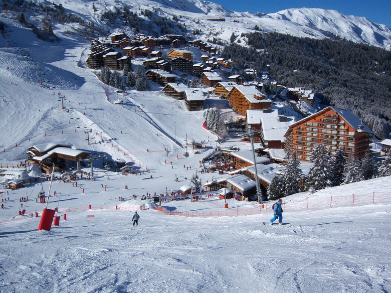
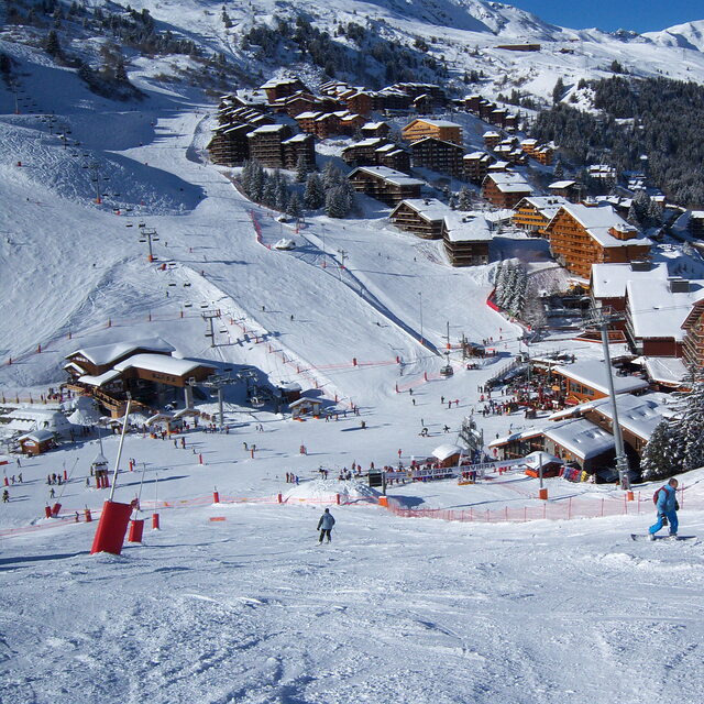
Latest snow reports near Mottaret:
| Top snow depth: | — |
|---|---|
| Bottom snow depth: | — |
| Fresh snowfall depth: | — |
| Last snowfall: | 4 Jun 2026 |
| Snow Alerts | Create Alert |
0.0 | Bluebird Powder days Fresh snow, mostly sunny, light wind. |
|---|---|
0.0 | Powder days Fresh snow, limited sun, any wind. |
0.0 | Bluebird days Average snow, mostly sunny, light wind. |
The above table gives the weather forecast for Mottaret at the specific elevation of 2200 m. Our sophisticated weather models allow us to provide snow forecasts for the top, middle and bottom ski stations of Mottaret. To access the weather forecasts for the other elevations, use the tab navigation above the table. For a wider view of the weather, check out the Weather Map of France.
Click here to read further information on freezing levels and how we forecast our temperatures.
Overall 4.3 Based on 6 votes and 10 reviews
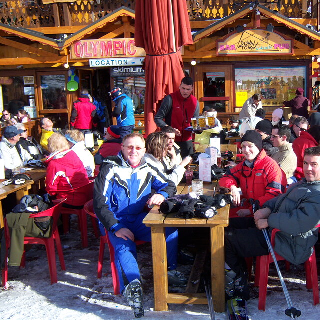
I have been visiting Mottaret for 10+ years since learning to ski there when I was young. I have also ski'd in Mayrhofen in Austria, Verbier in Switzerland, Whistler in Canada and Chamonix in France. I can say without question the 3 Valleys and Motteret is second to none! The sheer size of the ski area is incredible, you can ski all day without having to do any runs twice. My suggestion is plan your day and destination, try and get somewhere different as there are so many places to see and experience with a variety of exciting slopes to ski. We have an apartment there so I can't say much for the accommodation, however, we have had friends stay and they give very good reviews of the hotels. It is not cheap; the 3 valleys is the biggest and best ski resort in the world and you'll pay a premium for that, but with it you get the most incredible skiing, stunning views, lovely food and a very accessible resort. Great for beginners, who can navigate blue runs easily, and also offers plenty for the experienced skier too.
James from United Kingdom writes:
I have been visiting Mottaret for 10+ years since learning to ski there when I was young.
I have also ski'd in Mayrhofen in Austria, Verbier in Switzerland, Whistler in Canada and Chamonix in France. I can say without question the 3 Valleys and Motteret is second to none!
The sheer size of the ski area is incredible, you can ski all day without having to do any runs twice. My suggestion is plan your day and destination, try and get somewhere different as there are so many places to see and experience with a variety of exciting slopes to ski.
We have an apartment there so I can't say much for the accommodation, however, we have had friends stay and they give very good reviews of the hotels.
It is not cheap; the 3 valleys is the biggest and best ski resort in the world and you'll pay a premium for that, but with it you get the most incredible skiing, stunning views, lovely food and a very accessible resort.
Great for beginners, who can navigate blue runs easily, and also offers plenty for the experienced skier too.


 Nearest