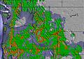
The above table gives the weather forecast for Montana Snowbowl at the specific elevation of 1921 m. Our sophisticated weather models allow us to provide snow forecasts for the top, middle and bottom ski stations of Montana Snowbowl. To access the weather forecasts for the other elevations, use the tab navigation above the table. For a wider view of the weather, check out the Weather Map of United States.
Click here to read further information on freezing levels and how we forecast our temperatures.
Dishonest, run down, manager runs the bar, restaurant whats left of it, zip line, rentals etc. One very inexperienced person trying to run the show. Also, did I mention rude? Cancelled zip line tour for no reason because not enough customers and refused to refund our 5 tickets. Manager was literally bragging about just getting the manager job, with bar tender, waitress, rental etc! In other words, they have like 3 people up there. I told her I would dispute it, which I did. She then said that she was the manger and she refuses to let me dispute it. I asked her in her 2 hours of being manger do you even have a clue how dispute works with a credit card? She gave me a blank look and said I don't need to I'm the manager now and I make the decisions. Clearly probably born high altitude. Anyway they are crooked as the day is long.
Dishonest, run down, manager runs the bar, restaurant whats left of it, zip line, rentals etc. One very inexperienced person trying to run the show. Also, did I mention rude? Cancelled zip line tour for no reason because not enough customers and refused to refund our 5 tickets. Manager was literally bragging about just getting the manager job, with bar tender, waitress, rental etc! In other words, they have like 3 people up there. I told her I would dispute it, which I did. She then said that she was the manger and she refuses to let me dispute it. I asked her in her 2 hours of being manger do you even have a clue how dispute works with a credit card? She gave me a blank look and said I don't need to I'm the manager now and I make the decisions. Clearly probably born high altitude. Anyway they are crooked as the day is long.
Free Snow-Forecast.com weather widget for your website
Embed the Montana Snowbowl weather widget on your site for free. It provides a weekly snapshot of snow and rain conditions across all elevations. Follow the two quick steps to grab your custom code and paste it into your site. Choose between metric or imperial units. Click here to get the code.


 Nearest