

Banff Sunshine Village Opening for Summer Skiing
Banff Sunshine Village has confirmed it will reopen for a fortnight of summer skiing, from this weekend. The only ski area in Canada to be open into July.

Next 3 days weather summary:Light rain (total 4.0mm), mostly falling on Fri morning. Warm (max 21°C on Sun afternoon, min 12°C on Fri night). Wind will be generally light. | Days 4-6 weather summary:Heavy rain (total 47.0mm), heaviest during Wed afternoon. Warm (max 22°C on Mon afternoon, min 14°C on Mon night). Wind will be generally light. | |||||||||||||||||
Friday 19 | Saturday 20 | Sunday 21 | Monday 22 | Tuesday 23 | Wednesday 24 | |||||||||||||
AM | PM | night | AM | PM | night | AM | PM | night | AM | PM | night | AM | PM | night | AM | PM | night | |
rain shwrs | rain shwrs | rain shwrs | clear | clear | clear | clear | clear | clear | clear | clear | clear | rain shwrs | t-storm risk | rain shwrs | t-storm risk | t-storm risk | rain shwrs | |
km/h | ||||||||||||||||||
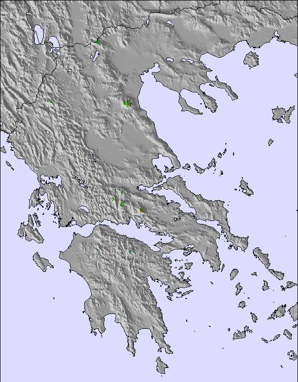
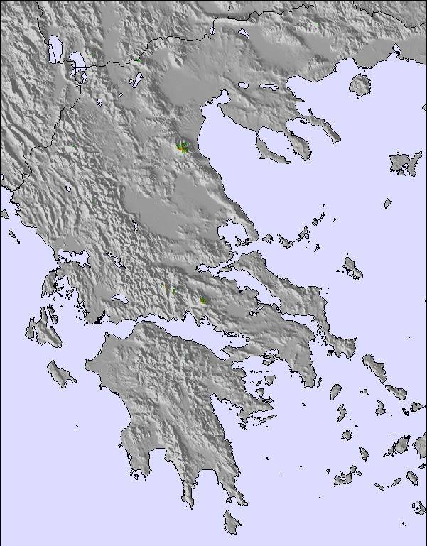
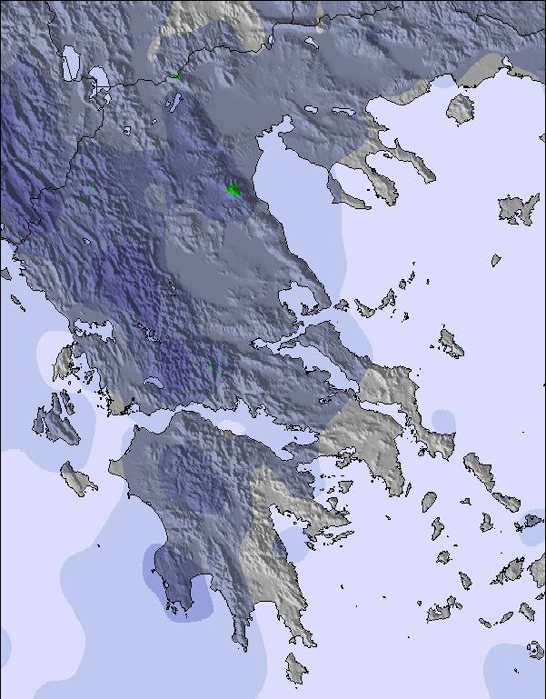
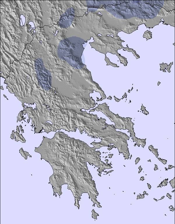
Snow map | 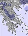 | 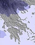 | 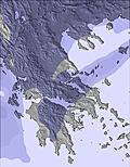 | 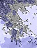 | 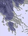 | 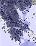 | ||||||||||||
— | — | — | — | — | — | — | — | — | — | — | — | — | — | — | — | — | — | |
mm | 1 | 2 | 1 | — | — | — | — | — | — | — | — | — | 1 | 6 | 7 | 2 | 22 | 9 |
max °C | 18 | 18 | 15 | 19 | 20 | 16 | 20 | 21 | 17 | 21 | 22 | 18 | 21 | 21 | 17 | 20 | 20 | 16 |
min °C | 15 | 18 | 12 | 16 | 19 | 13 | 17 | 20 | 14 | 18 | 21 | 14 | 18 | 20 | 15 | 18 | 16 | 15 |
chill °C | 15 | 18 | 12 | 16 | 19 | 13 | 17 | 20 | 14 | 18 | 21 | 14 | 18 | 20 | 15 | 18 | 16 | 15 |
Humid % | 68 | 57 | 60 | 72 | 49 | 60 | 64 | 51 | 58 | 66 | 48 | 53 | 65 | 61 | 74 | 75 | 70 | 64 |
Freeze m | 3500 | 3600 | 3550 | 3600 | 3600 | 3850 | 3800 | 3800 | 4050 | 3950 | 4000 | 4150 | 4100 | 4200 | 4250 | 4200 | 4250 | 4300 |
6:05 | — | — | 6:07 | — | — | 6:07 | — | — | 6:07 | — | — | 6:07 | — | — | 6:07 | — | — | |
— | — | 9:06 | — | — | 9:06 | — | — | 9:06 | — | — | 9:07 | — | — | 9:07 | — | — | 9:07 | |
Go pro and carve into:
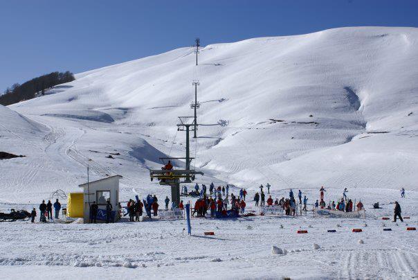
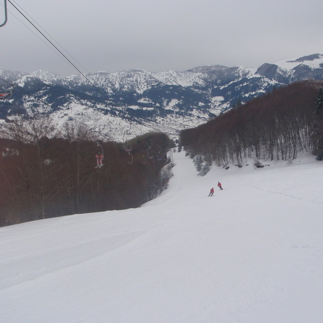
Latest snow reports near Metsovo Ski Resort:
| Top snow depth: | — |
|---|---|
| Bottom snow depth: | — |
| Fresh snowfall depth: | — |
| Last snowfall: | 2 May 2026 |
| Snow Alerts | Create Alert |
0.0 | Bluebird Powder days Fresh snow, mostly sunny, light wind. |
|---|---|
0.0 | Powder days Fresh snow, limited sun, any wind. |
0.0 | Bluebird days Average snow, mostly sunny, light wind. |

The above table gives the weather forecast for Metsovo Ski Resort at the specific elevation of 1360 m. Our sophisticated weather models allow us to provide snow forecasts for the top, middle and bottom ski stations of Metsovo Ski Resort. To access the weather forecasts for the other elevations, use the tab navigation above the table. For a wider view of the weather, check out the Weather Map of Greece.
Click here to read further information on freezing levels and how we forecast our temperatures.
Resort name is also written as Metsovo Ski Area.
Overall 3.3 Based on 6 votes and 3 reviews
επισκέφθηκα πρόσφατα το χ/κ ανηλίου, εύκολη πρόσβαση από εγνατία, ωραίο το σαλέ με την φανταστική θέα αφού πετύχαμε ηλιόλουστη ημέρα και γύρω όλα τα βουνα ήταν χιονισμένα, καλές πίστες ειδικά για αρχάριους, περάσαμε καλά γενικώς αξίζει μιας επίσκεψης
πανος from Greece writes:
επισκέφθηκα πρόσφατα το χ/κ ανηλίου, εύκολη πρόσβαση από εγνατία, ωραίο το σαλέ με την φανταστική θέα αφού πετύχαμε ηλιόλουστη ημέρα και γύρω όλα τα βουνα ήταν χιονισμένα, καλές πίστες ειδικά για αρχάριους, περάσαμε καλά γενικώς αξίζει μιας επίσκεψης
Read 2 more reviews of Metsovo Ski Resort or submit your own

 Nearest