

Banff Sunshine Village Opening for Summer Skiing
Banff Sunshine Village has confirmed it will reopen for a fortnight of summer skiing, from this weekend. The only ski area in Canada to be open into July.

Next 3 days weather summary:Moderate rain (total 17.0mm), heaviest on Tue night. Very mild (max 14°C on Mon afternoon, min 10°C on Mon night). Wind will be generally light. | Days 4-6 weather summary:Moderate rain (total 17.0mm), heaviest on Sat night. Very mild (max 16°C on Fri afternoon, min 12°C on Thu morning). Wind will be generally light. | |||||||||||||||||
Monday 22 | Tuesday 23 | Wednesday 24 | Thursday 25 | Friday 26 | Saturday 27 | |||||||||||||
AM | PM | night | AM | PM | night | AM | PM | night | AM | PM | night | AM | PM | night | AM | PM | night | |
clear | some clouds | rain shwrs | clear | t-storm risk | rain shwrs | rain shwrs | some clouds | some clouds | clear | clear | clear | some clouds | some clouds | rain shwrs | t-storm risk | t-storm risk | rain shwrs | |
km/h | ||||||||||||||||||
Snow map |  |  |  |  |  |  | ||||||||||||
— | — | — | — | — | — | — | — | — | — | — | — | — | — | — | — | — | — | |
mm | — | — | 7 | — | 1 | 8 | 1 | — | — | — | — | — | — | — | 3 | 1 | 3 | 10 |
max °C | 13 | 14 | 12 | 12 | 14 | 12 | 12 | 14 | 12 | 14 | 15 | 14 | 14 | 16 | 15 | 15 | 16 | 13 |
min °C | 11 | 14 | 10 | 11 | 13 | 10 | 11 | 13 | 11 | 12 | 15 | 12 | 13 | 16 | 13 | 14 | 16 | 12 |
chill °C | 11 | 14 | 10 | 11 | 12 | 10 | 10 | 12 | 11 | 12 | 15 | 12 | 13 | 16 | 13 | 14 | 16 | 12 |
Humid % | 57 | 57 | 69 | 66 | 74 | 62 | 60 | 63 | 66 | 42 | 57 | 65 | 62 | 65 | 75 | 66 | 66 | 72 |
Freeze m | 4150 | 4350 | 4250 | 4100 | 4250 | 4250 | 4150 | 4350 | 4350 | 4400 | 4600 | 4550 | 4500 | 4600 | 4600 | 4550 | 4700 | 4600 |
5:16 | — | — | 5:16 | — | — | 5:16 | — | — | 5:16 | — | — | 5:16 | — | — | 5:18 | — | — | |
— | — | 9:10 | — | — | 9:12 | — | — | 9:12 | — | — | 9:12 | — | — | 9:12 | — | — | 9:12 | |
Go pro and carve into:
Avalanche information: European Avalanche Warning Services (EAWS)
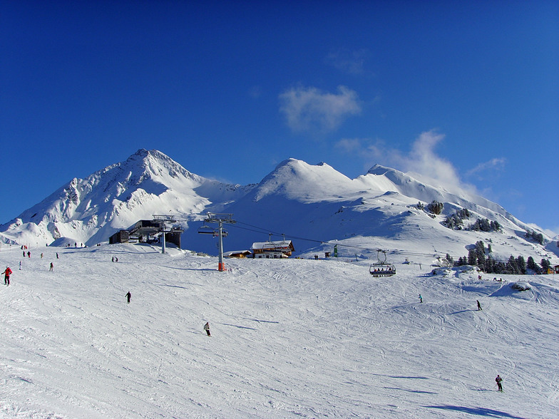
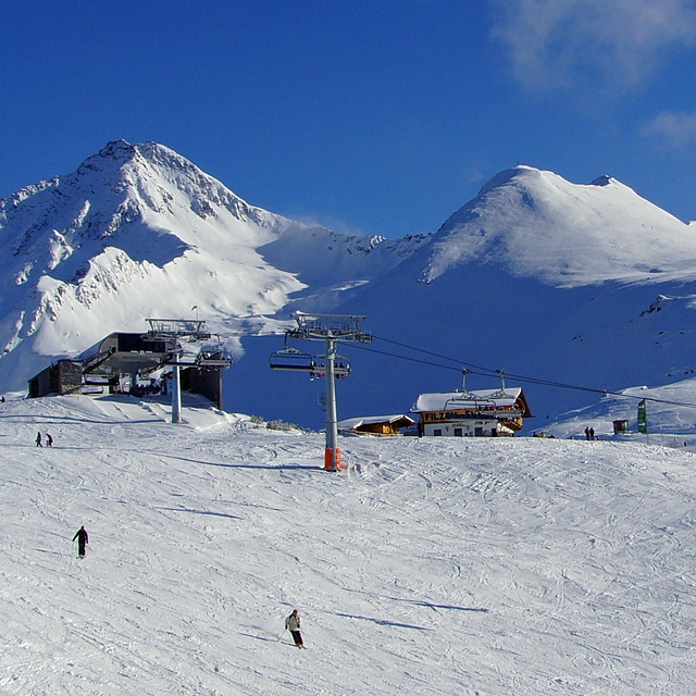
Latest snow reports near Mayrhofen:
| Top snow depth: | 0 cm |
|---|---|
| Bottom snow depth: | 0 cm |
| Fresh snowfall depth: | — |
| Last snowfall: | 18 May 2026 |
| Snow Alerts | Create Alert |
0.0 | Bluebird Powder days Fresh snow, mostly sunny, light wind. |
|---|---|
0.1 | Powder days Fresh snow, limited sun, any wind. |
0.1 | Bluebird days Average snow, mostly sunny, light wind. |

The above table gives the weather forecast for Mayrhofen at the specific elevation of 2500 m. Our sophisticated weather models allow us to provide snow forecasts for the top, middle and bottom ski stations of Mayrhofen. To access the weather forecasts for the other elevations, use the tab navigation above the table. For a wider view of the weather, check out the Weather Map of Austria.
Click here to read further information on freezing levels and how we forecast our temperatures.
Overall 4.4 Based on 35 votes and 52 reviews
So good for families. I took my kids who are now very competent skiers and it was perfect. Good variety of pistes, great food, lots of parks for kids, air bags. It’s sunny and shady in equal measures. We liked Eggalm a lot, the kids hated the Tux 150 lift and the piste back across if we hit it late and it gets super busy. The kids could ski with me and by themselves due to the easy layout. Did no nightlife as we had a great half board place. They even skied the Harikari a couple of times!
Ranger_dad from Germany writes:
So good for families. I took my kids who are now very competent skiers and it was perfect. Good variety of pistes, great food, lots of parks for kids, air bags. It’s sunny and shady in equal measures. We liked Eggalm a lot, the kids hated the Tux 150 lift and the piste back across if we hit it late and it gets super busy. The kids could ski with me and by themselves due to the easy layout. Did no nightlife as we had a great half board place. They even skied the Harikari a couple of times!


 Nearest