
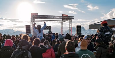
Tignes Unlimited Festival Into May
Tignes, one of the few French ski areas staying open into May, will round off the 2025–26 winter season with the return of the Tignes Unlimited electronic music festival, running from 25 April to 3 May 2026.

Next 3 days weather summary:A dusting of new snow. Freeze-thaw conditions (max 4°C on Wed afternoon, min -7°C on Mon night). Winds increasing (calm on Wed morning, fresh winds from the NNW by Thu morning). | Days 4-6 weather summary:Mostly dry. Freeze-thaw conditions (max 6°C on Sat afternoon, min -4°C on Thu night). Winds decreasing (fresh winds from the NNW on Thu afternoon, light winds from the NE by Sat night). | ||||||||||||||||
Mon 20 | Tuesday 21 | Wednesday 22 | Thursday 23 | Friday 24 | Saturday 25 | ||||||||||||
PM | night | AM | PM | night | AM | PM | night | AM | PM | night | AM | PM | night | AM | PM | night | |
light snow | some clouds | some clouds | some clouds | light snow | light snow | cloudy | cloudy | light snow | cloudy | some clouds | some clouds | some clouds | clear | clear | some clouds | clear | |
km/h | |||||||||||||||||
Snow map |  |  |  |  |  |  | |||||||||||
— | — | — | — | 2 | — | — | — | — | — | — | — | — | — | — | — | — | |
— | — | — | — | — | — | — | — | — | — | — | — | — | — | — | — | — | |
max °C | -4 | -5 | -2 | 3 | 1 | 2 | 4 | 3 | 1 | 2 | 0 | -1 | 2 | 0 | 3 | 6 | 4 |
min °C | -4 | -7 | -4 | 1 | 0 | 1 | 4 | 2 | 0 | 2 | -4 | -3 | 1 | -1 | 1 | 6 | 1 |
-10 | -12 | -7 | -3 | -5 | -2 | 3 | -2 | -6 | -4 | -9 | -9 | -4 | -5 | -3 | 4 | -3 | |
63 | 62 | 48 | 42 | 93 | 92 | 88 | 93 | 90 | 64 | 79 | 74 | 65 | 79 | 70 | 65 | 81 | |
400 | 0 | 600 | 1100 | 800 | 1300 | 1450 | 1250 | 800 | 1050 | 0 | 700 | 950 | 500 | 1150 | 1550 | 1150 | |
— | — | 5:58 | — | — | 5:56 | — | — | 5:54 | — | — | 5:54 | — | — | 5:52 | — | — | |
7:40 | — | — | 7:42 | — | — | 7:44 | — | — | 7:45 | — | — | 7:45 | — | — | 7:46 | — | |
Latest snow reports near Mad River Glen:
Light rain reported from Warren at 1788 feet 6 miles ESE of Sugarbush but it is forecast cold enough for snow at the ski area from Sugarbush
| Top snow depth: | — |
|---|---|
| Bottom snow depth: | — |
| Fresh snowfall depth: | 8 cm |
| Last snowfall: | 19 Apr 2026 |
| Snow Alerts | Create Alert |
0.1 | Bluebird Powder days Fresh snow, mostly sunny, light wind. |
|---|---|
0.6 | Powder days Fresh snow, limited sun, any wind. |
0.3 | Bluebird days Average snow, mostly sunny, light wind. |
The above table gives the weather forecast for Mad River Glen at the specific elevation of 798 m. Our sophisticated weather models allow us to provide snow forecasts for the top, middle and bottom ski stations of Mad River Glen. To access the weather forecasts for the other elevations, use the tab navigation above the table. For a wider view of the weather, check out the Weather Map of United States.
Click here to read further information on freezing levels and how we forecast our temperatures.
Overall 3.8 Based on 16 votes and 5 reviews
I tell ya, the "Ski it if you Can" moniker sure scares away most novices and intermediates. Perhaps that was the case before they started grooming and making snow, but it's no longer the case. I've been skiing here for over 20 years, and have skied pretty much every place in New England, so I can fairly compare things. I can go out any day and find beautiful, long, well-groomed green and blue trails that are packed down, not bumped up, icy or bare. Their grooming compares favorably with the big boys, Sugarbush, Mt. Snow, Stowe or even Stratton. The list goes on. Their grooming equipment is modern and goes out every night. I've taken fraidy-cat beginners, progressing intermediates and solid intermediates out and had an absolutely fun day. Not exhausting, not scary, not relentless. Go check out the "birdland" area of blues and greens. The hot shots stay out of them, the scenery is simply stupendous and you've got the trails to yourself. No worries about getting creamed. Well, you say, "their lifts are slow". True dat, but for good reason. It simply limits the number of people on the hill at any point in time. You can leisurely wind your way down any of these trails at ease, they are safe and clear. I'll give you that the trails are not "boulevards" like Stowe, Stratton, etc, but they are plenty wide; follow the countours of the mountain and just make for one photo shot after another. You don't need big wide trails when you've got the trail to yourself. Sure, there's plenty of very challenging stuff, especially black diamonds and the woods, and you'll see a fair share of these hot shots there. Fine with me, keeps them off the easier stuff. The shareholders are a diverse lot, but the one thing they have in common is their love of skiing. Lots of folks trying new things like telemark, or sticking with their 1970's skis, and a noticeable number of folks in their 70's and 80's are always out for a couple hours every day. And if you ski hard, even on groomers, you won't mind the longer lift ride to rest. The fixed-grip lifts have a special feature - they are reliable and lower to the ground and require less all-around clearance, so when you can't ski other places because of lift holds, go to MRG. They almost never have a lift hold. Lift lines you only see on "powder days", or mid mornings on the weekends. Any time else, it's ski on lift service. Things off-slope are simpler here - parking is not an ordeal, the cafeteria is simple but complete, you can always find a seat, the bar and restaurant are "cozy" but very picturesque and friendly. Local music on the weekends. But everyone is here to ski. Many call it "retro" and think "behind the times". Not so. The folks are just not caught up in the latest ski gear, bragging rites or the party scene. MRG has everything you need to have a delightful day on the slopes. Forget the thoughts of extreme skiing. Get here before it gets discovered!
Bill Tarkulich from United States writes:
I tell ya, the "Ski it if you Can" moniker sure scares away most novices and intermediates. Perhaps that was the case before they started grooming and making snow, but it's no longer the case. I've been skiing here for over 20 years, and have skied pretty much every place in New England, so I can fairly compare things.
I can go out any day and find beautiful, long, well-groomed green and blue trails that are packed down, not bumped up, icy or bare. Their grooming compares favorably with the big boys, Sugarbush, Mt. Snow, Stowe or even Stratton. The list goes on. Their grooming equipment is modern and goes out every night. I've taken fraidy-cat beginners, progressing intermediates and solid intermediates out and had an absolutely fun day. Not exhausting, not scary, not relentless. Go check out the "birdland" area of blues and greens. The hot shots stay out of them, the scenery is simply stupendous and you've got the trails to yourself. No worries about getting creamed.
Well, you say, "their lifts are slow". True dat, but for good reason. It simply limits the number of people on the hill at any point in time. You can leisurely wind your way down any of these trails at ease, they are safe and clear. I'll give you that the trails are not "boulevards" like Stowe, Stratton, etc, but they are plenty wide; follow the countours of the mountain and just make for one photo shot after another. You don't need big wide trails when you've got the trail to yourself.
Sure, there's plenty of very challenging stuff, especially black diamonds and the woods, and you'll see a fair share of these hot shots there. Fine with me, keeps them off the easier stuff.
The shareholders are a diverse lot, but the one thing they have in common is their love of skiing. Lots of folks trying new things like telemark, or sticking with their 1970's skis, and a noticeable number of folks in their 70's and 80's are always out for a couple hours every day.
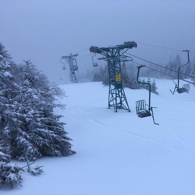
And if you ski hard, even on groomers, you won't mind the longer lift ride to rest. The fixed-grip lifts have a special feature - they are reliable and lower to the ground and require less all-around clearance, so when you can't ski other places because of lift holds, go to MRG. They almost never have a lift hold. Lift lines you only see on "powder days", or mid mornings on the weekends. Any time else, it's ski on lift service.
Things off-slope are simpler here - parking is not an ordeal, the cafeteria is simple but complete, you can always find a seat, the bar and restaurant are "cozy" but very picturesque and friendly. Local music on the weekends. But everyone is here to ski.
Many call it "retro" and think "behind the times". Not so. The folks are just not caught up in the latest ski gear, bragging rites or the party scene. MRG has everything you need to have a delightful day on the slopes.
Forget the thoughts of extreme skiing. Get here before it gets discovered!


 Nearest