

A New Largest Ski Area in New Zealand?
The Remarkables is hoping to overtake Cardrona as New Zealand’s largest ski area under a major NZD 150 million‑plus expansion proposal lodged by owner NZSki.

Next 3 days weather summary:Moderate rain (total 13.0mm), heaviest on Thu night. Warm (max 21°C on Thu afternoon, min 11°C on Thu night). Wind will be generally light. | Days 4-6 weather summary:Light rain (total 9.0mm), mostly falling on Sat night. Warm (max 23°C on Sun afternoon, min 13°C on Sat night). Wind will be generally light. | ||||||||||||||||
Wed 24 | Thursday 25 | Friday 26 | Saturday 27 | Sunday 28 | Monday 29 | ||||||||||||
PM | night | AM | PM | night | AM | PM | night | AM | PM | night | AM | PM | night | AM | PM | night | |
some clouds | rain shwrs | cloudy | light rain | light rain | t-storm risk | t-storm risk | rain shwrs | clear | some clouds | rain shwrs | clear | clear | rain shwrs | clear | clear | rain shwrs | |
km/h | |||||||||||||||||
Snow map |  |  |  |  |  |  | |||||||||||
— | — | — | — | — | — | — | — | — | — | — | — | — | — | — | — | — | |
mm | — | 1 | — | 1 | 4 | 2 | 4 | 1 | — | — | 3 | — | — | 3 | — | — | 1 |
max °C | 20 | 16 | 20 | 21 | 13 | 16 | 19 | 16 | 20 | 22 | 17 | 21 | 23 | 17 | 21 | 23 | 18 |
min °C | 19 | 12 | 15 | 15 | 11 | 14 | 18 | 12 | 15 | 21 | 13 | 16 | 22 | 13 | 16 | 23 | 15 |
chill °C | 19 | 12 | 15 | 15 | 11 | 13 | 18 | 12 | 15 | 21 | 13 | 16 | 22 | 13 | 16 | 23 | 15 |
Humid % | 63 | 75 | 53 | 75 | 97 | 91 | 77 | 92 | 64 | 60 | 84 | 63 | 61 | 81 | 55 | 51 | 75 |
Freeze m | 3150 | 2900 | 3000 | 3050 | 3250 | 3200 | 3300 | 3550 | 3600 | 3450 | 3350 | 3250 | 3250 | 3300 | 3250 | 3350 | 3250 |
— | — | 5:09 | — | — | 5:09 | — | — | 5:09 | — | — | 5:09 | — | — | 5:09 | — | — | |
— | 8:38 | — | — | 8:38 | — | — | 8:38 | — | — | 8:38 | — | — | 8:38 | — | — | 8:38 | |
Go pro and carve into:
Avalanche information: National Avalanche Center
Latest snow reports near Mad River Glen:
| Top snow depth: | — |
|---|---|
| Bottom snow depth: | — |
| Fresh snowfall depth: | — |
| Last snowfall: | 29 May 2026 |
| Snow Alerts | Create Alert |
0.0 | Bluebird Powder days Fresh snow, mostly sunny, light wind. |
|---|---|
0.0 | Powder days Fresh snow, limited sun, any wind. |
0.0 | Bluebird days Average snow, mostly sunny, light wind. |
The above table gives the weather forecast for Mad River Glen at the specific elevation of 488 m. Our sophisticated weather models allow us to provide snow forecasts for the top, middle and bottom ski stations of Mad River Glen. To access the weather forecasts for the other elevations, use the tab navigation above the table. For a wider view of the weather, check out the Weather Map of United States.
Click here to read further information on freezing levels and how we forecast our temperatures.
Overall 3.8 Based on 16 votes and 5 reviews
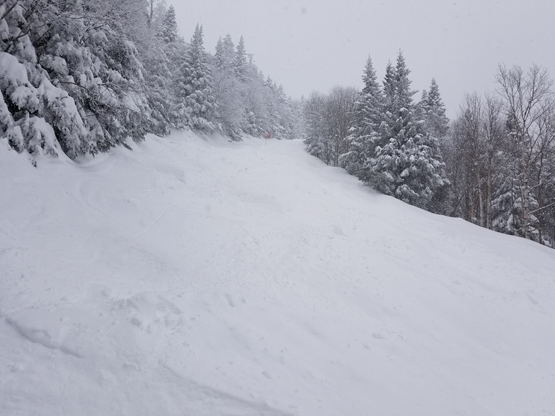
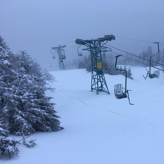
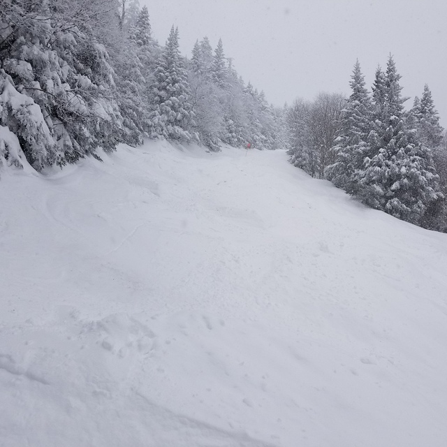
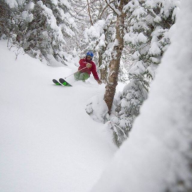
Truly unique and not for everyone, Mad River Glen hasn't widened and bulldozed trails to make way for snow-making, opting instead for terrain that retains the natural contours of the mountain. There's some snow-making, but only around the base. Locals clear lines in the woods during the summer, so glades are abundant for those willing to explore. The feature lift is a single chair that serves 2000 vertical feet of mostly steep terrain, but there are plenty of other options. Novice skiers have a dedicated lift that offers beautiful gently rolling terrain that starts well up from the base. This is a ski area that tolerates occasionally long weekend lift-lines because uncrowded terrain is the priority. We raised our kids skiing here without worry that some irresponsible fool would crash into them ... and they still come back from Colorado to ski the trails they grew up on. Their dad never left.
David Ross from United States writes:
Truly unique and not for everyone, Mad River Glen hasn't widened and bulldozed trails to make way for snow-making, opting instead for terrain that retains the natural contours of the mountain. There's some snow-making, but only around the base. Locals clear lines in the woods during the summer, so glades are abundant for those willing to explore. The feature lift is a single chair that serves 2000 vertical feet of mostly steep terrain, but there are plenty of other options. Novice skiers have a dedicated lift that offers beautiful gently rolling terrain that starts well up from the base. This is a ski area that tolerates occasionally long weekend lift-lines because uncrowded terrain is the priority. We raised our kids skiing here without worry that some irresponsible fool would crash into them ... and they still come back from Colorado to ski the trails they grew up on. Their dad never left.


 Nearest