The above table gives the weather forecast for La Tzoumaz at the specific elevation of 2354 m. Our sophisticated weather models allow us to provide snow forecasts for the top, middle and bottom ski stations of La Tzoumaz. To access the weather forecasts for the other elevations, use the tab navigation above the table. For a wider view of the weather, check out the Weather Map of Switzerland.
Click here to read further information on freezing levels and how we forecast our temperatures.
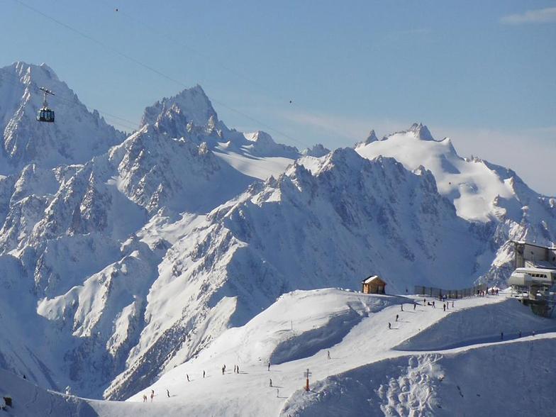
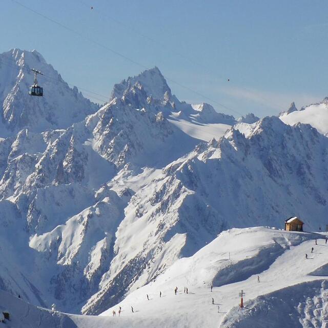
Just back from two weeks spent over Christmas and New Year and can honestly say that I managed to do some of the best skiing in my life. We are a family of seasoned skiers, having done most Europe famous resorts in France, Switzerland and Austria over the years so have something to compare with. So, why do we love La Tzoumaz? Amazingly easy access to Verbier ski area (fast modern 6-seater chair lift to Savolyers), no queues (in stark contrast to Verbier or Nendaz on either side), superb tree lined runs, amazing off-piste, better ski cover vs. southern facing Verbier, friendly locals, picture perfect views to opposite Iserables (much better than car congested Verbier). Easy drive from Geneva - just 1.5 hours or 2 hour train ride from Geneva airport to Riddes and just 15 mins drive up to the village. Or 8 hour drive from Calais. Well worth it if going on a self-catering basis so you can get all supplies from close by Conthey (30 mins drive). Nice that the village arranged events such as Father Christmas meets kids and gives free presents, free ice skating rink, NY party with live band, fireworks, etc. Mostly Dutch, Swiss and British tourists.
Just back from two weeks spent over Christmas and New Year and can honestly say that I managed to do some of the best skiing in my life. We are a family of seasoned skiers, having done most Europe famous resorts in France, Switzerland and Austria over the years so have something to compare with. So, why do we love La Tzoumaz? Amazingly easy access to Verbier ski area (fast modern 6-seater chair lift to Savolyers), no queues (in stark contrast to Verbier or Nendaz on either side), superb tree lined runs, amazing off-piste, better ski cover vs. southern facing Verbier, friendly locals, picture perfect views to opposite Iserables (much better than car congested Verbier). Easy drive from Geneva - just 1.5 hours or 2 hour train ride from Geneva airport to Riddes and just 15 mins drive up to the village. Or 8 hour drive from Calais. Well worth it if going on a self-catering basis so you can get all supplies from close by Conthey (30 mins drive). Nice that the village arranged events such as Father Christmas meets kids and gives free presents, free ice skating rink, NY party with live band, fireworks, etc. Mostly Dutch, Swiss and British tourists.
Free Snow-Forecast.com weather widget for your website
Embed the La Tzoumaz weather widget on your site for free. It provides a weekly snapshot of snow and rain conditions across all elevations. Follow the two quick steps to grab your custom code and paste it into your site. Choose between metric or imperial units. Click here to get the code.


 Nearest