The above table gives the weather forecast for Hochzillertal-Kaltenbach at the specific elevation of 554 m. Our sophisticated weather models allow us to provide snow forecasts for the top, middle and bottom ski stations of Hochzillertal-Kaltenbach. To access the weather forecasts for the other elevations, use the tab navigation above the table. For a wider view of the weather, check out the Weather Map of Austria.
Click here to read further information on freezing levels and how we forecast our temperatures.
In my opinion HochZillertal-Kaltenbach, is an outstanding place to ski. It has a little bit of skiing to suit most people. If I was being brutally honest I would have to say that the more adventurous skier would find it very hard to push their limits here however, there are some real long runs that can work you close to your limits.
I agree that the off piste skiing is limited and does get skied out quite quickly when it gets busy, but the simple way around this is get on the first lift up at 8am and you find pretty much every run will be yours up until around 10am. Then when it starts to get a little busy simply move over the mountain to the other side, Hochfugen.
My family and I come here to ski and that's what we do. We get very clear runs using the above method up until around 1pm, but by then we have been skiing for 5hrs so we ski off the mountain to finish the days skiing.
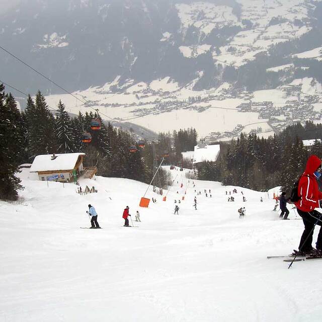
Hochzillertal and Hochfugen together offer around 155km of groomed piste so this will easily keep the beginner - Advanced skier/Family occupied for a 7 day period.
While Kaltenbach itself is very tiny, 15 minutes drive through the Ziller Valley will get you into Mayrhofen which is a Typical Ski resort town.
The prices are reasonable, expect to pay Euro 539 for three super ski passes (1 Child, 2 Adults) but these will give access to free transport via train and bus throughout the valley and access to every run in the Ziller valley which boasts the headline... 1 Valley, 174 Lifts, 636km of Piste and ONE pass.
We come back year after year which tells a story in itself!
In my opinion HochZillertal-Kaltenbach, is an outstanding place to ski. It has a little bit of skiing to suit most people. If I was being brutally honest I would have to say that the more adventurous skier would find it very hard to push their limits here however, there are some real long runs that can work you close to your limits.
I agree that the off piste skiing is limited and does get skied out quite quickly when it gets busy, but the simple way around this is get on the first lift up at 8am and you find pretty much every run will be yours up until around 10am. Then when it starts to get a little busy simply move over the mountain to the other side, Hochfugen.
My family and I come here to ski and that's what we do. We get very clear runs using the above method up until around 1pm, but by then we have been skiing for 5hrs so we ski off the mountain to finish the days skiing.
Hochzillertal and Hochfugen together offer around 155km of groomed piste so this will easily keep the beginner - Advanced skier/Family occupied for a 7 day period.
While Kaltenbach itself is very tiny, 15 minutes drive through the Ziller Valley will get you into Mayrhofen which is a Typical Ski resort town.
The prices are reasonable, expect to pay Euro 539 for three super ski passes (1 Child, 2 Adults) but these will give access to free transport via train and bus throughout the valley and access to every run in the Ziller valley which boasts the headline... 1 Valley, 174 Lifts, 636km of Piste and ONE pass.
We come back year after year which tells a story in itself!
Free Snow-Forecast.com weather widget for your website
Embed the Hochzillertal-Kaltenbach weather widget on your site for free. It provides a weekly snapshot of snow and rain conditions across all elevations. Follow the two quick steps to grab your custom code and paste it into your site. Choose between metric or imperial units. Click here to get the code.


 Nearest