


America’s Next Indoor Snow Centre Takes Shape
Construction of a new indoor snow centre for skiers, boarders and tubers appears to be making good progress at Heritage Farm in Wayne County, West Virginia.

Next 3 days weather summary:Moderate rain (total 18.0mm), heaviest on Sun morning. Warm (max 22°C on Thu afternoon, min 17°C on Fri night). Wind will be generally light. | Days 4-6 weather summary:Heavy rain (total 22.0mm), heaviest during Tue afternoon. Very mild (max 18°C on Mon morning, min 14°C on Tue night). Wind will be generally light. | ||||||||||||||||
Thu 23 | Friday 24 | Saturday 25 | Sunday 26 | Monday 27 | Tuesday 28 | ||||||||||||
PM | night | AM | PM | night | AM | PM | night | AM | PM | night | AM | PM | night | AM | PM | night | |
t-storm risk | rain shwrs | rain shwrs | t-storm risk | rain shwrs | t-storm risk | t-storm risk | rain shwrs | t-storm risk | light rain | rain shwrs | light rain | t-storm risk | cloudy | t-storm risk | t-storm risk | rain shwrs | |
km/h | |||||||||||||||||
Snow map | 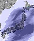 | 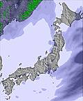 |  |  |  |  | |||||||||||
— | — | — | — | — | — | — | — | — | — | — | — | — | — | — | — | — | |
mm | 2 | 1 | 1 | 3 | 1 | 1 | 3 | 1 | 5 | 3 | 2 | 2 | 2 | — | 3 | 6 | 1 |
max °C | 22 | 18 | 21 | 20 | 18 | 21 | 20 | 18 | 18 | 17 | 16 | 18 | 17 | 16 | 16 | 16 | 15 |
min °C | 20 | 18 | 20 | 19 | 17 | 19 | 19 | 17 | 17 | 17 | 15 | 17 | 16 | 15 | 15 | 15 | 14 |
chill °C | 20 | 18 | 20 | 19 | 17 | 19 | 19 | 17 | 17 | 17 | 15 | 17 | 16 | 15 | 15 | 15 | 14 |
Humid % | 68 | 77 | 63 | 79 | 86 | 79 | 74 | 81 | 72 | 78 | 86 | 83 | 82 | 89 | 90 | 91 | 90 |
Freeze m | 5250 | 5200 | 5050 | 5150 | 5150 | 5050 | 4950 | 4800 | 4600 | 4550 | 4750 | 4700 | 4800 | 4600 | 4500 | 4550 | 4650 |
— | — | 4:47 | — | — | 4:48 | — | — | 4:48 | — | — | 4:50 | — | — | 4:50 | — | — | |
7:01 | — | — | 7:01 | — | — | 7:00 | — | — | 7:00 | — | — | 6:59 | — | — | 6:59 | — | |
Go pro and carve into:
Avalanche information: Japan Avalanche Network
Latest snow reports near Hakuba Goryu:
| Top snow depth: | — |
|---|---|
| Bottom snow depth: | — |
| Fresh snowfall depth: | — |
| Last snowfall: | 7 Apr 2026 |
| Snow Alerts | Create Alert |
0.0 | Bluebird Powder days Fresh snow, mostly sunny, light wind. |
|---|---|
0.0 | Powder days Fresh snow, limited sun, any wind. |
0.0 | Bluebird days Average snow, mostly sunny, light wind. |
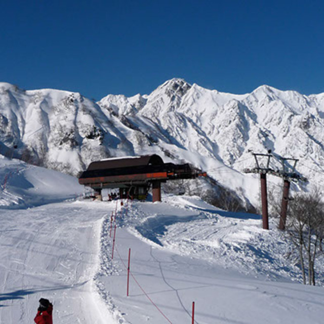
The above table gives the weather forecast for Hakuba Goryu at the specific elevation of 1676 m. Our sophisticated weather models allow us to provide snow forecasts for the top, middle and bottom ski stations of Hakuba Goryu. To access the weather forecasts for the other elevations, use the tab navigation above the table. For a wider view of the weather, check out the Weather Map of Japan.
Click here to read further information on freezing levels and how we forecast our temperatures.
Overall 4.5 Based on 9 votes and 3 reviews
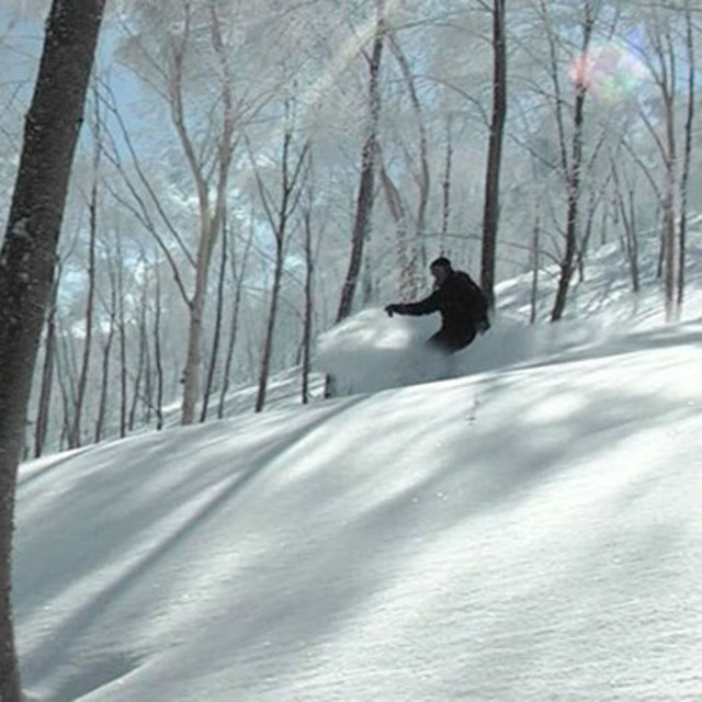
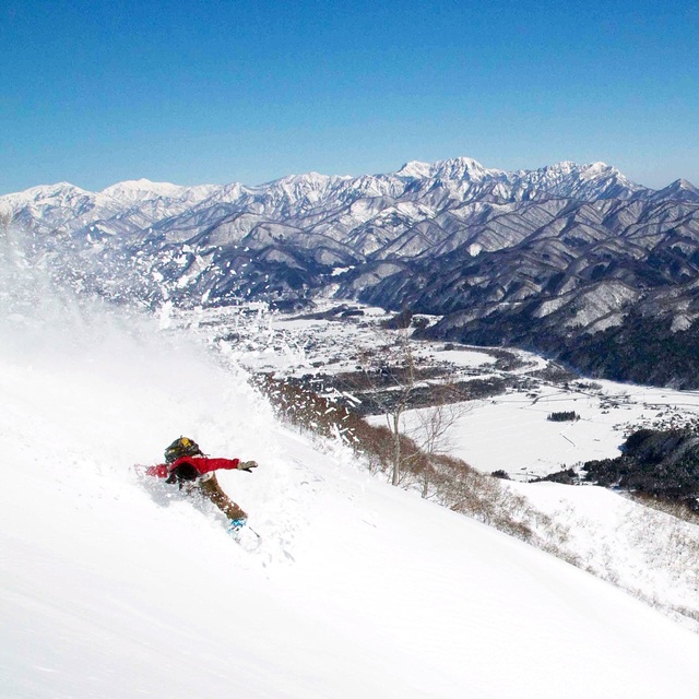
We were up in Goryu last weekend and conditions were perfect, light snow on Saturday and chilly, but then pure sunshine on Sunday and Monday and gorgeous conditions. Will be up again in a week's time. [note from the editor: do contact the Help Desk ([email protected]) if you are able to submit regular snow reports from the resort. This post will remain for a short time.]
Lisa Fox from Japan writes:
We were up in Goryu last weekend and conditions were perfect, light snow on Saturday and chilly, but then pure sunshine on Sunday and Monday and gorgeous conditions. Will be up again in a week's time.
[note from the editor: do contact the Help Desk ([email protected]) if you are able to submit regular snow reports from the resort. This post will remain for a short time.]


 Nearest