

America’s Next Indoor Snow Centre Takes Shape
Construction of a new indoor snow centre for skiers, boarders and tubers appears to be making good progress at Heritage Farm in Wayne County, West Virginia.

Next 3 days weather summary:Some drizzle, heaviest during Tue night. Warm (max 23°C on Wed afternoon, min 14°C on Tue night). Wind will be generally light. | Days 4-6 weather summary:Light rain (total 7.0mm), mostly falling on Sat night. Warm (max 24°C on Fri afternoon, min 7°C on Sat night). Winds decreasing (fresh winds from the WSW on Fri afternoon, calm by Sun afternoon). | ||||||||||||||||
Tue 21 | Wednesday 22 | Thursday 23 | Friday 24 | Saturday 25 | Sunday 26 | ||||||||||||
PM | night | AM | PM | night | AM | PM | night | AM | PM | night | AM | PM | night | AM | PM | night | |
some clouds | rain shwrs | clear | some clouds | clear | clear | some clouds | clear | clear | some clouds | clear | clear | t-storm risk | rain shwrs | clear | some clouds | some clouds | |
km/h | |||||||||||||||||
Snow map |  |  | 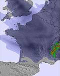 |  | 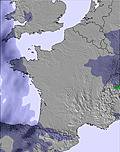 | 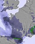 | |||||||||||
— | — | — | — | — | — | — | — | — | — | — | — | — | — | — | — | — | |
mm | — | 1 | — | — | — | — | — | — | — | — | — | — | 1 | 6 | — | — | — |
max °C | 22 | 19 | 20 | 23 | 19 | 22 | 23 | 21 | 22 | 24 | 21 | 17 | 16 | 13 | 11 | 14 | 13 |
min °C | 22 | 14 | 15 | 23 | 17 | 18 | 23 | 16 | 17 | 24 | 16 | 15 | 16 | 7 | 7 | 14 | 10 |
chill °C | 22 | 14 | 14 | 23 | 17 | 18 | 23 | 15 | 16 | 24 | 14 | 13 | 15 | 4 | 5 | 14 | 9 |
Humid % | 30 | 51 | 36 | 30 | 43 | 29 | 29 | 32 | 26 | 19 | 36 | 30 | 39 | 80 | 56 | 56 | 68 |
Freeze m | 4750 | 4650 | 4650 | 4850 | 4800 | 4700 | 4800 | 4750 | 4800 | 4900 | 4700 | 4250 | 4000 | 3550 | 3550 | 4000 | 4500 |
— | — | 6:33 | — | — | 6:33 | — | — | 6:35 | — | — | 6:35 | — | — | 6:37 | — | — | |
— | 9:22 | — | — | 9:22 | — | — | 9:21 | — | — | 9:20 | — | — | 9:19 | — | — | 9:17 | |
Go pro and carve into:
Avalanche information: European Avalanche Warning Services (EAWS)
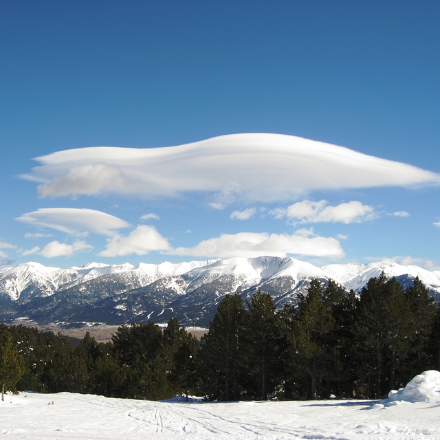
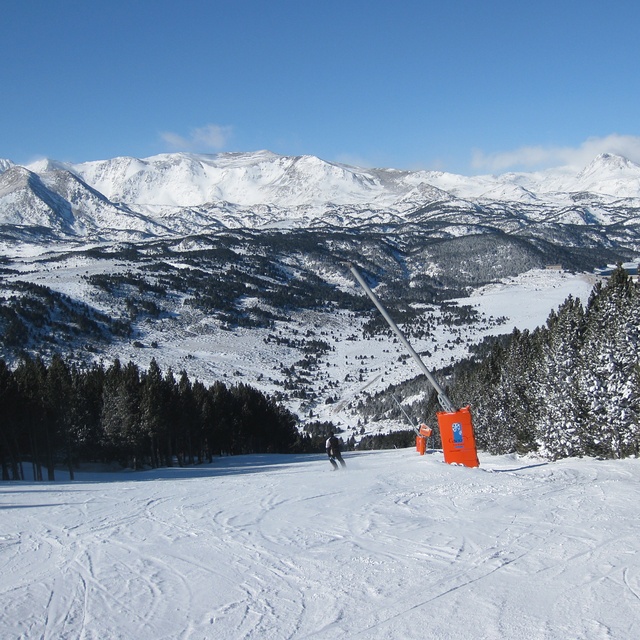
Latest snow reports near Font Romeu:
| Top snow depth: | 0 cm |
|---|---|
| Bottom snow depth: | 0 cm |
| Fresh snowfall depth: | — |
| Last snowfall: | 17 May 2026 |
| Snow Alerts | Create Alert |
0.0 | Bluebird Powder days Fresh snow, mostly sunny, light wind. |
|---|---|
0.0 | Powder days Fresh snow, limited sun, any wind. |
0.0 | Bluebird days Average snow, mostly sunny, light wind. |
The above table gives the weather forecast for Font Romeu at the specific elevation of 2088 m. Our sophisticated weather models allow us to provide snow forecasts for the top, middle and bottom ski stations of Font Romeu. To access the weather forecasts for the other elevations, use the tab navigation above the table. For a wider view of the weather, check out the Weather Map of France.
Click here to read further information on freezing levels and how we forecast our temperatures.
Overall 4.0 Based on 17 votes and 4 reviews
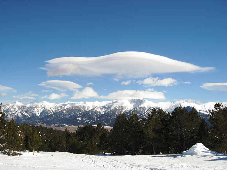
My family and I skied Font Romeu in early January 2010. This is an excellent family friendly resort linked to a neighbouring resort called Pyrenees 2000. The slopes are excellent for beginners with greens in abundance. There are not many resorts where you can ski from the top right to the bottom on greens! There are a large number of smooth blues all over and an excellent blue into Pyrenees 2000. There are a number of blacks but these are more red in nature although sometimes icy. Many good pistes for intermediates at the back of the resort and into Pyrenees 2000.The resort is well interlinked with 3 mountain restaurants to allow frequent hot chocolates. We stayed in Font Romeu and found an excellent pub with a central fireplace where one could order food through a 'hole in the wall'. All in all, an excellent family friendly resort with a creche at the base of the ski resort and a linked lift right from the centre of Font Romeu village. We have been to the Pyrenees many times and enjoy neighbouring resorts of Les Angles and Formigueres. For a weeks trip taking in all three resorts is very possible. We would highly recommend Font Romeu for a 3-4 day trip.
Tony Pembroke from Ireland writes:
My family and I skied Font Romeu in early January 2010. This is an excellent family friendly resort linked to a neighbouring resort called Pyrenees 2000. The slopes are excellent for beginners with greens in abundance. There are not many resorts where you can ski from the top right to the bottom on greens! There are a large number of smooth blues all over and an excellent blue into Pyrenees 2000. There are a number of blacks but these are more red in nature although sometimes icy. Many good pistes for intermediates at the back of the resort and into Pyrenees 2000.The resort is well interlinked with 3 mountain restaurants to allow frequent hot chocolates. We stayed in Font Romeu and found an excellent pub with a central fireplace where one could order food through a 'hole in the wall'. All in all, an excellent family friendly resort with a creche at the base of the ski resort and a linked lift right from the centre of Font Romeu village. We have been to the Pyrenees many times and enjoy neighbouring resorts of Les Angles and Formigueres. For a weeks trip taking in all three resorts is very possible. We would highly recommend Font Romeu for a 3-4 day trip.


 Nearest