

Portillo Storm Snowfall Total Passes 5m / 17 Feet
A snow storm that has now continued for nine days has taken Chilean ski resort Portillo to a snowfall total of 5.2 metres (17 feet) so far, with more snow forecast.

Next 3 days weather summary:Heavy rain (total 26.0mm), heaviest during Sat afternoon. Warm (max 30°C on Fri afternoon, min 15°C on Sat night). Wind will be generally light. | Days 4-6 weather summary:Heavy rain (total 25.0mm), heaviest during Tue night. Warm (max 26°C on Mon afternoon, min 14°C on Tue night). Wind will be generally light. | |||||||||||||||||
Thursday 30 | Friday 31 | Saturday 1 | Sunday 2 | Monday 3 | Tuesday 4 | |||||||||||||
AM | PM | night | AM | PM | night | AM | PM | night | AM | PM | night | AM | PM | night | AM | PM | night | |
clear | clear | clear | clear | t-storm risk | mod. rain | t-storm risk | t-storm risk | rain shwrs | rain shwrs | light rain | rain shwrs | clear | light rain | rain shwrs | t-storm risk | mod. rain | rain shwrs | |
km/h | ||||||||||||||||||
Snow map |  |  |  |  |  |  | ||||||||||||
— | — | — | — | — | — | — | — | — | — | — | — | — | — | — | — | — | — | |
mm | — | — | — | — | 1 | 8 | 1 | 9 | 7 | 1 | 3 | 3 | — | 1 | 1 | 1 | 8 | 7 |
max °C | 26 | 29 | 24 | 28 | 30 | 19 | 24 | 23 | 18 | 24 | 24 | 19 | 25 | 26 | 21 | 25 | 24 | 17 |
min °C | 21 | 28 | 17 | 21 | 21 | 16 | 19 | 19 | 15 | 19 | 20 | 17 | 20 | 23 | 17 | 20 | 18 | 14 |
chill °C | 21 | 28 | 17 | 21 | 21 | 16 | 19 | 19 | 15 | 19 | 20 | 17 | 20 | 23 | 17 | 20 | 18 | 14 |
Humid % | 29 | 21 | 53 | 29 | 64 | 85 | 50 | 85 | 82 | 52 | 70 | 72 | 43 | 51 | 67 | 46 | 84 | 72 |
Freeze m | 4450 | 4750 | 4650 | 4650 | 4500 | 4400 | 4350 | 4300 | 4300 | 4450 | 4500 | 4500 | 4500 | 4600 | 4450 | 4350 | 4300 | 4150 |
5:52 | — | — | 5:54 | — | — | 5:54 | — | — | 5:56 | — | — | 5:58 | — | — | 5:58 | — | — | |
— | — | 8:52 | — | — | 8:52 | — | — | 8:51 | — | — | 8:49 | — | — | 8:47 | — | — | 8:45 | |
Go pro and carve into:
Avalanche information: European Avalanche Warning Services (EAWS)
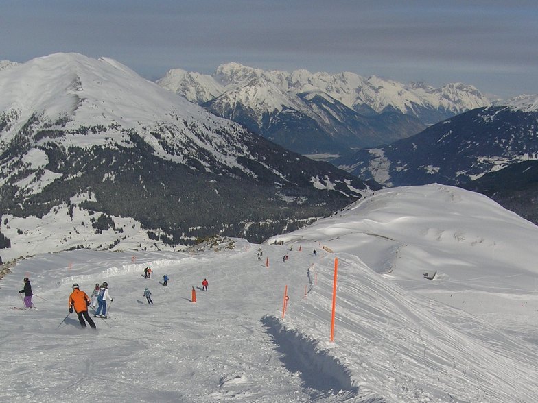
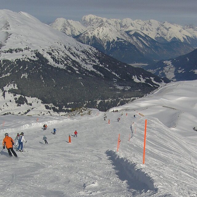
Latest snow reports near Fiss:
| Top snow depth: | 0 cm |
|---|---|
| Bottom snow depth: | 0 cm |
| Fresh snowfall depth: | — |
| Last snowfall: | 10 Jun 2026 |
| Snow Alerts | Create Alert |
0.0 | Bluebird Powder days Fresh snow, mostly sunny, light wind. |
|---|---|
0.0 | Powder days Fresh snow, limited sun, any wind. |
0.0 | Bluebird days Average snow, mostly sunny, light wind. |
The above table gives the weather forecast for Fiss at the specific elevation of 1200 m. Our sophisticated weather models allow us to provide snow forecasts for the top, middle and bottom ski stations of Fiss. To access the weather forecasts for the other elevations, use the tab navigation above the table. For a wider view of the weather, check out the Weather Map of Austria.
Click here to read further information on freezing levels and how we forecast our temperatures.
Overall 4.1 Based on 15 votes and 4 reviews
Fiss is extremely well set up for families, great traditional rural village feel and a ski area that's hard to beat. Lift infrastructure and piste preparation is exceptional and the ski school has loads of languages and nationalities on offer plus a perfect playground for kids to learn the craft.
Joanna from Australia writes:
Fiss is extremely well set up for families, great traditional rural village feel and a ski area that's hard to beat. Lift infrastructure and piste preparation is exceptional and the ski school has loads of languages and nationalities on offer plus a perfect playground for kids to learn the craft.


 Nearest