The above table gives the weather forecast for Fiesch - Eggishorn - Aletsch at the specific elevation of 1219 m. Our sophisticated weather models allow us to provide snow forecasts for the top, middle and bottom ski stations of Fiesch - Eggishorn - Aletsch. To access the weather forecasts for the other elevations, use the tab navigation above the table. For a wider view of the weather, check out the Weather Map of Switzerland.
Click here to read further information on freezing levels and how we forecast our temperatures.
Before I went, I'd never heard of this place, so I didn't really know what to expect - but it was pretty darn good, and has everything!
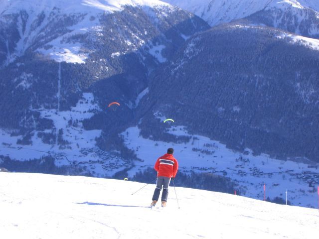
It is a massive ski area that runs along the side of mountains. I stayed in Fiesch, a traditional swiss village in the valley at 1050m. We got a cable car up to Fiescheralp at 2200m, so there was tons of great snow, and from there there are miles of slopes that takes you to nice villages like Bettmeralp and Riederalp. It takes a whole day to ski from one end to the other and back. There is skiing for all abilities, although you have to be able to do decent blues to get along to Bettmeralp. There are a couple of blacks - one through a tunnel to start with!! It's scary at the entrance, but when you do the run, you'll wonder what the fuss is about (probably because once you've done the gently downhill tunnel you can't go back unless you want to spend 15 minutes going back up!)
Overall the advantages are:
- High elevation skiing, so no need to worry about snow
- Masses of runs that are included on the Aletsch ski-pass
- runs for all abilities - Bettmeralp is great for beginners
- A choice of where to stay. You can stay up in one of the mountain villages so you can ski-to-door, or down in the valley
- There is also a snow-park
- Amazing views across the Rhone valley, including the Matterhorn
Disadvantages -
- Some lifts were quite busy, but it was Feb half term
- Maybe not perfect for experts but there are tons of reds that are hard
- Lots of annoying French snowboarders!
For somewhere so unknown, the Aletsch ski area is fantastic.
Before I went, I'd never heard of this place, so I didn't really know what to expect - but it was pretty darn good, and has everything!
It is a massive ski area that runs along the side of mountains. I stayed in Fiesch, a traditional swiss village in the valley at 1050m. We got a cable car up to Fiescheralp at 2200m, so there was tons of great snow, and from there there are miles of slopes that takes you to nice villages like Bettmeralp and Riederalp. It takes a whole day to ski from one end to the other and back. There is skiing for all abilities, although you have to be able to do decent blues to get along to Bettmeralp. There are a couple of blacks - one through a tunnel to start with!! It's scary at the entrance, but when you do the run, you'll wonder what the fuss is about (probably because once you've done the gently downhill tunnel you can't go back unless you want to spend 15 minutes going back up!)
Overall the advantages are:
- High elevation skiing, so no need to worry about snow
- Masses of runs that are included on the Aletsch ski-pass
- runs for all abilities - Bettmeralp is great for beginners
- A choice of where to stay. You can stay up in one of the mountain villages so you can ski-to-door, or down in the valley
- There is also a snow-park
- Amazing views across the Rhone valley, including the Matterhorn
Disadvantages -
- Some lifts were quite busy, but it was Feb half term
- Maybe not perfect for experts but there are tons of reds that are hard
- Lots of annoying French snowboarders!
For somewhere so unknown, the Aletsch ski area is fantastic.
Free Snow-Forecast.com weather widget for your website
Embed the Fiesch - Eggishorn - Aletsch weather widget on your site for free. It provides a weekly snapshot of snow and rain conditions across all elevations. Follow the two quick steps to grab your custom code and paste it into your site. Choose between metric or imperial units. Click here to get the code.


 Nearest