The above table gives the weather forecast for Chandolin at the specific elevation of 1650 m. Our sophisticated weather models allow us to provide snow forecasts for the top, middle and bottom ski stations of Chandolin. To access the weather forecasts for the other elevations, use the tab navigation above the table. For a wider view of the weather, check out the Weather Map of Switzerland.
Click here to read further information on freezing levels and how we forecast our temperatures.
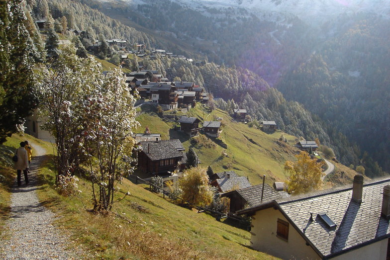
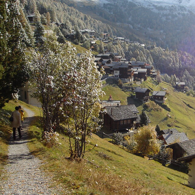
Chandolin is a sleepy little village located high on a sunny bench, precariously perched above the Val d'Anniviers. The ski area is shared with St. Luc, a bigger village with better lift access a few k's back along the road. Since Chandolin is arguably the highest village in Switzerland the road can be very slippery, especially after sunny afternoons have allowed a bit of runoff.
The resort is tiny, nightlife non-existent and the lifts are antiquated yet it is still one of my favorite places in Switzerland. The combined ski area is respectably big, invariably quiet, sunny, and after new snow, the off-pitse is excellent. Lack of crowds mean that it can stay that way for several days, especially through the trees. Views are spectacular and lift tickets reasonably affordable. The old part of the village is especially picturesque. All in all it is an excellent place from which to explore the diverse and largely undiscovered slopes of the Anniviers Valley. It is helpful to have your own transport if that's your plan.
Free Snow-Forecast.com weather widget for your website
Embed the Chandolin weather widget on your site for free. It provides a weekly snapshot of snow and rain conditions across all elevations. Follow the two quick steps to grab your custom code and paste it into your site. Choose between metric or imperial units. Click here to get the code.


 Nearest