

Portillo Re-Opens To Guests Arriving By Helicopter
Chile’s famous Portillo ski resort is reported to have re-opened to guests arriving by helicopter after being cut off by road for more than two weeks by over 6m/20 feet of snowfall.

Next 3 days weather summary:Heavy rain (total 46.0mm), heaviest during Mon night. Warm (max 23°C on Mon afternoon, min 15°C on Tue afternoon). Wind will be generally light. | Days 4-6 weather summary:Moderate rain (total 11.0mm), heaviest on Thu afternoon. Very mild (max 19°C on Sat afternoon, min 12°C on Thu night). Wind will be generally light. | |||||||||||||||||
Monday 3 | Tuesday 4 | Wednesday 5 | Thursday 6 | Friday 7 | Saturday 8 | |||||||||||||
AM | PM | night | AM | PM | night | AM | PM | night | AM | PM | night | AM | PM | night | AM | PM | night | |
clear | t-storm risk | rain shwrs | clear | t-storm risk | rain shwrs | clear | rain shwrs | rain shwrs | clear | mod. rain | rain shwrs | some clouds | some clouds | clear | clear | clear | clear | |
km/h | ||||||||||||||||||
Snow map |  |  |  |  |  |  | ||||||||||||
— | — | — | — | — | — | — | — | — | — | — | — | — | — | — | — | — | — | |
mm | — | 4 | 17 | — | 13 | 10 | — | 1 | 1 | — | 9 | 2 | — | — | — | — | — | — |
max °C | 22 | 23 | 17 | 19 | 20 | 16 | 18 | 20 | 20 | 18 | 16 | 13 | 13 | 16 | 16 | 16 | 19 | 18 |
min °C | 19 | 17 | 16 | 16 | 15 | 15 | 16 | 20 | 17 | 16 | 14 | 12 | 12 | 15 | 14 | 13 | 18 | 16 |
chill °C | 19 | 16 | 16 | 16 | 15 | 15 | 16 | 20 | 17 | 16 | 14 | 12 | 12 | 15 | 14 | 13 | 18 | 16 |
Humid % | 39 | 71 | 64 | 57 | 84 | 65 | 57 | 52 | 58 | 59 | 94 | 88 | 81 | 67 | 64 | 53 | 42 | 45 |
Freeze m | 4550 | 4400 | 4500 | 4500 | 4350 | 4400 | 4300 | 4350 | 4400 | 4300 | 4300 | 4150 | 4150 | 4250 | 4350 | 4300 | 4200 | 4250 |
6:16 | — | — | 6:16 | — | — | 6:18 | — | — | 6:18 | — | — | 6:20 | — | — | 6:22 | — | — | |
— | — | 9:00 | — | — | 8:59 | — | — | 8:58 | — | — | 8:55 | — | — | 8:54 | — | — | 8:53 | |
Go pro and carve into:
Avalanche information: European Avalanche Warning Services (EAWS)
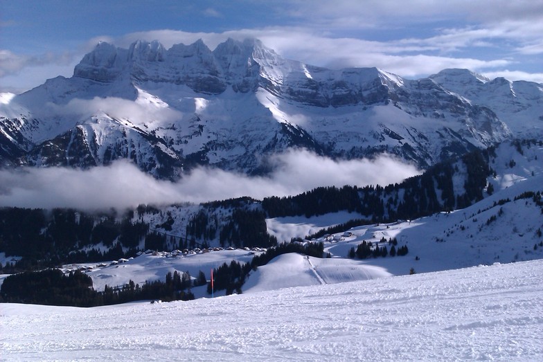
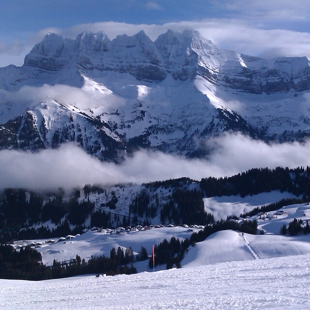
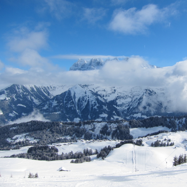
Latest snow reports near Champoussin:
| Top snow depth: | — |
|---|---|
| Bottom snow depth: | — |
| Fresh snowfall depth: | — |
| Last snowfall: | 16 May 2026 |
| Snow Alerts | Create Alert |
0.0 | Bluebird Powder days Fresh snow, mostly sunny, light wind. |
|---|---|
0.0 | Powder days Fresh snow, limited sun, any wind. |
0.0 | Bluebird days Average snow, mostly sunny, light wind. |
The above table gives the weather forecast for Champoussin at the specific elevation of 1730 m. Our sophisticated weather models allow us to provide snow forecasts for the top, middle and bottom ski stations of Champoussin. To access the weather forecasts for the other elevations, use the tab navigation above the table. For a wider view of the weather, check out the Weather Map of Switzerland.
Click here to read further information on freezing levels and how we forecast our temperatures.
Overall 4.1 Based on 6 votes and 7 reviews
A gem of peace and great skiing with access to the full Porte du Soleil. As of winter 2017/18 the Morgins and Champoussin ski areas are now under new management and over the next few years the lifts and snow making facilities will all be hugely improved which will no doubt bring the crowds so go now whilst it's still relatively undiscovered. Slopes are quiet and a mix for all levels. For apres-ski and lunch/dinner the fabulous Italian "Amici" is the top pick (great food and location) followed by Le Poussin. The views are stunning and it's a great choice for families with quiet sunny nursery slopes and a great ski school next to the Amici Restaurant.
Gareth Lewis from United Kingdom writes:
A gem of peace and great skiing with access to the full Porte du Soleil. As of winter 2017/18 the Morgins and Champoussin ski areas are now under new management and over the next few years the lifts and snow making facilities will all be hugely improved which will no doubt bring the crowds so go now whilst it's still relatively undiscovered. Slopes are quiet and a mix for all levels. For apres-ski and lunch/dinner the fabulous Italian "Amici" is the top pick (great food and location) followed by Le Poussin. The views are stunning and it's a great choice for families with quiet sunny nursery slopes and a great ski school next to the Amici Restaurant.


 Nearest