

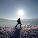
Banff Sunshine Village Opening for Summer Skiing
Banff Sunshine Village has confirmed it will reopen for a fortnight of summer skiing, from this weekend. The only ski area in Canada to be open into July.

Next 4 days weather summary:Heavy rain (total 30.0mm), heaviest during Wed night. Warm (max 24°C on Tue afternoon, min 14°C on Mon night). Wind will be generally light. | Days 5-7 weather summary:Heavy rain (total 50.0mm), heaviest during Fri afternoon. Warm (max 24°C on Sun afternoon, min 14°C on Fri night). Wind will be generally light. | |||||||||||||||
Tuesday 23 | Wednesday 24 | Thursday 25 | Friday 26 | Saturday 27 | ||||||||||||
night | AM | PM | night | AM | PM | night | AM | PM | night | AM | PM | night | AM | PM | night | |
rain shwrs | clear | t-storm risk | rain shwrs | t-storm risk | t-storm risk | rain shwrs | clear | t-storm risk | t-storm risk | some clouds | t-storm risk | rain shwrs | t-storm risk | t-storm risk | rain shwrs | |
km/h | ||||||||||||||||
Snow map |  |  |  |  |  |  | ||||||||||
— | — | — | — | — | — | — | — | — | — | — | — | — | — | — | — | |
mm | 5 | — | 2 | 4 | 1 | 5 | 7 | — | 6 | 8 | — | 10 | 9 | 2 | 9 | 7 |
max °C | 20 | 22 | 24 | 20 | 21 | 23 | 19 | 21 | 22 | 20 | 22 | 22 | 17 | 21 | 23 | 17 |
min °C | 14 | 18 | 22 | 14 | 18 | 22 | 14 | 17 | 21 | 15 | 17 | 19 | 14 | 17 | 21 | 14 |
chill °C | 14 | 18 | 22 | 14 | 18 | 22 | 14 | 17 | 21 | 15 | 17 | 19 | 14 | 17 | 21 | 14 |
Humid % | 68 | 39 | 52 | 69 | 56 | 53 | 71 | 60 | 69 | 78 | 59 | 78 | 77 | 66 | 67 | 71 |
Freeze m | 4400 | 4450 | 4600 | 4400 | 4400 | 4600 | 4500 | 4500 | 4600 | 4550 | 4600 | 4650 | 4500 | 4650 | 4700 | 4600 |
— | 5:39 | — | — | 5:39 | — | — | 5:39 | — | — | 5:39 | — | — | 5:39 | — | — | |
— | — | — | 9:22 | — | — | 9:22 | — | — | 9:22 | — | — | 9:22 | — | — | 9:22 | |
Go pro and carve into:
Avalanche information: European Avalanche Warning Services (EAWS)
Latest snow reports near Champoluc:
| Top snow depth: | — |
|---|---|
| Bottom snow depth: | — |
| Fresh snowfall depth: | — |
| Last snowfall: | 18 May 2026 |
| Snow Alerts | Create Alert |
0.0 | Bluebird Powder days Fresh snow, mostly sunny, light wind. |
|---|---|
0.0 | Powder days Fresh snow, limited sun, any wind. |
0.0 | Bluebird days Average snow, mostly sunny, light wind. |
The above table gives the weather forecast for Champoluc at the specific elevation of 1587 m. Our sophisticated weather models allow us to provide snow forecasts for the top, middle and bottom ski stations of Champoluc. To access the weather forecasts for the other elevations, use the tab navigation above the table. For a wider view of the weather, check out the Weather Map of Italy.
Click here to read further information on freezing levels and how we forecast our temperatures.
Overall 4.2 Based on 24 votes and 23 reviews
Just back from this hidden treasure of a resort. Wonderful variety of slopes with superb views. Dead quiet with no lines for ski pass, lifts, restaurants etc. Many cosy restaurants on the slopes and very well priced. Stayed at the Le Rocher hotel: spotless, great food and comfortable. Also access to a super spa 5 minutes away. This place is largely unknown. Go, you will not be disappointed. It's truly unspoilt and brilliant fun (way better than those faceless French resorts).
walt from South Africa writes:
Just back from this hidden treasure of a resort. Wonderful variety of slopes with superb views. Dead quiet with no lines for ski pass, lifts, restaurants etc. Many cosy restaurants on the slopes and very well priced. Stayed at the Le Rocher hotel: spotless, great food and comfortable. Also access to a super spa 5 minutes away.
This place is largely unknown. Go, you will not be disappointed. It's truly unspoilt and brilliant fun (way better than those faceless French resorts).


 Nearest