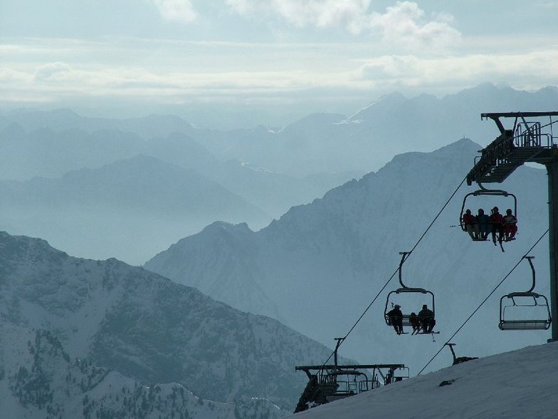
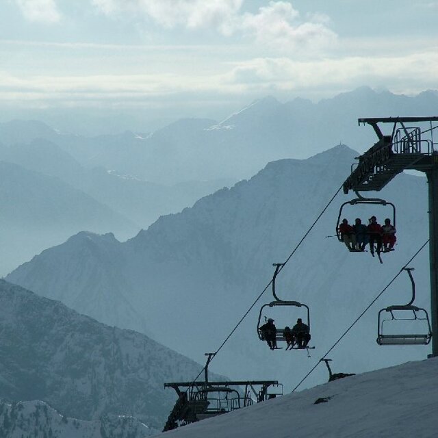
Champoluc snow
Ski Italy

Champoluc Snow Forecast

Weather Forecast for Champoluc at 2705 m
Issued: 6 am  01 Dec 2025 (local time)

New snow in Champoluc

1.2cm0.5in
Wed 3rd (PM)
The snow forecast for Champoluc is: A dusting of new snow. Temperatures will be below freezing (max -5°C on Mon morning, min -8°C on Tue afternoon). Wind will be generally light.

Champoluc Weather (Next 3 days): The snow forecast for Champoluc is: A dusting of new snow. Temperatures will be below freezing (max -5°C on Mon morning, min -8°C on Tue afternoon). Wind will be generally light.

Champoluc Weather (Days 4-6): A light covering of new snow, mostly falling on Thu night. Temperatures will be below freezing (max -5°C on Fri morning, min -7°C on Thu morning). Wind will be generally light.


Champoluc Live Weather

ResortSnow DepthTemp. (°C)Wind (km/h)Weather
Top Lift: 
-5
5
part cloud
Middle Lift: 
-2
5
part cloud
Bottom Lift: 
2
5
part cloud
6 Day Forecast
Issued: 6 am 01 Dec 2025 / Updates in ::
Change Forecast Height
Choose Forecast
Last 6 daysScroll left for last 6 daysNow
Monday
1
Tuesday
2
Wednesday
3
Thursday
4
Friday
5
Saturday
6
Sunday
7
AM
PM
night
AM
PM
night
AM
PM
night
AM
PM
night
AM
PM
night
AM
PM
night
AM
PM
night
part cloud
part cloud
clear
part cloud
cloud
light snow
light snow
light snow
light snow
light snow
light snow
mod snow
part cloud
clear
clear
part cloud
snow showers
clear
part cloud
part cloud
snow showers
some clouds
some clouds
clear
some clouds
cloudy
light snow
light snow
light snow
light snow
light snow
light snow
mod. snow
some clouds
clear
clear
some clouds
snow shwrs
clear
some clouds
some clouds
snow shwrs
 km/h
5
SE
10
S
5
S
5
SSE
10
SSE
5
SSE
10
SE
10
SSE
10
SSE
10
SSE
10
SE
10
E
5
SE
5
NNW
5
SSW
5
W
10
NW
15
NW
5
NW
5
NW
10
WNW
Snow map
1
1
1
6
max °C
-5
-5
-5
-6
-7
-8
-7
-7
-7
-6
-6
-6
-5
-5
-5
-5
-6
-7
-4
-3
-1
min °C
-6
-5
-5
-6
-8
-8
-7
-7
-7
-7
-7
-7
-6
-5
-5
-5
-7
-7
-6
-4
-3
-8
-9
-8
-9
-12
-12
-11
-11
-11
-12
-11
-7
-6
-7
-5
-7
-12
-13
-8
-7
-7
80
62
47
56
71
81
93
94
96
96
96
95
81
73
51
46
84
51
46
36
79
1600
1700
1350
1400
1550
1200
1500
1600
1500
1600
1700
1650
1600
1700
1200
1650
1750
950
1450
1850
1550
topbotSea lvl1000m2000m3000m4000m5000m
-6-5-5-6-8-8-7-7-7-7-7-7-6-5-5-5-7-7-5-4-21-2-5-1-2-30-1-21-1-21-3-51-2-6-1-2-1
Sunrise
7:48
7:50
7:50
7:52
7:52
7:54
7:54
Sunset
4:45
4:45
4:45
4:45
4:45
4:44
4:44

Snow Radar

Latest snow reports near Champoluc:

No recent snow reports

No recent snow reports

Champoluc Snow Conditions

Top snow depth:
Bottom snow depth:
Fresh snowfall depth:3.0cm
Last snowfall:30 Nov 2025
Snow AlertsCreate Alert
Other resorts in Italy are reporting: powder (0) / good piste (2)

Find Your Trip

Snow History

Week 1 of December has on average:
0.3
Bluebird Powder days
Fresh snow, mostly sunny, light wind.
2.1
Powder days
Fresh snow, limited sun, any wind.
1.5
Bluebird days
Average snow, mostly sunny, light wind.


Champoluc Resort Webcam

Live Snow webcam for Champoluc
Most recent Champoluc webcam image
Webcam courtesy of Val d'Aoste website
  • todayChampoluc webcam at lunchtime today
  • 2pm yesterdayChampoluc webcam at 2pm yesterday
  • 2 days agoChampoluc webcam 2 days ago
  • 3 days agoChampoluc webcam 3 days ago
  • 4 days agoChampoluc webcam 4 days ago